Bara: An Ancient Byzantine Settlement in Syria
Site at a Glance
- Popularity
- Medium
- Country
- Syria
- Primary era
- Classical
- Eras represented
- Classical, Medieval
- Civilizations
- Byzantine, Roman
- Site type
- Settlement
- Remains
- City
On this page20 sections
History
Bara, an ancient settlement in Syria, was founded in the fourth century on an important trade route between Antioch and Apamea. During the early Byzantine period, it became the administrative center of southern Apamene, the territory associated with Apamea. Bara was one of only three city-sized settlements among roughly 700 early Byzantine communities in the region.
Foundation and Byzantine prosperity
The settlement expanded especially rapidly up to about 470 and flourished in the fifth and sixth centuries. Its economy relied on olive oil, wine and cereal production, supported by the trade route and abundant groundwater. Residents dug for underground springs and developed wells and canals, private rainwater reservoirs and large communal reservoirs. The population may have reached 5,000.
In the early seventh century, Persian and Arab conquests of the eastern Roman provinces left Bara intact. The settlement remained inhabited under Muslim rule, with most residents still Christian. During the following century, many Christians from mountain settlements gradually moved to the plains. Bara belonged to the Syrian Orthodox ecclesiastical province of Apamea until 1098. The Syrian Orthodox Church is an Oriental Orthodox Christian tradition.
Crusader rule and abandonment
On 31 December 1097, Bohemond of Taranto and Robert of Flanders defeated a Turkish force attempting to relieve besieged Antioch. During the First Crusade, a military campaign from western Europe to the eastern Mediterranean, a contingent led by Raymond of Toulouse captured Bara on 25 September 1098. The conquest ended the period of rule during which a Jewish minority had lived in the town. After taking Antioch, Crusader forces seeking winter provisions passed through Bara toward Maarat al-Numan, where the campaign culminated in a massacre. Bara then became part of the Principality of Antioch, a Crusader state established during the campaign.
A Latin Christian bishopric, or diocese, operated in Bara from 1098 to 1148. The Crusaders appointed Peter of Narbonne as bishop; in 1099, John IV, the Orthodox Patriarch of Antioch, confirmed and ordained him. Control of the town repeatedly changed hands. Ridwan of Aleppo captured it in 1104, and Tancred recovered it the following year. Muslim forces held Bara from 1119 to 1122. Balak, also known as Belek Ghazi, took it in 1123 and built a fortress. The Crusaders had regained the town by 1130, but Nur ad-Din captured it permanently in 1148. The predominantly Christian population was subsequently expelled.
Earthquakes severely damaged Bara in 1157 and 1170, and it was abandoned by the end of the twelfth century. A modern village arose nearby in the early twentieth century. Excavations in the central area from 2007 to 2010 uncovered a mosque and a bath complex, including a well-preserved prayer niche in the mosque and evidence for distinct phases of use in the baths. Bara is included in a World Heritage listing.
Remains
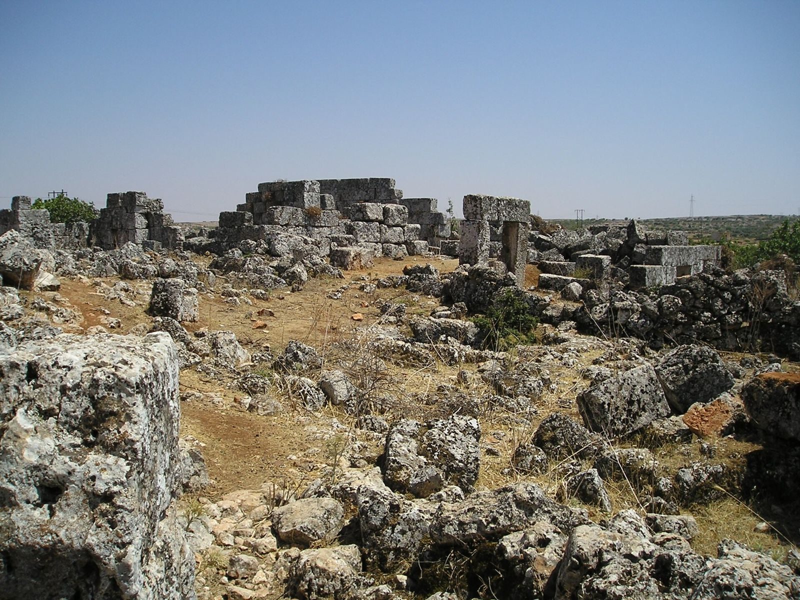
The ruins extend across about 3 by 2 kilometres on a slope that descends eastward, at roughly 700 metres above sea level. They are scattered among wooded hills, olive groves, cultivated land and scrub. The ancient settlement lies beyond a wadi, several hundred metres from the modern village.
Settlement and agricultural works
Stone houses, some still partly standing, and several villas lie among the remains of presses for olive oil and grapes, along with more than a dozen hearths. Some old vaulted spaces contain presses, including examples with an inscription naming Bacchus, the Roman god associated with wine. Wells, channels, private reservoirs and large communal reservoirs formed part of the settlement’s water and agricultural infrastructure.
Churches
Five churches were built at Bara, and most are now largely destroyed. They were three-aisled basilicas, long churches with a central nave and side aisles, with semicircular eastern apses, or recesses, flanked by two smaller rooms. The first three were built in the early fifth century, followed by two more large churches. The earliest began as a small building around 400 and was enlarged several times during the fifth and sixth centuries.
El Hosn Basilica
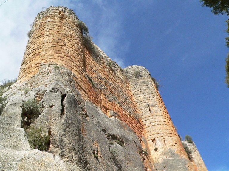
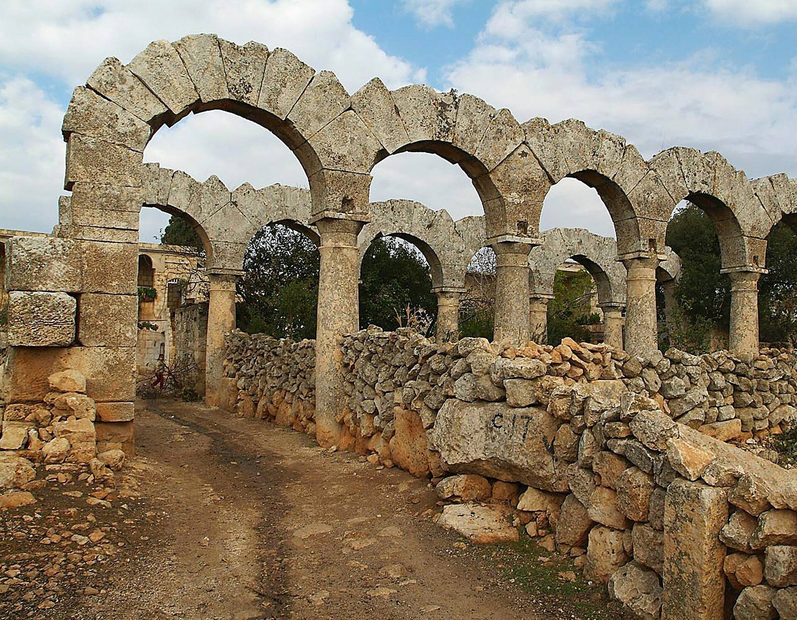
El Hosn, or Church E1, stood north of the settlement. The basilica measured 56 by 29.5 metres and occupied a walled precinct measuring 100 by 60 metres. It may have served as a pilgrimage church. Horizontal beams, or architraves, in the central nave walls rested on columns. The lower columns had bracket-shaped capitals, while the upper ones bore varied Corinthian capitals ornamented with acanthus leaves. A western projection with a tower at each corner may have emphasized the church’s west end. The building was later used as a fortress.
Main city church
The main city church dates to the middle of the fifth century. Galleries, or upper-level passages, ran above its side aisles. Architraves supported the raised walls at ground level, with round arches on columns above. The apse and adjoining rooms were set within a straight eastern wall. A western entrance vestibule, or narthex, brought the building’s total length to 34.6 metres; it was 16.9 metres wide. The church probably had three entrances on the south, two on the west and two on the north. A separate, single-aisled building with an apse stood beyond its northeastern corner. The main church and El Hosn shared elaborate decoration and were probably made by the same craftsmen; both were complete before 470.
Later church and decorative work
Church E5, built in the middle of the sixth century, had especially rich decoration. Its layout and mosaic images have been compared with those at nearby Apamea. Across Bara, Corinthian capitals, acanthus friezes and leafy scrolls formed a distinctive style that influenced other sites in the Jebel Zawiye, a mountain region in northwestern Syria. Plans of the main church were drawn around 1900 and revised in the 1950s. In the 1970s, excavators recovered nine capitals from the ground floor, twelve from the upper storey and four from pilaster projections. All were Corinthian, and some had wind-swept acanthus ornament.
Monasteries
Deir Sobat
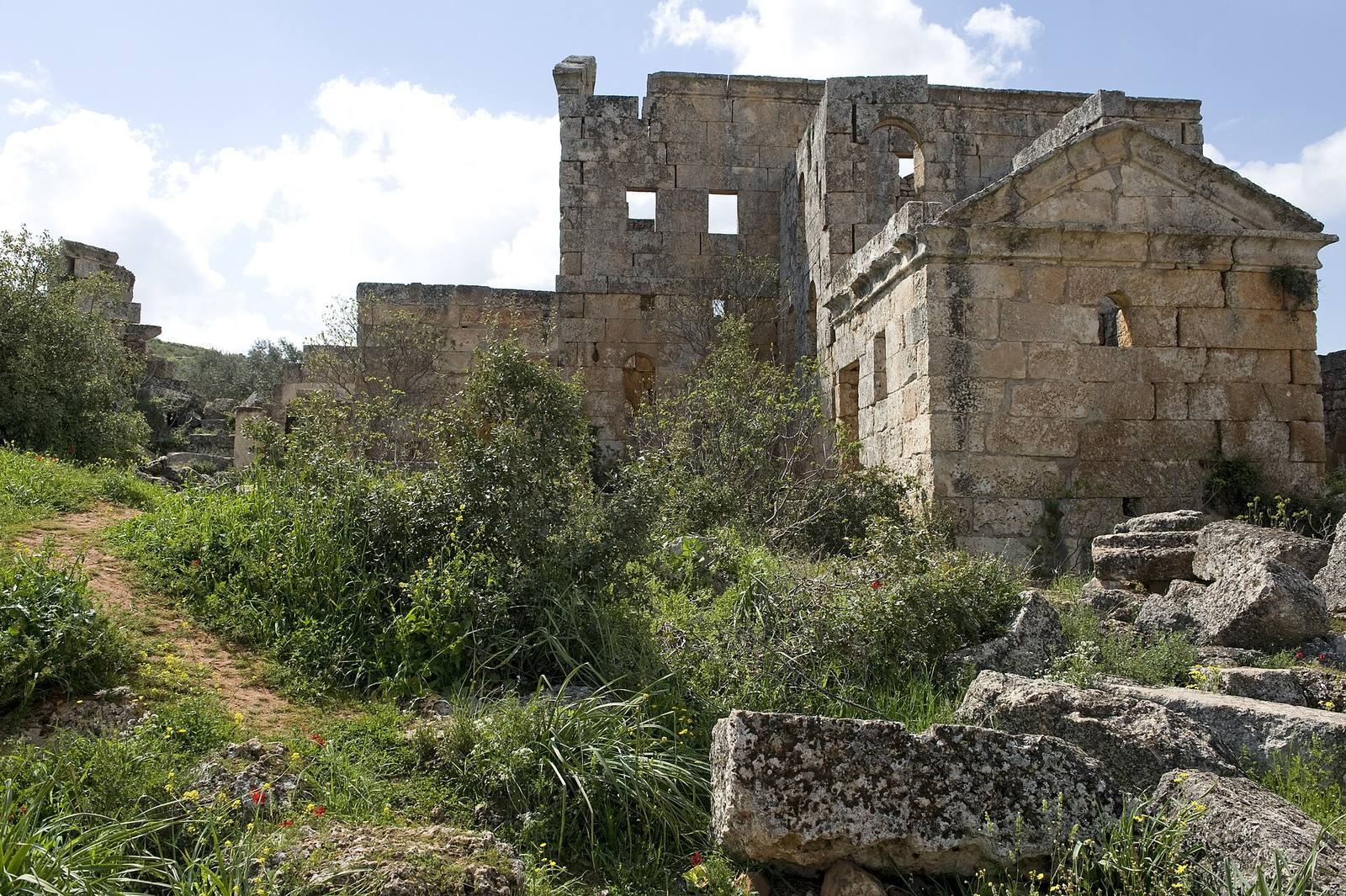
Near the southern edge of the site, Deir Sobat is in relatively good condition. The sixth-century monastery stands about 500 metres southwest of the village, beside a wadi. Partly reconstructed walls enclose an overgrown field of ruins, including an interlocking group of buildings and a three-storey main structure. A reconstruction drawing shows a central courtyard beside a two-storey, L-shaped wing. The main building’s large hall is surrounded by corridors and smaller rooms. A square room on its east side served as an oratory, or place of prayer, around which the complex was organized. Separate church buildings stood nearby.
Deir Debbane and al-Deir
The remains of Deir Debbane and al-Deir are also near the southern edge of Bara. Both are more poorly preserved than Deir Sobat.
Tombs
Pyramid tombs
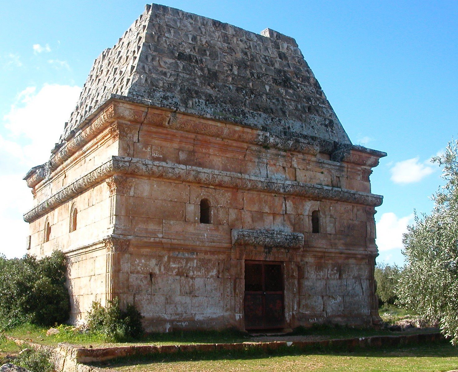
Two sixth-century pyramid tombs stand about 200 metres apart, one in the ancient town centre and the other at its western edge. Each has a square base of dressed stone and a pyramidal roof. The smaller tomb retains its complete roof, while the larger has lost its apex. Three bands of encircling cornice ornament the larger tomb’s walls. Fine vine scrolls on the central band and eaves meet above two round-arched windows on each side in cross-shaped or Christ-shaped medallions. Relief pilasters with Corinthian capitals form the corners, and five stone sarcophagi bearing similar medallions line the interior walls. The tombs follow a Hellenistic tradition, meaning Greek cultural forms that spread after Alexander the Great; their later form is related to the Mausoleum at Halicarnassus.
Rock-cut tomb
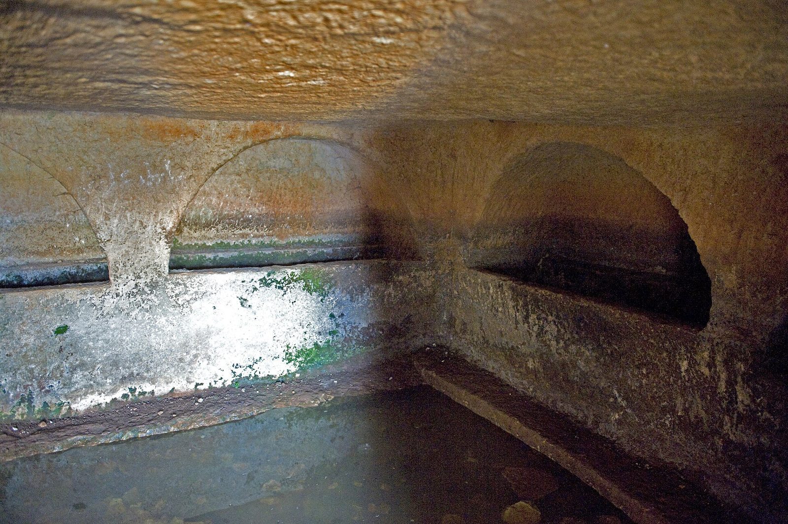
Farther south, a large underground tomb cut into the rock has an entrance framed by three solid-stone round arches supported by columns. An underground burial chamber of this kind is known as a hypogeum.
Baths and mosque
Bath complex
The large bath complex stood in the centre of the ancient settlement and was oriented east to west. Its reconstructed original plan has a large hall and four smaller rooms arranged in a row along the south side. In its early Byzantine phase, the complex was probably a communal building without an enclosing wall. It was later converted into Islamic bathhouses, abandoned in the eleventh century and adapted for housing in the fourteenth century, during the Mamluk period.
Mosque and prayer rooms
The mosque stands beside the baths, in the only cleared part of the site. A medieval cemetery runs along the west edge of the former mosque. Its first building phase dates to the eighth century. The nearly rectangular structure was aligned east to west and measured 7.45 metres wide and 15.90 metres long on its north side, and 16.40 metres on its south side, excluding the entrance porch. Its prayer-direction wall has an outward-projecting, half-domed niche called a mihrab. In a later phase, probably around the time of nearby medieval tombs, a smaller and simpler mosque was built inside the larger hall. Five small prayer rooms are scattered across the site; an inscription dates one of them to 1103–1104.
Fortress
Qalat Abu Safyan
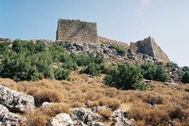
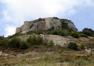
A few hundred metres northeast of the ancient settlement, Qalat Abu Safyan consists of a three-storey keep with walls 4 to 5 metres thick. Its limestone blocks are more roughly cut than those in the Byzantine buildings, and its small interior rooms have very few windows. An enclosure wall with two corner towers surrounds foundations of subsidiary buildings, now among scrub and olive trees. A local legend attributes the fortress’s foundation to a pre-Islamic Jewish king named Abu Safyan. In the story, his daughter Luhaifa married Abd al-Rahman, and both converted to Islam. After Abu Safyan persecuted them, Muslims aided by Jibril, the angel Gabriel in Islamic tradition, defeated him in battle, bringing the whole country under their control.