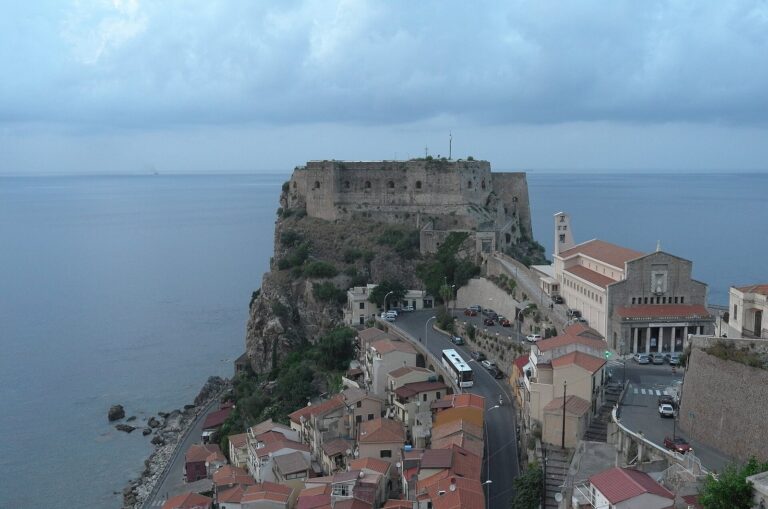
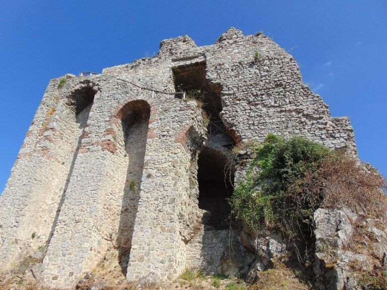
Tauriana: An Ancient City near Palmi, Italy
Site at a Glance
- Popularity
- Medium
- Country
- Italy
- Primary era
- Classical
- Eras represented
- Classical
- Civilizations
- Roman
- Site type
- Settlement
- Remains
- City
On this page14 sections
History
Tauriana was an ancient city in the territory of present-day Palmi, Italy, associated with the Italic Taurians who gave it its name. Its foundation date is uncertain. Traditions link it either to Achaean Greek settlers or to arrivals from Rhegion and Locri in the second half of the fourth century BC. In Latin it was known as Taurianum, and it was also called Taureana.
Origins and Roman autonomy
During the Hellenistic period, which followed Alexander the Great’s conquests, Taurians from Rhegion took control of lands south of the Metauros River. The river separated their territory from that of nearby Metauros, a city founded near its mouth in the seventh century BC. Cato the Elder placed the boundary with Rhegion at the Pecoli River, a passage that some archaeologists regard as support for Tauriana’s possible Achaean connections.
Roman-era writers including Livy, Cato, Pomponius Mela, and Pliny the Elder referred to Tauriana. Pliny described it as the town of Tauroentum. The Peutinger Table, a map of routes and places in the Roman world, marks the city during the imperial period, while the Ravenna Cosmography lists it among settlements near the Strait of Messina in Late Antiquity, the transition from the classical Roman world to the early Middle Ages.
During the Second Punic War, Taurians returned to Rome’s protection. After the Social War and the Romanization of the region, they gained political and administrative autonomy from Rhegion. The local Bruttian, or Brettian, presence then disappeared.
Byzantine rule and the early medieval city
Tauriana later belonged to the Byzantine Theme of Calabria, a provincial administration, and to the subordinate district of the Saline. It became a bishop’s seat, though its establishment is dated variously to the third or fourth century, or to around 600. The diocese, the area governed by a bishop, belonged to the ecclesiastical province of Reggio Calabria.
Around 590, Lombard raids from the Duchy of Benevento forced Tauriana’s bishop to seek refuge in Messina, while monks scattered across Sicily. Further attacks followed. A raid dated to the seventh or eighth century, attributed either to African Saracens or to Lombards, had already caused severe damage to the city.
An eighth-century life of Fantino the Elder, written by Peter, bishop of Tauriana, recounts a Saracen attack and a local miracle tradition. According to the account, Fantino and the Virgin Mary intervened after people prayed at the saint’s tomb. The story fostered the local veneration of Our Lady of the High Sea, also called Santa Maria ab alto Mari.
After Metauros was abandoned in the eighth century, Tauriana’s settlement extended to the north bank of the river. In 904, its port received a ship carrying the remains of the monk Elijah of Enna from Thessaloniki. Elijah’s followers took the remains to Mount Salinas, where he had lived and established a monastery.
Destruction and resettlement
By the middle of the tenth century, Tauriana had lost much of its earlier prosperity. It was the only maritime city on this part of Calabria’s western coast, but piracy encouraged people to move inland, leaving coastal settlements deserted. In 951, after the Byzantines failed to pay tribute, the emir of Palermo, Abū l-Qāsim al-Hasan, led a campaign against the region. He sought help from the caliph of Africa, whose army was commanded by Farag Mohadded. After capturing Reggio Calabria, the forces ravaged the surrounding territory.
Tauriana’s inhabitants had fled before the attack. The city had no walls, was sparsely populated, and had already suffered damage from earlier raids. The attackers destroyed the abandoned settlement and nearby lands. Its bishop, clergy, and wealthier residents moved to Seminara; others went to Oppido Mamertina, Galatro, and Cinquefrondi. Some began settlements among the ruins of Sappominulim, including Terranova, San Martino, and Pedavoli.
People involved in maritime trade settled at De Palmis, on higher ground between Mount Salinas and the Metauros and above Rovaglioso. Their settlement eventually became Palmi. Tauriana’s former territory came under Seminara’s jurisdiction and followed its history until Palmi gained independence in 1632. In 1086, Roger I, count of Calabria, assigned the lands of the ruined and abandoned diocese to the Diocese of Mileto. Tauriana had lost territory to the newly established Diocese of Oppido Mamertina in 1040; its remaining territory was transferred to Mileto in the late eleventh century, and the diocese was formally suppressed in 1093.
The port continued in use until the eighteenth century. Roger I is also believed to have landed there from Normandy during the eleventh century.
Investigation of the site
In the late nineteenth century, Antonio De Salvo produced an early study of Metauria and Tauriana, including a plan of the ruins then visible. Chance finds from that period came chiefly from the Scinà coast and the plateau at Taureana di Palmi, and represented Greek-Italic, imperial Roman, and Byzantine-medieval periods. Archaeological work beginning in the mid-1990s exposed further remains of the ancient town.
Remains
Landscape and early settlement
The site lies about a kilometre south of the Metauros River, probably the modern Petrace, on the north-western Tyrrhenian coast. Cultivable plains formed by raised marine terraces surround it, with the land rising toward the foothills of the Aspromonte. Finds of obsidian and related pottery types point to connections with the Aeolian Islands and north-eastern Sicily from the protohistoric period, before written records for the society. Tauriana’s position near the entrance to the Strait of Messina also linked it to Mediterranean sea routes.
Street plan and infrastructure
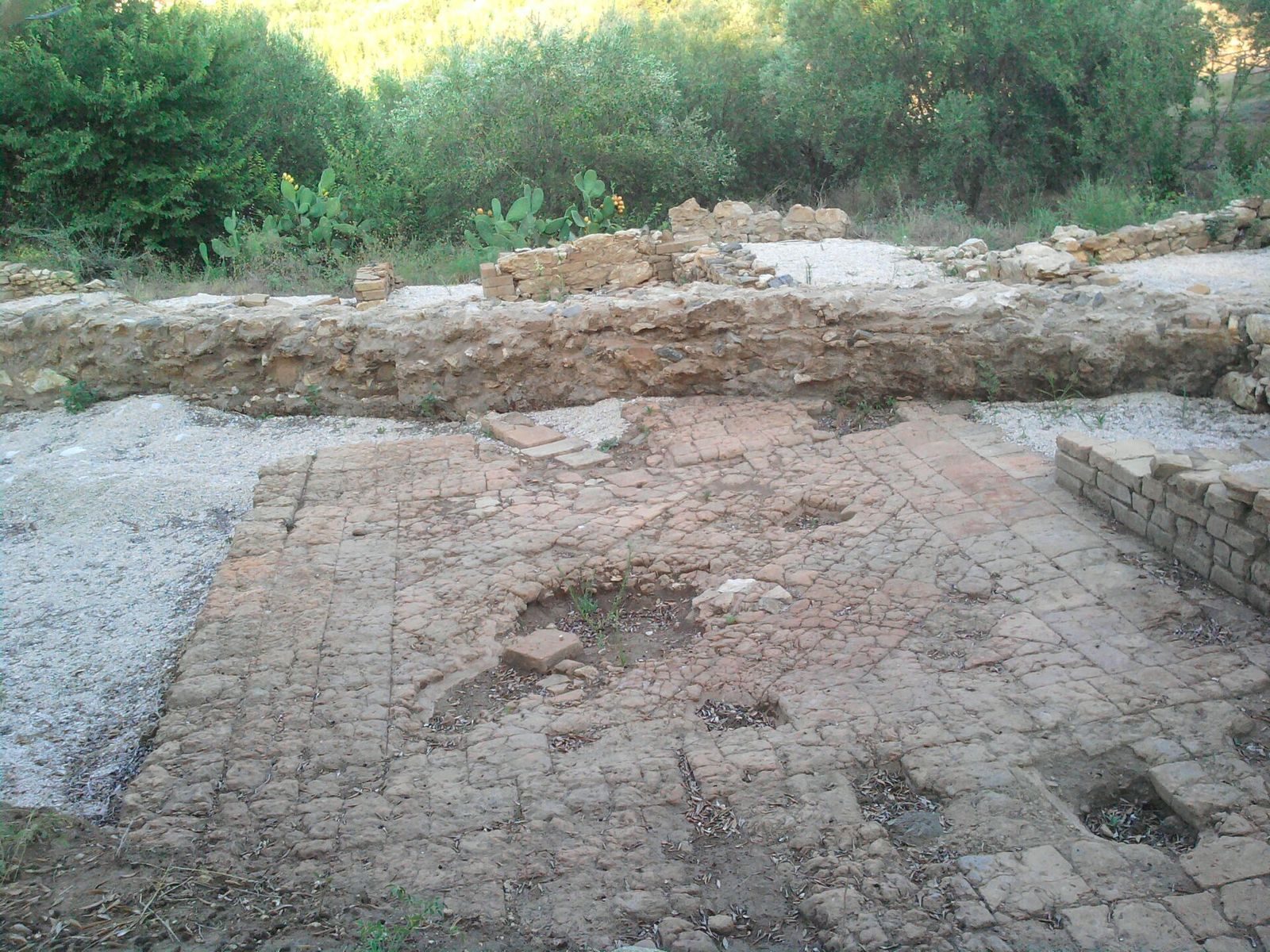
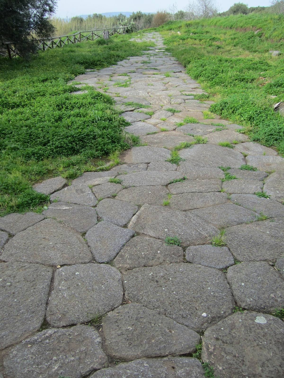
A village at the site dates to about 2000 BC. Later excavated remains include roads, buildings, floor surfaces, drainage channels, and large storage jars, from the latter half of the fourth century to the first century BC. In the second century BC, a newly planned city overlaid earlier walls. Its rectangular street grid divided the town into blocks. A five-metre-wide Roman road ran along the western edge of the plateau as one of the settlement’s main routes, with houses opening to its south. Another road may have connected Tauriana to the Roman Via Popilia.
Northern public and residential buildings
House of the Mosaic
The House of the Mosaic, also known as the House of Donna Canfora, dates to the second or first century BC. At least twenty rooms opened onto what was probably a portico around a courtyard paved with terracotta tiles. The house stood at the edge of a terrace and differed in orientation from the rest of the town. Large cut-stone blocks, stucco, painted plaster, floor mosaics, and fine ornaments marked its design. Its unusual alignment may have had symbolic meaning if the house belonged to a public figure.
The northern banquet room could hold seven couches. One was made of bronze and decorated with silver and precious stones; it is now displayed at the National Archaeological Museum of Reggio Calabria. The room’s floor is thought to have included black-and-white decoration and a central multicoloured mosaic. Its scene showed two horsemen and a spear-bearer beside a wounded bear, beneath a large tree, with a dog, a feline, and a wild boar. The house was later demolished, and its materials were reused in the construction of the major sanctuary.
Urban sanctuary
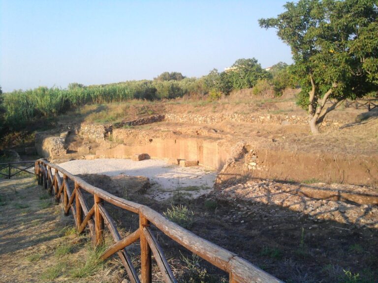
The Roman sanctuary stood near the northern edge of the plateau, on its western side, overlooking the coast and set apart from much of the residential area. It was a podium temple, meaning a temple raised on a substantial platform, in the Etruscan-Italic tradition. Its rectangular platform measured about 10 by 20 metres and rested on a 2.25-metre foundation of Roman concrete. Local stone, marble, and stucco formed its original decoration and coverings, while brick facing partly covered the structure. Two bricks carry a readable stamp, (C) Numitori.
The temple’s entrance stair was probably on its short northern side, though it does not survive. Foundation-level walls of a surrounding portico remain on three sides. Building the sanctuary changed the earlier Brettian settlement; a rectangular channel a few metres to its west was covered during construction. Bricks from the channel also carried stamps.
Performance and Christian worship
Amphitheatre
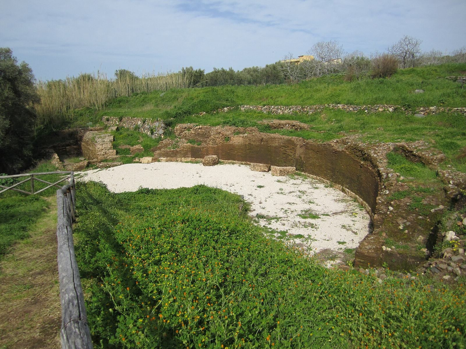
An amphitheatre, possibly built in the first century AD, remained in use until the fourth century. Its small scale and architectural features are unusual for southern Italy. It may have accommodated both games and theatrical performances.
Crypt beneath the Temple of Santo Fantino
A chamber beneath the Temple of Santo Fantino is identified as the burial place of Fantino the Elder’s remains. It is regarded as the oldest Catholic place of worship in the region.