Jönköping Castle and Fortifications: A Swedish Royal Stronghold
Site at a Glance
- Popularity
- Medium
- Country
- Sweden
- Primary era
- Early Modern
- Eras represented
- Early Modern
- Civilizations
- Swedish
- Site type
- Military
- Remains
- Castle
On this page17 sections
History
Medieval monastery and political meetings
Jönköping Castle and Fortifications formed a royal stronghold in Jönköping, Sweden, adapted from a Franciscan monastery beginning in 1544. A building in the area is known from the mid-13th century. The monastery was founded in 1283, probably at the initiative of Magnus Ladulås. Its Franciscans belonged to a Catholic religious order, and the monastery later became a venue for political meetings.
Magnus Eriksson and his son Erik Magnusson made peace there with the help of Albert of Mecklenburg. In 1439, Swedish and Danish representatives met at the monastery and deposed Erik of Pomerania. These gatherings gave the site a political role before it was converted into a royal fortress.
From monastery to royal fortress
Following the Reformation, the religious and institutional upheaval that changed church life in Sweden, the monastery closed and the Crown took over its buildings. The castle conversion began in 1544 and is dated to 1545–1555. The existing structures were altered only to a limited extent, while substantial new defenses were added.
The fortress was a direct response to the Dacke uprising of 1542–1543, a major revolt against the government of Gustav Vasa in Småland. The central government wanted to secure a stronghold at the junction of Eriksgatan, Nissastigen, and Lagastigen and strengthen its control over northern Småland. Artillery was installed in 1556.
In autumn 1567, the castle and town were burned ahead of a threatened Danish attack during the Northern Seven Years’ War, a conflict involving Sweden, Denmark-Norway, and their allies. The castle then remained in ruins for an extended period.
Rebuilding and military use
Reconstruction and expansion began late in the 16th century and continued, with interruptions, into the first half of the 17th. The rebuilding is dated to 1595–1620. Hans Fleming, the royal castle master builder, prepared a largely unified plan, and his architectural work is dated to 1595–1623. Gustav Vasa and Gustav II Adolf were the castle’s royal patrons.
The system of projecting defensive works, or bastions, took shape in the early 17th century. The southern bastions Gustavus and Carolus were probably complete before the town fire of 1612. Adolphus, to the northwest, was probably almost finished by then, while the northeastern Christina was completed several years later. Further outer defenses were added in the 1640s. At its greatest extent, the fortress covered about 10 hectares and was among Sweden’s largest.
After the Treaty of Roskilde in 1658 ended a war between Sweden and Denmark and changed their border, Jönköping was no longer a border city. The fortress nevertheless remained an administrative centre and continued to matter for military mobilization. In 1677, the government commissioned fortification engineer Sven Rasmusson Wassander to prepare plans and profiles. He had worked under Erik Dahlbergh from 1658 into the 1680s. Two large artillery storehouses were built in the bailey during the 1680s, while the fortress’s main artillery was disarmed toward the end of the century.
Olof Hård of Segerstad served as lord of the fortress from 1600 to 1609 and again in 1612, as well as castle and county governor. He lived there with his wife and six children. King Karl IX had a room for his use during visits. The castle produced some supplies, including vegetables and spices, and raised pigeons and turkeys. Its smithy, carpentry workshop, and weaving room served practical needs, while most goods came from local farmers and craftspeople.
Fire, decline, and archaeological investigation
A devastating fire in 1737 destroyed the castle, which was not rebuilt. Carl Hårleman drew plans for a new governor’s residence in 1752, but they were never carried out. The former castle area was later used for a prison and storehouses, while military activity shifted to the bailey. The ramparts and bastions deteriorated, and Jonas Carl Linnerhielm depicted their ruined state late in the 18th century.
The Crown left the castle in 1842, transferring its central depots to the newly built fortress at Karlsborg. Land outside the fortress was transferred to the town in 1850, and in 1862 the Riksdag decided that the remaining land should also pass to the town. The last ramparts and outer defenses were demolished in 1871. The former castle shore was subsequently developed for harbor, railway, and road uses.
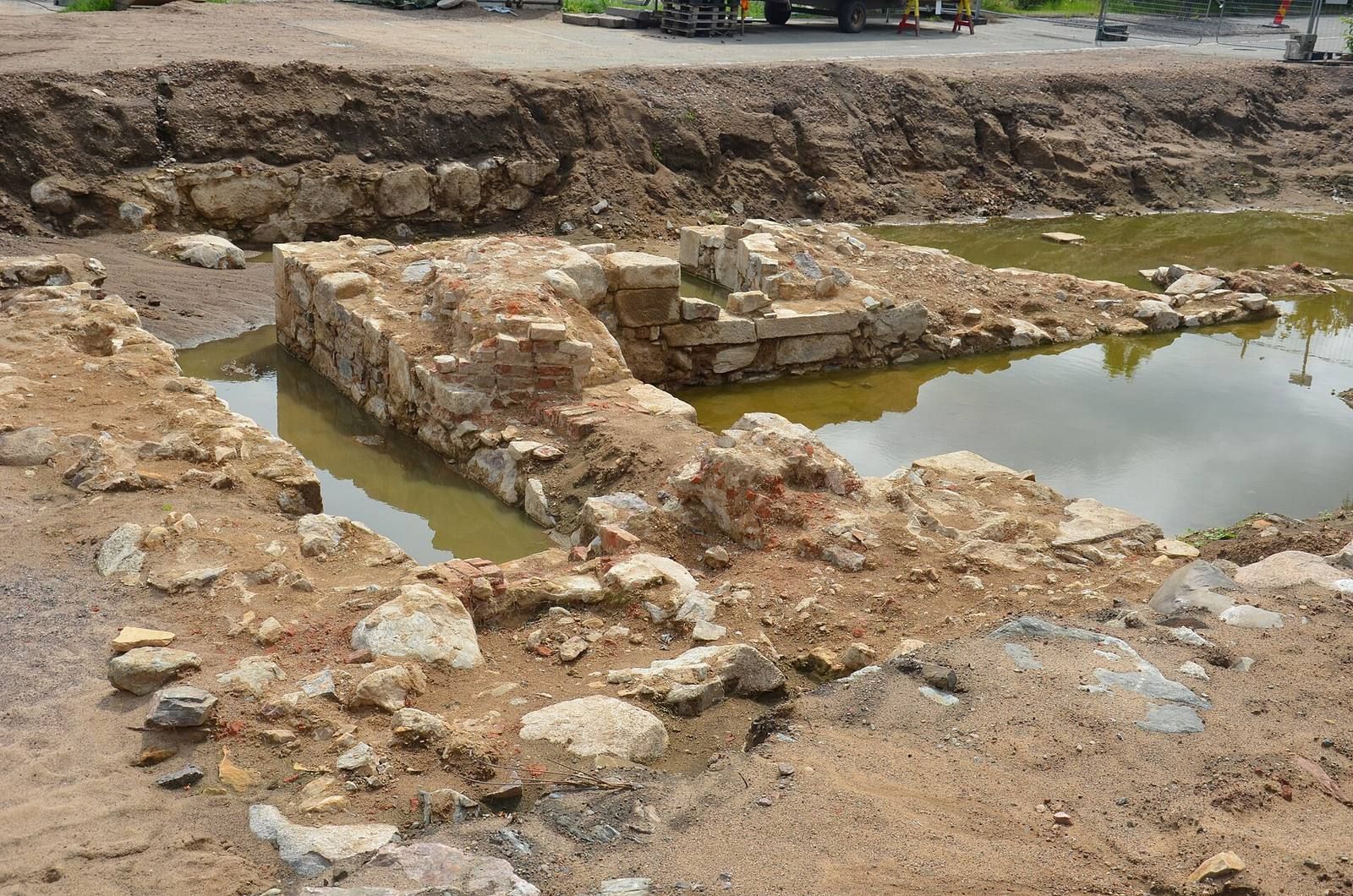
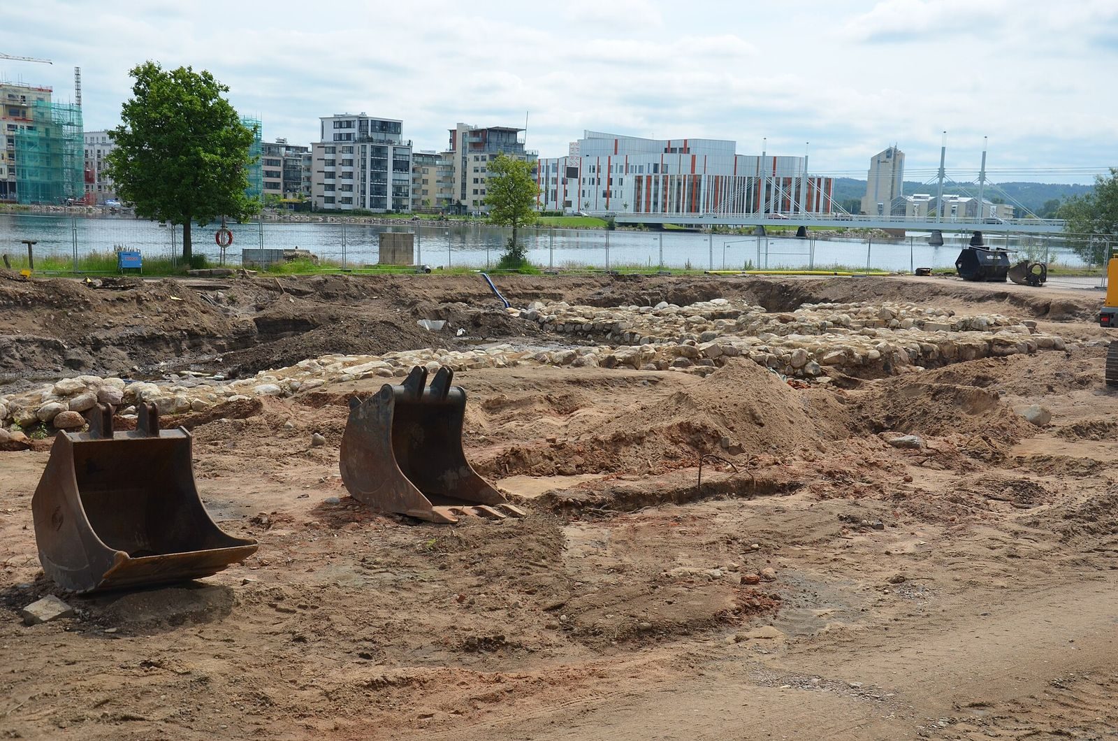
Archaeological investigations began in the early 1970s and concentrated more on the fortifications than on the castle buildings. Work at Västerport in 2002 identified wall remains; in 2007, a section of the eastern curtain wall was exposed, and the municipality chose to preserve it for display in a planned park. In 2010, ground-penetrating radar, which detects buried features, located walls of two bastions and a round gun tower. The first large-scale excavations within the fortress area followed in 2011–2012, ahead of construction at Västra kajen.
Remains
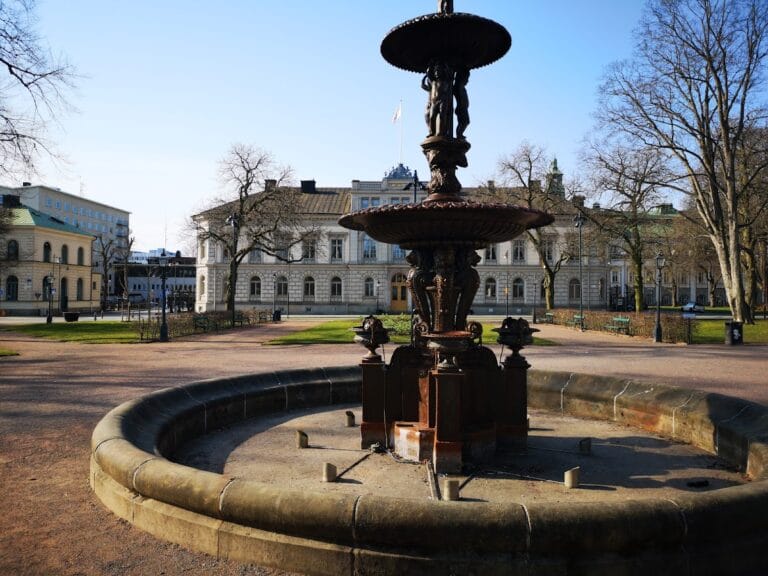
The former complex combined a four-winged stone-and-brick monastery with a castle core and successive layers of defensive works. Its early building stood near the stream between Lakes Munksjön and Vättern, west of present-day Hamnkanalen. The monastery and castle occupied the same general site, in the northeastern part of what is now Rådhusparken.
Monastery and castle buildings
Monastery
The monastery formed a four-winged block of stone and brick, with its church in the northern wing. Excavations along the shore have also revealed quays and shoreline revetments dating to the monastery period. Plant remains from deposits associated with its garden include a broad range of useful species.
Castle core
The castle adapted the monastery buildings with limited structural changes and added defenses around them. In 1556, artillery was placed on the ramparts and in round corner towers; this installation was known as the Little Arsenal. The County Administrative Board building now occupies the site of the principal castle buildings. Other buildings on the former fortress grounds include the old police station and the governor’s residence.
Fortifications
Bastions
The four named bastions were Gustavus and Carolus to the south, Adolphus to the northwest, and Christina to the northeast. Christina and Carolus faced Lake Munksjön and were smaller than the two landward bastions. The landward works had two levels of casemates, protected vaulted chambers, and galleries, reaching about 13 metres above the bottom of the surrounding moat. Per Brahegymnasiet frames the former Gustavus bastion.
Archaeological work exposed parts of the northern and western flanks of the southeastern bastion. Some of its walls used Trånghalla sandstone, and the northern flank’s casemates and gun openings were particularly well preserved. Buried walls of Gustavus and Carolus were also located, as was a round gun tower beneath the present Per Brahegymnasiet parking area.
Curtain wall
A curtain wall, the connecting stretch between defensive works, ran along the lakefront. Excavations exposed a 75-metre section and revealed several building phases. The original design called for protected firing galleries on the lakeside, but a massive solid wall was built instead. This change has been interpreted as a response to Sweden’s financial difficulties after the Kalmar War, a later conflict between Sweden and Denmark-Norway. A section of the eastern curtain wall exposed in 2007 was selected for preservation and planned display. Wall remains at Västerport are marked in paving beside Hamnparken.
Bailey and outer defenses
A spacious, fortified bailey, an enclosed outer area, extended north toward the shore of Lake Vättern. In the 1640s, the outer defenses included two broad dry moats with a rampart between them, as well as large, three-sided earthwork ravelins to the south and west. A ravelin is an outer earthwork used to defend a fortress.
Archaeological features and present setting
Storehouses and former bailey
Foundations of the Great and Small Artillery Storehouses remain in Rådhusparken, within the former bailey. These remains help locate the fortress’s storage buildings within its northern outer area.
Shoreline and workshop remains
Investigations beside Lake Munksjön uncovered remains of the castle’s pier, a pump-house tower, and a small workshop where the garrison’s weapons were repaired. Harbor, railway, and road construction now overlies castle remains across much of the eastern and southeastern area.
Garden plant remains
Plant material recovered from layers associated with the monastery garden provides evidence of the useful plants cultivated there. Analysis of these remains identified a wide range of species.