Tell Bi’a: The Archaeological Site of Ancient Tuttul
Site at a Glance
- Popularity
- High
- Country
- Syria
- Primary era
- Bronze Age
- Eras represented
- Bronze Age, Medieval
- Civilizations
- Akkadian, Byzantine
- Site type
- Settlement
- Remains
- City
On this page25 sections
History
Tell Bi’a, in Syria, is an archaeological mound identified with Tuttul, a major ancient city of northern Mesopotamia. Tuttul’s principal period of prosperity extended from the second half of the third millennium BCE into the seventeenth century BCE, when it was under Mari’s authority.
Early settlement and regional connections
Tuttul was occupied during the Uruk period, the late-fourth-millennium BCE phase of Mesopotamian history. Its position near the Balikh-Euphrates confluence connected it to routes between Mari, Emar, Carchemish, and Aleppo, as well as routes toward Qatna and north along the Balikh. These links placed Tuttul between several kingdoms and helped make it a political and trading center. Trade through the city connected Mari with western markets and, by way of Qatna, the Mediterranean.
The surrounding region supported barley, wheat, and sesame cultivation, livestock raising, and the cutting of timber from floodplain forests for boatbuilding. Tuttul’s fields relied mainly on Balikh water. In an early-second-millennium BCE letter to Shamshi-Adad I, residents complained that people upstream at Zalpah were diverting too much water for irrigation. At that time, the Euphrates flowed south of the Mišlab depression.
Inscriptions relate that Sargon of Akkad, founder of the Akkadian Empire, prayed to Dagān at Tuttul. Dagān, a major deity associated with storms and fertility, then granted Sargon authority over the Upper Land, including Mari, Tuttul, Jarmuti, and Ebla, as far as the Cedar and Silver Mountains. References to cedar and silver reflect the value of these resources. Texts from the reign of Sargon’s grandson Naram-Sin also mention Tuttul, although some may refer to another city with the same name.
Ur III and the Old Babylonian period
During the Ur III period, the Third Dynasty of Ur, Tuttul appears to have been less prominent. An economic record from Amar-Suena’s reign names Jašši-Lim as the city’s ensi, a ruler or governor. Political and marriage ties connected the region with Mari and Ebla.
In the Old Babylonian period, an early-second-millennium BCE era, Tuttul became a major center of worship for Dagān, revered there as Father of the Gods. Rulers from other small states attended his festivals, and a procession carried the god’s statue upriver to Emar and other places. Ebla’s archives refer to Tuttul more than a hundred times, often in connection with Dagān as Lord of Tuttul. Texts from Ugarit also link that city’s Dagān with Tuttul.
Yahdun-Lim, king of Mari, named Ba’lu-Kullim king of Tuttul and its territory. He counted Ba’lu-Kullim among rulers who rebelled against him; Sumu-Epuh, ruler of Yamhad in northern Syria, sent forces to support the revolt, but Yahdun-Lim defeated it. Tuttul had previously been independent. Around or shortly after 1800 BCE, it entered the sphere of Shamshi-Adad I, an Assyrian king who established authority over Mari and the surrounding Euphrates region. After Shamshi-Adad took Mari, his son Yasmah-Adad governed from there, and letters from his reign record Tuttul’s officials and tribute payments. The city later regained independence. Zimri-Lim, who ruled Mari after Shamshi-Adad, used a royal title that included Mari, Tuttul, and the land of Hana. A year-name records his entry into Tuttul and may refer to his recovery of territory west of Mari.
Tuttul’s decline began during Zimri-Lim’s reign, and very few texts from the city date after 1700 BCE. Zimri-Lim may have destroyed its palace, possibly around 1714 BCE, though his presence at Tuttul itself remains unconfirmed. A Mari letter describes Dagān entering the city in a procession accompanied by Sumu-laba and Dadi-Hadun, leaders of Yaminites’ clans. Another records unrest linked to the presence of Zimri-Lim’s governor Lanasum, during which residents pulled the doors of Dagān’s temple from their hinges.
Conquest and later use
Hammurabi, king of Babylon, defeated Mari and its surrounding region in the thirty-third year of his reign, a conquest that presumably included Tuttul. Hittite conquest in the sixteenth century BCE ended the region’s shifting political dependencies and former trading connections. Tuttul continued as a small cult center of Dagān in the Late Bronze Age, and Hittite and Middle Assyrian texts mention the city.
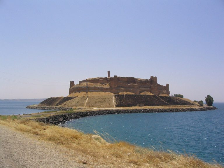
Several later settlements occupied nearby ground but were distinct from Tuttul. Nikephorion was founded about 300 BCE at the then-bank of the Euphrates, roughly two kilometres south of the mound. It became known as Callinicum in Roman times and corresponds to present-day Mišlab. In the sixth century CE, Justinian, a Byzantine emperor, refortified Callinicum. The center of present-day ar-Raqqa was founded separately, about two kilometres west of Tuttul, in the early eighth century under the Abbasids, a dynasty that ruled the caliphate from the eighth century onward.
From about the third century CE into the early Islamic period, the western part of Tuttul’s mound served as a cemetery. In the early sixth century, a monastery associated with Callinicum was established on the central mound over palace remains. It is identified with the Zacchaeus Monastery, also called Mar Zakkay, and may have remained in use into the Abbasid period.
Identification and modern damage
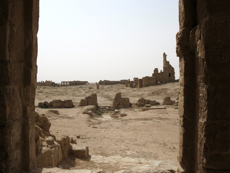
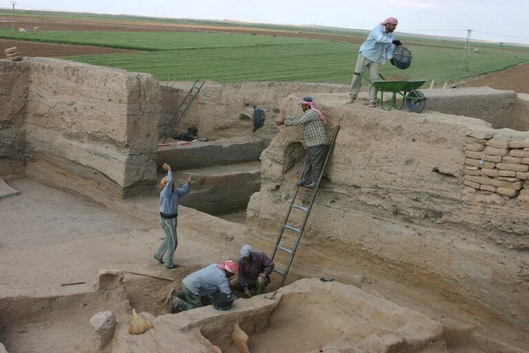
Georges Dossin identified Tell Bi’a with Tuttul in 1954. Surface investigation began in 1980, followed by twelve excavation seasons through 1995 that exposed major settlement levels in selected areas. Tablets bearing the name Tuttul were found at the site in 1992. The mound had also been targeted by modern looters, especially around the ancient cemetery. It suffered extensive looting during the Syrian Civil War, which began in 2011, as well as damage from tunneling and the creation of a detention camp.
Remains
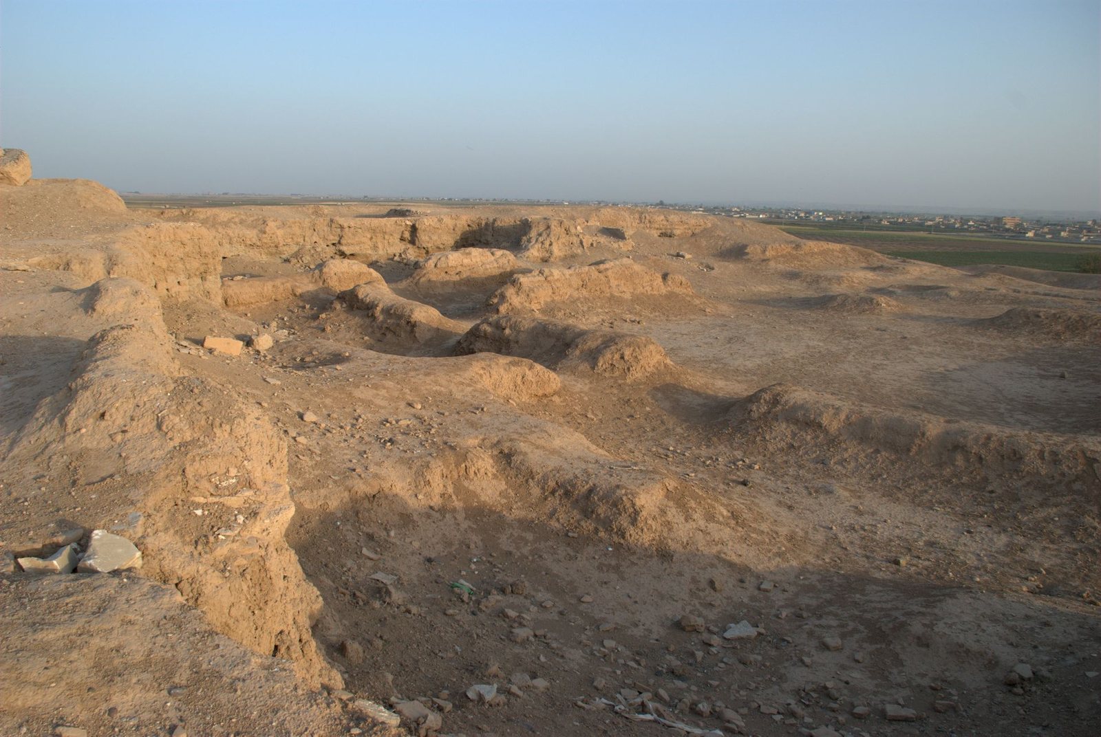
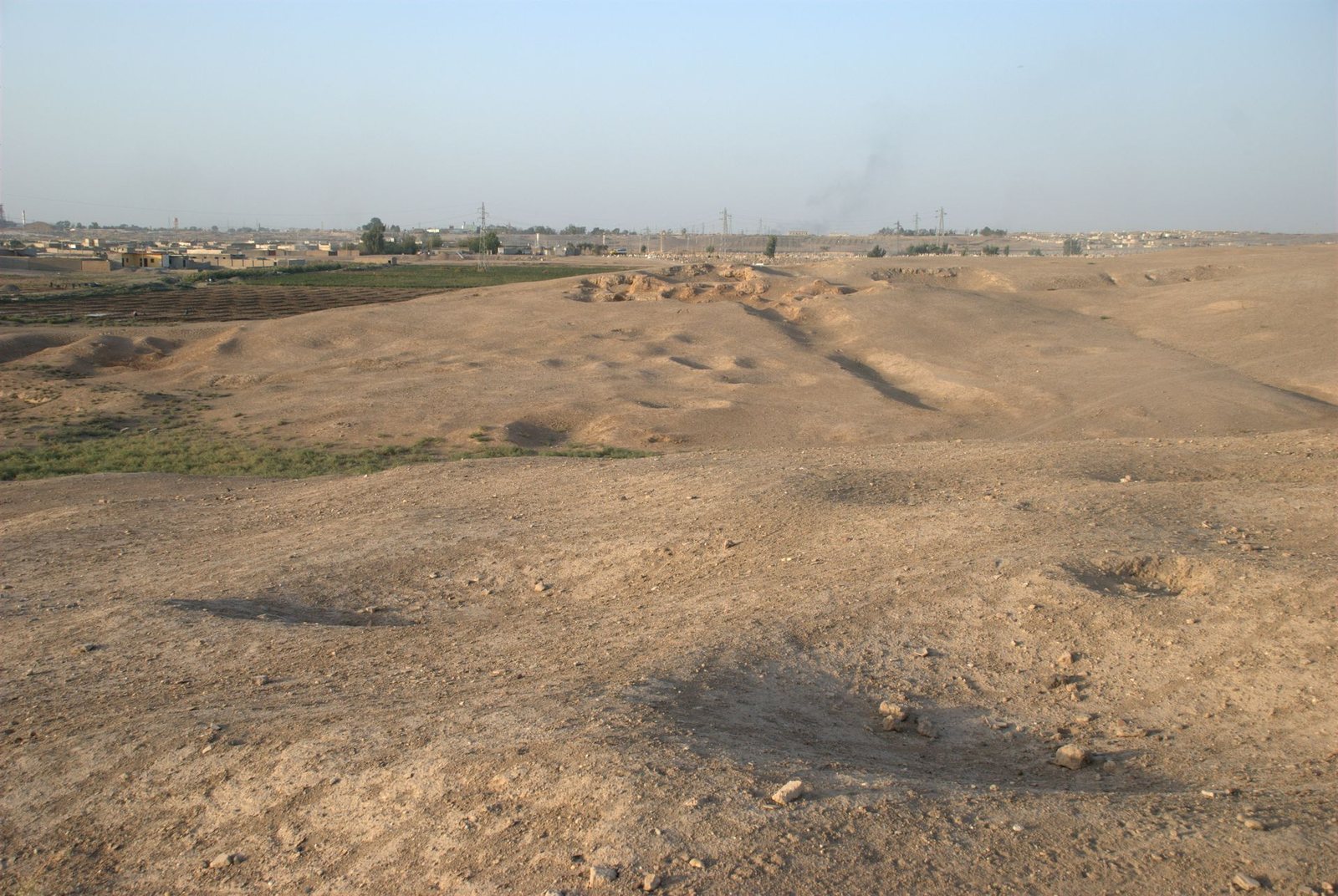
The remains occupy a complex of mounds covering about 35 to 40 hectares. A roughly semicircular main mound has a straight southern edge and measures approximately 750 metres east to west by 650 metres north to south. Subsidiary rises and smaller surrounding ridges form part of the site’s layout.
Setting and defenses
River terrace and mound
Tell Bi’a stands on a river terrace near the Balikh-Euphrates confluence. The Euphrates valley is about five to six kilometres wide here, and its floodplain lies at roughly 240 to 242 metres above sea level. A lower area called the Mišlab depression separates the settlement from the floodplain, while a slight rise reaches about 248 metres. The mound’s base is around 246 metres above sea level, and its summit reaches 266 metres. Mound E, at the center, rises as much as 12 metres above the residential area. Ancient settlements in this region stood on terraces at least 15 metres high to reduce flood risk.
The Euphrates is now about three kilometres from Tell Bi’a and the Balikh about 2.5 kilometres away. In antiquity, the Balikh ran for several kilometres parallel to the Euphrates before joining it. Its course has since been straightened and directed toward the Euphrates by a more direct channel.
City wall and gates
The mudbrick city wall was about 6 to 6.3 metres wide, including pillars projecting from its inner face. A tamped-earth glacis, a sloping defensive earthwork, survives better on the wall’s southern exterior. A later outer wall, about two metres wide, was traced for 25 metres at a point 16 metres beyond the main wall. The southern and western gate buildings each measured about 20 by 20 metres. They were partly built of stone, and their walls, plastered with mud on both sides, projected about 12 metres outward. The northern wall’s position was identified in a narrow test trench.
Channel on the northern slope
A steep northern slope, with a height difference of about 35 to 40 metres, contains an artificial channel that extends four metres below present ground level. It was once filled with standing groundwater. Its purpose is uncertain, though it may have connected with the river or served as a landing place.
Palace and residential areas
Palaces on Mound E
Mound E contained the earliest palace, dating to the second half of the third millennium BCE. Beneath Old Babylonian Palace A, also called the Young Palace, excavators identified an Akkadian-period public building and an earlier palace phase. The complex underwent repeated alterations. Palace A served representative and economic purposes. In its large courtyard, several ovens were installed after Room Q, previously the main room, had been converted to that use. A pit in the courtyard received ash and refuse.
Houses on Mound E
Structures E1 to E9 are mostly central-hall houses, with a long rectangular main room flanked by smaller chambers. The main rooms in E1 and E2 measure about 12 by five metres, close to the width that timber beams could span for a roof. A further group of houses, E10, lay northeast of Palace A.
Western residential areas
Excavations on Mound B uncovered substantial houses. Building B6, in the uppermost layer just below the surface, covered about 475 square metres; its irregular outer boundary was traced in part. Older layers 2 and 3 contain dense housing from the beginning of the second millennium BCE. An Arab cemetery disturbed portions of these levels.
Temple, tombs, and other early features
Temple on Mound C
Near the western city wall, Mound C contains a medium-sized, single-room anta temple, a temple with projecting side walls at the entrance. It stood on high ground within a residential area, with its entrance facing east. Its exposed foundation measures 19 by 13 metres, excluding the entrance projections, and is built of nearly square mudbricks about 45 centimetres across and 9 to 12 centimetres high. The temple is the oldest known anta form with an identifiable cult niche.
Royal tombs on Mound E
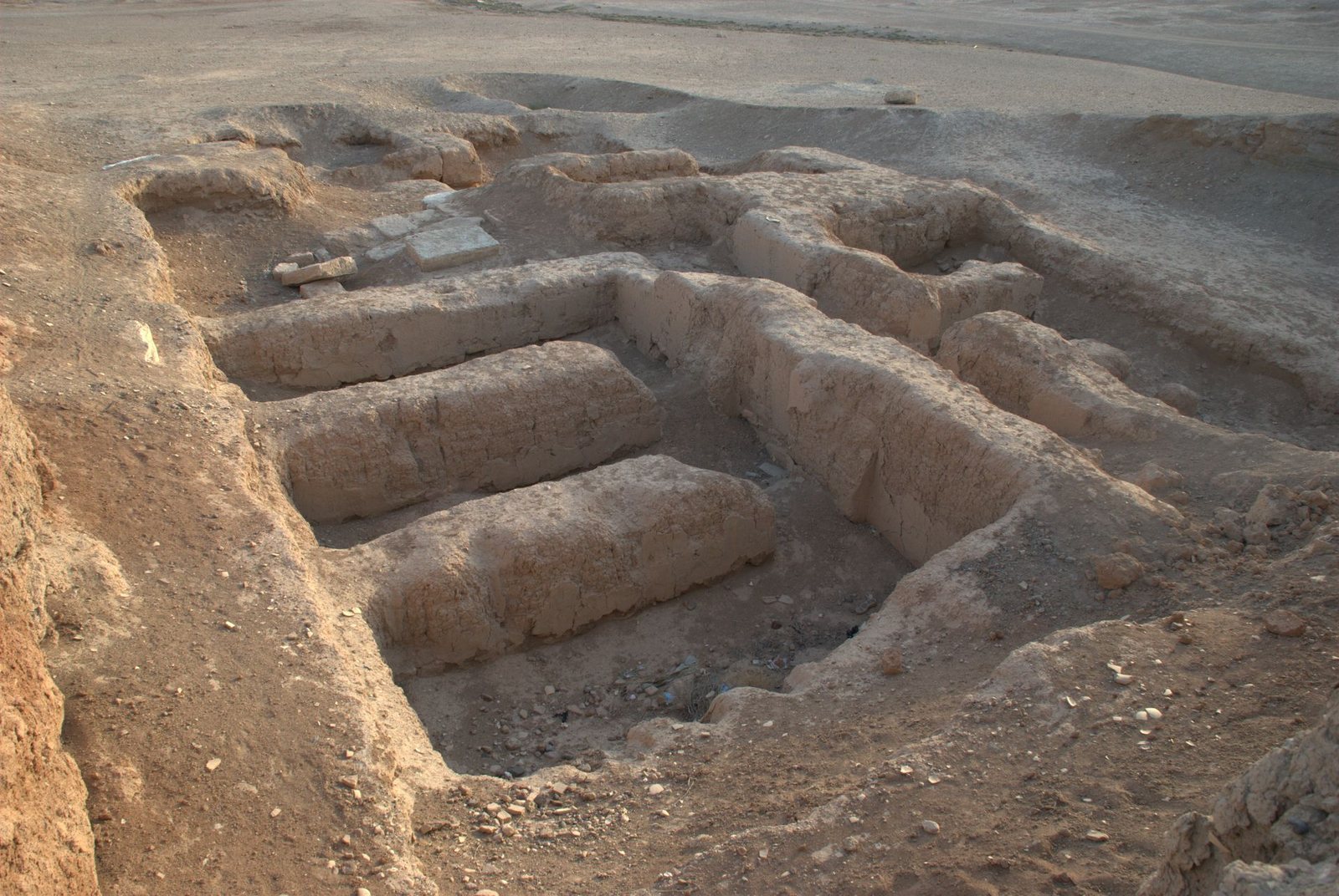
Six above-ground, multichambered royal tombs were found at the southern end of Mound E in Early Bronze Age levels. Built of mudbrick and comparable to the royal tombs at Ur, they were intended for local rulers and had been looted in antiquity. Their finds included human and animal bones, jewelry, inlaid furniture, and pottery. The excavated remains represent 32 people, including 14 women and adult or subadult males. One burial remained intact, accompanied by a flat axe, two axes with holes for their handles, a quiver with a bronze base, and a dagger.
Cemetery beyond the settlement
A cemetery from the same period lay about 700 metres outside the settlement. Its graves were markedly poorer than the royal tombs.
Building indicated on Mound D
A 2002 geomagnetic survey, which maps magnetic variations to help locate buried structures, indicated a square building about 30 metres across on Early Bronze Age Mound D, near Palace A. The survey also indicated a wall enclosing the palace complex.
Monastery and later cemetery
Monastery on the central mound
The monastery complex covered about 2,500 square metres and included a church dating to the sixth century. Its mudbrick walls survive to a height of up to 80 centimetres. A communal dining room had omega-shaped benches and mosaic floors. Inscriptions on two of the three floors give the dates 509 and 595, while coins found in the floors provide further evidence for the complex’s history. Beneath the monastery, excavations exposed two or three Middle and Late Bronze Age layers, each about half a metre thick, separated from the monastery remains by a 10 to 15 centimetre layer of earth.
Western burial ground
The cemetery that served the site from about the third century CE through the early Islamic period occupied the western mound, especially Mound B.
Tablets, seals, and inscriptions
Tablets and seal impressions
About 200 cuneiform tablets, written in a wedge-shaped script used in ancient Mesopotamia, are associated with Tuttul, chiefly with the Old Babylonian palace. Around 51, reused as building fill, probably belong to the Isin-Larsa period. Most of the others date to Yasmah-Adad’s time, while two are later. Numerous seal impressions, designs pressed or rolled onto a surface with a seal, were also found. They include local seals of palace officials, seals belonging to senior officials associated with Shamshi-Adad’s administration, and imported seals that arrived with traded goods. Many impressions came from imported merchandise or private seals used by residents; relatively few were official seals.
Inscribed axe
A bronze axe known from the antiquities market bears an inscription naming Il’e-Lim as lord of Tuttul.