Castrotorafe: A Medieval Fortified Settlement in Spain
Site at a Glance
- Popularity
- Medium
- Country
- Spain
- Primary era
- Medieval
- Eras represented
- Medieval
- Civilizations
- Kingdom of León
- Site type
- Settlement
- Remains
- Town
On this page11 sections
History
Roman possibility and the twelfth century
Castrotorafe is a ruined medieval fortified settlement on an escarpment beside the River Esla, at the Ricobayo reservoir in Spain. Its origins may lie at Vico Aquario, a Roman road station on the Via de la Plata, an ancient route across the Iberian Peninsula, but the town is first recorded in 1129. That year, Alfonso VII of León and his wife, Berenguela of Barcelona, granted it a charter setting out the community’s rights and obligations, and defined the district governed from the town.
After Portugal became independent in 1143, Castrotorafe’s strategic value grew. The settlement may have supported Portuguese separatists, prompting Alfonso VII to order its walls demolished and part of its territory transferred to Moreruela. When León and Castile separated in 1157, Fernando II of León promoted the town. He granted it to the Order of Santiago in 1176, and the order issued it a charter two years later.
Royal and religious authority
Urraca of Portugal, a widowed queen of León, later assigned Zamora Cathedral half the toll income from traffic crossing Castrotorafe’s bridge. After a fire damaged the cathedral early in the thirteenth century, a ruler granted tithes and other support for its rebuilding and work on its cloister.
After Urraca died in 1211, Castrotorafe passed to Martín, bishop of Zamora, who gave it to the Order of Santiago. The crown also took possession of the town and castle despite the order’s opposition. An agreement made at Benavente in 1230 united León and Castile under Fernando III. Castrotorafe then became an important fief, a landholding granted within a relationship of service, and came under papal authority, the governing power of the Catholic Church.
Political and military upheaval
The town became involved in thirteenth-century disputes over the succession of Sancho IV. In 1296, Prince Juan, son of Alfonso X, declared himself an independent king of León. He may have initiated the castle’s construction; his will refers to it in 1319. The town later returned to the Order of Santiago. In 1333, Alfonso XI authorized Vasco Rodríguez to choose five Jewish residents for Castrotorafe.
In 1351, Pedro I asked the order to hand the town to Juan Alfonso de Albuquerque. After losing the king’s favor, Albuquerque took refuge at Castrotorafe and later fled to Portugal. Pedro granted the town to Men Rodríguez de Sanabria. Under Enrique III, it was razed as punishment for supporting the king’s brother.
During the Castilian succession war between Isabella and Juana la Beltraneja, a rival claimant to the throne, Alfonso V of Portugal captured Castrotorafe and besieged its castle in 1475. He abandoned the effort when Fernando II of Aragon arrived in Zamora. The following year, while the Catholic Monarchs, Isabella and Fernando, besieged Zamora, they secretly reached an agreement with Castrotorafe’s mayor, Alfonso de Valencia, who was to receive the same office at Castrotorafe. In 1480, the monarchs ordered the town handed to Alfonso Enríquez, count of Alba de Aliste. Alfonso de Valencia carried out work on the castle and tried to compel residents of Pajares to assist. Their revolt led the monarchs to rule in the villagers’ favor in 1481.
Abandonment and later protection
From the fifteenth century onward, bridge problems and poor sanitation contributed to the settlement’s abandonment, and the castle later fell into disrepair. By 1751, the deserted place, then described as San Pelayo, had only one hermit. The castle was considered destroyed, while the church was the sole building still standing. A 1798 disentailment, a legal transfer of church property, enabled religious images and other resources to be moved. The church continued in use as a hermitage into the nineteenth century. Napoleonic troops looted it, and its altarpiece and the Virgin of Realengo were transferred to the church of San Cebrián de Castro. The building at Castrotorafe later became a ruin.
Castrotorafe was declared a National Monument by decree on 3 June 1931 and has held the Site of Cultural Interest designation in the archaeological-zone category since 1949. Abandonment and a lack of structural stabilization have left its visible remains vulnerable to deterioration and collapse; Hispania Nostra has included the site on its red list of endangered heritage. Consolidation work at the castle’s northwest corner was authorized in 2009, but one of its corner towers collapsed in 2010.
Remains
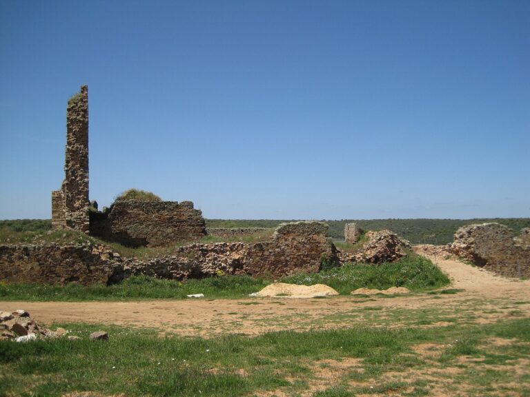
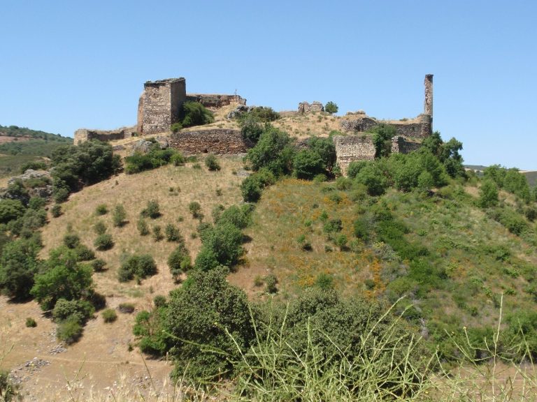
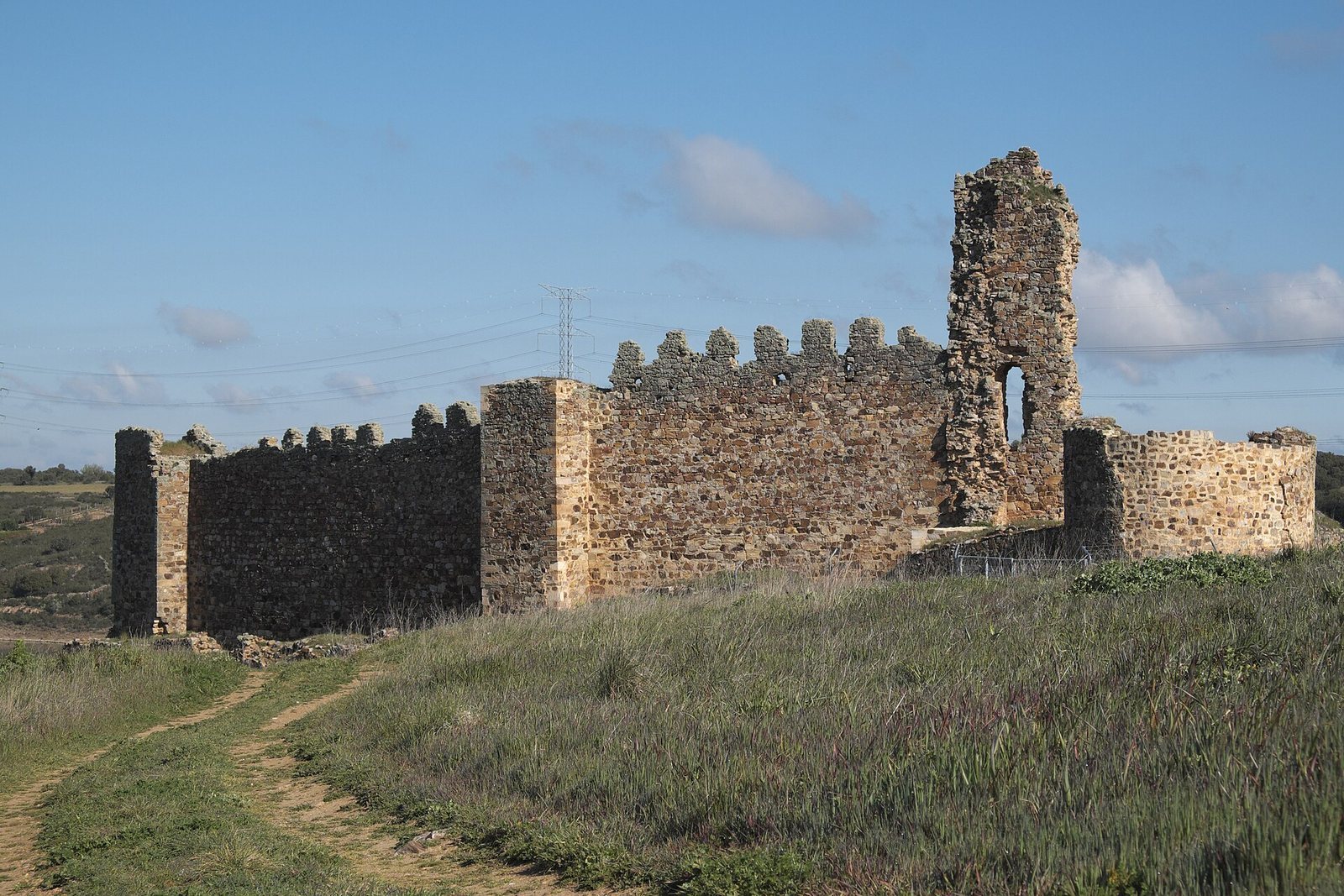
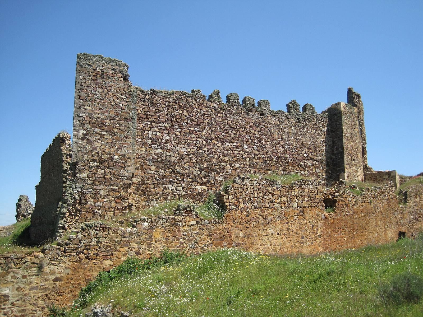
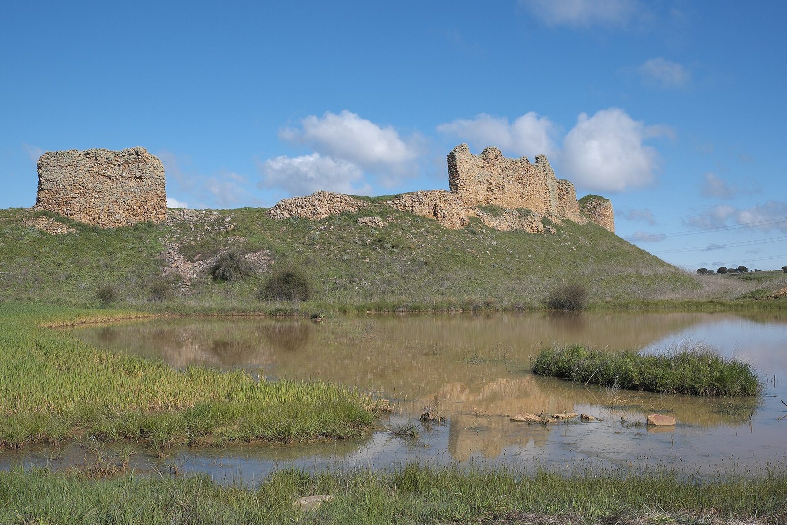
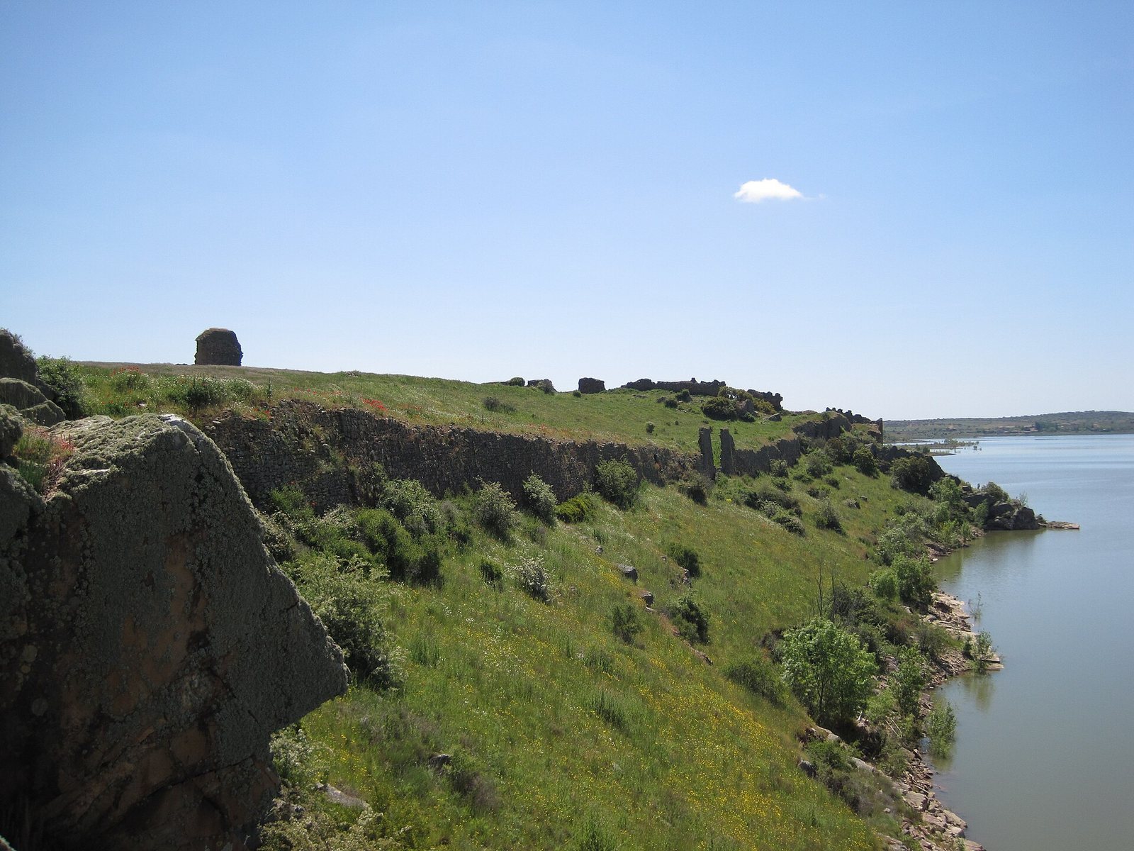
The ruins stand at about 718 metres above sea level on an escarpment beside the River Esla and the Ricobayo reservoir. The settlement’s remains include defensive walls, the castle, bridge piers, church walls, and watermills. The castle is formed by two irregular, roughly trapezoidal enclosures.
Castle
The castle occupies the settlement’s northwest corner. Its outer enclosure is built of rubble masonry and has towers at the corners, two of which were modified to accommodate artillery. Two gates pierced its walls, one opening toward the settlement and the other toward the bridge; the western entrance was known as the Gate of Coraja. The similarly shaped inner enclosure has two towers on its south wall, built from more carefully worked small stone blocks than the other walls. A staircase gave access to the wall-walk, a path along the top of a defensive wall. The inner enclosure is now completely ruined.
Settlement wall
A stone perimeter wall enclosed an area of 4,709 square metres. The irregular circuit ran for more than a kilometre, with the castle at its northwest corner. Only sections of the wall survive, and these are ruined.
Bridge
The bridge linked the settlement, especially the castle, with the opposite bank to provide passage across the river. It collapsed in the sixteenth century, leaving masonry piers at the approaches. Its earlier design may have resembled Zamora’s stone bridge, with a sequence of arches.
Church
Only a few standing walls remain of the church. Its plan may have been basilican, arranged around a central nave and often including side aisles, a common form for the period.
Watermills
Four watermills survive, though the settlement may once have had more; they supplied its needs. The oldest, the Igal Mill, lies below the castle. The Flores Mill had a large weir, while the Presamediana and Pisones mills stand together beyond it. The Santa Clara Mill belonged to the convent of Santa Clara in Zamora.