Castra Othona: A Roman Saxon Shore Fort in Essex
Site at a Glance
- Popularity
- Medium
- Country
- United Kingdom
- Primary era
- Classical
- Eras represented
- Classical, Medieval
- Civilizations
- Anglo-Saxon, Roman
- Site type
- Military
- Remains
- Fort
On this page13 sections
History
Castra Othona was a Roman coastal fort on the Dengie Peninsula in Essex, United Kingdom, probably built in the late third century as part of the Saxon Shore, the late Roman coastal military district and network of defenses.
Othona and the Carausian Revolt
The fort was probably constructed during or shortly before the Carausian Revolt, Carausius’s late-third-century break from imperial authority in Britain. Finds suggest that construction took place under his rule. The name also appears as Othonae, but its meaning is uncertain. A proposed connection with the emperor Otho, who ruled briefly in AD 69, is considered highly unlikely because the Saxon Shore forts were built centuries later.
The fourth-century Roman historian Eutropius recorded that around 285 the naval commander Carausius was assigned to protect the Channel from Portus Itius, at modern Boulogne, against raiders he called Franks and Saxons. Their attacks disrupted civilian shipping and the movement of British trade goods and precious metals to Gaul and Rome. Around 287, Carausius reorganized coastal defenses. Together with his successor Allectus, he developed a chain of forts through new construction and the adaptation of existing sites. These defenses also reflected concern that the Roman government might invade the breakaway territory.
Roman command and garrison
In 398, when the Roman army under the general Flavius Stilicho again operated on a large scale in Britain, the administration established the Litus Saxonicum, a coastal military district on both sides of the Channel. British forces were commanded by the comes litoris Saxonici per Britanniam, the commander of the Saxon Shore forces in Britain. This office may have first appeared in the Notitia Dignitatum, a late Roman register of government offices and military units, around this time. The defenses were linked to Roman military posts in Gaul, while Britain’s rivers offered Germanic raiders in shallow boats routes inland.
An early-fifth-century entry in the Notitia Dignitatum names Othona’s garrison as the Numerus Fortensium, meaning “unit of the brave,” a Roman military unit. Its commander held the rank of praepositus, an officer in command. Othona may also have served as a harbor and supply base for the Classis Britannica, Rome’s fleet associated with Britain, although a permanent fleet presence there is uncertain.
Monastery and later history
After Roman rule ended, Anglo-Saxons called the locality Ythancester, probably adapting the name Othona. In 653, Cedd, a missionary and bishop of the East Saxons, founded a monastery on the former fort site. The monastery became a base for the Christianization of Essex.
A storm surge in November 1099 may have destroyed much of the fort area. Its western walls remained into the seventeenth century, when the writer Philemon Holland described them as a “huge ruin.”
Rediscovery and continuing use
Essex antiquarian and archaeologist Oxley Parker identified the remains in 1864 and opened exploratory trenches inside the fort. Extensive excavations followed in the late nineteenth and mid-twentieth centuries. In 1947, Brinson excavated a trench at the west wall. A later survey assessed erosion and archaeological potential, while geophysical investigations indicated that damage to the foundations was less severe than feared.
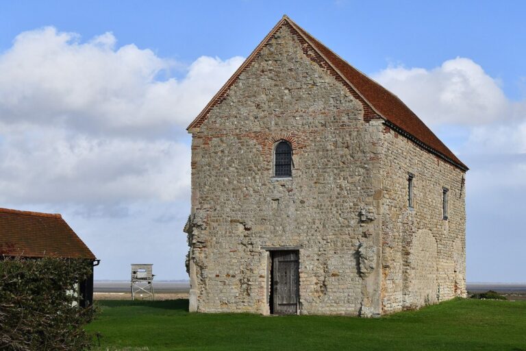
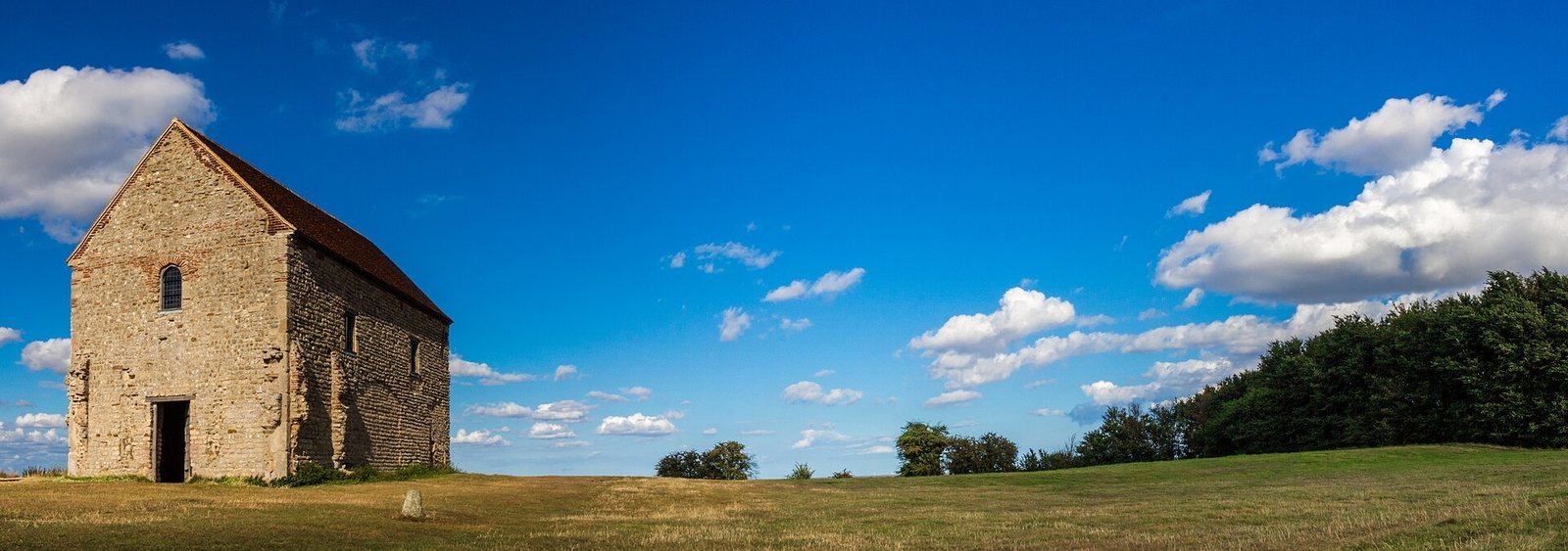
St Peter-on-the-Wall chapel remains in regular use for Church of England services and by the Othona Community, a Christian community and retreat centre founded in 1946 by Church of England priest Norman Motley. The chapel belongs to Chelmsford Cathedral.
Remains
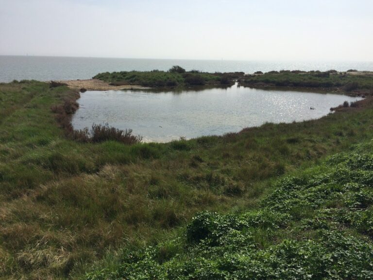
The fort stood at the edge of the Dengie Peninsula, overlooking the estuaries of the Blackwater and Colne rivers. Its position controlled the mouth of the Blackwater and the Colne, which led toward Camulodunum, modern Colchester. The roughly trapezoidal fort had rounded corners and a stone rampart. Its surviving foundations enclose close to two hectares, while the original fort extended farther.
Ramparts and defensive layout
Rampart and walls
The rampart was built largely from local stone and faced with three external bands of brickwork. An inner earth ramp supported the wall, whose substantial foundations consisted of tightly packed rubble and fieldstone set in mortar. A trench through the south wall measured it at about 4.2 metres thick. Robin George Collingwood described the wall base as 12 feet thick, with masonry standing more than 4 feet high. He recorded the west wall as 522 feet long and estimated the north and south walls at 290 and 150 feet respectively. Those two walls ended at the riverbank. The western, northern, and southern outlines remain discernible; tidal erosion has removed much of the eastern side, where a few masonry traces survive.
Towers, ditch, and gate
At least three towers projected from the walls, with horseshoe-shaped plans. They stood at the northwest corner, between that corner and the chapel, and at the southwest corner. Collingwood described the intermediate towers as oval and considered them probably contemporary with the wall. A single external V-shaped ditch surrounded the fort and is best preserved on the west; its fill included Anglo-Saxon pottery. A gate stood on the west side, and the northwest sector is considered the likely location of the barracks.
Chapel, roads, and finds
St Peter-on-the-Wall
The mid-seventh-century chapel of St Peter-on-the-Wall was built on the foundations of the Roman west gate. Its masonry incorporates Roman bricks and limestone reused from the fort. The chapel is now the principal visible marker of the archaeological site. About two metres of the south wall survive beneath trees and brambles, and intensive agricultural use around the chapel has been associated with continuing loss of remains.
Road connections
An eastern road connected the fort with the mainland. A proposed Roman route ran from Othona toward the Crouch near Battlesbridge, where it joined another road leading to a Roman settlement on Foulness Island. The route continued along the Crouch to meet a north-south road at Brentwood.
Archaeological finds
Finds from the fort include first-century clothing brooches, arm rings, Roman and Anglo-Saxon iron objects, a fragment of stamped hollow tile, and a gold ring set with an onyx cameo. More than 200 coins range from the reign of Gallienus to that of Honorius. Most bear Carausius’s portrait, and many date to the Constantinian period. Coins and pottery together span about 280 to 468, while a few finds are attributed to the second century, including a clothing brooch found within the fort.
Roman wall stone has also been found in shoreline mud with Roman pottery, including terra sigillata (red-gloss Roman pottery) and Nene Valley Ware (pottery made in the Nene Valley), as well as roof-tile fragments. Most finds from the fort are held at Colchester Museum.