Stahlberg Castle: A Medieval Fortress above Steeg, Germany
Site at a Glance
- Popularity
- Medium
- Country
- Germany
- Primary era
- Medieval
- Eras represented
- Medieval, Modern
- Civilizations
- Electoral Palatinate, Electorate of Cologne, German, Holy Roman Empire
- Site type
- Military
- Remains
- Castle
On this page15 sections
History
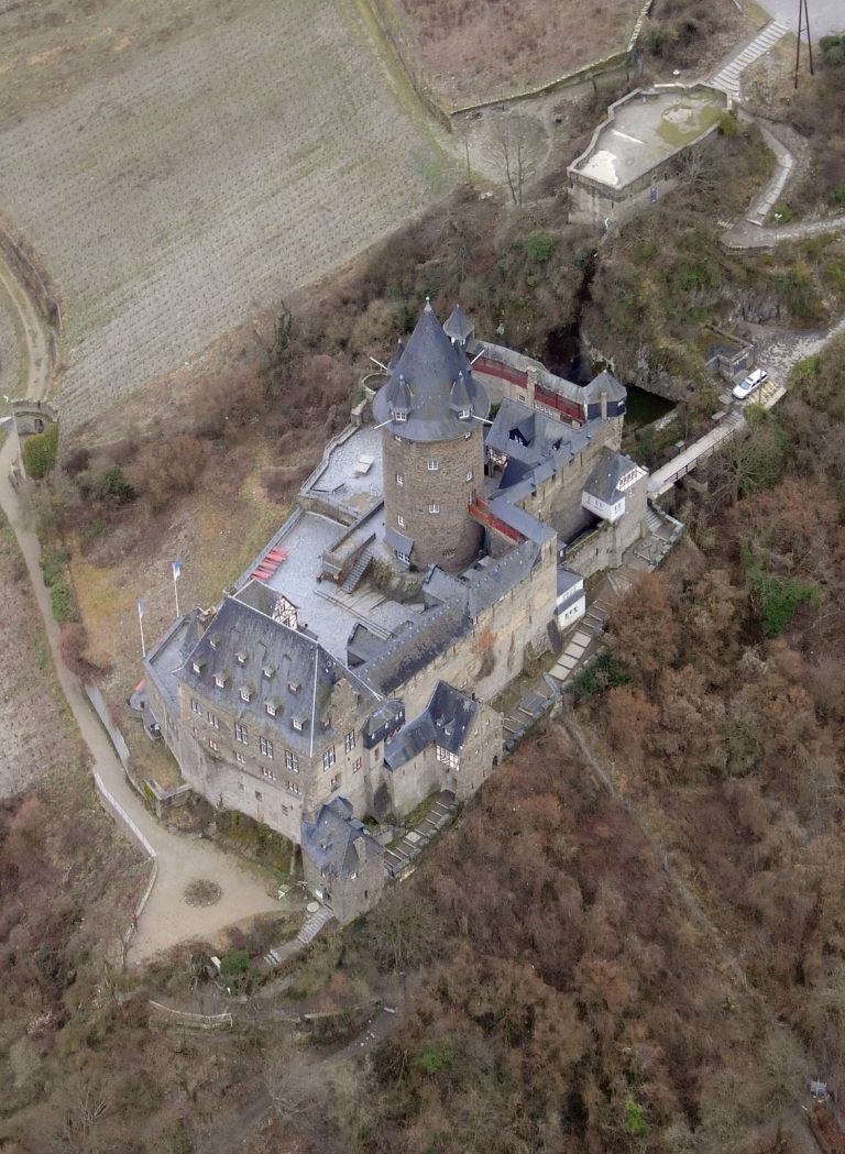
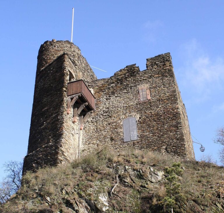
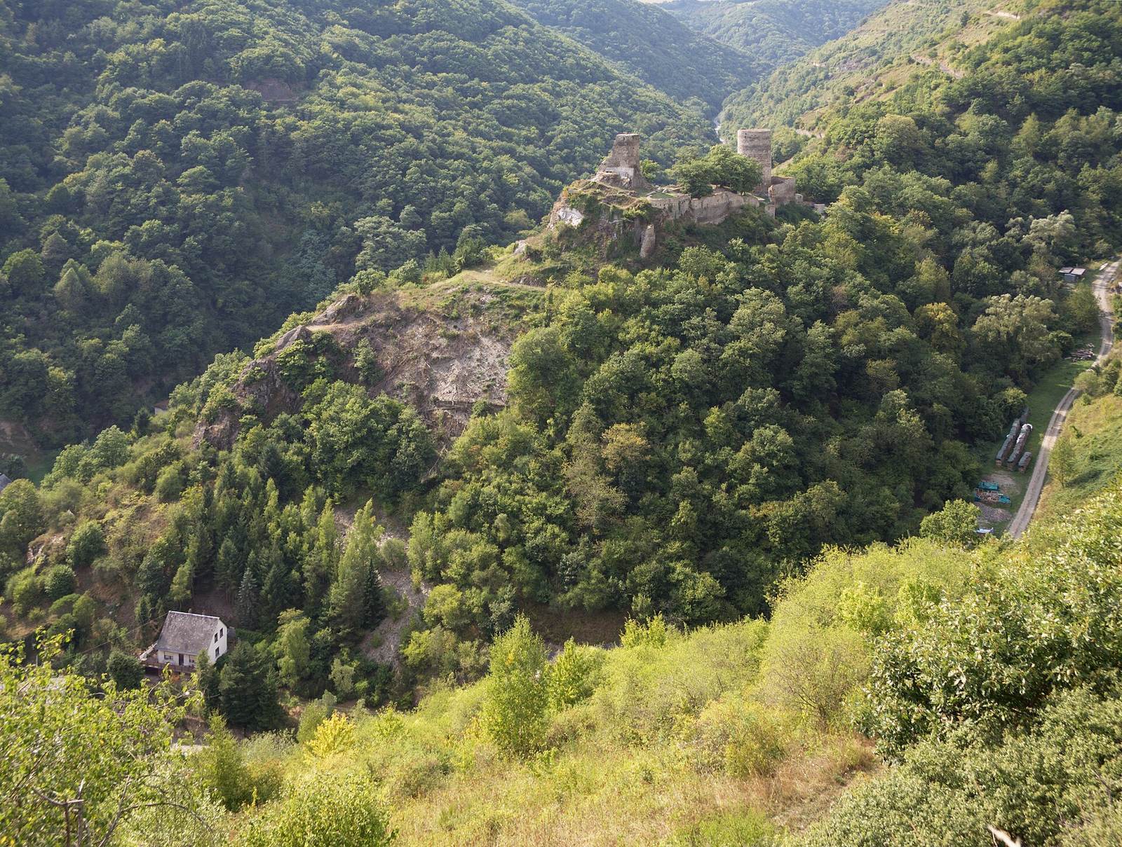
Stahlberg Castle is a medieval fortress on a ridge above Steeg, part of Bacharach, in Germany. Tree-ring analysis dates construction of the castle as a whole to 1158–1168. Much of it is Romanesque, a medieval architectural style marked by rounded arches and massive masonry. The dating indicates that the upper and lower parts belong to the same building campaign. The archbishops of Cologne probably commissioned the castle to secure their lands in the area. It may also have been planned as a counter-castle, a fortress intended to oppose nearby Stahleck Castle.
Cologne and the Counts Palatine
Around 1120, Gozwin of Stahleck served as a Vogt, a lay official who represented or administered ecclesiastical interests, over the Cologne archbishopric’s lands on the Middle Rhine. His son Hermann later became a Count Palatine, a high-ranking territorial ruler, and acted largely independently. This earlier political setting forms part of the context for the possibility that Stahlberg was intended to counter Stahleck.
In 1243, Stahlberg and Fürstenberg passed to the Wittelsbach counts palatine of the Rhine as fiefs, or lands held under a feudal arrangement. The archbishops of Trier held Stahlberg in pledge from 1317 to 1353; otherwise, it remained in the counts palatine’s possession. Castle governors, known as burgraves, from the Knebel family of Katzenelnbogen administered it for an extended period.
Expansion and Administrative Use
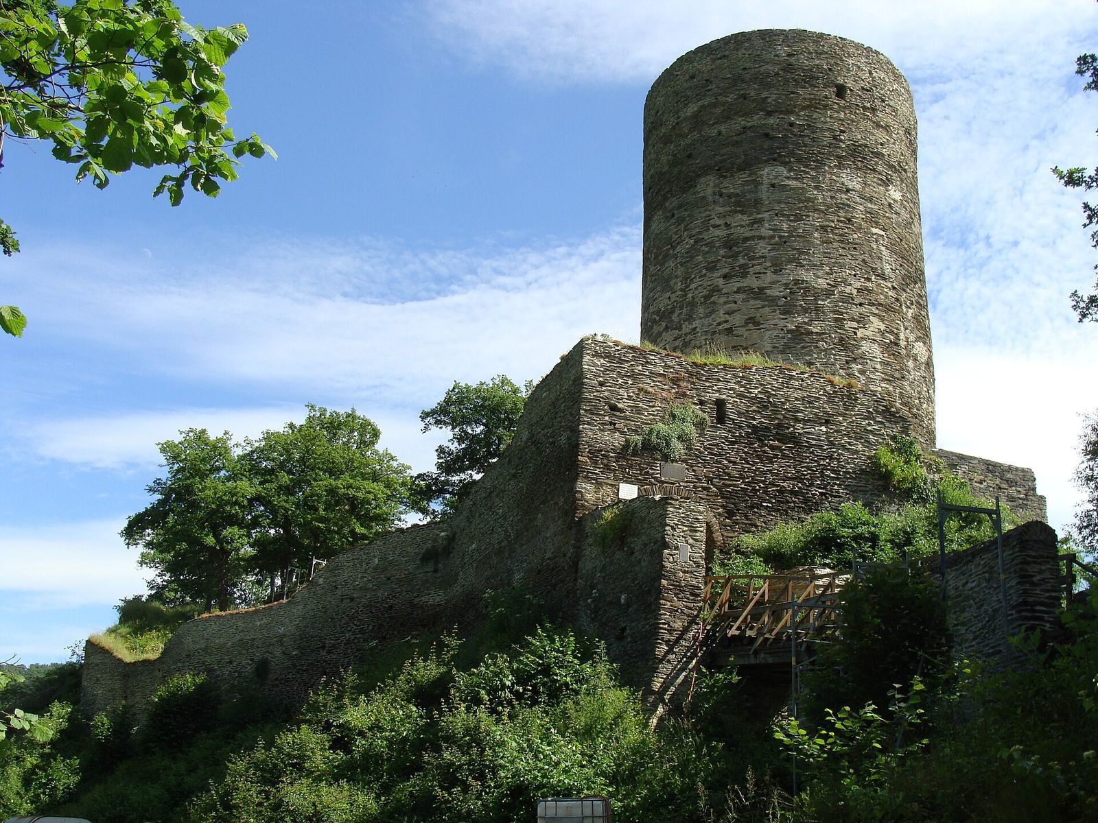
After the rectangular defensive tower and southwest ring wall suffered collapses, a major expansion followed in the second quarter of the 14th century. The round defensive tower was raised during this work. In that century, Stahlberg served as an administrative center for the counts palatine, even as they shifted their main seat of power to Heidelberg. Smaller expansions took place around 1470.
The outer bailey, the castle’s outer enclosed area, remained in use into the 15th century, while the inner ward, its principal fortified enclosure, continued in use into the 17th. By the 16th century, the inner ward’s armament was outdated as firearms came into use around 1500.
Decline, Conflict, and Preservation
During the Thirty Years’ War, a major European conflict fought from 1618 to 1648, Swedish troops may have damaged the castle in the early 1630s while capturing Bacharach. Troops occupied Stahlberg again in 1638 and 1647. It was described as derelict in 1678. The castle apparently escaped the destruction that befell Stahleck and Fürstenberg in 1689, instead deteriorating gradually. Excavations at the chapel have helped clarify that process.
The Rhenish Association for Monument Preservation and Landscape Conservation has owned the ruin since 1912, when it cleared the site. Stabilization work followed in 1930–31 and 1967, with further repairs in the 1980s and 1990s. From 2009 to 2013, work focused on the southwest defensive wall, round tower, and entrance, as well as excavation and stabilization near the hall and chapel. Repairs to the inner ward have continued since 2021. Since 2002, Stahlberg has been part of the Upper Middle Rhine Valley UNESCO World Heritage Site, a designation for places considered to have outstanding importance to humanity.
Remains
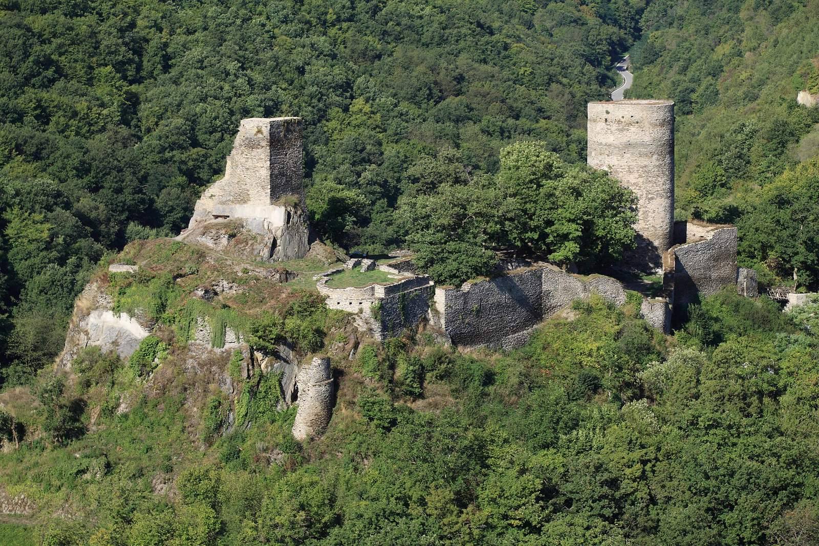
The castle follows a projecting ridge as a spur castle, a fortification built on a ridge extending from higher ground. Its complex runs north-northwest to south-southeast, toward Bacharach-Steeg, between the valleys of the Dorweiler Bach to the north and the Borbach to the south. The inner ward extends for roughly 100 metres, with the upper castle toward Steeg and lower defenses on the approach side.
Outer Defenses and Approaches
Outer bailey
Facing toward the Hunsrück, the outer bailey retains walls just over two metres high. It defended the castle’s attack side and the approach from Steeg, which crosses the neck ditch, a defensive cut across the narrow approach to a ridge.
Lower defensive tower
A round tower in the lower castle guarded the attack side, the neck ditch, and the long approach. Its position connected the lower defenses with the approaches to the inner enclosure.
Historic approaches
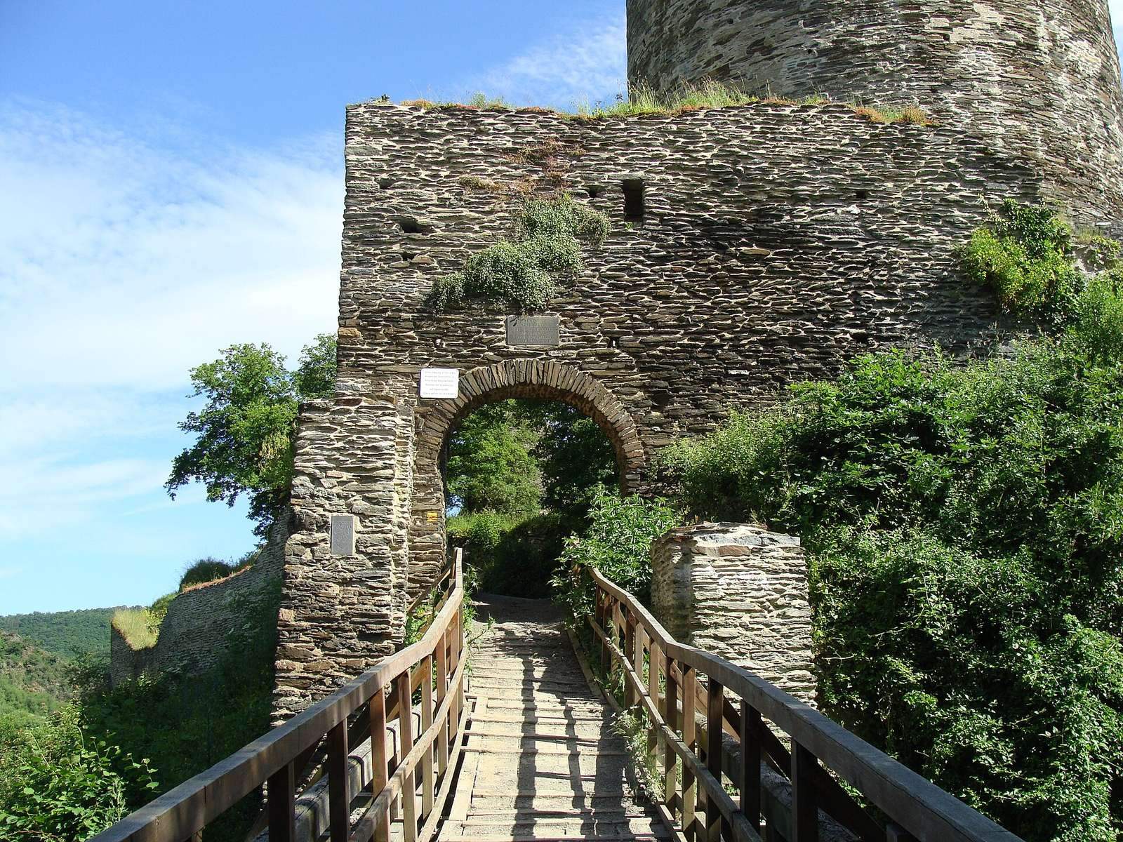
A wooden bridge now crosses the neck ditch. From the Dorweiler Bach valley, a long, steep historic approach climbs toward the castle, supported by a high retaining wall. The wall is an unusual example of high-medieval engineering in the Middle Rhine region. The upper part of the route from Steeg across the ditch was also supported by this retaining wall.
Inner Ward and Defensive Lines
Ring wall and outer circuit
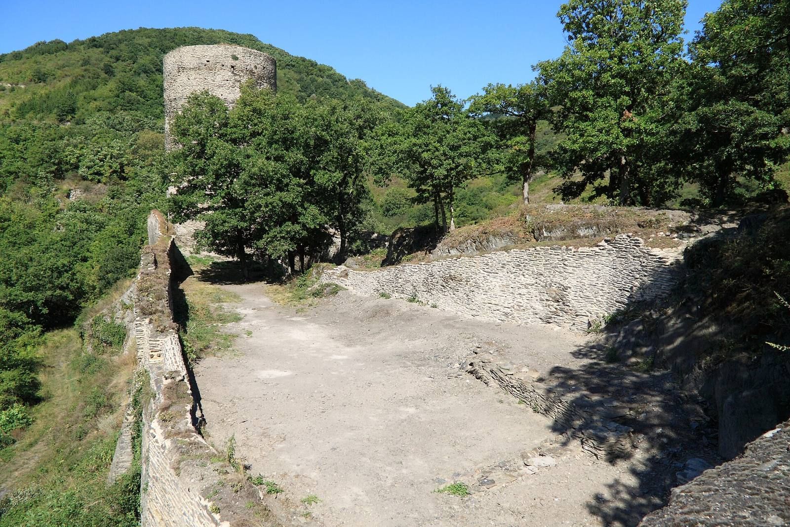
The inner ward’s ring wall survives in part, along with remnants of a wall walk, the path along the top of a defensive wall. A broader passage or circuit surrounds the ward and may have functioned as an outer defensive enclosure. A palisade may have been intended to provide its wartime defensive line.
Southwest wall
On the southwest side, a wall 63 centimetres thick descends from a buttress. It may have connected the castle with the Gebück, a hedge-based defensive boundary associated with protecting the area encompassing Bacharach, Rheindiebach, Manubach, and Steeg.
Upper Castle Buildings
Hall, chapel, and stair tower
The upper castle’s principal building group comprised a great hall, a chapel dedicated to Saint Peter, and a stair tower. The hall’s cellar survives. The chapel retains its ground plan, including a recessed apse, the rounded recess at a chapel’s end, and remains of the stairs leading to its gallery. The stair tower may also have linked the upper castle to a possible area for service buildings and staff accommodation on the southeast part of the ridge, below the upper castle.
Rock-cut ramp and angular tower
Near Steeg, a ramp cut into the rock retains wheel ruts. An angular defensive tower in the upper castle is surrounded by the remains of buildings.