Fort Suzac: A Coastal Defense Fort in France
Site at a Glance
- Popularity
- Medium
- Country
- France
- Primary era
- Modern
- Eras represented
- Early Modern, Modern
- Civilizations
- French, German
- Site type
- Military
- Remains
- Fort
On this page14 sections
History
Fort Suzac is a coastal defense site on Suzac Point in Saint-Georges-de-Didonne, France, where French batteries were established in the seventeenth century to guard the entrance to the Gironde estuary and access to Bordeaux’s port. Its defenses were strengthened and rebuilt over several centuries as military threats and weapons changed.
Early batteries and nineteenth-century modernization
The defenses were substantially strengthened during the First French Empire, when Napoleon I ruled France. Around 1840, renewed tensions with Britain led to plans to modernize the older batteries. A new guardhouse followed in 1846, but advances in weapons and fortification soon made it outdated.
A broader redesign took shape in 1877, with Suzac and Fort du Chay forming part of the defenses of the Royan area. Their artillery positions were planned to overlap with the fields of fire of Fort de Grave and Fort du Verdon at Pointe de Grave. A protected powder store was built at Suzac in 1882. In 1912, the fort fell under the Bordeaux/Blaye district of the French military engineers.
German fortifications and the 1945 fighting
German military construction began at Suzac in August 1942 under Organization Todt, the German agency responsible for major military engineering projects. The work continued into 1943 as part of the Atlantic Wall, Germany’s coastal defense system intended to deter an Allied landing.
In August and September 1944, Suzac became a major German strongpoint in the Royan pocket, an area held by German forces as Allied lines advanced around it. The site was targeted during Operation Venerable, the Allied campaign to liberate Royan. In April 1945, bombers and the warships Lorraine and Duquesne attacked the fort. Its garrison surrendered on 15 April, the day after Meschers was liberated.
Abandonment and protection
After the war, the fort was abandoned and became overgrown. The headland was also used as a motocross track before public authorities recognized its ecological and historical importance. The Conservatoire du littoral, a French public agency that acquires and protects coastal land, acquired the headland, which was designated a protected natural area. Paths and interpretive signs were installed in the 1990s.
Remains
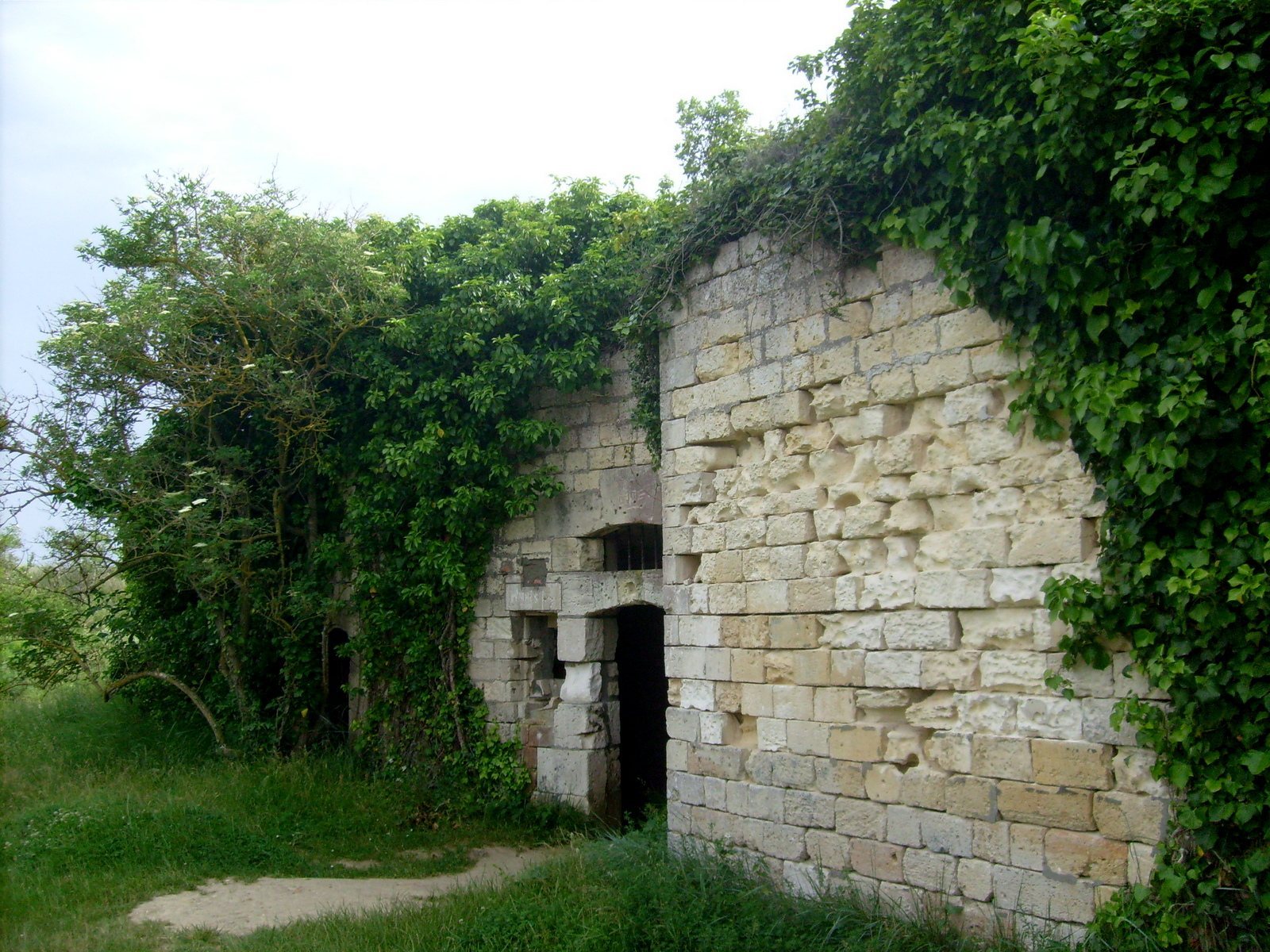
The defenses occupy a naturally defensive headland at the entrance to the Gironde estuary. Their physical remains reflect successive phases of coastal fortification, from French gun positions to German concrete works. The cliffs are being worn away by the sea and wind, while shell craters from the April 1945 fighting remain visible in the landscape.
French coastal defenses
Coastal tower
Napoleon I ordered an 1811-model tower, a standardized French design for coastal defense, armed with twelve guns. The tower formed part of the fort’s earlier system of batteries.
Guardhouse
Built in 1846 to a crenellated design, with a toothed defensive parapet, the guardhouse followed the type 2 pattern used between 1846 and 1861. It was equipped with eight 30-pound guns and designed to house forty soldiers.
Batteries and ammunition lift
The renovated batteries included an ammunition lift and two 16 cm howitzers, artillery pieces designed to fire shells on a high trajectory. They also held two 19 cm guns and two 27 cm guns. In 1912, the fort’s armament comprised two 19 cm guns, two 27 cm guns, and four 95 mm Lahitolle guns, a French artillery design, mounted for coastal defense.
Powder magazine
A protected, enclosed powder store was built in 1882 and survives at the site. Its construction sheltered gunpowder within the fortifications.
German fortifications
Concrete casemates and artillery
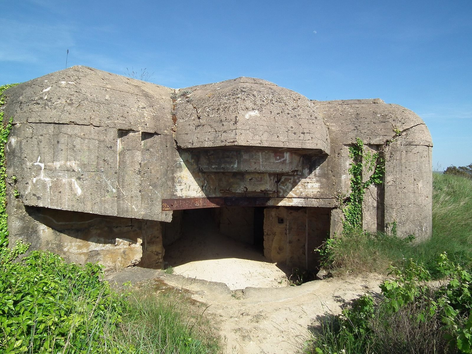
German construction added eight concrete casemates, protected enclosed positions for guns. During the Royan-pocket period, the weapons included four 105 mm K 331 Schneider guns captured from the French army in 1940, four 76.2 mm GK 307 guns, 50 mm mortars, antiaircraft guns, and 20 mm machine guns. A long-range searchlight and a minefield protecting the approaches also formed part of the defenses.
Fire-direction and defensive positions
The fort included a fire-direction post, a position used to observe and direct artillery fire, identified as H 636 A. Other works comprised a shelter, five blockhouses, and small, generally open-topped defensive emplacements known as Tobruk positions. The listed designations include H 669, H 671, and H 134. A terrace on the fire-direction post affords views over the estuary, the Médoc coast and Pointe de Grave, the Meschers cliffs, and, to the north, Royan and the Grande-Côte. On clear days the view reaches the Île d’Oléron.
One bunker was converted into a dwelling and remains visible.
Headland and vegetation
Mediterranean-type scrub covers parts of the headland, including pines, holm oaks, and strawberry trees. The Chemin de l’Anglais runs beneath the trees toward Suzac beach and Suzac forest.