Limantepe: A Prehistoric Harbor Settlement in Türkiye
Site at a Glance
- Popularity
- Medium
- Country
- Turkey
- Primary era
- Bronze Age
- Eras represented
- Stone Age, Bronze Age
- Civilizations
- Unclassified
- Site type
- City
On this page17 sections
History
Limantepe is a prehistoric harbor settlement at Urla, in İzmir, Türkiye, inhabited from 3300 BCE. Its artificial harbor made it one of the oldest known ports in the Aegean. It may also have been the earliest and longest-inhabited center on the Anatolian Aegean coast.
Prehistoric settlement and Aegean networks
The sheltered natural harbor may have attracted settlement as early as the Late Neolithic, a later Stone Age period associated with farming and settled communities. The settlement was occupied from 3300 BCE, with remains from the Chalcolithic, or Copper Age between the Neolithic and Bronze Age, followed by successive Bronze Age phases. The Bronze Age was a period when bronze became prominent in tools and other cultural developments.
During the Early Bronze Age, Limantepe joined trade routes linking Cilicia, the İzmir region, and Troy, with connections extending across Anatolia and Thrace toward Mesopotamia. Its exchanges also reached the Aegean island world. The Kastri culture, an Early Bronze Age culture named for a settlement on Syros, served as an intermediary between Limantepe and the Cyclades, the islands of the Aegean. Kastri, occupied around 2500–2200 BCE, had fortifications with horseshoe-shaped bastions resembling those at Limantepe. Its pottery and tin bronze, an alloy of copper and tin, also show similarities to material from Limantepe and other parts of Anatolia. Its pottery included depas drinking vessels, bell-shaped cups, and small pyxides, or containers, with Anatolian characteristics.
During the Chalcolithic, Limantepe shared cultural connections with the eastern Aegean islands and the western Anatolian coast. In the Early Bronze Age, links also connected it to Tepekule and Bayraklı, later associated with Old Smyrna, to Panaztepe near the mouth of the Gediz River, and to Cyprus. Some of these relationships continued into the Middle Bronze Age.
Late Bronze Age to Roman period
Limantepe’s Late Bronze Age level dates to the 14th and 13th centuries BCE, a period broadly associated with the Trojan War. Some objects from this phase reflect cultural closeness to the Mycenaeans, a Bronze Age Greek civilization. The surrounding region may have belonged to Mira, a western Anatolian kingdom under the authority of the Hittite Empire, a major Bronze Age power.
In the sixth century BCE, Alyattes, king of Lydia, attacked the area. Later, during the Ionian Revolt, an uprising of Greek cities in western Anatolia against Persian rule, fear of Persian attacks led to the reorganization of settlements in the region. Nearby Klazomenai was moved to an offshore island. In the Hellenistic period, which followed classical Greece and spread Greek cultural influence across the eastern Mediterranean, and in Roman times, Limantepe was known as the Greek town of Larisa. Klazomenai remained a distinct city immediately south of the site. It used the mound created by prehistoric remains as its acropolis, the elevated central area of an ancient settlement, and occupation in the area continued into the Roman period.
Archaeological investigation
Ekrem Akurgal identified Limantepe as a prehistoric settlement in 1950. Excavations at Klazomenai began in 1979 under G. Bakır and Ç. Anlağan and included Limantepe as a possible acropolis. From 1992, work focused directly on Limantepe under Hayat Erkanal and an international team, and has continued since. Land excavation has been complemented by underwater archaeology and geological research led by M. Artzy, with participation from the Recanati Institute for Marine Studies at the University of Haifa and Israeli archaeologists and divers.
Remains
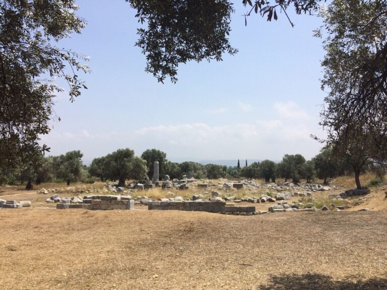
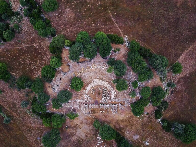
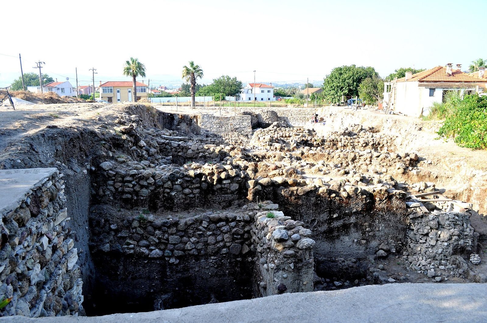
Limantepe occupies a peninsula where a natural rocky outcrop meets the bedrock. The projecting landform extends toward the Gulf of İzmir and has natural harbors at both ends; a fertile plain lies to the south, while rocks to the north offer some shelter from northerly winds. The excavated mound rises in the peninsula’s northern part. Its remains include an artificial harbor, partly submerged defenses, and buildings and fortifications from several prehistoric phases.
Peninsula and harbor
Coastal landform
The northern coastal plain probably developed within a long bay. A sandbar first separated the bay from the sea, after which deposits carried by the Zongurlu and Kocadere streams formed a low plain. Limantepe lies near the modern harbor and south of Karantina Island.
Artificial harbor and underwater finds
The artificial harbor dates to 3300 BCE and extends partly beneath the water offshore. A fortification wall associated with the harbor settlement is also partly submerged. Underwater exploration has recovered vessels and urns thought to have reached the harbor from Greece and possibly Cyprus, with a route through the Black Sea proposed. In 2007, a wooden anchor from a merchant ship was found wedged in the seabed. It dates to the seventh century BCE and may be the oldest anchor of its kind found.
Chalcolithic architecture
Earlier buildings
In the mound’s higher northern area, the earliest excavated architectural level lies directly above bedrock. It contains simple wattle-and-daub buildings, made with an interwoven framework covered in material such as mud, on single rows of irregular stones. At least two building phases are represented. Finds include decorated, burnished vessels, abundant obsidian from the Aegean island of Melos, figurines, and part of a marble vessel with a conical body.
Later house and fire destruction
Above the Middle Chalcolithic layer, the excavated corner of a later wattle-and-daub house preserves evidence of a major fire. Large quantities of wheat seeds were charred inside the building. Its pottery includes dark-slipped and glossy burnished vessels, white-painted pieces, and many bowls with thickened inner rims. Melos obsidian remained in use, including for blades and arrowheads.
Bronze Age architecture
Occupation continued from the Late Chalcolithic into the Early Bronze Age. The excavated sequence also includes three phases of the lowest cultural layer, dated from the third millennium BCE onward.
Early Bronze Age defenses and finds
By at least Early Bronze Age I, the settlement had a substantial defensive system made from stone slabs. A sloping, ramp-like outer wall of gathered stones supported the defenses, with tooth-shaped buttresses spaced about 1.5 metres apart. A large feature uncovered in 1980 and 1981 was interpreted as a bastion, a projecting defensive structure, or a tower; its scale demonstrated the settlement’s importance in this period. Finds from Early Bronze Age I include fragments of finely made Cycladic frying pans, a name for a distinctive decorated ceramic vessel. In Anatolia, examples are also known from Bakla Tepe and Karahisar in the Aphrodisias region; the Limantepe pieces are among the finest found there.
Early Bronze Age II building
Early Bronze Age II remains include two architectural levels. In the later level, dating to the end of the period, excavators exposed part of a wall and the western portion of a building. The wall, partly uncovered in 2005, has large slabs along its edges and rubble stones through its middle. It rests directly on the earlier Early Bronze Age II defensive system.
Middle Bronze Age, Level 3
Level 3 is represented by scattered pottery and the remains of a pig, including its head, ribs, leg bones, and vertebrae. The head faced away from the body, while the backbone lay elsewhere. This arrangement has been interpreted as evidence that the animal was butchered before its remains were deposited. Two cups were also recovered, one beside the head and another among the pottery.
Middle Bronze Age, Level 4
Level 4 preserves the western part of an oval structure aligned northwest to southeast. Slabs over its curved end were damaged. In 2006, three oven bases of undetermined form were found to the east. Their position in the same architectural level and nearby location suggest they may have been used in connection with the structure.
Finds and modern impacts
Many objects recovered at Limantepe are displayed at the İzmir Archaeology Museum. Coastal summer houses have partly damaged the site, and a modern asphalt road crosses the mound from east to west. The excavation director sought to have the road rerouted.