Pacbitun: A Maya Archaeological Center in Belize
Site at a Glance
- Popularity
- Low
- Country
- Belize
- Primary era
- Medieval
- Eras represented
- Iron Age, Classical, Medieval
- Civilizations
- Maya
- Site type
- City
On this page24 sections
History
Pacbitun is a Maya archaeological site in San Antonio, Belize, near San Ignacio in the Cayo District; Maya settlement began there around 900 BCE. The modern name means “stone set in earth” and probably refers to fragments of stone monuments. From a small farming community, Pacbitun grew into a local kingdom and an important political and ceremonial center.
Village and early ceremonial center
The earliest settlement was a small farming village, probably home to only several dozen people. Its residents drew on the resources of nearby forests and lowlands. The favorable setting supported farming, construction, sculpture, and exchange, and helped sustain an autonomous local kingdom whose name remains undeciphered.
Archaeologists divide Pacbitun’s early history into local phases, identified chiefly through pottery and radiocarbon dating. The Mai phase belongs to the Middle Preclassic, a broad period in Maya history, and lasted from about 900 to 300 BCE. The Puc and Ku phases followed during the Late and Terminal Preclassic, from about 300 BCE to 300 CE. Early homes were concentrated around the areas later called Plazas A, B, and C.
During the Late and Terminal Preclassic, the settlement was extensively replanned. Older residential buildings were covered, plazas enlarged, and monumental construction begun. By the end of this period, the population had reached about 500 to 600. The scale of construction points to greater social divisions and growing regional prominence. Work on the ballcourt also began during this era, among the earliest evidence for ballgame architecture in the southern Maya Lowlands.
Dynasty and Classic-period prosperity
In the Early Classic Tzul phase, about 300 to 550 CE, major buildings were enlarged or renewed. Inscriptions on Stela 6 and Altar 3 indicate that a ruling dynasty was established. Imported objects reached Pacbitun, including a green obsidian point from highland Central Mexico and a large stemmed chert point from Colha.
Pacbitun prospered through the Late and Terminal Classic. During the Late Classic Coc phase, about 550 to 800 CE, its population grew to an estimated 1,400 to 1,800 by 800. Its rulers, called ahaws, made the site an important political and ceremonial center in what is now southwestern Belize.
Pacbitun’s political ties to the larger Mutul and Kanul kingdoms remain uncertain. Architectural influence linked to Mutul, the kingdom centered on Tikal, has prompted the suggestion that Pacbitun was within its sphere. After Mutul weakened, local rulers appear to have retained their territory. Pacbitun’s eighth- and ninth-century peak has also been tentatively connected with a renewed expansion of Mutul’s regional influence.
Terminal Classic and abandonment
During the Tzib phase, about 800 to 900 CE, population rose sharply. Around 6,000 people lived across an area of roughly 9 square kilometers. This growth coincided with more intensive farming and extensive terracing on nearby hillsides. Ritual activity also increased, with many ceramic offerings; compared with earlier Classic-period offerings, the later deposits contained fewer imported materials. The latest pottery cache has a radiocarbon date of 860 ± 40 CE.
Pacbitun was abandoned by about 900 CE, during the wider decline of major centers in the southern Maya Lowlands near the end of the Classic period. The cause is unknown. One possibility is that people from other declining centers moved to Pacbitun before it, too, was deserted. Subterranean caves and other limestone formations in the surrounding region continued to be used after the central settlement’s abandonment.
The site was first reported in the 1970s. Archaeologist Paul F. Healy led extensive excavations, including work on the palace complex in 1986–1987. Investigations of residential areas followed in the 1990s and 2007, and Terry G. Powis led further work in the 2010s.
Remains
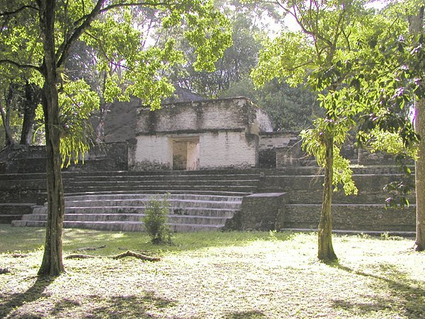
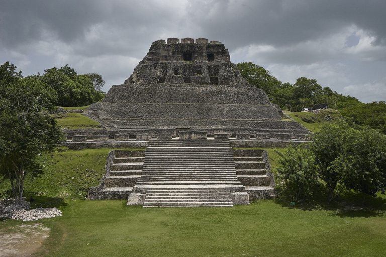
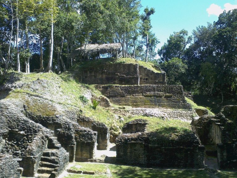
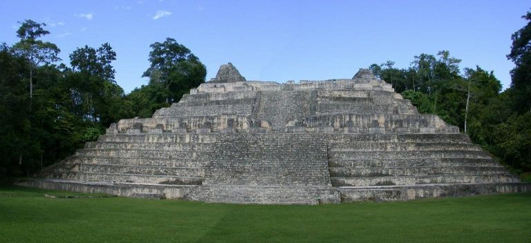
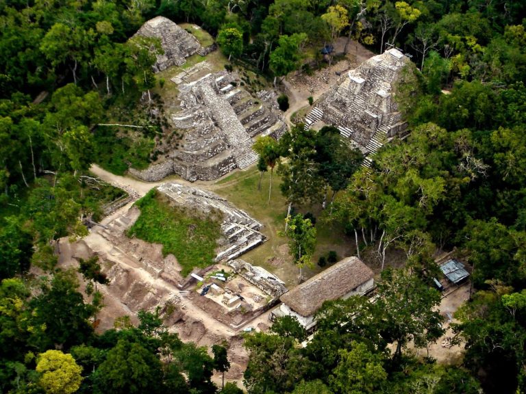
Pacbitun’s central complex occupies a partly artificial limestone elevation oriented east to west. Its 41 masonry structures are arranged around five major plazas. The administrative center and elevated central complex, or acropolis, cover about 0.5 square kilometers; the central area extends over about 1 square kilometer, and the surrounding settlement zone covers roughly 8 square kilometers. Temple-pyramids, palaces, homes, and a ballcourt formed the core. The larger temple-pyramids rise to about 12 meters, while 25 of the central structures served as residences for members of the ruling family, elite households, and priests.
Plazas and central buildings
Plaza A and the Eastern Shrine
Plaza A contains the E-Group, a Maya arrangement associated with observation and ceremonial activity, also known as the Eastern Shrine complex. It comprises Structures 1, 2, 4, and 5, with construction beginning in the Late Preclassic. Structure 1 stood 7 meters high in an early phase; later, with its temple, it reached 16.5 meters. Stone temples were also built on Structures 4 and 5. A temple atop Structure 2 brought the platform and temple together to more than 10 meters in height and may have been Pacbitun’s first stone temple.
An earlier stepped platform lies beneath the present Plaza A. Radiocarbon dating places it around 600 BCE. The structure measures about 16.5 meters east to west, 3 meters north to south, and 1.5 meters high. Five steps face east; the platform may have had a cross-shaped plan and stairs on all four sides. It appears to have burned and been abandoned before later plaza floors covered it. The structure is interpreted as an early religious and ritual focus.
Plaza B and the palace complex
Excavations beneath Plaza B revealed low, four-sided platforms of earth and stone, some built over earlier platforms. They probably supported houses made with perishable pole-and-thatch roofs. Shell fragments, chert drills, and beads at different stages of manufacture point to the production of thousands of small shell disk beads in this area.
Structure 23, also on Plaza B, began in the Late Preclassic and later became part of the palace complex. It was the first of three large platforms to which elite residential groups were added. In the Late Classic, rooms were constructed around its perimeter. The northern rooms faced Plaza B and included raised benches, some visible from the plaza; smaller rooms to the south provided more private spaces. Work on slate took place in rooms on the west, where one contained 30 prepared stone slabs, some as long as 110 centimeters.
Plaza E ballcourt
Structures 14 and 15 form the ballcourt in Plaza E. Its construction began in the Late Preclassic. An Early Classic cache found there held a green obsidian point imported from highland Central Mexico, a large stemmed chert point from Colha, and carved objects of jade, slate, and shell.
Causeways and monuments
Raised causeways
Raised, paved causeways connected the center with other parts of the settlement. The Mai Sacbe ran about 230 meters east to Structure 10, an endpoint complex approximately 8 meters high. The Tzib Sacbe extended for as much as 1 kilometer. A segment about 0.5 kilometers long linked a temple complex north of the route with a public plaza to its south. The Tzul Sacbe ran about 2.3 kilometers southwest toward Tzul Cave and crossed the Tzib route roughly 1.3 kilometers from the center.
Stone monuments
At least 20 fragmentary monuments have been identified, including 13 upright stones called stelae and seven altars. Most are plain and may once have been painted. Stela 6 and Altars 3 and 4 bear carvings, while two carved monuments preserve parts of hieroglyphic texts. Many monuments were found in the Eastern Shrine complex, the Eastern Courtyard, or near the southwestern palace complex.
Stela 6
Stela 6 was found shattered on Plaza A and later reconstructed. It depicts a seated Maya ruler. Its Long Count date, from a calendar system that records elapsed days, corresponds to 22 March 485 CE. The monument is among the earliest dated examples known from the eastern Lowlands.
Altar 3
A carved fragment of Altar 3 shows the lower half of a richly dressed standing figure above two hieroglyphs. One glyph may represent the place-name “Sky Cave,” which also appears on Late Classic Stela 21 at Caracol, about 50 kilometers to the south.
Residential areas and craft production
House mounds
The settlement’s outer zone contains more than 300 surveyed house mounds, about one-quarter of which were test excavated. Slightly more than half stand alone; the others form residential patios, commonly with three mounds. Most lie within 250 meters of the center, although some are 3 to 5 kilometers away. Generally 1 to 2 meters high, the mounds are mainly earth-and-stone platforms that supported perishable houses. Household remains include grinding stones, broken chert and obsidian tools, and coarse pottery. Some mounds contain modest graves beneath dirt or plaster house floors.
Workshops and household evidence
Craft production took place in both the core and the surrounding settlement. The slate-working rooms at Structure 23 formed part of a Late Classic workshop attached to the royal-court area. The wider zone also contains a Late Classic granite workshop for making grinding stones and debris from marine-shell working. Together with the earlier shell-bead production, these finds show several kinds of craft activity. Imported materials included obsidian from the Guatemalan highlands and marine shell from the Caribbean.
Food remains include corn, ramon, and coyol, as well as deer, peccaries, tapirs, dogs, jaguars, howler monkeys, turtles, catfish, agouti, paca, curassow, turkey, and freshwater snails called jute. The turtles were probably taken from a local waterhole, while the catfish may have come from the Macal River.
Burials and ritual deposits
Early burials in the Eastern Shrine
Burial 1-5, a Late Preclassic male burial with few grave goods, lay beneath Structure 1. An Early Classic sanctuary of stone and wood was later built over the burial beside the structure’s western staircase. Burial 1-6, a female burial found in the E-Group’s western pyramid, included a valued spondylus shell, from a marine mollusk, engraved with a ballplayer.
Tomb BU 1-9
The large masonry tomb BU 1-9, associated with Structure 1, dates to the Late Classic. Its inward-projecting stone courses formed a corbel vault. The tomb held a man estimated to have been 40 to 50 years old; red cinnabar pigment covered both his body and the tomb floor. The grave goods included 19 ceramic vessels, polychrome pottery, jade and shell jewelry, jadeite and pyrite ornaments, bone objects that probably included hollow flutes, and a slate-backed pyrite mosaic mirror. A spondylus shell covered the man’s artificially shaped skull.
Later elite burials
Seven elite burials dating to the Late Classic were found in Structures 1, 2, and 23. Their furnishings were less rich than those in earlier burials. More broadly, elite graves and crypts contained jade jewelry, marine-shell ornaments, distinctively shaped flint objects, painted pottery, slate objects, and musical instruments. These included ceramic ocarinas, effigy whistles, rattles, flutes, and a pottery hand drum. Most came from burials of elite women or people of lower elite rank in the core during the later Classic period.
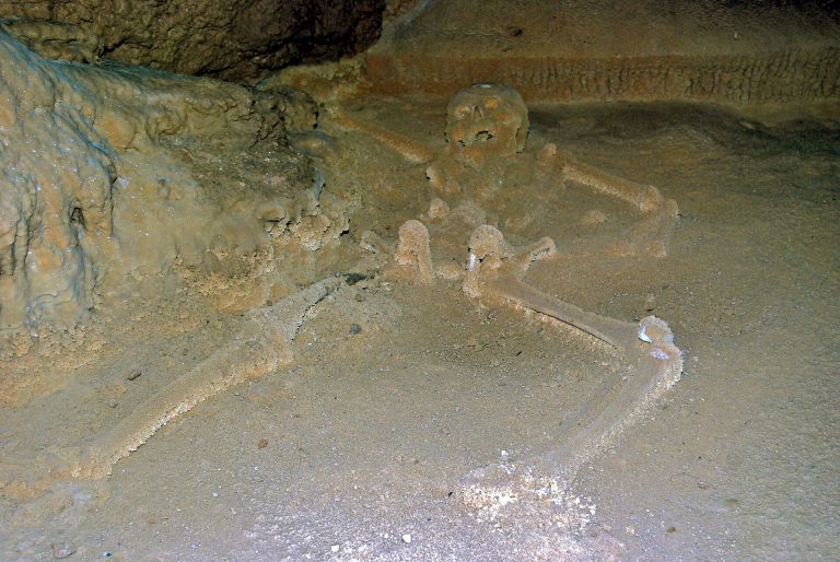
Burial customs included extended interments, usually with the deceased lying on their backs and their heads to the south, a pattern also found elsewhere in the Belize River Valley. Some elite burials contained male-female pairs. Several graves held sacrificial victims, including adults and children. Commoner graves generally had few offerings, while elite burials contained a wider range of objects.
Surrounding landscape and caves
Agricultural terraces
Stone walls on nearby hillsides are remnants of agricultural terraces, most dating to the Tzib phase. Their construction accompanied the intensification of farming during Pacbitun’s late population growth.
Caves and rockshelters
Limestone caves, rockshelters, and exposed bedrock in the surrounding region show evidence of ancient Maya use. Cave activity began by the Late Preclassic to Early Classic period and continued after the central settlement was abandoned. The strongest evidence dates to the Late and Terminal Classic, when people broke cave formations, built formal structures, and buried large caches. Actun Lak Cave also contains remains of Pleistocene giant sloths.