Karahan Tepe: A Neolithic Settlement and Gathering Site in Türkiye
Site at a Glance
- Popularity
- Very High
- Country
- Turkey
- Primary era
- Stone Age
- Eras represented
- Stone Age
- Civilizations
- Unclassified
- Site type
- Religious
- Remains
- Sanctuary
On this page17 sections
History
Karahan Tepe is a Neolithic archaeological site near Kargalı in Şanlıurfa Province, southeastern Türkiye. Neolithic communities occupied it during Pre-Pottery Neolithic A and B, phases before pottery was in use, from about 9600 to 8000 BCE. It formed part of the Taş Tepeler (Stone Hills), a group of roughly twelve Neolithic sites in the province, and provides evidence of both permanent residence and communal or ritual gatherings.
Use and abandonment
The site served as a place for gatherings, but excavations have also supported the interpretation that people lived there permanently. How much activity was domestic or practical, as opposed to ritual, remains debated. The stone buildings and sculptures required skilled work and the coordination of many people. Moving heavy pillars across the hillside likely depended on ropes, wooden beams and workers supplied with food and water. The scale of this effort has been interpreted as evidence of organized labor and specialized tasks before communities had fully adopted agriculture.
Karahan Tepe was occupied for roughly 1,500 years before it was abandoned. The reason is unknown. Prolonged drought and water shortages linked to climate change have been proposed, but neither is established as the cause.
Identification and interpretation
Archaeologist Bahattin Çelik identified the site during regional surveys in 1997. Systematic excavations began in 2018–2019 under archaeologist Necmi Karul of Istanbul University, and initial results were presented publicly on 24 September 2021. By 2023, excavations had covered about five percent of the site.
Karahan Tepe has also been drawn into claims about a lost advanced civilization and forgotten astronomical knowledge. Archaeologist Marco Valenti has criticized such interpretations as going beyond the archaeological evidence; the site is instead understood within the Neolithic landscape of Taş Tepeler.
Remains
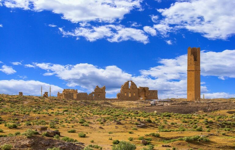
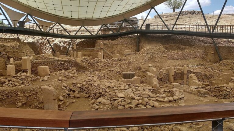
Karahan Tepe occupies a limestone hill in the Tek Tek Mountains, near Yağmurlu and Kargalı, about 50 km east of Şanlıurfa and roughly 700 m above sea level. The site extends across the eastern slope, a western terrace and the southern plain, covering about 10 hectares. Quarries occupy a further five hectares. The hill is also known locally as Keçilitepe, or Girê Keçel. Local limestone supplied material for the buildings and pillars. Excavated architecture includes linear galleries or enclosures as well as circular and oval buildings.
Buildings and carved architecture
Western-slope complex
Early excavations on the northern part of the western slope exposed four structures dating to about 10,800 years before present, an archaeological convention that counts backward from 1950 CE. Three formed a complex cut into the bedrock, with pillars incorporated into its construction. After use, people covered the complex with stone and earth but left the tops of pillars showing, making the buildings easier to locate and uncover later. One stairway led in and another led out. A carved human head in a wall tilts toward those entering.
Structure AD
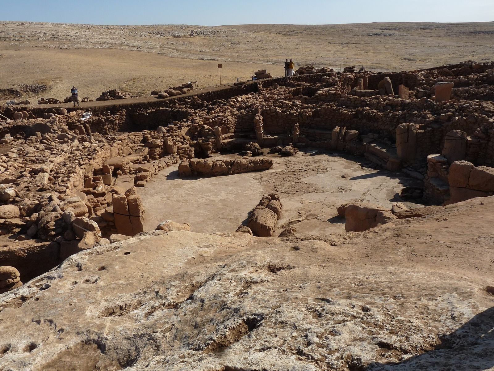
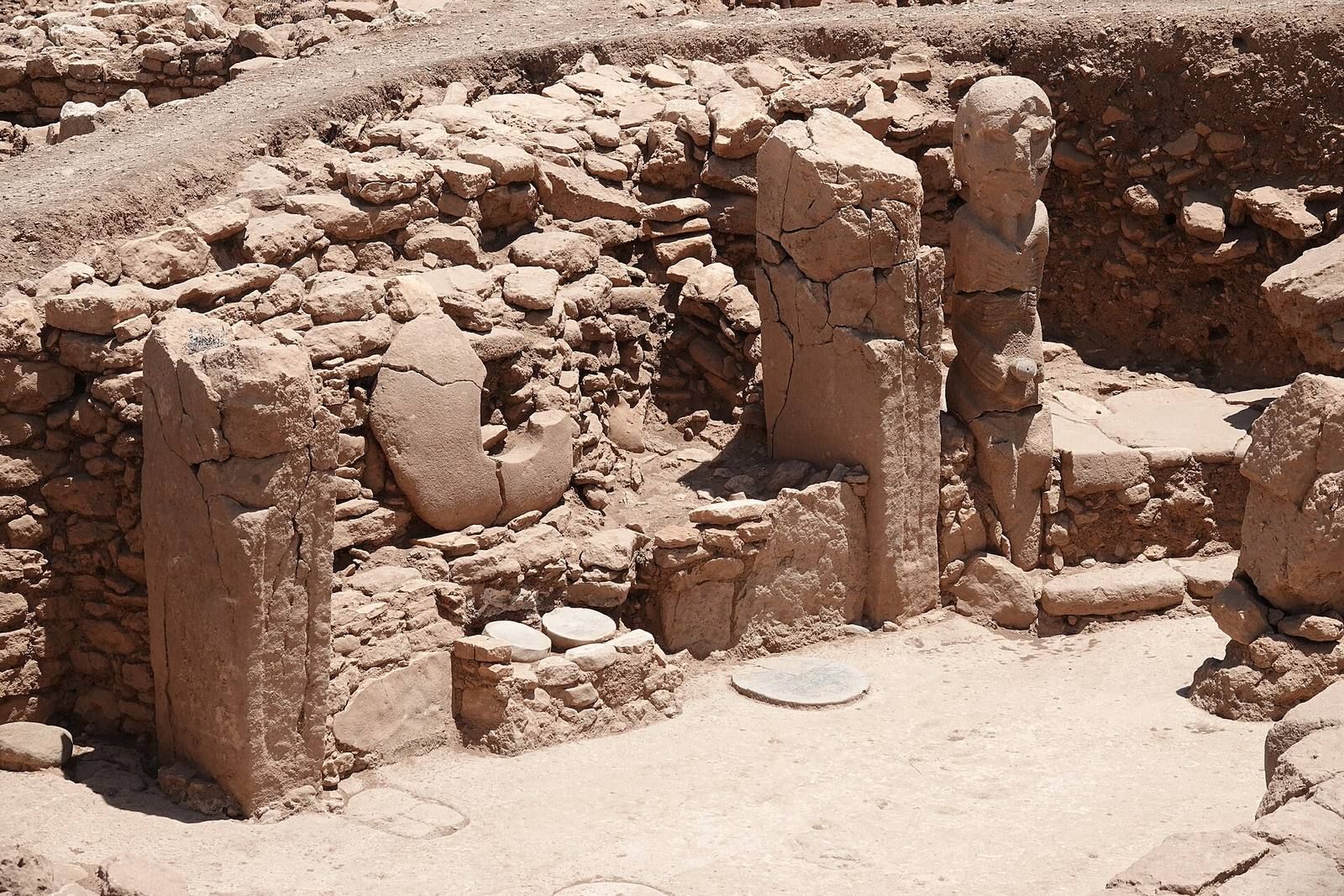
Structure AD is a central circular building with a floor coated in mortar. It measured about 28 m across in its first construction phase and about 30 m in a later phase. Its benches were partly carved from bedrock and partly assembled from large flat stones. Eighteen pillars, each weighing more than 10 tonnes, probably supported a timber roof. Two taller pillars stood facing one another at the centre.
Two bench areas face each other along the central pillars’ axis. The northern bench has two steps. A broken horizontal stone at the middle of its upper step resembles a seat or an offering support, while large stone dishes and animal statues were found on the lower step. When the building was filled in after use, numerous statues and reliefs were placed opposite the benches. A niche in the wall held a statue’s head; other niches may have contained sculptures, including a leopard figure beside the head. The sculptures may once have used colour, an interpretation drawn by comparison with a boar sculpture at Göbekli Tepe. Burial pits in the structure were emptied when the site was abandoned.
Structure AB and connected spaces
Structure AB contains ten upright pillars carved from bedrock and a human-serpent head sculpted into a wall. Nearby, a space contains pillars shaped in phallic forms, some facing a statue’s head. Channels wind between spaces toward Structure AD and may have carried liquid into it. Rock-cut pits connect to adjacent structures through channels and passages.
Quarry pillar
On the south-sloping western spur, an unfinished T-shaped pillar remains partly attached to the bedrock in a quarry. It is about 4.5 m high, 1.5 m wide and 80 cm thick. Its position suggests that builders may have used the hillside’s slope to help separate it from the rock.
Pillars, sculpture and other finds
T-shaped pillars and reliefs
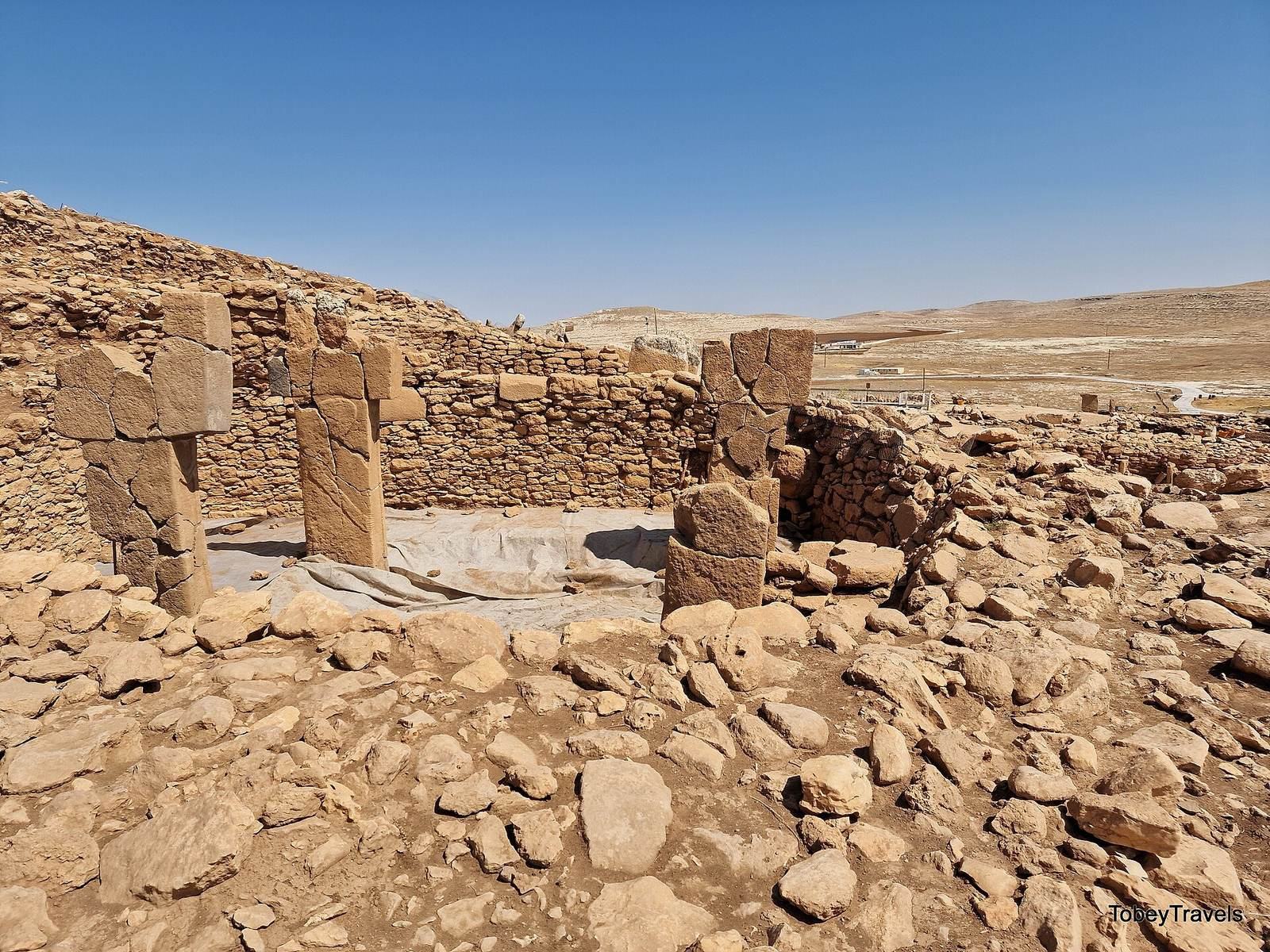
Surveys in 2000 and 2011 recorded about 266 limestone T-shaped pillars. Some still rise 50–60 cm above the ground, and their arrangement points to circular buildings of different sizes beneath the surface. Carved reliefs include snakes and animals, among them a rabbit’s head and foot, deer legs and hindquarters, and what may be the hind legs of another animal. Other finds include a bird-shaped relief and three fragments of upright stone slabs bearing arms shaped like human arms. Grooves resembling numerals may have served for keeping accounts.
Human and animal sculpture
A stone statue found in 2023 and dated to about 9400 BCE stands 2.3 m tall. It depicts a probably seated naked man holding his penis with both hands. Incised lines mark his ribs and fingers, and a V-shaped collar is carved around his neck. The figure is considered an early example of realistic human sculpture. A finely carved vulture statuette, with detailed beak and wings, was found in the same room and is displayed at the Şanlıurfa Archaeological Museum.
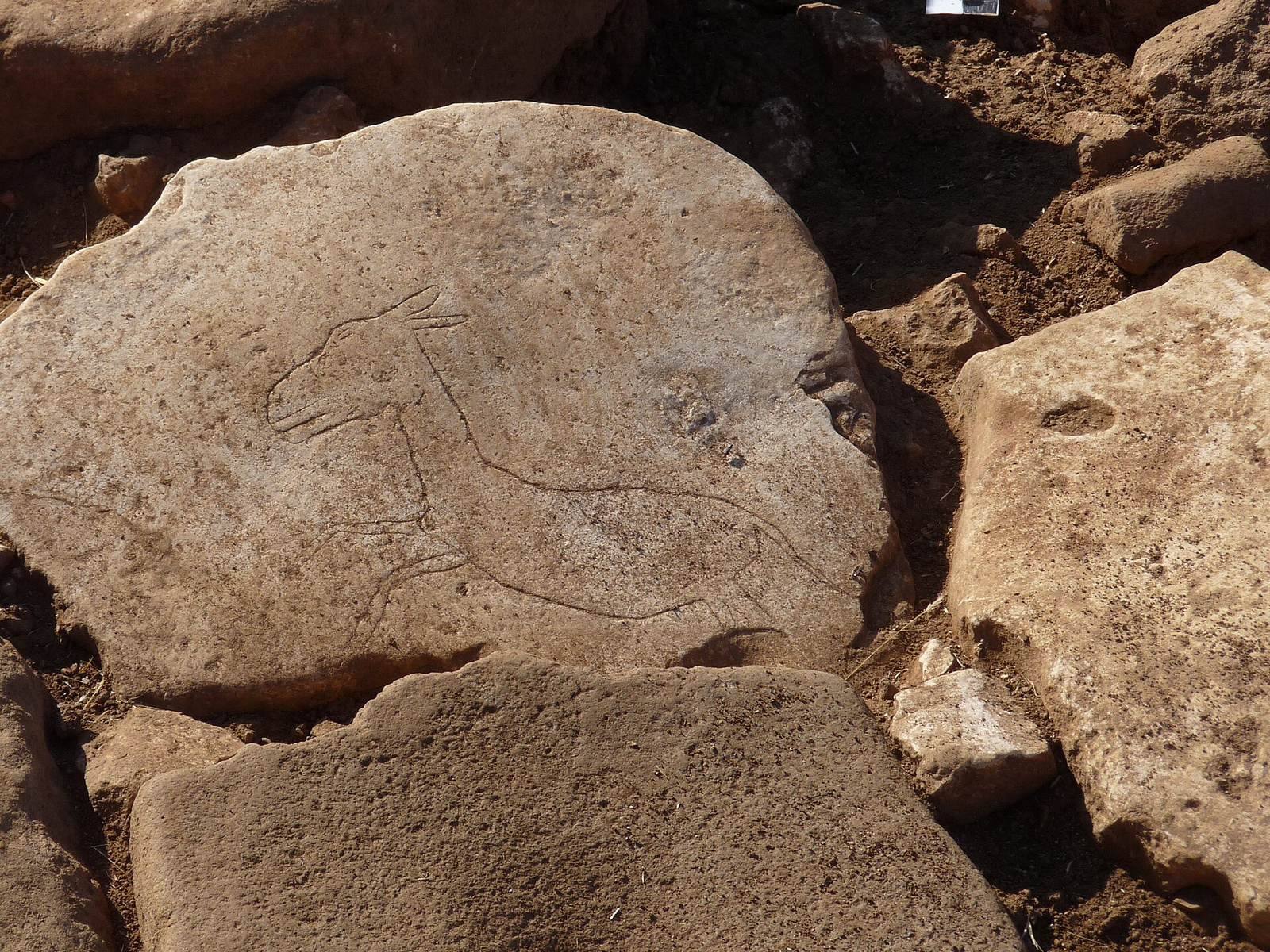
A human-faced T-shaped pillar discovered in 2025 has deeply cut eyes, a straight nose and defined cheekbones. It may prompt a reassessment of the symbolic character of Neolithic monuments in the region and may be the oldest known realistic depiction of a human face from the Neolithic. A relief of a running wild ass, found in 2024 on a stone that served as the floor of an underground building, measures about 20 cm long. It is the first depiction of a wild ass in motion found at Karahan Tepe.
Tools and food remains
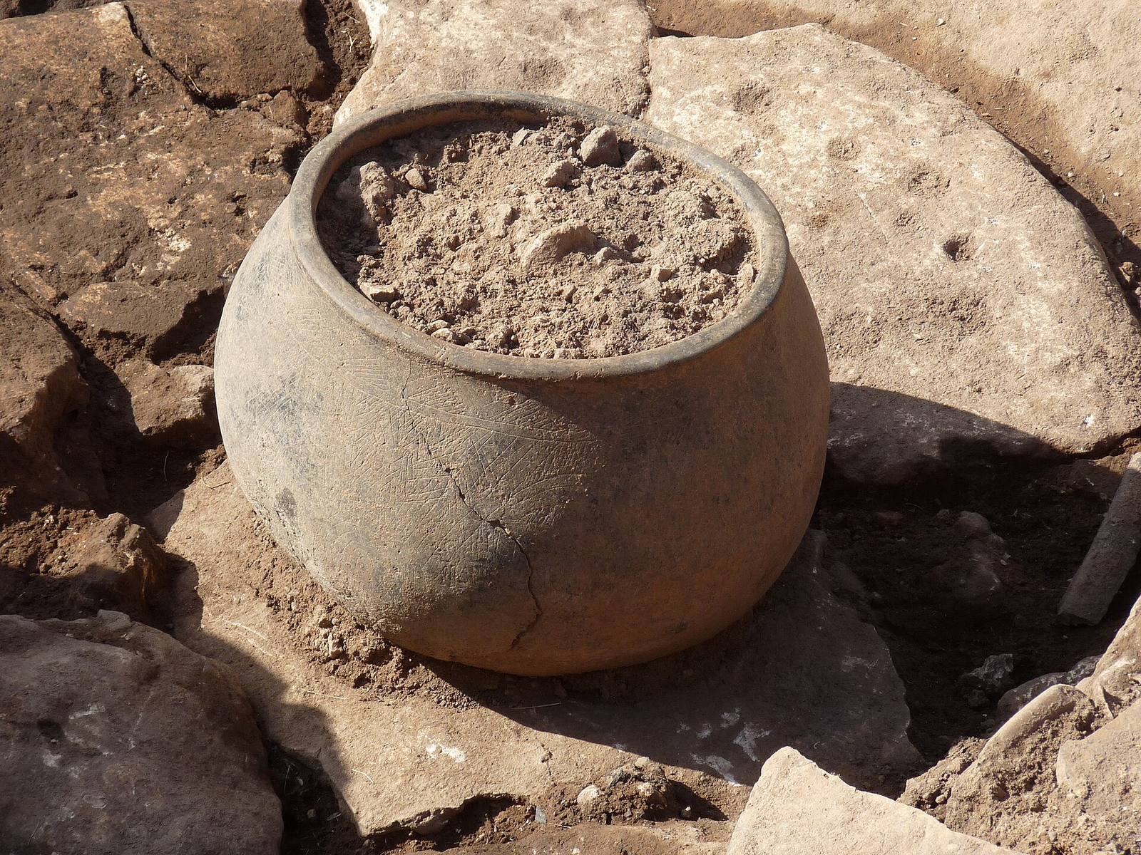
Excavations have yielded chisels, adzes, beads, fragments of stone vessels, mortars and pestles, as well as millstones, plant remains and animal bones. The tools were made from flint, obsidian, pebbles and limestone. Together, the food remains indicate intensive use of local resources; the diet consisted mainly of gazelles and legumes. Most of the finds are displayed at the Şanlıurfa Archaeological Museum.
Water collection and surrounding terrain
Water-management system
About 500 m north of the settlement, a system of rock-cut reservoirs, channels and basins collected rainwater. The channels run in winding courses down the slope and are divided into sections of varying lengths. Deep reservoirs were cut into the main bedrock surface. Shallower basins, no more than 1.5 m deep and with openings wider than 2 m, may have served to settle water; their size and depth could also have allowed sheep or goats to drink. The system has been interpreted as evidence of extensive knowledge of water management and the local environment.
Ravines and hunting
Steep, difficult-to-cross ravines surround the area. It has been proposed that stone walls across their ends could have turned them into traps for game, making the landscape useful for hunting as well as settlement.
Proposed readings of the architecture
Some researchers have suggested that the orientation of a building was deliberately connected to the winter solstice. Near the solstice, sunrise through an eastern opening would illuminate a carved human face on the south wall; calculations indicate that this effect may also have occurred when the site was in use, perhaps marking the annual cycle. Another proposal links an arrangement of eleven pillars, considered alongside V-shaped symbols at Göbekli Tepe, to epagomenal days, extra days outside a calendar’s regular months, in an ancient lunisolar calendar. Such a calendar follows lunar months while keeping the year aligned with the sun.