Khirbet Mazin: A Fortified Harbor Complex on the Dead Sea
Site at a Glance
- Popularity
- Low
- Country
- Palestine
- Primary era
- Classical
- Eras represented
- Iron Age, Classical
- Civilizations
- Israelite
- Site type
- Infrastructure
- Remains
- Harbour
On this page7 sections
History
Khirbet Mazin is a fortified archaeological complex on the northwestern shore of the Dead Sea in Palestine. Its earliest remains belong to Iron Age II, an archaeological period that includes the eighth and seventh centuries BCE. The site was later developed as a Hasmonean harbor.
Iron Age remains
Pottery from the eighth and seventh centuries BCE indicates activity at the site during Iron Age II. Interpretations of the earliest construction differ. One places the oldest remains near the end of the First Temple period, the era associated with the First Temple in Jerusalem, during the reign of King Josiah of Judah. Pessah Bar-Adon assigned an Iron Age tower at the site to the earlier reign of King Uzziah of Judah.
Hasmonean harbor
The Hasmoneans, a Jewish ruling dynasty that established a kingdom in Judea in the second and first centuries BCE, enlarged the fortification and developed harbor facilities as part of their effort to control the Dead Sea shore. The port works were probably built during the reign of Alexander Jannaeus, a Hasmonean king. Archaeologist Ehud Netzer interpreted the complex as an anchorage, a place where vessels could anchor, for as many as four royal boats, each estimated to be about 14 metres long. Guards stationed in the tower may have protected them.
The harbor may have enabled travel from Jerusalem across the Dead Sea to the resort at Ayn al-Zara, known in antiquity as Callirrhoe, and onward to the fortress of Machaerus on the opposite shore.
Names and archaeological investigations
Archaeologists named the site Khirbet Mazin in 1960, after nearby Wadi Mazin. Other names used for it include Qasr el-Rubai and Qasr el-Yahud, the latter used by Bar-Adon. Metzad Kidron means stronghold by the Kidron. A later identification with Khirbet el-Yahud confused the site with a place marked about three kilometres farther north on Félicien de Saulcy’s 1853 map.
Bar-Adon proposed that Khirbet Mazin was Middin, one of six wilderness towns named in the Book of Joshua, a biblical text describing the Israelites’ settlement in Canaan. He also suggested that the name Wadi Mazin might preserve the name of one of those towns. Hanan Eshel reiterated the identification in 1995.
Robert de Langhe made a preliminary study in 1953 while exploring the area during Belgian excavation work at Khirbet al-Mird. Jordan’s Department of Antiquities carried out preliminary excavations over two months, from December 1960 to January 1961, under the direction of John Allegro of the University of Manchester. Bar-Adon conducted more extensive excavations from 1971 to 1974 and excavated at the site again in 1976.
Remains
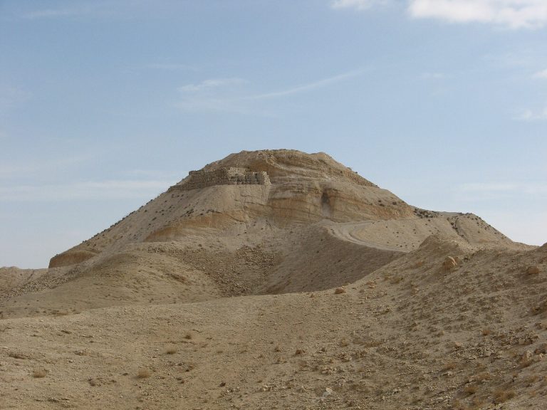
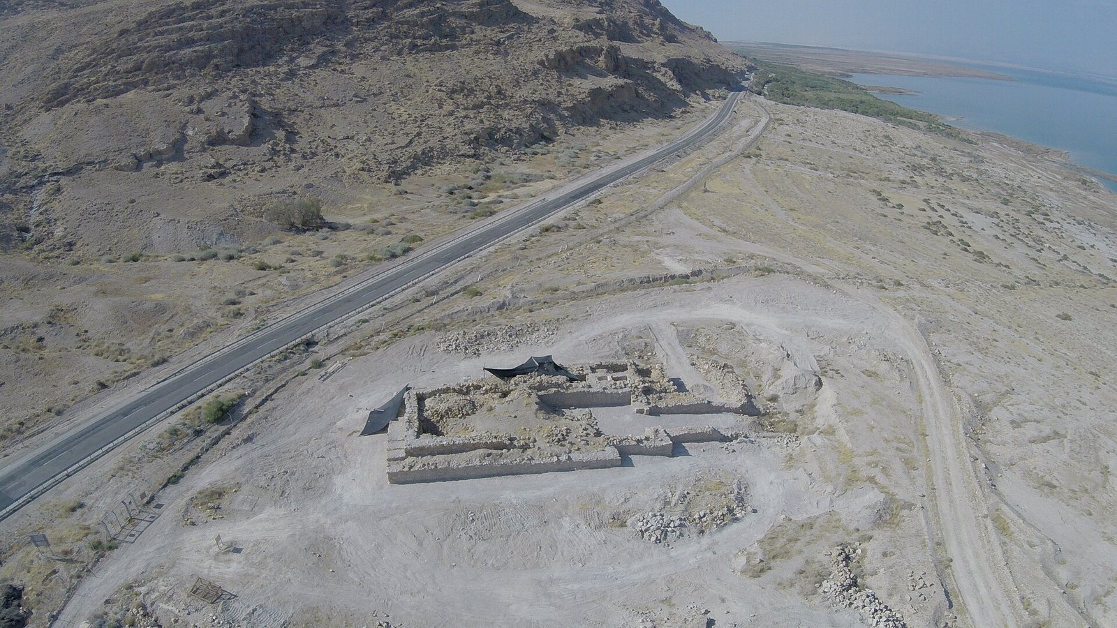
The complex occupies the inlet or delta of Wadi Mazin, a valley channel that may carry water seasonally, on the northwestern shore of the Dead Sea and north of the Kidron stream. It lies in the southern part of Ein Feshkha nature reserve, about 3.5 kilometres south of Ein Feshkha and 0.5 kilometres north of the point where the Kidron Valley meets the sea. Thick outer walls enclose a courtyard about 11 by 30 metres, with a tower at the northeastern corner and an entrance on the east side.
Enclosure and tower
The tower’s base measures about 9 by 18 metres. It originally rose two or three storeys, and its walls now stand up to six metres high. The tower was enlarged during the Hasmonean period. Inside, partition walls divide rooms that may have served as storage or accommodation. Two connected, plastered cisterns extend to depths of as much as four metres.
Waterfront works and finds
The eastern entrance is a gate 5.2 metres wide. From it, a stone-supported ramp about six metres wide and 22 metres long descends toward the Dead Sea. The ramp may have served as a slipway, a ramp for moving boats between land and water, while the courtyard may have functioned as a dry dock, where boats could be kept out of the water for inspection or repair. The complex also included a quay, a structure at the water’s edge where boats could moor. During Yizhar Hirschfeld’s 2001 survey, thousands of bronze coins bearing Alexander Jannaeus’s name and an anchor-and-star design were found on the nearby shore. Shipwreck fragments were found outside the anchorage. Some wall sections emerge above loose gravel deposited as the Dead Sea’s level changed.