Hezekiah’s Tunnel: An Ancient Water Conduit in Jerusalem
Site at a Glance
- Popularity
- Very High
- Country
- Israel
- Primary era
- Iron Age
- Eras represented
- Iron Age, Modern
- Civilizations
- Israelite
- Site type
- Infrastructure
- Remains
- Aqueduct
On this page13 sections
History
Hezekiah’s Tunnel is an ancient water conduit beneath the City of David in Jerusalem, Israel, traditionally attributed to Hezekiah, king of Judah, and usually dated to the late eighth or early seventh century BC. The City of David is the ancient southeastern ridge generally regarded as Jerusalem’s earliest urban core. The tunnel is often connected with efforts to prepare the city for an Assyrian attack, although both its date and intended purpose remain disputed.
Judahite waterworks and disputed dates
The biblical account describes Hezekiah blocking the Gihon Spring’s outlet and directing its water westward into the City of David. The tunnel is often identified as the channel in that account. In 701 BC, during the Assyrian king Sennacherib’s campaign against Judah, Hezekiah prepared Jerusalem for a possible siege. Sennacherib suppressed the revolt and received tribute from Hezekiah, but did not capture the city.
The conduit could have kept the spring’s flow inside Jerusalem’s defences and denied water to an attacking force. Yet the Gihon was already protected by fortifications and a system of shafts. One interpretation sees the tunnel as a further effort to contain the spring’s full outflow within the defended area; another suggests it may have supplied the royal garden rather than being built specifically for a siege.
Dating evidence has led to differing conclusions. Study of the inscription’s script and language initially supported an eighth-century-BC date, while a proposal published in 1996 placed construction in the Hellenistic period. Radiometric tests in 2003, using plant material in the original plaster and deposits formed after excavation, placed the tunnel between 800 and 600 BC. Pottery recovered from blocking material at the northern entrance in 2011 dates to the late ninth or early eighth century BC and may point to construction before Hezekiah’s reign. Some scholars have also associated the biblical references to Hezekiah’s waterworks with installations in the Mamilla area instead.
From the First Temple period to Byzantine Jerusalem
The tunnel was known during the First Temple period, the era before Babylon destroyed Jerusalem and its temple. After the Babylonian exile, people who returned to Jerusalem knew the Pool of Siloam but apparently did not connect it with the Gihon Spring. They seem to have understood the tunnel’s outlet as a separate spring. The first-century Jewish historian Josephus likewise referred to a “spring of Siloam.” The biblical name Shiloah may refer to water sent from the Gihon or to irrigation in the area. The Pool of Shiloah, mentioned in the account of Jerusalem’s rebuilding, may have been the “King’s Pool,” though that identification is uncertain.
During the Roman period, a new pool was built closer to the water’s outlet, shortening the flow by about 80 metres. It remains uncertain whether this work removed part of the tunnel or whether an open channel had always linked it to an older pool farther south. In the Byzantine period, the connection between the Gihon and the tunnel was still not recognized, and the outlet was treated as a spring. Christian tradition connected the Pool of Siloam with the story of Jesus sending a man born blind to wash there. Empress Eudocia, a fifth-century ruler of the Eastern Roman Empire, established a church near the Roman pool for worshippers who came to pray and bathe. A pilgrim who visited around 560–570 described the pool and church.
Medieval abandonment and modern investigation
After the Arab conquest in 640, the City of David became sparsely inhabited and was eventually abandoned in the eleventh century. Fatimid rulers repaired Jerusalem’s walls but left the hill outside them. The Gihon’s outlet was rediscovered later, perhaps during the Mamluk period, but sand and fallen stones blocked passage through the tunnel.
A monk named Julius crossed the tunnel before 1620, and Franciscus Quaresmius described it in 1625. Two Franciscan monks traversed it in 1674 but encountered fallen stones obstructing much of the passage; a Catholic priest crossed it in 1817. Edward Robinson made the first scientific survey in 1838, and Charles Warren measured the tunnel in 1866. The Parker expedition and Louis-Hugues Vincent carried out a major investigation from 1909 to 1911, diverting the water to dry, clean and measure the passage. Water was returned on 11 October 1910, and Vincent’s measured length of 533.10 metres became widely accepted. Ronnie Reich and Eli Shukron dried the tunnel again in January 2007 for research and repair.
The Siloam inscription was discovered accidentally in the tunnel in 1880 and removed in 1890. A copy placed beside its recess in 2007 was later taken away. In 2002, a leak from a main sewer line near the Rockefeller Museum contaminated the Gihon Spring and tunnel; the leak was repaired and the passage cleaned. Heavy snow that winter contributed to a collapse on the City of David’s eastern slope. During stabilization work, a drill for retaining-wall anchors pierced both sides of the tunnel. Drilling stopped, and the wall was built without an anchor at that location.
Remains
The water tunnel
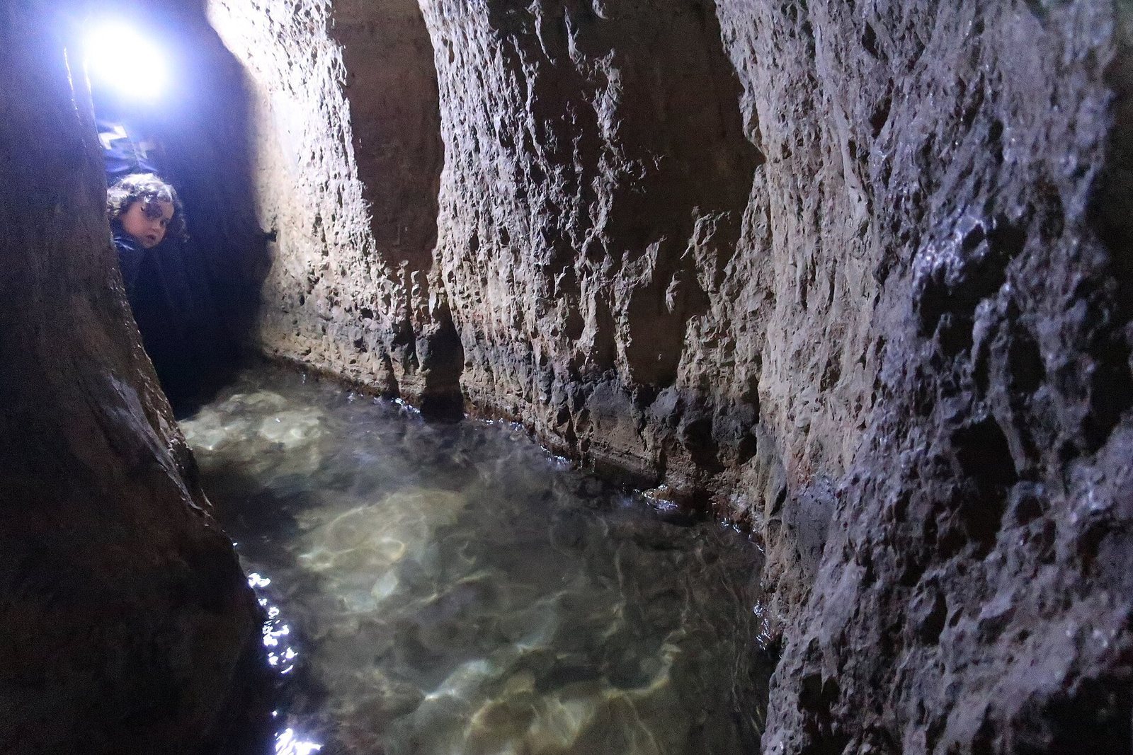
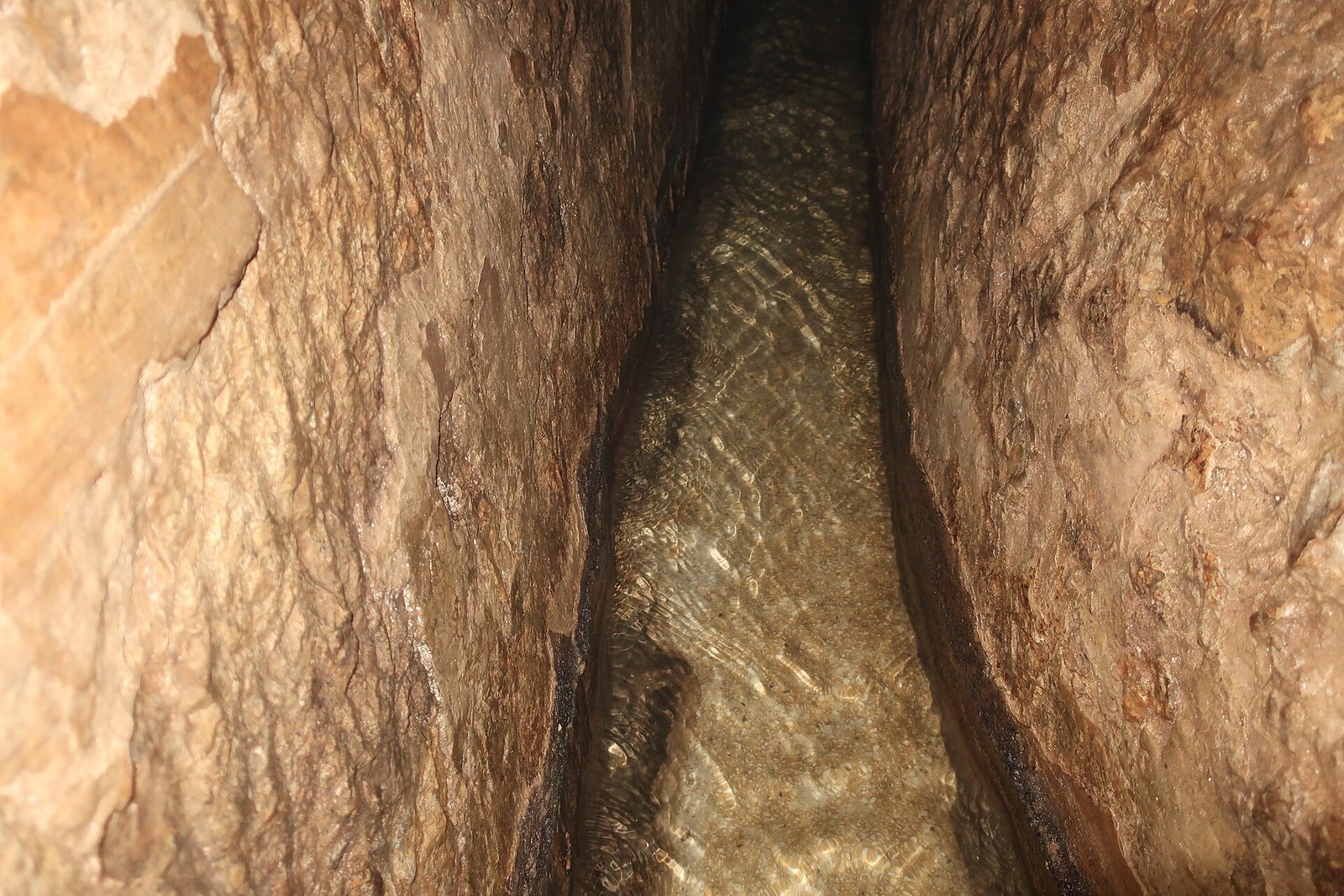
The passage runs east to west beneath the City of David, carrying water by gravity from the Gihon Spring to the Pool of Siloam. It extends about 533 metres, although the straight-line distance between its ends is only about 320 metres. Its winding course is cut through dense dolomitic limestone. The tunnel averages about 70 to 80 centimetres in width, and its height ranges from roughly 1.1 to 5 metres. The floor falls around 30 centimetres from the spring to the pool, a shallow gradient of about 0.6 per mille.
Two work teams excavated from opposite sides of the ridge and met approximately halfway along the route. The meeting point can be recognized through the passage’s alignment, tool marks and changes in workmanship. About ten metres on either side are more irregularly cut than the better-finished stretches elsewhere. At the junction, the southern floor lies about 30 centimetres above the northern floor. Rough cuts on the southern floor and lower walls contrast with the more finished upper walls and ceiling. One explanation is that the southern team lowered the floor quickly to correct a level error, though the precise reason is uncertain. The ceiling rises above five metres near the tunnel’s end.
The teams joined and levelled their sections before cutting a short final passage to the spring’s natural chamber, apparently to keep flowing water from interfering with excavation. The northern team began by cutting a short channel at the bottom of a nearby Canaanite pool and running a little water through it to test the floor’s slope. One ventilation shaft lies in the southern section. How workers managed airflow, lighting and the removal of excavated rock along the underground route remains uncertain.
Several explanations have been proposed for the tunnel’s bends, including navigation errors, following cracks or softer rock, and deliberately curving the routes to help the teams meet. Another proposal links the southern bend to an abandoned plan to connect an older channel to the pool. Geological research has rejected the idea that the whole tunnel was made simply by enlarging a single natural cavity, although local cavities may have been incorporated. The smaller bends near the meeting point are generally understood as attempts by the crews to find one another. A dead-end passage cut by mistake also survives. The Gihon was an intermittent, or pulsing, spring, and sudden rises in its flow could raise the water level in the tunnel. Changes to Jerusalem’s water system, and possibly tectonic movement, altered the aquifer, and the spring gradually became more regular.
The Siloam inscription
The inscription was carved in ancient Hebrew script on a smoothed stone panel in the tunnel’s southern wall, about six metres from its connection to the Byzantine pool. It is the longest surviving historical Hebrew inscription from the First Temple period, though portions of the text are damaged. The inscription recounts how the two teams excavated toward each other and met; it says that only three cubits separated them on the final day and that they worked with axes.
The text gives the tunnel’s length as 1,200 cubits and the height of rock above the workers as 100 cubits. A cubit may have measured about 40 to 50 centimetres. The stated height is inaccurate or exaggerated, since the rock above the passage is no more than about 15 metres deep. The length figure has also prompted debate about the original route. Some interpretations propose a tunnel exceeding 600 metres, with a later section destroyed. Others regard the present passage as complete and suggest that an open channel continued about 80 metres farther to an older pool south of the Byzantine pool. The inscription is now in the Istanbul Archaeological Museum, while its empty recess remains visible in the tunnel.
Earlier water systems
Fortifications and Warren’s Shaft
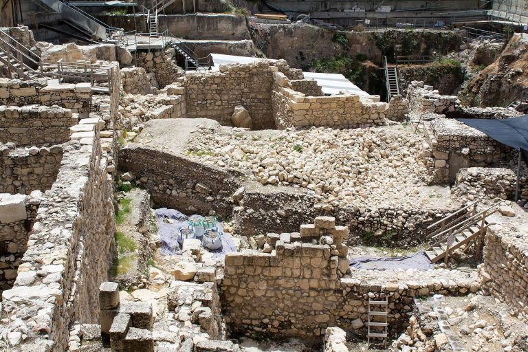
An earlier Canaanite system protected the Gihon Spring with a strongly fortified tower, a connecting wall and a sheltered corridor leading toward the city’s defences. The Warren’s Shaft system also allowed people to reach the spring, but it did not carry water as a channel would: users had to descend and climb back up with the water they drew.
Middle Bronze Age channel
Discovered in 1899 and dated by Ronnie Reich to around 1800 BC, the Middle Bronze Age channel follows a more direct route south from the Gihon, reaching about halfway to the Pool of Siloam. For much of its length it is a trench about six metres deep, covered with large stone slabs. It is narrower than Hezekiah’s Tunnel but passable on foot along much of its course. Several outlets directed water toward gardens and fields beside the Kidron Valley; an outlet near the pool stood about one metre high.
Pools and spring access
The Roman-period pool
Excavations in 1882 uncovered remains of a square pool surrounded by a colonnade. It has been identified as a Roman-period pool, although it may instead belong to the Byzantine period. Its identification with a pool described by a pilgrim from Bordeaux in 333 is also uncertain.
The Byzantine pool and spring steps
Fragments of columns and walls associated with the Byzantine pool lie at the tunnel’s end within the present Pool of Siloam. At the Gihon Spring, a Roman arch stands over steps descending to the water, with a ritual bath from the Second Temple period beneath them. After silt built up in the Kidron Valley, the spring lay deep below the surface and could be reached only by the external staircase. These remains have also challenged the claim that the spring itself became unknown during the Second Temple period.