Pyramid of Khentkaus I: A Royal Tomb on the Giza Plateau
Site at a Glance
- Popularity
- Medium
- Country
- Egypt
- Primary era
- Bronze Age
- Eras represented
- Bronze Age
- Civilizations
- Egyptian
- Site type
- Burial
- Remains
- Tomb
On this page22 sections
History
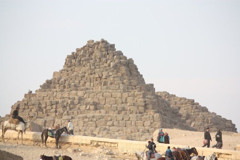
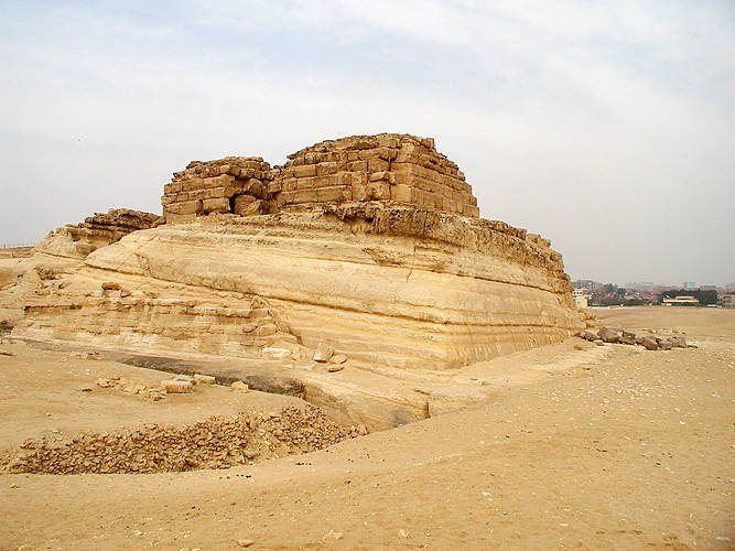
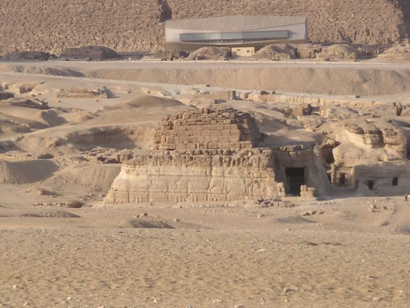
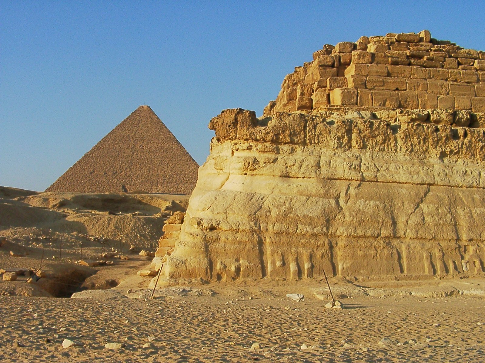
The Pyramid of Khentkaus I is a royal tomb on Egypt’s Giza Plateau, built for Queen Mother Khentkaus I at the end of the Fourth Dynasty. It was the largest tomb built for a queen during the Old Kingdom, the period when the Giza pyramid complexes were constructed. Its unusual form combined a rock-cut tomb with features of a mastaba, a flat-roofed rectangular tomb, and a stepped pyramid.
Construction and royal status
The tomb was cut into a quarry that had supplied stone for Khafre’s pyramid. It was built in two phases. During a later phase, probably in the early or first half of the Fifth Dynasty, builders placed a limestone structure over part of the original tomb. This addition may have reflected Khentkaus’s elevated position as the mother of two kings. Egyptologist Miroslav Verner proposed that the builders intended to develop it into a complete pyramid, perhaps with three steps, but stopped because of concerns about the tomb’s stability. Her sons may have overseen the work; they have been tentatively identified as Shepseskaf, the last king of the Fourth Dynasty, and Userkaf, founder of the Fifth.
An inscription at the tomb carries a title with two possible readings: “Mother of two kings of Upper and Lower Egypt,” or “King of Upper and Lower Egypt, and Mother of the King of Upper and Lower Egypt.” An image shows Khentkaus wearing a vulture crown and ritual beard and holding a scepter, details that have been interpreted as possible signs of kingship. However, her name does not appear in a royal cartouche, the oval frame used around a king’s name, or in king lists. Whether the title meant that she ruled as king remains unsettled.
Identification and later interpretation
Early investigators disagreed about the monument’s identity. John Shae Perring and Howard Vyse, who visited in 1837–38, regarded it as a fourth pyramid at Giza. In 1912, Uvo Hölscher described it as an unfinished pyramid belonging to Shepseskaf, and George Andrew Reisner likewise argued that it was a king’s incomplete pyramid. Karl Richard Lepsius instead classified it as a private tomb. Selim Hassan’s excavations in 1932–33 connected the monument to Khentkaus I through inscriptions bearing her name and titles on red-granite chapel blocks. The inscriptions associate her with the Fourth Dynasty and distinguish her from the later queen Khentkaus II.
A settlement near the tomb probably supported its mortuary cult, the continuing ritual service for a deceased person. Hassan proposed that priests served Khentkaus there until the end of the Sixth Dynasty. Mark Lehner and colleagues have suggested that people in the settlement’s southern houses may also, or instead, have served Menkaure’s mortuary cult. Its layout indicates that the estates of the two monuments were kept separate. A nearby building has also been identified as Khentkaus’s valley temple, but its ownership and relationship to Menkaure’s temple remain uncertain.
The burial was badly damaged and robbed in antiquity. Fragments of a sarcophagus do not establish that Khentkaus herself was buried there; a later burial or reburial has been proposed, but remains uncertain. Excavations in 2005–09 also revised the interpretation of a paved feature once thought to be a causeway to the proposed valley temple: it was an ascending ramp, though its connection to Khentkaus’s causeway has not been established.
Remains
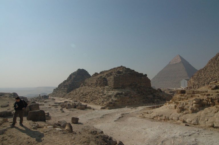
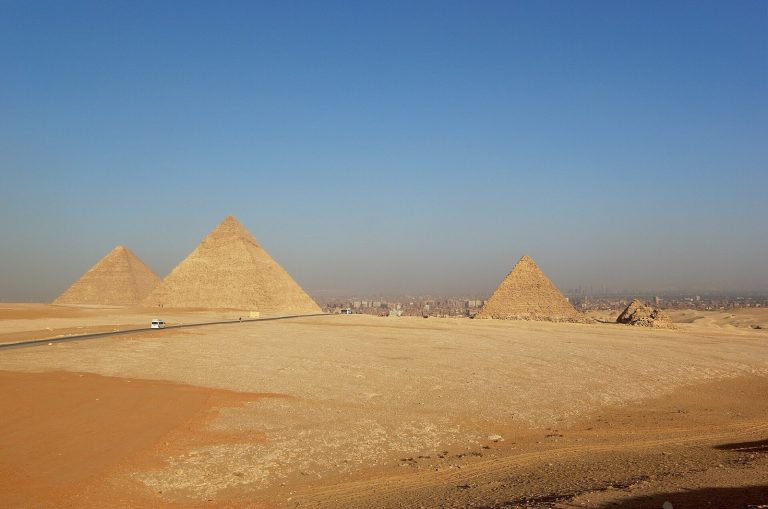
The tomb occupies the ground between the causeways of Khafre’s and Menkaure’s pyramids. Its two stepped levels were formed partly from bedrock left in the quarry and partly from masonry. The tomb, chapel, approach, boat pit, settlement, and nearby buildings together preserve the layout of a funerary complex, although the identification of some associated structures remains disputed.
Tomb and enclosure
Lower step
The lower level is a nearly square block of bedrock, aligned north–south, with a base measuring about 45.8 by 45 metres and a height of approximately 10 metres. It was faced with fine white Tura limestone set at a slope of about 74 degrees. Much of this casing survives on the north and west sides, while the south face has lost almost all of it. Niches on the sides followed a pattern resembling a palace façade and included forms like symbolic false doors, which represented entrances associated with the deceased and offerings. Rainer Stadelmann argued instead that the niches were limited to the south face, with a false door at the northeast corner.
Upper step
The upper level was built over the western half of the bedrock block, leaving its eastern portion clear above chambers cut below. Its off-centre position may have prevented excessive weight on the tomb. Seven courses of local limestone formed the structure, with larger blocks at the base and smaller ones higher up. The resulting upper step was mastaba-like and slightly vaulted, measuring about 28.5 by 21 metres at its base and 7–8 metres high. White Tura limestone casing covered the completed monument. Its original height was about 18 metres, and the surviving structure stands about 17 metres high.
Perimeter and embalming area
A whitewashed mudbrick wall, about 2.75 metres thick, enclosed the tomb on the north, west, and south. On the east, a high wall cut from bedrock formed a chamber against the tomb where the queen was embalmed. The southern enclosure began near the boat pit, ran along the eastern side, and continued partway along the north to the courtyard entrance.
Approach and boat pit
Covered causeway
A covered causeway connected the valley to the chapel on the tomb’s southeast side. Three parallel walls initially left a passage about 5–5.2 metres wide. A later wall divided this space into a causeway passage about 1.6 metres wide and a street passage about 2.2 metres wide. The southern perimeter wall was dismantled and rebuilt, though whether this resulted from natural damage or human action is uncertain. The earlier section used large bricks made with dark silt; the rebuilt stretch used smaller sandy-silt bricks faced with limestone chips.
Boat pit
At the southwest corner, an east–west boat pit measures about 30.25 metres long and 4.25 metres deep. Its walls are built of rubble set in mortar. The pit held a vessel with a raised prow and stern. Limestone and black-granite blocks led Hassan to propose that it had a roof and represented the night boat of Re, the Egyptian sun god, used for passage through the Duat, the Egyptian realm of the dead.
Chapel and burial chambers
Chapel and gateway
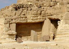
A paved courtyard gave access to the chapel through a large pink-granite gateway. One jamb measures 1.25 metres wide and 2 metres high. Stone removal badly damaged both jambs, but inscriptions and an image of Khentkaus survive. The entrance is recessed 2.85 metres into the bedrock structure. Inside, the chapel measures about 2.6 by 2.7 metres and has a pavement and lining of fine white Tura limestone.
Statuary room and hall
A room west of the chapel has three niches and white-limestone lining, with carved scenes and inscriptions. A black-granite doorway to the north leads into a hall about 11.8 by 4.5 metres. Two pink-granite false doors stand in its west wall. A shaft below one of them descends into the tomb’s underground chambers.
Passage and eastern chamber
A sloping passage, lined and paved with granite, runs about 5.6 metres to a small antechamber, or room before the burial chamber. The eastern section of the burial chamber measures about 7.85 by 2.7 metres and is 3.7 metres high. Six storage rooms open from its east and south walls. Their entrances are generally about 1 by 0.5 metres, and the rooms measure roughly 1.5–1.6 metres deep, 1 metre wide, and 1.4 metres high. Two false doors, each about 3.3 metres high and 0.95 metres wide, are cut into the western wall; they may once have had high-quality stone facing.
Western burial chamber
The western chamber measures about 4.6 by 3.96 metres. A depression measuring roughly 3.6 by 3 metres occupies much of its floor. The south wall has a square niche, and a shelf in the north wall probably held canopic jars, containers for organs removed during mummification. Fragments of an alabaster sarcophagus were recovered from the chamber. Hassan also found a brown limestone scarab attributed to the Twelfth Dynasty.
Settlement
Houses and layout
The settlement formed an L-shaped area east and south of the tomb, around Menkaure’s valley temple. Its mudbrick houses were planned in rows along the causeway rather than added through unplanned growth. Ten carefully laid-out houses stood beside it. Six shared a plan with entrances from both the northern street and southern causeway, a porter’s lobby, reception and living rooms, two bedrooms, an open court, kitchen, water reservoir, and domestic office. Some substituted a granary for the kitchen or reception room. Four other houses had similar arrangements but lacked the lobby and reception room. The homes were coated with yellow plaster and included granaries and food-storage rooms.
Streets and service buildings
The settlement’s north and south boundary walls began at the courtyard doorjambs and extended eastward before turning or disappearing beneath a cemetery. Near the west end of the southern houses, a building with unusually thick walls may have served as a symbolic palace. A large building in the southern extension may have been the residence of an official responsible for the granaries. A staircase led from a street intersection toward the granary area, where a courtyard, narrow rooms, storage rooms, and a large house were arranged around a service zone. A nearby water tank measures about 29 by 8.5 metres.
At the intersection, a limestone double-leaf door once stood above a passage cut beneath the causeway. The unfinished passage is about 0.9 metres wide and reaches 2.47 metres at its deepest point. Thirteen steps descend along its north side, while the gentler south side is smooth. Bulges near the bottom suggest the work was unfinished and may have seen limited use. A street about 2 metres wide continues south for 17 metres to an east–west street, where another double-leaf door once stood.
Associated buildings
Proposed valley temple
The building Hassan identified as Khentkaus’s valley temple has its main entrance on the north, an unusual arrangement for this type of temple. A roofed porch stood over the entrance; two limestone column bases survive, but the columns, possibly wooden, are lost. The paved limestone floor and whitewashed walls remain. Inside, a vestibule, or entrance room, had a roof supported by four columns, whose alabaster bases were found in place. The walls had white upper surfaces and dark lower panels edged in red. Finds from the vestibule include a limestone incense burner and pieces of two schist statuettes, one of a king and one of a sphinx. A diorite statue of Khafre found near the doorway had been brought there later.
A doorway south of the vestibule opened into a court about 10.5 by 9.9 metres. Most of its floor was mudbrick, with a limestone path running southwest beneath a wall into the vestibule of Menkaure’s temple. A doorway between the two temple areas was later blocked with brick. A long storage room stood northwest of the court. A corridor to the east and the temple’s southern half were later turned into dwellings. An alabaster offering-table fragment from a storage room has an incomplete inscription, including the words “… her father, king’s daughter.” Hieroglyphs may include the triple-ka sign, associated with Khentkaus’s name and with a person’s life force, but the reading is uncertain.
Washing-tent
Northwest of the proposed temple stood a mudbrick building measuring about 6.05 by 3.1 metres, known as the Washing-tent. It was used to purify the queen’s body before it was carried through the necropolis to the embalming house. Debris inside included stone-vessel fragments, pottery, and flint tools. A covered, sloping limestone drain ran about 7.2 metres from the floor to a large rectangular stepped basin. The basin’s upper step measured about 9.68 by 1.6 metres, while its bottom limestone step measured about 8.8 by 0.8 metres; the step between them was made of rubble and plaster.