Château fort de Conflans: A Medieval Fortress in France
Site at a Glance
- Rating
- 4.4
- Popularity
- Medium
- Country
- France
- Primary era
- Medieval
- External website
- Open
- Eras represented
- Medieval
- Civilizations
- Holy Roman Empire
- Site type
- Military
- Remains
- Fortified Town
On this page13 sections
History
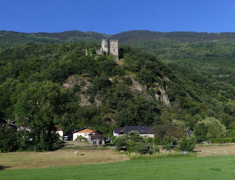
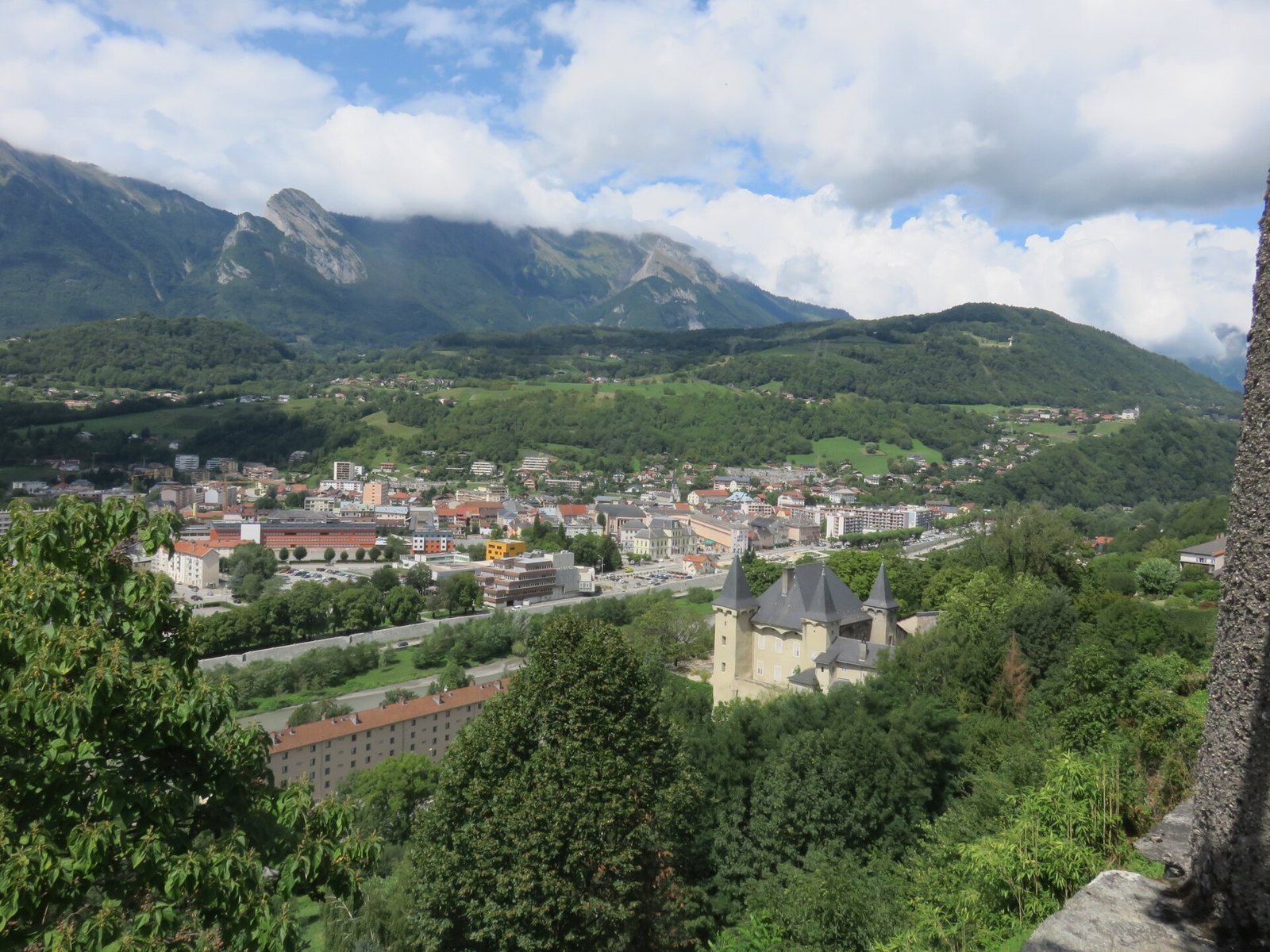
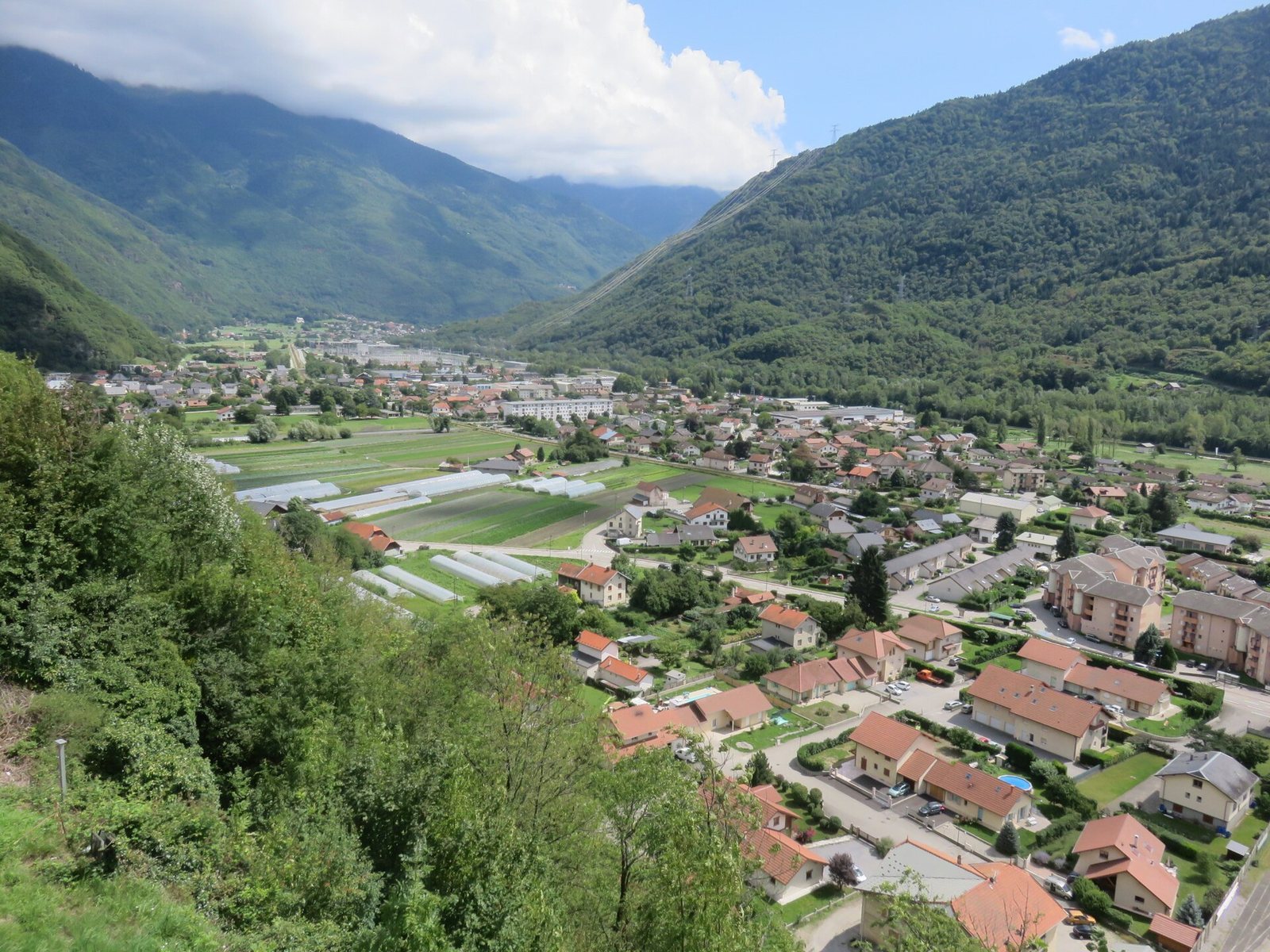
Château fort de Conflans is a ruined eleventh-century fortress in Conflans, now the upper district of Albertville, France. Built in a period of insecurity associated with the arrival of Germanic peoples in the region, it was a castrum, meaning a fortified settlement or stronghold, on a rocky height above the confluence of the Arly and Isère rivers. Its position controlled the entrance to the Tarentaise Valley and routes linking the Savoie valley, Chambéry, the Dauphiné, and the Kingdom of France with the Petit-Saint-Bernard Pass and the Aosta Valley.
Early settlement and ecclesiastical lordship
Conflans appears in written records as “Conflenz” in a charter of 1015 concerning a donation to Queen Ermengarde. The site may have been the Roman customs post called Ad Publicanos, where the Fortieth of the Gauls, a customs duty of one-fortieth on goods, was collected. Tournon and the village of Tours have also been proposed for that post, so the identification remains uncertain.
The lords of Conflans held the fortress as vassals and co-lords under the archbishops of Tarentaise. From the middle of the twelfth century, they became métraux of the counts of Savoy. A métral was a local official who exercised administrative authority for a higher lord. In 1142, the castle hosted a meeting of regional bishops under Pierre II, archbishop-count of Tarentaise. The bishops sought to arbitrate a dispute between Amédée III, count of Savoy, and Guérin, bishop of Sion.
Conflans under the counts of Savoy
A family inheritance dispute in 1253 helped divide authority within the lordship. Humbert and Jacques de Conflans contested the inheritance of their father, Raymond de Conflans, and the count of Savoy acted as arbitrator. Humbert received the métralie of Conflans and the châtellenie, including the Château de la Cour, the Nassine Tower, and Petite Roche. Jacques received the castrum. The settlement created two junior branches of the Conflans family.
In 1289, Rodolphe de Conflans, also called de Duin and descended from the Duin family, received the castri Confleti as a feudal holding from the archbishop of Tarentaise and rendered homage for the stronghold. The counts of Savoy gradually displaced the archbishop’s authority and became lords of Conflans shortly before the middle of the fourteenth century. The Conflans family nevertheless retained Le Châtel, the fortified house of La Cour, and lands toward Ugine.
From the middle of the thirteenth century, the fortress served as the seat of the Châtellenie de Conflans, also called a mandement. This was a territorial administrative district governed from a castle by a châtelain. After the count acquired part of the rights and possessions of a junior Conflans branch in 1319, he organized a châtellenie that included the new town of L’Hôpital de Conflans, the section of upper Conflans under comital authority, and the castle transferred by its former métral.
The district covered Lower Tarentaise, including La Bâthie, Cevins, Saint-Paul, Les Esserts, Feissons, and Tours, together with their castles or fortified houses. It belonged to the Bailiwick of Savoy. When the Bailiwick of Tarentaise was created in the sixteenth century, Lower Tarentaise remained within the Bailiwick of Savoy.
Administration and strategic role
The count’s châtelain kept the district’s accounts, collected fiscal revenues, maintained the castle, and exercised major military responsibilities. The office was held for a defined period and could be revoked, while a receiver of accounts sometimes assisted the châtelain. The châtelain occupied the tower of the former fortified house known as Nasine. Petite Roche may also have accommodated the office, although its interior was described as basic.
The rolls of the châtellenie name a long succession of officeholders. Among them were Amé and Humbert de Conflans in 1305–1319, Jean and Étienne Folliet or de Foilet in 1319–1325, Brunon de Chignin and Pierre Ronde in 1325–1329, and Aymon de La Chambre and his sons Pierre and Humbert in 1333–1343. Later holders included Jacques de Clermont, Nicolet François, Jean Dufour, Humbert Bertrand of Montmélian, Rolet Bonivard, Pierre de Serraval, Pierre de Montgelaz, and Ogier, an illegitimate son of Count Aymon of Savoy. The Belletruche family held the office repeatedly from 1388 to 1485, with other holders including Jacob Provana, Soffrey de La Pallud, Jean Malingre, and Guichard Marchand. Pierre Gros was châtelain in 1513–1514.
Conflans also stood within a much older communications network. A secondary Roman road called the Alpis Graia linked Mediolanum, modern Milan, with Vienna by way of Bergiatrium, Axima, and Darantasia, corresponding to Bourg-Saint-Maurice, Aime, and Moûtiers. The route through the Val d’Arly connected Beaufortain with the County of Geneva and Faucigny through Ugine. Because the fortress controlled these approaches, Conflans became known as the “Gateway of Savoy” or “Gateway of France,” a description also associated with its two principal gates.
Hospital foundation and destruction
In the early twelfth century, the Order of Saint John of Jerusalem, a medieval religious and military order that operated hospitals and defended routes, built a hospital at the foot of Conflans on the right bank of the Arly. Known as Hôpital-sous-Conflans, it came under the protection of Amédée V, count of Savoy, toward the end of the century.
The Kingdom of France captured the castle during the siege of Conflans in 1600, in the Franco-Savoyard War, a conflict between France and Savoy. The last remains of the fortress disappeared in 1875–1876, when artillery batteries were installed under the Séré de Rivières system, the French network of late nineteenth-century fortified positions, and a water tower was built.
Remains
The surviving physical evidence occupies a rocky promontory above the meeting of the Arly and Isère rivers. The fortified settlement was enclosed by numerous ramparts and could be reached by only two roads. The two principal gates were linked by the Grande-Rue, organizing movement through the settlement and reflecting its role in controlling the routes toward the surrounding valleys.
Fortified town and gates
Porte de Savoie
The Porte de Savoie, also called the Porte de France, formed one of the principal entrances to the fortified town. It led toward the Savoie valley and the former County of Savoy, placing the gateway within the defensive and territorial system governed from Conflans.
Ramparts and Grande-Rue
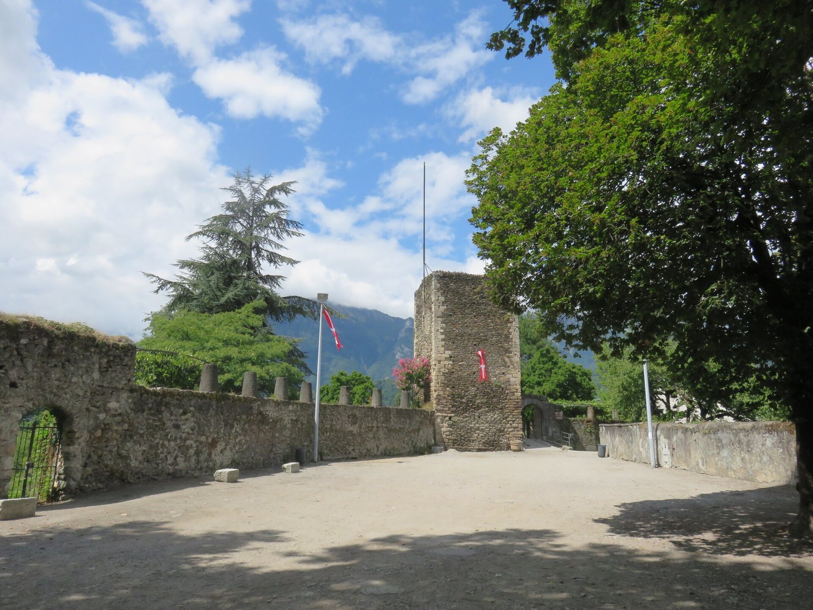
The surviving ramparts mark the defensive enclosure of the town. They were connected with the two principal gates by the Grande-Rue, while the settlement’s position above the river confluence gave the fortress command over the entrance to the Tarentaise Valley and views toward that valley and modern Albertville.
La Cour and the castle grounds
Saracen Tower
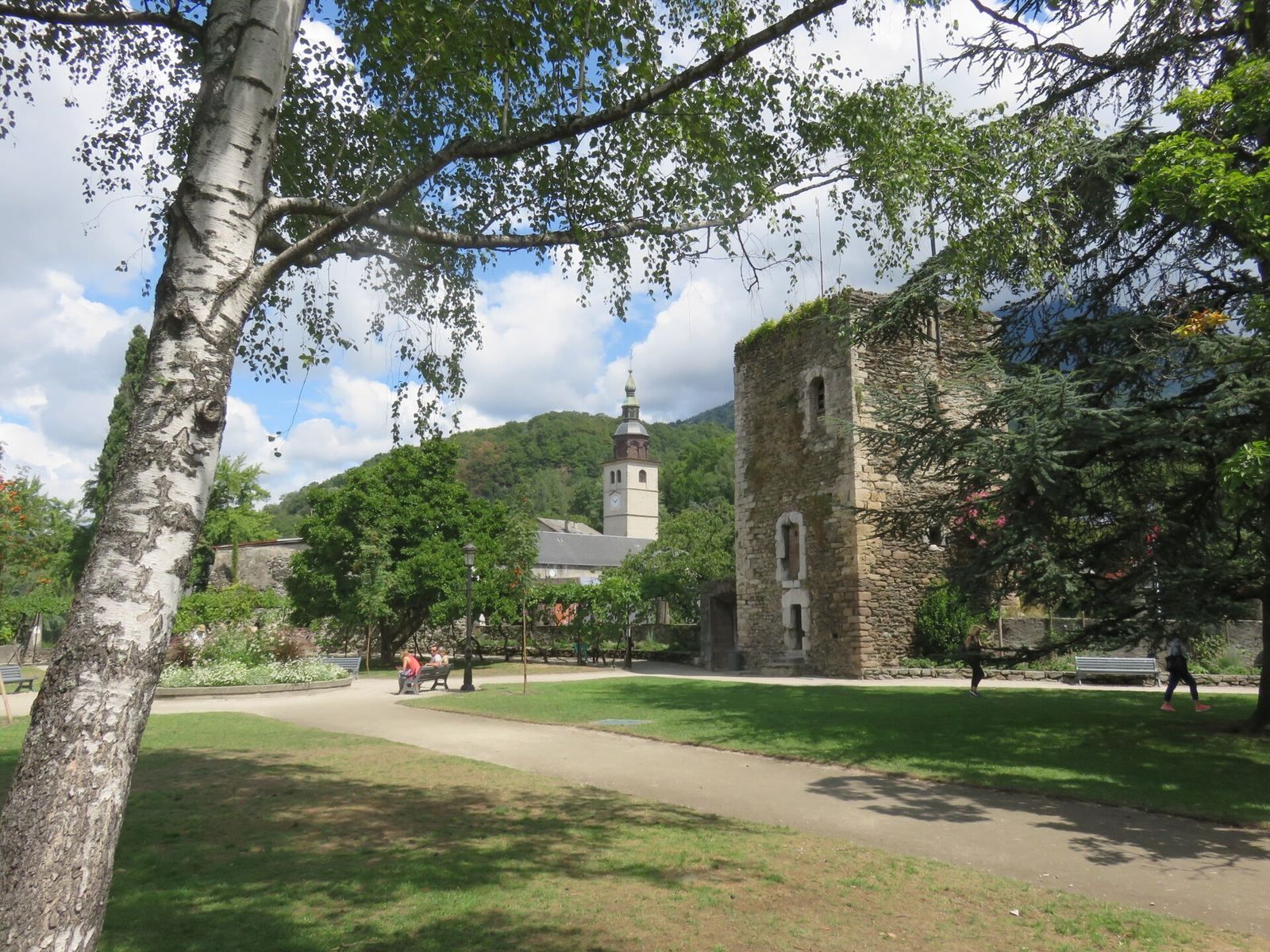
The fortified house of La Cour, known from the twelfth century, survives only in the form of the Tour sarrasine, or Saracen Tower, a keep. Its corners are strengthened with carefully laid stone chainwork. The tradition that the tower was built because of a Moorish presence in the surrounding area is rejected; the name is instead understood as a later attempt to explain an origin that had been forgotten.
Jardin de la tour sarrasine
The Jardin de la tour sarrasine occupies the original location of the former castle. The grounds include the garden entrance, the surviving fortified-town ramparts, and the Saracen Tower or keep, bringing together the principal visible elements of the site.
Later military evidence
A cannon dated 1834 stands on the ramparts. The earlier appearance of the castle is preserved in a sketch made in 1675 by Jean Errard, a military engineer, before the later disappearance of most of the remains.