Chan Chan: Capital of the Chimú Kingdom in Peru
Site at a Glance
- Rating
- 4.5
- Popularity
- Very Low
- Country
- Peru
- Primary era
- Medieval
- Eras represented
- Medieval
- Civilizations
- Chimú
- Site type
- City
On this page18 sections
History
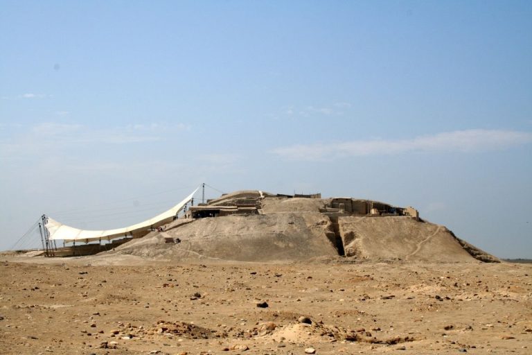
Chan Chan is the archaeological site of the former Chimú capital in Huanchaco, Peru. Built around AD 850 by the Chimú, it became the capital of Chimor from about 900 until the Inca conquest in 1470. The city flourished during the Late Intermediate Period, an era of regional kingdoms before the expansion of the Inca Empire.
Chimú foundation and kingdom
Chimú tradition names Tacaynamo as the city’s first ruler. In this account, he came from across the sea on a raft made of bundled sticks and was skilled in knowledge of the sea, land, and stars. The tradition traces a dynasty of ten rulers through Tacaynamo’s son Guacricaur and grandson Ñancempinco to Minchancaman, the last ruler, who was defeated by the Incas.
Estimates of Chan Chan’s population vary. Figures for its foundation range from 20,000 to 30,000 people, rising to an estimated 60,000 to 100,000 as the kingdom expanded from around 1300. Another overall estimate places the city’s population at 40,000 to 60,000. Irrigated farming and coastal resources supported the Chimú economy, but a major flood around 1100 destroyed many northern canals. The Chimú then relied more on trade and resources from outside the region than on subsistence agriculture. Their close management of water also helped sustain social control.
Water and the sea held religious importance for the Chimú. One belief described the sun as creating three eggs: gold was assigned to rulers and elites, silver to their spouses, and copper to other people. Royal burial and ceremonies honoring ancestors were associated with the city’s palace compounds.
Inca conquest and Spanish rule
In 1470, the Inca ruler Túpac Yupanqui besieged Chan Chan and destroyed the aqueducts that supplied it. The city’s population is estimated to have fallen to about 5,000 to 10,000. After the conquest, the Incas also dispersed Chimú people through the Mitma system, an Inca policy of relocating conquered populations.
Around 1500, the Chimú rebelled, and the Inca ruler Huayna Cápac sacked Chan Chan and partially burned it. The Chimor kingdom’s population, estimated at about 500,000 before the Spanish conquest, fell to around 40,000 within the following century. In 1535, Francisco Pizarro founded the Spanish city of Trujillo, further reducing Chan Chan’s regional role. Spanish looting followed the belief that the city contained great wealth. A sixteenth-century record lists 80,000 pesos’ worth of gold taken from a burial tomb, and pillaging and destruction continued under Spanish colonial rule.
Modern history and conservation
On 27 July 1932, during the Trujillo uprising, members of the Peruvian Army shot an undetermined number of civilians in Chan Chan’s ruins. The killings were reprisals for an alleged attack on the O’Donovan barracks, where several soldiers had died. Later investigations attributed the soldiers’ deaths to civilian forces and concluded that leaders of APRA, the American Popular Revolutionary Alliance, had not ordered the incident.
The name Chan Chan has an unsettled origin. The earliest recorded form, Cauchan, appears in a 1536 document; Canda has also been proposed as a variant, while Chanchan became a stable written form from the mid-seventeenth century. Proposed explanations connect the name either to Quingnam, the extinct language associated with Chimor, or to Quechumara, combining a Quechua word for an enclosure with a place-name suffix probably derived from Aymara. These proposals reject a Mochica origin. Some compounds were given names derived from Mochica, a separate regional language, a practice criticized for obscuring the local linguistic history.
Archaeological excavations began in 1969 and have continued under Peru’s National Institute of Culture. UNESCO added Chan Chan to the World Heritage List in 1986 and placed it on the List of World Heritage in Danger that same year. Its recommendations emphasized conservation, restoration, and management, called for excavation to be paired with conservation measures, and urged action against looting. A conservation course used the site for fieldwork in 1997, and a government-approved plan drawn up in 1998 combined traditional methods and modern engineering to reinforce and stabilize structures. Rain covers and improved drainage have also been used to reduce damage to adobe. Peru recognizes Chan Chan as Cultural Heritage.
From 2000, safety measures included site documentation, public management, and emergency and disaster planning. Forty-six locations were identified as critical damage points, although deterioration extends beyond them. An Italian mission has worked with local archaeologists at Chan Chan since 2002. The ruins remain vulnerable to weathering, floods, strong winds, and El Niño, a recurring warming of Pacific waters that can bring unusually heavy rain to Peru’s coast. In May 2025, a vandal defaced the site with spray paint. Urban encroachment and occupation of land beside a road through the archaeological area are also reported threats.
Remains
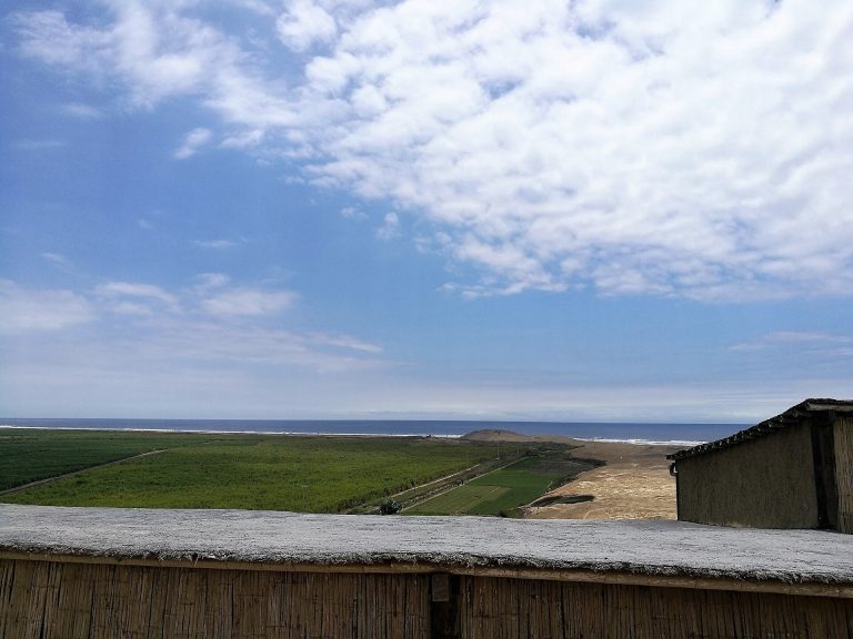
Chan Chan occupies the lower Moche Valley near the Pacific coast, extending roughly three kilometres inland from the shore. The ancient city covered about 20 square kilometres, with a dense central area of roughly six square kilometres; the defined archaeological zone covers about 14.15 square kilometres. Its roughly triangular perimeter enclosed an asymmetrical urban layout. Streets and paths divided areas for storage, wells, workshops, palaces, and artisan neighborhoods, while raised roads connected the capital to administrative centers in surrounding valleys.
Citadels and residences
Citadel organization
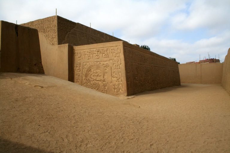
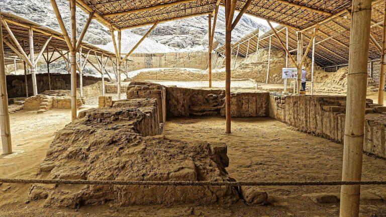
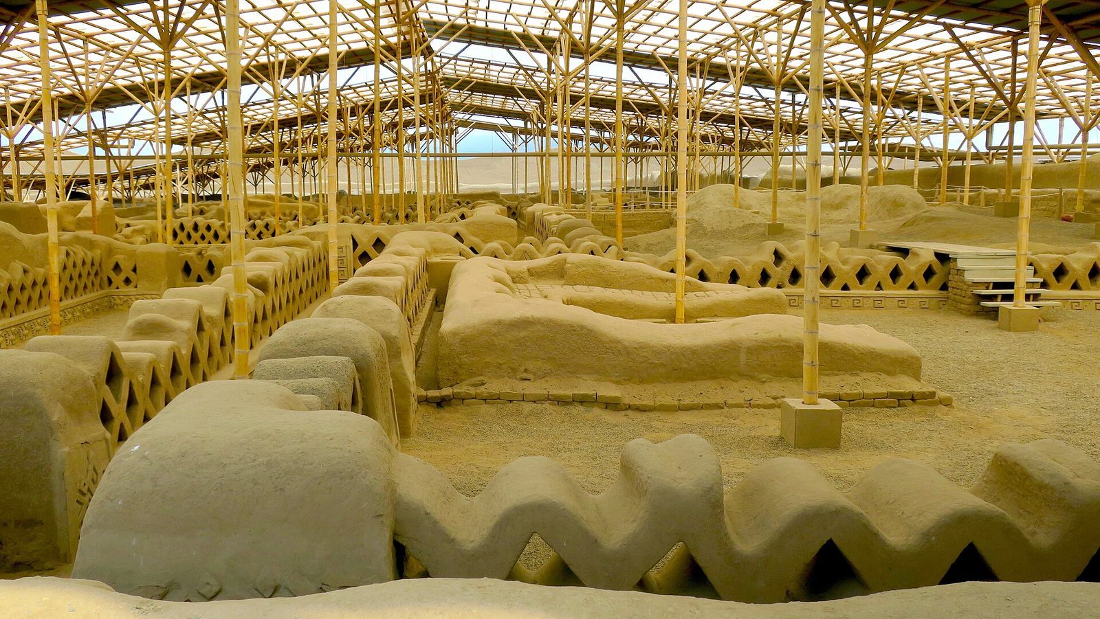
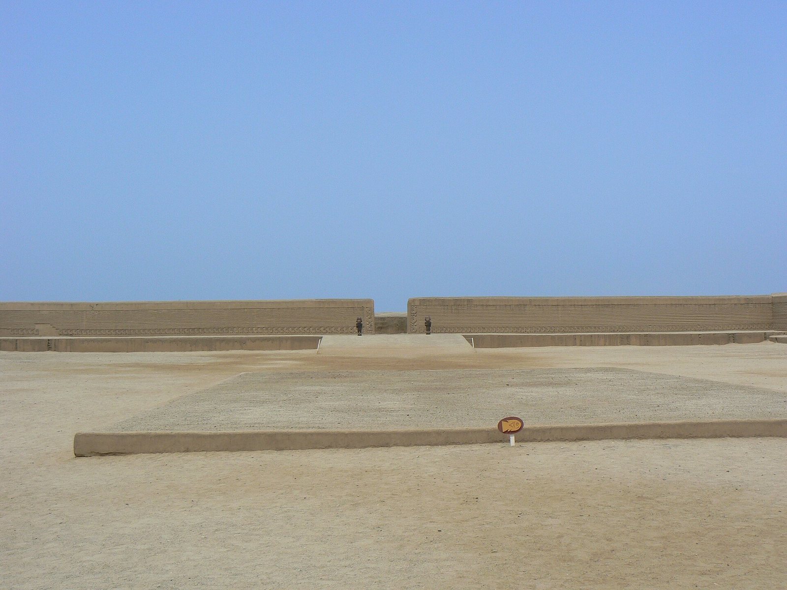
The central area includes ten rectangular walled compounds, or citadels, oriented north to south, along with separate pyramidal structures. Four citadels have been excavated. Their high perimeter walls enclosed planned groups of courts, storage rooms, wells, and burial platforms; a typical complex is described as about 12 metres high. The compounds were generally divided into northern, central, and southern sectors, with a main entrance usually on the north side. At the city’s outer edge, perimeter walls originally stood about 15 to 18 metres high. North-facing walls helped block wind and absorb sunlight in a frequently foggy area, while the tallest walls sheltered the city from southwesterly winds.
Citadel sectors
In the northern sector, a court with low benches around its edges connected by a small ramp to U-shaped administrative rooms and storage areas. These rooms are thought to have served officials or others carrying out important administrative work. Storage buildings were most concentrated in the central sector, beside a low, flat-topped pyramidal burial platform for the citadel’s principal lord. Most of these platforms were looted during the early years of Spanish conquest. The southern sector included kitchens, sleeping areas, and wells supplying residents. Excavations revealed domestic structures there, despite the sector’s appearance as an open enclosure.
Tschudi compound, or Nik An
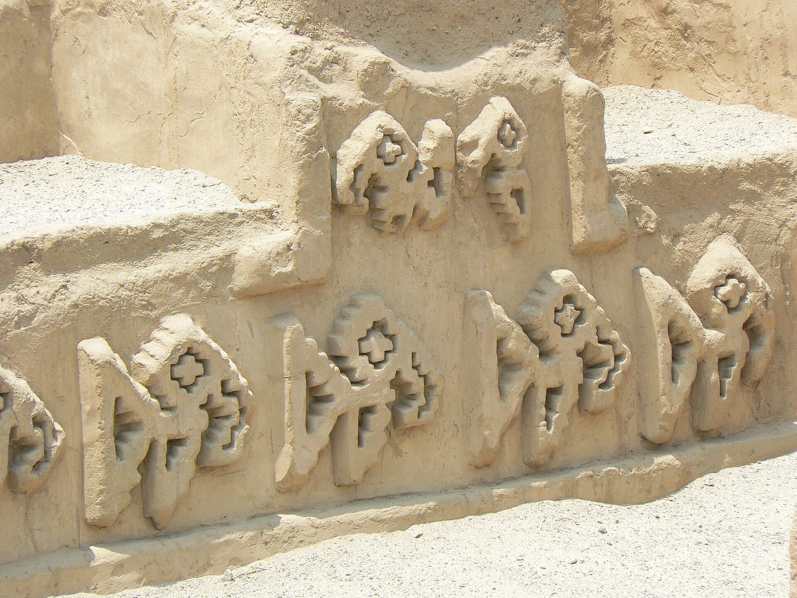
Tschudi, also known as Nik An, was among the last citadels built. Its name comes from the Swiss explorer Johann Jakob von Tschudi. The compound had one entrance and defensive walls up to 12 metres high, about five metres thick at the base and one metre at the top, a profile intended to withstand earthquakes. High-relief carvings show fish facing north and south, waves, fishing nets, pelicans, and creatures combining features of sea lions and otters. The fish orientations may refer to the cold Humboldt Current from the south and the warm El Niño Current from the north. A pond at the compound’s center is thought to have served ceremonies connected with fertility or water worship.
Elite and residential areas
Outside the citadels, compounds for elites who were not of royal descent varied in size, form, and construction quality. Built of adobe with straight walls and right-angled corners, they repeated features of the citadels, including patios, administrative rooms, storage areas, and wells, and served both residential and administrative purposes. Other districts contained housing and workshops for middle-ranking groups, as well as closely adjoining homes for lower-class residents. Small, irregular clusters of rooms served especially as homes and workshops for artisans.
Water and agricultural infrastructure
Wells and canals
More than 140 wells formed part of Chan Chan’s water system, with some reaching about 15 metres deep. Canals diverted water from the Moche River to farmland around the city, and some ran as far as 20 miles down the valley. The distribution of wells varied sharply across the settlement: about 60 percent were in citadels containing less than 10 percent of the population, while 12 percent were in residential districts occupied by more than 90 percent.
Artificial basins and ponds
Large artificial depressions dug through the desert surface to groundwater supported cultivation on the city’s outskirts. Ponds within palace compounds had a different association and were linked with ceremonial use. The pond in the Tschudi compound, for example, is thought to have been used in rites connected with fertility or the worship of water.
Construction and carved decoration
Materials and building methods
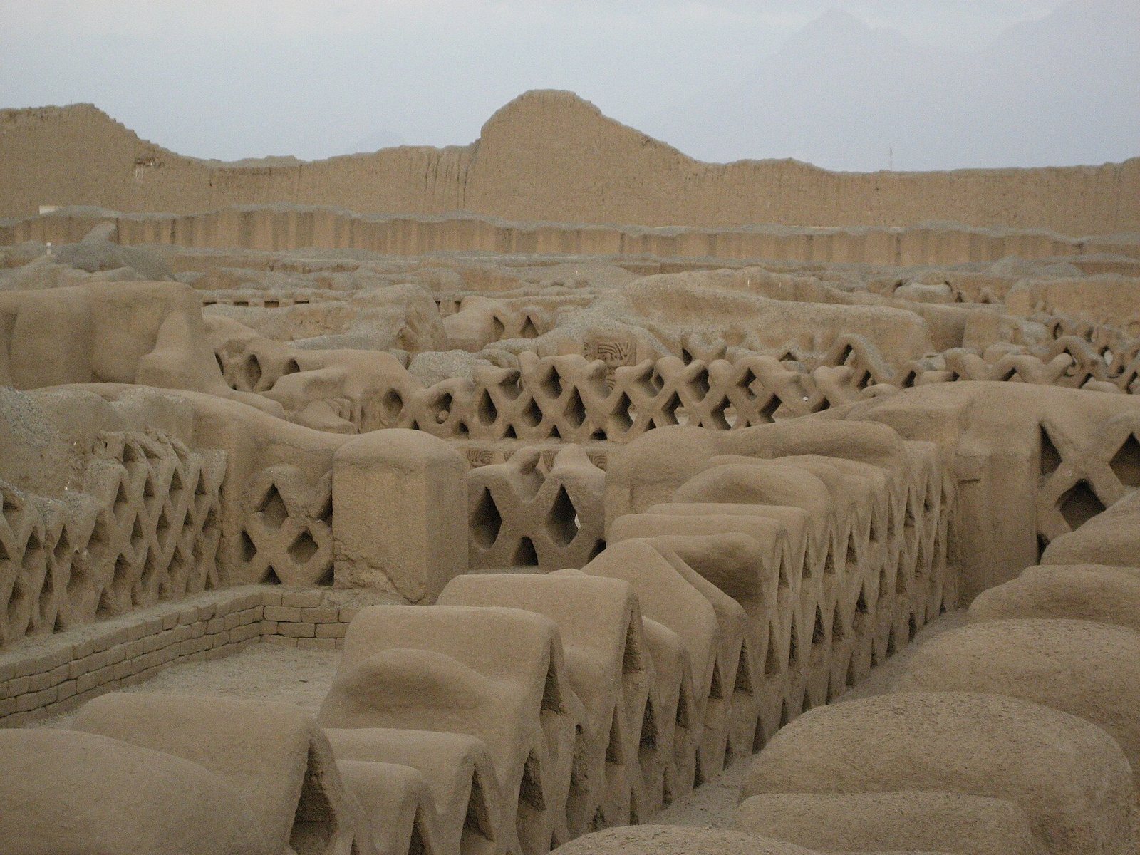
Citadel walls were built of adobe, or sun-dried mud brick, above stone foundations bonded with mud, and were broader at the base than at the top. Broken adobe, earth, stones, and other debris filled floors, ramps, and platforms. Elsewhere, pebble courses about 50 centimetres high supported cane-and-mud walls with wooden supports. Posts, columns, and lintels were made of wood; reeds, cane, and mats were also used, and roofs were formed from interwoven straw bundles. Cane from the Guayas basin near Guayaquil, Ecuador, was used at Chan Chan. Some walls were faced with gold panels.
Reliefs and motifs
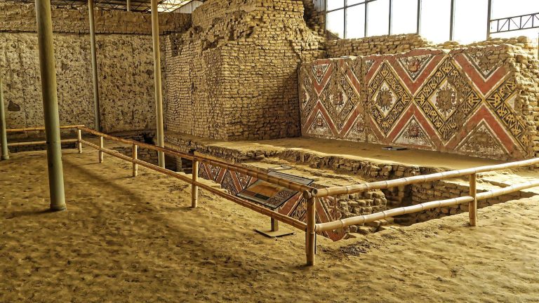
Mold-made high-relief carvings decorated patios, courts, corridors, and other interior walls. Their images include birds, fish, small mammals, crabs, turtles, molluscs such as Spondylus, and fishing nets, alongside geometric patterns. Many motifs relate to the sea and coastal life. Domestic remains include hearths, grinding stones, containers, and everyday ceramics.
Huaca Arco Iris
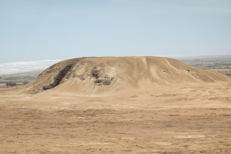
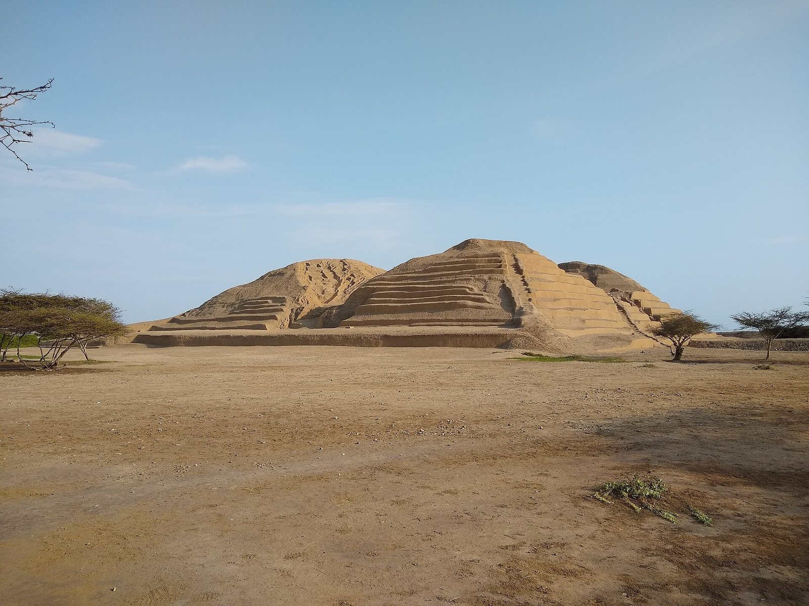
Huaca Arco Iris, a huaca or sacred monument, is a large adobe complex associated with Chan Chan’s earliest structures and dated to the end of the Middle Horizon, the period before the Late Intermediate Period. It is believed to have served as a ceremonial funerary platform. A restoration campaign in 1963 repaired much of its wall fabric without adding new designs. An international project from 2016 to 2022 developed a digital three-dimensional building model to support monitoring and preservation. An inspection in 2018 identified additional brick layers on the exterior of the southeast wall.
Archaeological collections
The Chan Chan Site Museum holds objects recovered from the urban complex, including textiles, gold, silver and copper items, fine ceramics associated with ritual feasting, and ritual objects connected with sacred Spondylus shells. Wooden sculptures representing guardians or ritual officiants associated with the nobility were found embedded in openings and main entrances of pre-Hispanic palaces and later transferred to the museum for protection.