Megalithic Tombs near Tangeln: Neolithic Burial Monuments in Germany
Site at a Glance
- Popularity
- Very Low
- Country
- Germany
- Primary era
- Stone Age
- Eras represented
- Stone Age
- Civilizations
- Unclassified
- Site type
- Burial
- Remains
- Necropolis
On this page16 sections
History
Neolithic origins
The Megalithic Tombs near Tangeln are a group of prehistoric burial monuments in the forests between Tangeln, Mellin, and Ristedt in Germany. Associated with the Neolithic, the later Stone Age when farming communities became established, and the Deep-Stroke Pottery culture, whose pottery was decorated with deeply cut patterns, the tombs were built between 3700 and 3350 BC. The group once comprised more than ten tombs. Seven survive, while an unknown number were destroyed during the nineteenth century.
Destruction and archaeological records
The early records use different numbering systems, and some tombs cannot be matched securely between them. Tombs 1 and 7 correspond to numbers 161 and 160 in the survey by Eduard Krause and Otto Schoetensack. Tombs 5 and 6 match their numbers 157 and 158, and Danneil’s numbers 117 and 118. Tomb 4 is probably the monument Danneil numbered 116.
Dismantling began in 1836 at two tombs between Tangeln and Mellin. Workers removed a roof stone from one and broke a cremation urn found beneath it. Johann Friedrich Danneil examined two destroyed tombs in 1837 and described the monuments in a report published in 1843. He also recorded tombs near Mellin and in Gutstein Forest, and noted that other monuments had already been destroyed farther north in the Tangeln fields.
In the early 1890s, Krause and Schoetensack found that three tombs near Mellin described by Danneil had since been destroyed. They recorded another monument in Gutstein Forest and two near Neumühle. Julius Müller investigated Tomb 6 in 1904. A survey and measurement of surviving tombs across the Altmark, a historic region in northern Saxony-Anhalt, followed in 2003–04, involving the state heritage office, the Johann Friedrich Danneil Museum in Salzwedel, and the Young Archaeologists of the Altmark association. In November 2006, another tomb was discovered in the forest east of Mellin, near the Tangeln stream and about one kilometre south-southwest of Tomb 5.
Some tombs were used for burials after their original use. These later interments included cremations and inhumations, or burials of uncremated bodies. One group of skeletons is probably from the late Roman Imperial period, the later centuries of rule by Roman emperors; the cremation urn broken in 1836 may date to the Bronze Age.
Remains
Surviving tombs
The tombs lie at intervals in woodland between Tangeln, Mellin, and Ristedt. Tomb 1 stands at the forest’s northern edge, 1.8 kilometres south of Tangeln, with Tomb 7 about 100 metres farther south. Tomb 4 is roughly 1.2 kilometres southwest of Tomb 7. Tomb 5 lies about 120 metres west of Tomb 4, and Tomb 6 about 1.3 kilometres east-southeast of it. The Ristedt tomb is about one kilometre southeast of Tomb 6, while the tombs near Immekath are about 2.1 kilometres southeast. A small group of stones about 30 metres southwest of Tomb 4 may mark another tomb.
Tomb 1
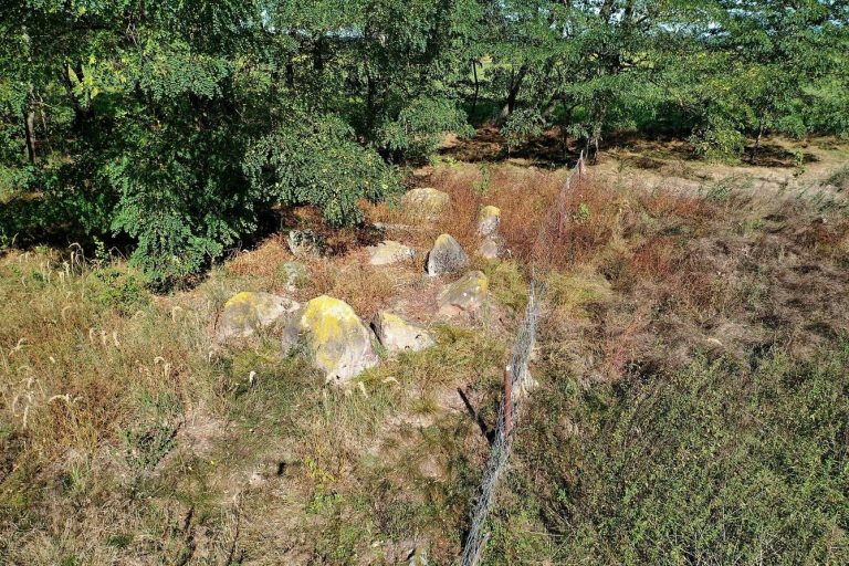
Tomb 1 lies on a north-facing slope. Its oval mound, aligned north to south, measures 20.5 by 11.3 metres and stands 0.6–0.8 metres high. The likely oval stone enclosure was about 20 metres long and 8.5 metres wide; nine or ten of its stones remain. Blasting split a stone at the southern end, and part of the blast hole can still be seen. The central chamber also ran north to south. Two wall stones survive, and the chamber was probably rectangular and about 1.4 metres wide. Plundering damaged the structure, whose original type cannot now be identified.
Tomb 4
Tomb 4 also occupies a north-facing slope. Its circular mound measures 14 metres across and about half a metre high, though its earth has slumped and spread. Two chamber wall stones and one roof stone remain near the centre. The chamber probably ran east to west, but its original shape and dimensions cannot be established. The tomb is too damaged for its original type to be classified.
Tomb 5
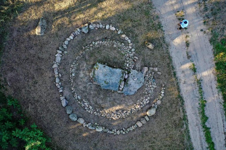
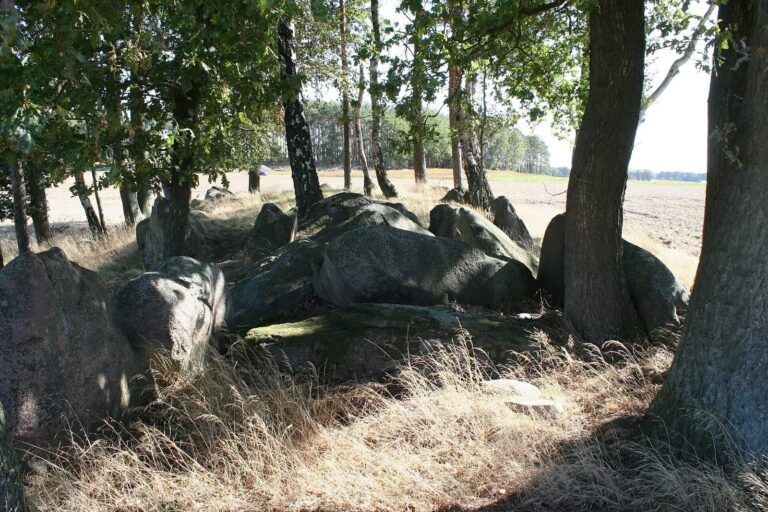
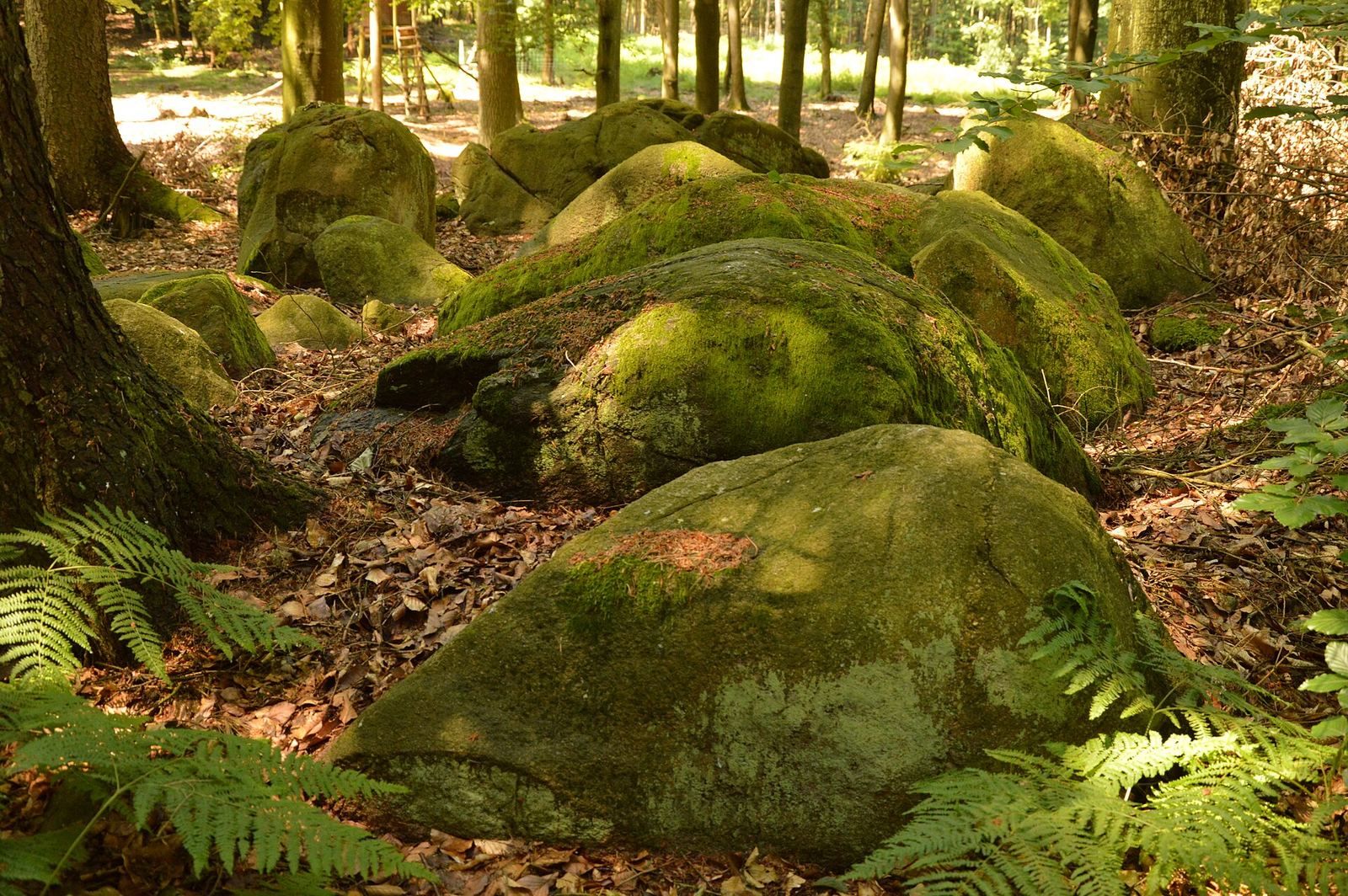
Tomb 5 is a large megalithic chamber tomb. Its oval mound was probably bordered by a stone enclosure, of which four or five stones survive. The chamber runs northwest to southeast and retains about 16 wall stones and at least five roof stones. The structure has collapsed, making it difficult to distinguish the two kinds of stone. The chamber was probably rectangular, with an interior measuring 11.5 by 4 metres.
Tomb 6
Tomb 6 is another large megalithic chamber tomb. Its elongated mound is about half a metre high. The likely trapezoidal enclosure runs northwest to southeast and measures 23.6 metres long and 5.2–6.4 metres wide. Thirty-two of its original 38 stones are visible, with others still buried. Two fallen guard stones lie beyond the enclosure to the southeast.
The chamber occupies the enclosure’s northwestern part and follows the same alignment. It is rectangular, 5 metres long, 1.5–1.8 metres wide, and about a metre high. Its ten wall stones and four roof stones survive, although two roof stones and nearly all the walls have sunk and become overgrown. The largest roof stone measures 2.5 by 1.2 by 1.1 metres. Pebbles and cobbles 10–30 centimetres across were packed into gaps between the wall stones, and some of this packing remains visible. Inside, a stone pavement was covered with sand.
The chamber had been plundered before excavation. Finds from the investigation included a small limestone tool, two flint axes, and pottery fragments associated with the Globular Amphora culture, dated to 3100–2700 BC, and the Schönfeld culture, dated to 2900–2100 BC. These prehistoric cultures are identified partly through characteristic pottery.
Tomb 7
Tomb 7 is an extended type of megalithic chamber tomb. Its mound, originally oval or elongated, measures 17.5 by 11 metres and stands about a metre high. The likely rectangular enclosure runs north to south, measures 7.2 metres wide, and retains eleven stones, one broken. Its rectangular chamber follows the same alignment and measures 3.1 by 1 by 0.6 metres. All six wall stones remain. Two stones beyond the enclosure may be displaced roof stones. The chamber was plundered.
Four-stone group near Tomb 4
A cluster of four stones about 30 metres southwest of Tomb 4 may be part of a monument numbered 156 or 159 in Krause and Schoetensack’s survey. The chamber, built into a natural hill, runs east to west and is rectangular, measuring 3.6 by 2.3 metres. Three wall stones, including an end stone, and one roof stone stand above ground; other wall stones are buried. Most of the stones were apparently removed in the 1920s. Danneil described wall and enclosure stones at monument 156, while Krause and Schoetensack later saw only a few. For monument 159, they counted ten smaller stones.
Destroyed tombs and later burials
Tomb dismantled in 1836
One destroyed tomb had an oval mound measuring 15.7 by 12.5 metres and 1.6 metres high, surrounded by a stone enclosure. Its east-to-west chamber had several wall stones and a large roof stone, which workers removed in 1836. The urn they broke held cremated remains and may have been a Bronze Age secondary burial, meaning an interment made after a tomb’s original use.
When Danneil investigated the tomb in 1837, he found seven skeletons laid along the chamber’s east-west axis. Three occupied its eastern half on a stone pavement; four lay to the west on sand, with some also resting on clay, particularly near the head. The burials are probably from the late Roman Imperial period. One skeleton wore a bronze-wire neck ring fastened by a hook and eye.
Long chamber tomb
A separate destroyed tomb had a chamber measuring 10 by 3.1 metres. Danneil described four roof stones, including one measuring 3.1 by 2 by 1.1 metres. The monument was probably a passage grave, a tomb whose burial chamber is reached through a passage.
Tomb resembling KS 154
Another destroyed tomb was described as similar to monument 154 in Krause and Schoetensack’s numbering. Near a stone in the northeastern part of its enclosure, Danneil found a human skeleton and three crushed cremation urns. One urn contained an iron needle 20.9 centimetres long.
Recorded locations near Mellin
Early descriptions place monument 153 at Hellberge, about 900 metres northwest of Mellin. Monuments 154 and 155 stood north of Mellin beside the road to Neumühle, with 155 about 40 metres east of 154.