Bent Bridge: A Medieval Crossing of the Kızılırmak near Sivas
Site at a Glance
- Popularity
- Medium
- Country
- Turkey
- Primary era
- Modern
- Eras represented
- Modern
- Civilizations
- Ottoman
- Site type
- Infrastructure
- Remains
- Bridge
On this page4 sections
History
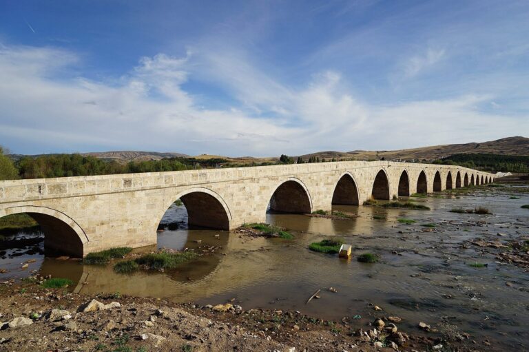
Bent Bridge, also known as the Curved Bridge or Eğri Köprü, is a medieval stone crossing over the Kızılırmak River about 3 km southeast of central Sivas, Turkey. It carried the route from Sivas toward Malatya and onward to Syria and Mesopotamia, and the Baghdad Silk Road crossed it for centuries.
Medieval origins
The bridge’s original builder is uncertain, though it may have been built under the Seljuk Sultanate of Rum, a Turkic state that ruled much of Anatolia. If that attribution is correct, its construction followed the Seljuk conquest of Sivas under Sultan Kilij Arslan II in 1174 and preceded the city’s capture by Mongol commander Baiju in 1243. Baiju took Sivas after the Battle of Köse Dağ, a major conflict in which Mongol forces defeated the Seljuks, on 26 June that year.
Historian Thomas Alexander Sinclair interpreted the reused Classical and Anatolian Seljuk stonework as evidence that the Seljuk bridge incorporated material from an earlier Classical-period building, and that the present bridge was rebuilt with stone from its Seljuk predecessor.
Ottoman repairs and modern changes
The bridge was repaired in 1585 during the reign of Ottoman Sultan Murad III, and again in 1802–1803. Further repairs in the nineteenth century were undertaken under the patronage of Sivas Governor Halil Rifat Pasha, who held office from 1882 to 1885, and at the direction of Abdurrahman Pasha, the local official known as the agha of Kangal. The present structure was extensively rebuilt in the late Ottoman period.
Turkey’s Ministry of Culture and Tourism added the bridge to its national cultural-heritage inventory in 1983. After a modern road bridge was built about 50 m upstream, Bent Bridge was closed to vehicles and retained for pedestrians.
Remains
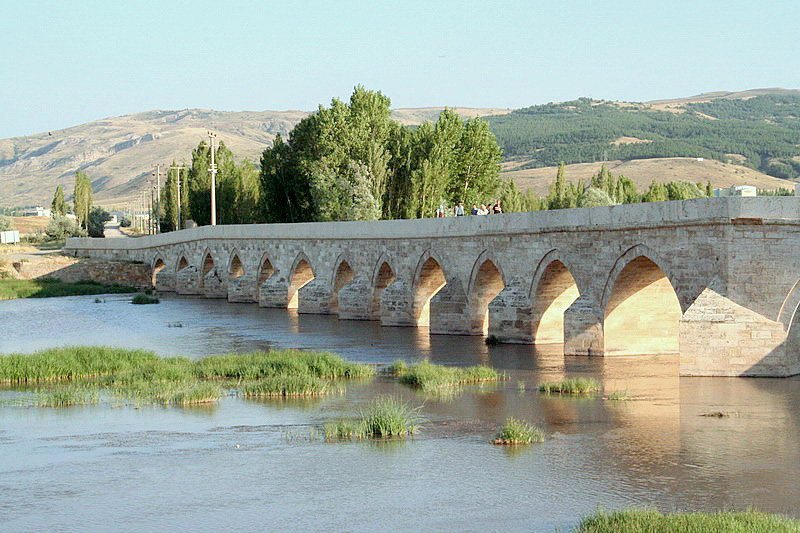
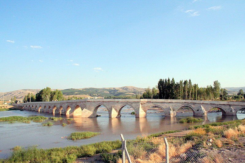
The stone bridge is 179.60 m long and 4.55 m wide. From the northern riverbank, it rises gently and runs nearly east for about 60 m across its first six arches. It then bends about 45 degrees and descends southeast for roughly 120 m over the remaining twelve arches, with a particularly steep gradient across the final three.
Its 18 arches are pointed. Most are of similar width, while three are especially wide; the central arches are also larger in both width and height. Stone cutwaters, projecting features that divide or deflect flowing water, face upstream on the piers. Along the roadway, a parapet, or low protective wall, has a thick outer moulding and openings that drain water. Restoration in 2006 left the stonework unusually pale in appearance.