Šamuḫa: A Hittite Royal City and Religious Center in Anatolia
Site at a Glance
- Popularity
- High
- Country
- Turkey
- Primary era
- Bronze Age
- Eras represented
- Bronze Age, Classical
- Civilizations
- Assyrian, Hittite, Roman
- Site type
- City
On this page17 sections
History
Šamuḫa was a Middle Bronze Age city identified with the settlement mound at Kayalıpınar in Turkey, and later a royal center of the Hittites, an ancient Anatolian people whose kings ruled an empire centered at Ḫattuša. People had lived at the site since at least the fifth millennium BC. Under Hittite rule, Šamuḫa became a major political and religious center, and at a time of crisis served as the kings’ residence and, in effect, the empire’s capital.
Trading colony and early Hittite rebuilding
During the period of Assyrian trading colonies, Šamuḫa began as a trading station and developed into a colony of merchants. Seals and two commercial texts in cuneiform, a wedge-shaped writing system impressed on clay, attest to their presence. The city controlled a river crossing and had a palace. River traffic also connected Šamuḫa with Arziya and Pittiyarik. Hittite texts describe goods, including bread, flour, barley, and wheat, shipped from Pittiyarik to Šamuḫa, a journey of just under 100 kilometres. Ships sometimes had to turn back when the water level fell.
A major fire brought the trading-colony-period city to an end. The Hittites then built a new city with a palace complex. This Middle Hittite city was later destroyed, probably in an earthquake around 1450 BC. A seal associated with the destruction points to the reign of Tudḫaliya I and his wife, Queen Nikkalmati. The nearby mountain city of Šarišša may have been struck by the same earthquake. Šamuḫa and its palace were rebuilt soon afterward.
Šamuḫa in Hittite political crises
Under Tudḫaliya II, Šamuḫa’s palace was systematically plundered and burned. Hittite records describe an enemy from Azzi, an ancient Anatolian land, taking the Upper Land, a regional area within the Hittite realm, and making Šamuḫa its frontier. Šarišša was also plundered. Later, after Kaska peoples, who fought and raided in Hittite territory, burned Ḫattuša, Šamuḫa became the temporary residence of the Hittite kings. As the leading city of the Upper Land, it also served as a major base for Hittite military operations during this crisis.
Šamuḫa remained a base for later Hittite campaigns. Tudḫaliya III and his general Suppiluliuma I used it in their efforts to recover lost territory. A Hittite account of Suppiluliuma’s actions says that he returned Kaska captives to Šamuḫa after campaigning toward Hayasa on Tudḫaliya’s behalf. Tudḫaliya III also established the religious practices of Kizzuwatna, an ancient kingdom in southeastern Anatolia, at the city.
Muwatalli II stayed at Šamuḫa briefly before moving the Hittite capital to Tarḫuntašša. Before becoming king, Ḫattušili III also operated from Šamuḫa at times. After Ḫattušili deposed Muršili III, the latter fled to the city, where Ḫattušili besieged him. During the siege, about 20 metres of the city wall suddenly collapsed. The collapse was attributed to the aid of Ištar of Šamuḫa and allowed Muršili’s capture.
Cults and royal authority
Šamuḫa was an important Hittite religious center, with strong influence from Hurrian religion and a pantheon in which female deities predominated. Rituals were conducted in Hurrian and Hattian, an ancient Anatolian language distinct from Hittite, while the cult of Pirinkir also used Babylonian. Worship included the storm god of lightning and Ḫebat of Šamuḫa, the storm god and Ḫebat of Ḫalab, Šaušga of the Field of Šamuḫa, Abara, the Night Goddess, Pirinkir, the glorious Sun Deity of the Field, and Ḫuwariyanzipa of Šamuḫa.
Tudḫaliya I brought the cult of the Night Goddess from Kizzuwatna. Pirinkir, an originally Elamite goddess whose worship reached the Hittites through Babylonian and Hurrian traditions, was worshipped in the Night Goddess’s temple. The relationship among Pirinkir, the Night Goddess, and Šaušga of Šamuḫa is uncertain. All three were described as forms of Ištar, a major Mesopotamian goddess. Pirinkir and the Night Goddess emphasized Ištar’s astral aspect, while Šaušga of the Field emphasized her martial aspect.
Muršili II renewed the city’s cults and built a temple that became the chief sanctuary of Šaušga during the later Hittite Empire. He appointed his youngest son, Ḫattušili III, as priest of the local goddess called Ištar of Šamuḫa. Scholars identify this goddess as Šaušga or a related deity. Ḫattušili later chose Šaušga of Šamuḫa as his personal goddess. In his Apology, a text defending his seizure of the throne, he presented her as his protector and as a source of legitimacy. His son Tudḫaliya IV served as a priest at Šamuḫa while crown prince and reorganized the city’s cults. Abara, apparently the city’s second most important deity after Šaušga, was named with other city goddesses in Hittite treaty oath-lists.
Later occupation and archaeological investigation
Šamuḫa was occupied in later periods, with remains indicating activity in Roman, Early Byzantine, and medieval times. Its long sequence of occupation, from prehistoric settlement through the Hittite city and beyond, has made Kayalıpınar an important source for understanding Šamuḫa’s history.
Tuba A. Ökse first described the remains as those of an extensive Hittite city. A clay-tablet fragment found on the surface in 1999 prompted further investigation. Large-scale surveys in 2002 and 2003 mapped the settlement’s extent and basic layout, and excavation began in 2005 under Andreas Müller-Karpe and Vuslat Müller-Karpe of the University of Marburg’s Prehistoric Seminar. Work on Buildings A to C was completed, while later excavations focused mainly on Building D. A fragment of a thirteenth-century BC tablet was found there in 2013.
Remains
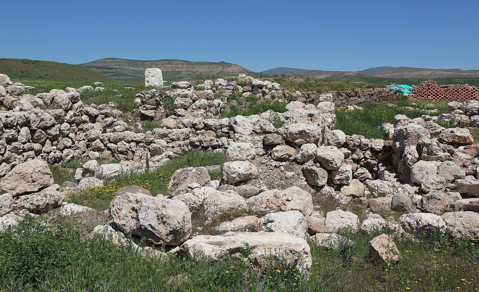
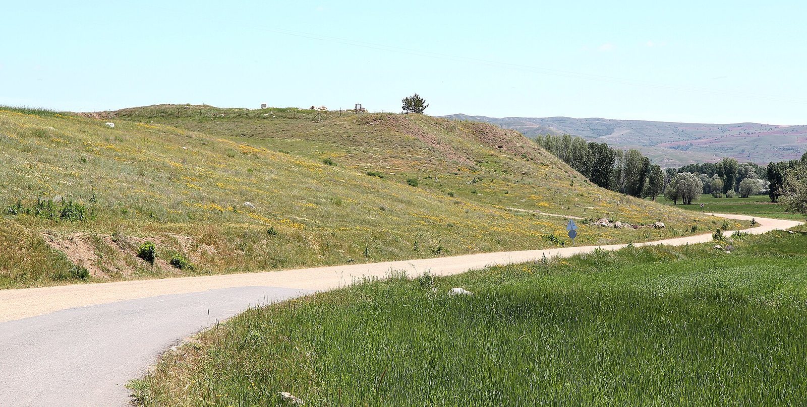
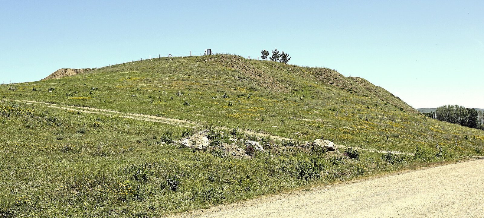
The mound lies in central Anatolia, about 40 kilometres west of Sivas and roughly one kilometre northeast of the village of Kayalıpınar. It stands on the north side of the Kızılırmak River, a few hundred metres from its present and former courses. The river was called the Halys in classical times and Maraššanda in Hittite texts. Earlier occupation lies on the steep southern slope above the river floodplain, while important Hittite buildings stand on the southeast mound. Later graves disturbed some of the architecture beneath them.
River crossing and settlement layers
The river crossing
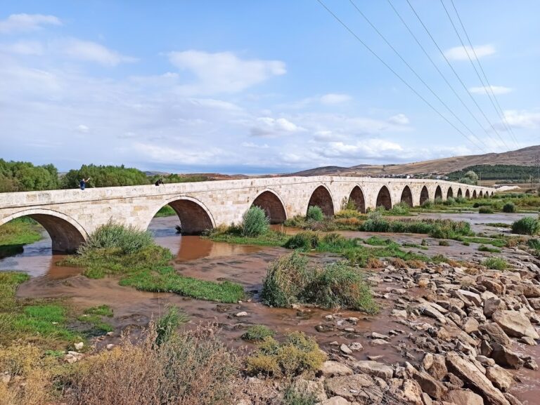
A bridge crossed the river in Hittite times. A cult inventory, a record of objects or practices associated with worship, describes two upright stones at the bridge that its guards venerated. Earlier Assyrian records also describe reaching Šamuḫa from the south by crossing a bridge.
Layers of settlement
The steep southern slope contains Copper Age, or Chalcolithic, and Early Bronze Age material, including pottery of the Alişar III type. Beneath a central wall of the House of Tamura, excavators found a separate stretch of wall about five metres long. In the trading-colony-period layer, they uncovered the House of Tamura and the House of Tatali. Both names come from people mentioned in tablets found in the respective houses. A major fire ended this layer.
Older Middle Hittite buildings include the earliest phase of Building A. Its later phase was built on foundations laid in the earlier layer, and a major fire in that phase is dated to between 1400 and 1450 BC. A later layer contains structures rebuilt over earlier fire debris, including public buildings from the Late Hittite Empire. These buildings are now difficult to reconstruct, and another fire ended this phase.
Hittite buildings and relief
Building A
Building A stands at the southern edge of the southeast mound. Its irregular, nearly rectangular plan measures 43 by 20 metres and contains 18 ground-floor rooms and one entrance. Most walls are about two metres thick, apart from those in the west wing. In the central part, the thicker walls of the earlier phase can be distinguished from the thinner walls of the later one. Room 4, the narrowest and smallest, may have held a servants’ staircase.
The building’s size and decoration suggest that it was not an ordinary residence or an economic building. A sanctuary or palace has been proposed, but comparisons with temples at Ḫattuša and Šarišša weigh against identifying it as a sanctuary. It may instead have been a ruler’s residence.
Building B
Building B lies northeast of Building A, at right angles to it. It has an approximately rectangular plan measuring about 18 by 35.6 metres, with 20 rooms arranged over two storeys.
Relief on a door-jamb block
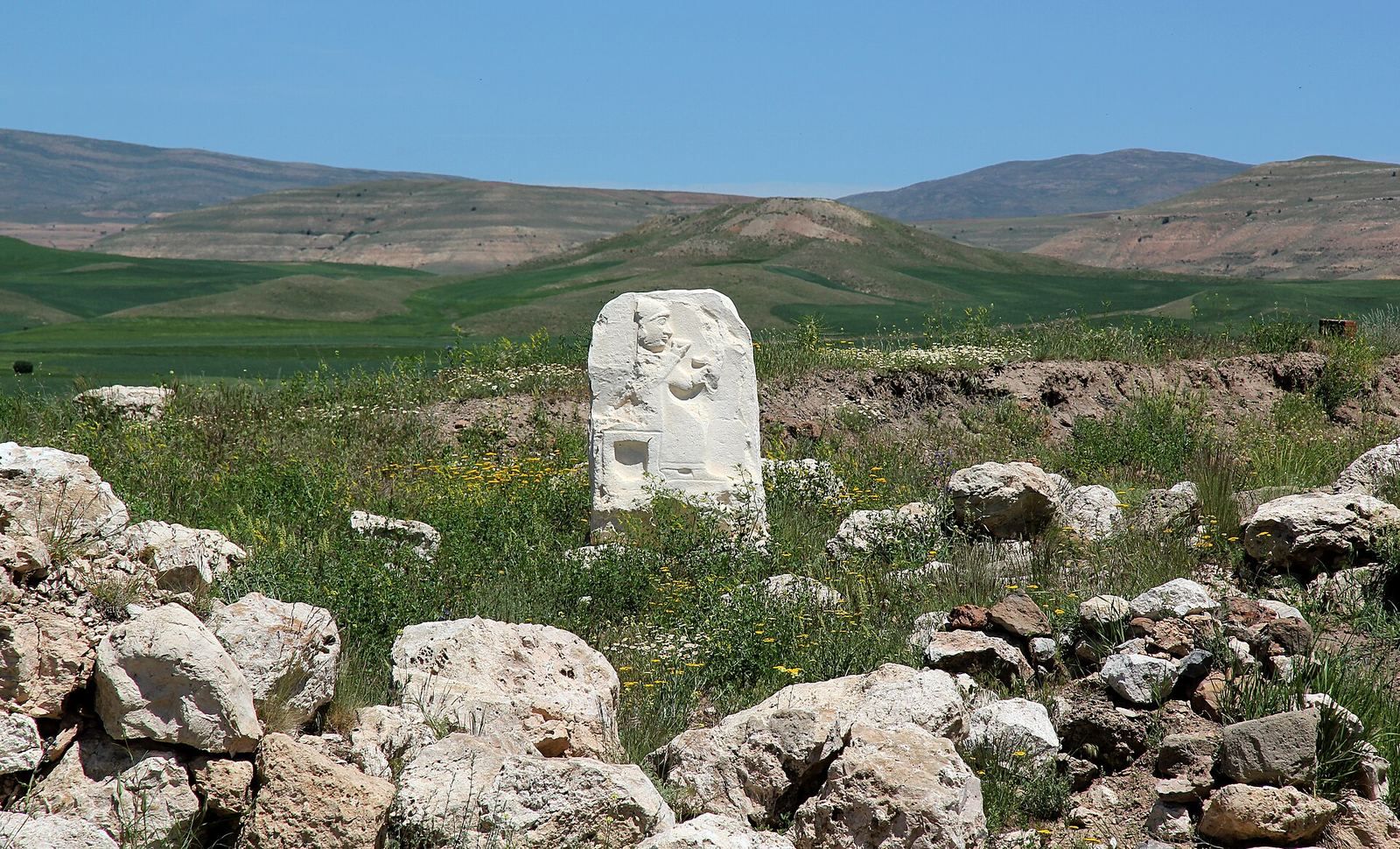
A white-limestone door-jamb block from Building A bears a relief of a seated deity on a plain stool with lion-paw feet. The figure wears a round cap with the beginnings of horns, marking it as divine. Traces of cloth above the cap may indicate a female deity, and the well-preserved face has feminine features. The figure raises a drinking bowl toward its mouth. A bird appears at its right, with its surviving tail pointing toward the figure. The deity wears beak-shaped shoes, and the tip of another foot beside them suggests a person standing in front, perhaps making an offering or worshipping.
Oğuz Soysal has proposed that the deity is Abara. Fragments of the same limestone found elsewhere in the area suggest that similar relief blocks may have decorated the building’s entire base. An oven from a later layer partly overlies the block, placing the relief before the late thirteenth century BC; Mirko Novák has instead proposed a later date on stylistic grounds. Excavated finds are displayed at the Sivas Archaeological Museum, and a copy of the relief is installed at Kayalıpınar.
Burials and small finds
Graves
One layer on the southeast mound contains 16 graves classified as Christian-Roman, built using mudbrick, stone, or pits. Building remains and a Roman roof tile were also found in this layer. Another layer holds 102 Hellenistic and Roman graves, including clay coffins, stone graves, and pit graves. By 2005, a total of 128 graves and collections of bones had been found across the mound. They span the Late Hittite period, the Hellenistic period, and early Christian times, and some had disturbed earlier structures.
Horse-shaped vessels
Small fired-clay vessels shaped as horses were found on the southeast mound. They were used for drinking or pouring liquids.
Clay tablets and archive
The site’s clay-tablet collection includes letters, inventories of cult objects and practices, festival rituals, divination texts, and a Hurrian version of the Song of Silver. Most texts are in Hittite, sometimes with Luwian glosses and Hurrian expressions. Seven are in Hurrian, and two commercial documents from the trading-colony period are in Old Assyrian. By 2015, more than 100 tablets had been found. Texts recovered through 2017 were published in 2019 as KpT 1.1–100; a later excavation uncovered 131 tablets and fragments, bringing the total from the site to 184.
Among the texts are a Hurrian letter about a Hittite campaign involving Kizzuwatna, Alalakh, and Mittani, and an oracle seeking the cause of Šaušga’s anger through lots and bird divination. The cult inventory known as the Šamuḫa Tablet is KpT 1.36; the Song of Silver is KpT 1.14, and the campaign letter is KpT 1.11. The oracle is represented by KpT 1.56 and KpT 1.71, while festival texts for Šaušga include KpT 1.74–77 and KpT 1.86.