Ponte Salario: The Via Salaria Bridge over the Aniene
Site at a Glance
- Popularity
- Medium
- Country
- Italy
- Primary era
- Modern
- Eras represented
- Classical, Modern
- Civilizations
- Italian, Roman
- Site type
- Infrastructure
- Remains
- Bridge
On this page7 sections
History
Origins and Roman traditions
Ponte Salario carried the Via Salaria across the Aniene just outside Rome, Italy, near the ancient settlement of Antemnae. It stood at the road’s third mile, about 3 km north of Porta Collina. The road carried salt toward Sabina, and the bridge was the only crossing over the Aniene mentioned by ancient Roman writers, including Livy. Its earliest origins were traditionally linked to the Etruscans, while the first stone structure is generally dated to the 1st century BC.
Legend held that the Sabine women abducted by the Romans crossed at the bridge. In 361 BC, a duel there pitted the Roman Titus Manlius against a Gaul wearing a rigid neck ornament. After winning, Manlius took the surname Torquatus. In 211 BC, the Carthaginian general Hannibal camped on the plain near the Aniene’s meeting with the Tiber while marching toward Rome during the Second Punic War between Rome and Carthage. He hoped to force Rome to lift its siege of Capua.
Military conflicts and repairs
The area around Ponte Salario served as a camp for armies approaching Rome. The fifth-century military leader Ricimer stopped there in 472. In 537, the Ostrogothic king Vitiges camped at the bridge but did not capture Rome, which the Byzantine commander Belisarius defended at Porta Salaria. During the Gothic War between Byzantine and Ostrogothic forces, King Totila’s army badly damaged the bridge’s main arch. The Byzantine commander Narses repaired it in 565.
In 728, Lombards supporting Pope Gregory II fought near the bridge against the forces of Exarch Paul, a senior Byzantine governor sent by Emperor Leo III. In 1378, Bretons hostile to Pope Urban VI defeated Romans who had come to support him. The commander Nicolò Piccinino’s troops occupied the bridge in 1433, and the Orsini family held it for much of 1485.
Destruction and reconstruction
The bridge suffered repeated damage in the conflicts of the modern period. In 1798, Napoleonic troops battered it, removing its balustrade and an ancient inscription. Neapolitan forces blew it up in 1799 to block French troops under Napoleon. In 1849, French forces led by General Oudinot destroyed it again to impede Giuseppe Garibaldi’s advance toward Rome. Papal troops demolished the central arch in 1867, and the bridge was restored in 1874.
During road-widening work in 1930, the bridge was rebuilt, leaving almost none of its ancient structure. A second bridge of reinforced concrete was built to its east in the late 1970s or early 1980s to carry northbound traffic; the earlier bridge was assigned to southbound traffic.
Remains
The bridge structure
The historical bridge measured about 72 m long and 6.5 m wide. Its form included a large semicircular central arch, spanning about 24.9 m, and two smaller semicircular arches, each spanning about 3.4 m. The masonry used regularly cut blocks of Fidenae tuff, a volcanic rock. Travertine, a type of limestone, was also used in the large central arch, while concrete formed the inner core.
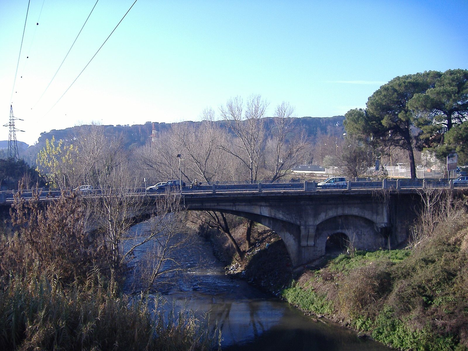
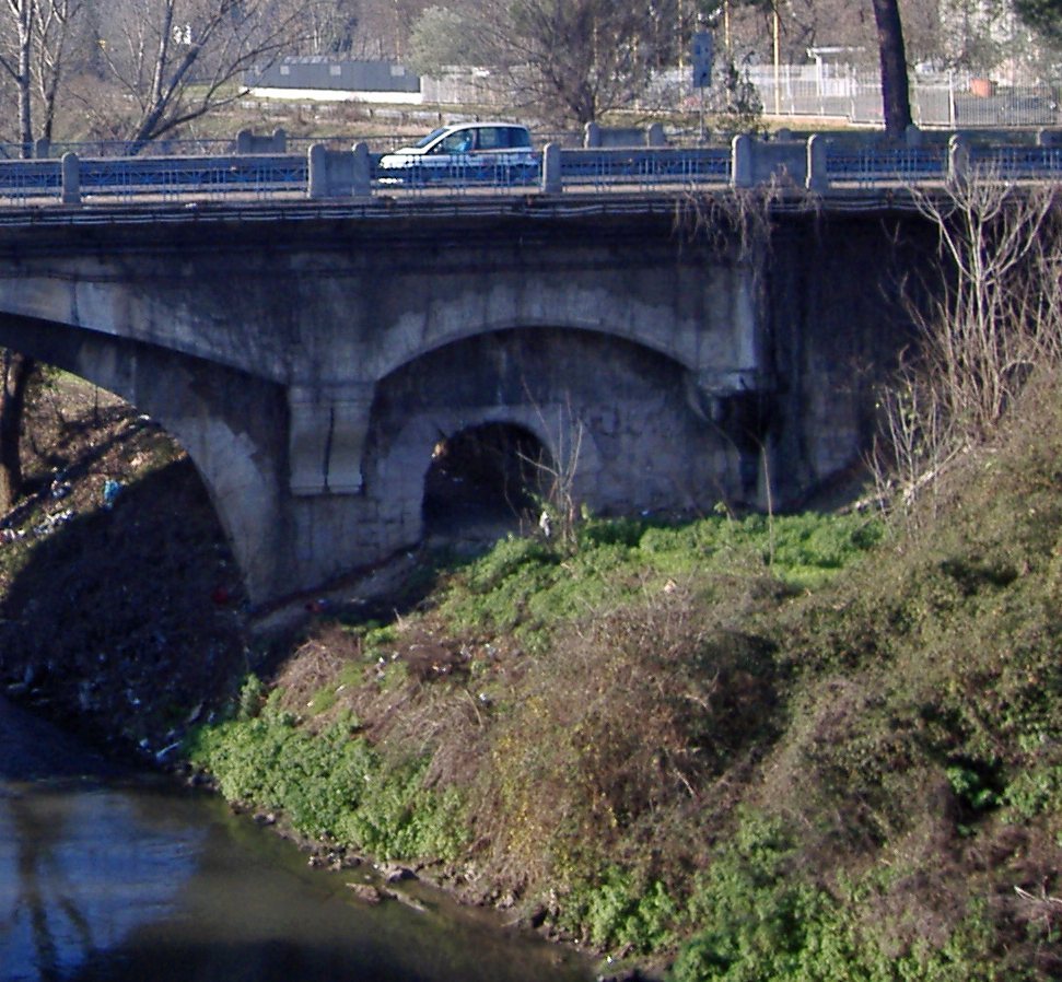
The present bridge combines a modern central arch with two smaller arches beneath the approach ramps, one on either side. The surviving side arches are thought to belong to the first stone bridge of the 1st century BC. An inscription on the bridge described Narses’ repairs, including a diversion of the river, and the structure also had an ancient balustrade.
The defensive tower
A large defensive tower once stood on the bridge. It was probably built in the early medieval period and fortified in the 15th century. Giovanni Battista Piranesi depicted it in an engraving made between 1754 and 1760. The tower was demolished in 1829.