Aqua Claudia: The Roman Aqueduct That Supplied Rome
Site at a Glance
- Popularity
- Very High
- Country
- Italy
- Primary era
- Classical
- Eras represented
- Classical
- Civilizations
- Roman
- Site type
- Infrastructure
- Remains
- Aqueduct
On this page14 sections
History
The Aqua Claudia was a Roman aqueduct built to supply Rome, Italy. Construction began in AD 38 under Emperor Caligula, and Emperor Claudius completed it on August 1, AD 52, together with the Anio Novus aqueduct. The eighth aqueduct built for the city, it was counted among Rome’s four major water supplies.
Construction and expansion
The Claudia may have been carrying water by AD 47. Pliny the Elder placed the combined cost of the Claudia and Anio Novus at nearly 350 million sesterces. As Rome’s population and need for water increased, the aqueduct became an important part of the city’s supply.
After AD 60, Nero added a branch, and Domitian later extended it to the Palatine. In combination with the Anio Novus, the system could supply all fourteen districts of Rome. Water served the Caelian, Palatine, Aventine, and Transtiberine areas, as well as the Quirinal, Viminal, and Esquiline. The Claudia carried good-quality water. Nerva addressed problems caused by its mixing with water from the Anio Novus by separating the supplies into distinct channels.
Frontinus, the Roman official who administered the water supply, recorded several daily flow totals. He used the quinaria, an ancient unit for measuring water flow. Regulations listed 3,263 quinariae, while the measured flow at the aqueduct’s head was 4,738 and scheduled distribution was 4,211. Frontinus identified theft of at least 527 quinariae. Another set of figures gives a combined daily supply of 3,824 quinariae from the Claudia and Anio Novus for the fourteen districts, distributed through 92 tanks. Of this amount, 779 went to the emperor, 1,839 to private users, and 1,206 to public uses, including workshops, entertainment venues, public basins, and camps.
Repairs, interruptions, and damage
An inscription records that the aqueduct operated for ten years and then remained out of service for nine years before Vespasian restored it in AD 71. Titus repaired it in AD 81. Brick stamps indicate further restoration under Hadrian in AD 123, and later repairs are associated with Arcadius and Honorius in the fifth century. Repairs or strengthening are also attributed to Trajan, the Severan emperors, later imperial authorities, and medieval authorities. Belisarius undertook repairs in the sixth century, followed by Pope Adrian I in the eighth.
The aqueduct was damaged during the Gothic siege of Rome in AD 537. Two years later, the Ostrogothic king Vitiges’s forces used its crossing at Tor Fiscale as a defensive position against Belisarius, a general of the Eastern Roman Empire. They blocked the arches there and interrupted the water flow.
In 1585, Pope Sixtus V’s construction of the Aqua Felice damaged further sections of the Claudia. In later periods, builders also removed some of its squared stone blocks for reuse.
Remains
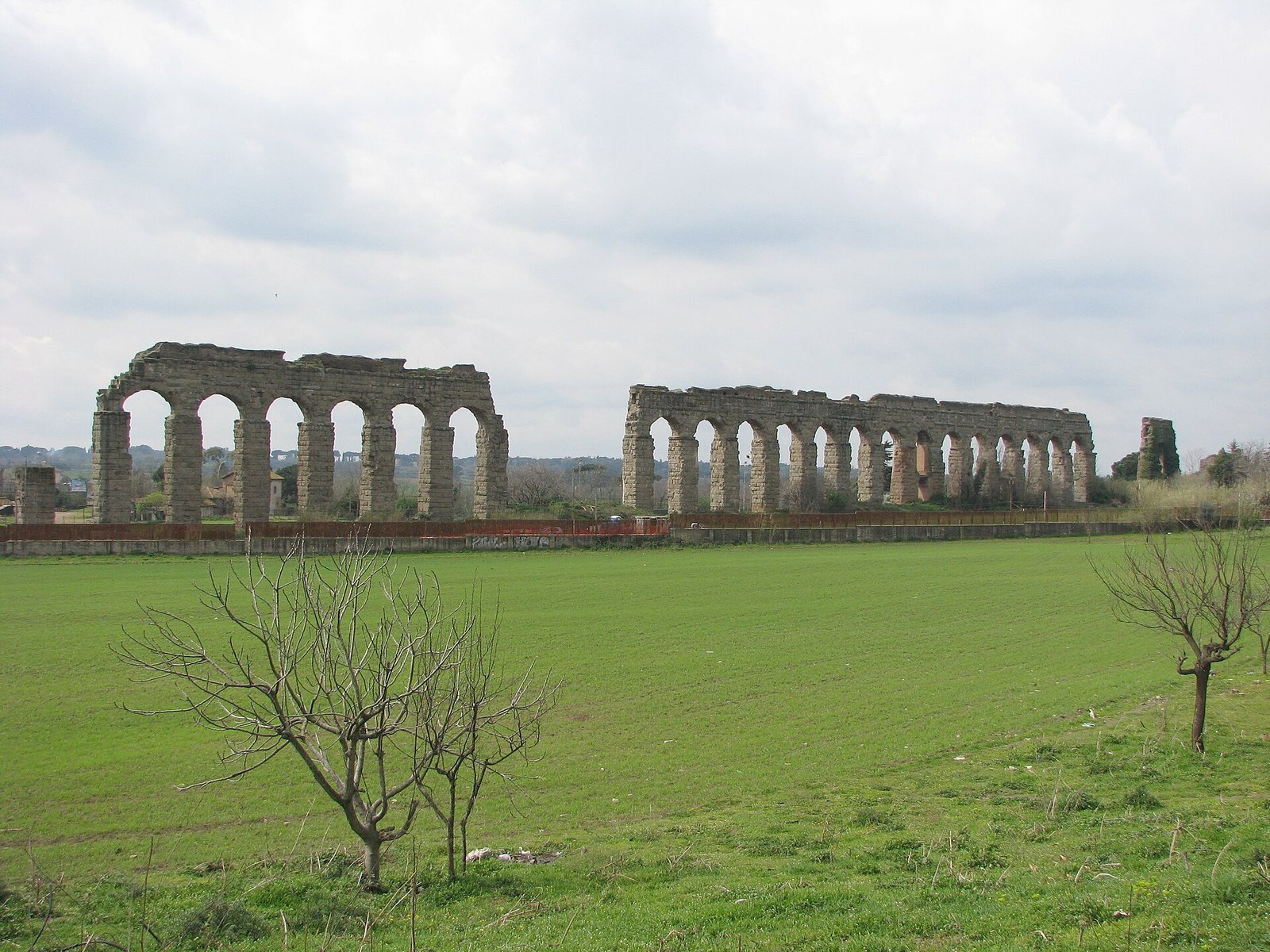
The Aqua Claudia ran for about 68.7 km, with approximately 53.7 km underground and about 15 to 16 km carried on above-ground works. These included arcades near the springs, substructures, and long stretches of arcades approaching Rome. In the surviving sections, the route combines underground channels, elevated arcades, and bridges. Near the city, the Claudia shared its final 13 km with the Anio Novus, whose channel ran above it.
Route and elevated crossings
Springs and route
The springs lay in the upper Anio valley, near the 38th milestone of the Via Sublacensis, between present-day Arsoli and Marano Equo. The main sources were called Curtius and Caeruleus, and other springs also contributed. The spring locality may correspond to the small lake of Santa Lucia. Exchanges with the Aqua Marcia helped regulate the intake.
The aqueduct first followed the Anio’s right bank in relatively straight stretches, then crossed to the left bank near the present-day San Cosimato weir. Beyond Vicovaro, it passed around Monte Sant’Angelo in Arcese and continued to Tivoli. From there, it turned south toward the Via Prenestina, then west toward the Via Latina and the Alban Hills. Near Rome it followed the Via Latina for about 10 km.
Arcades and bridges
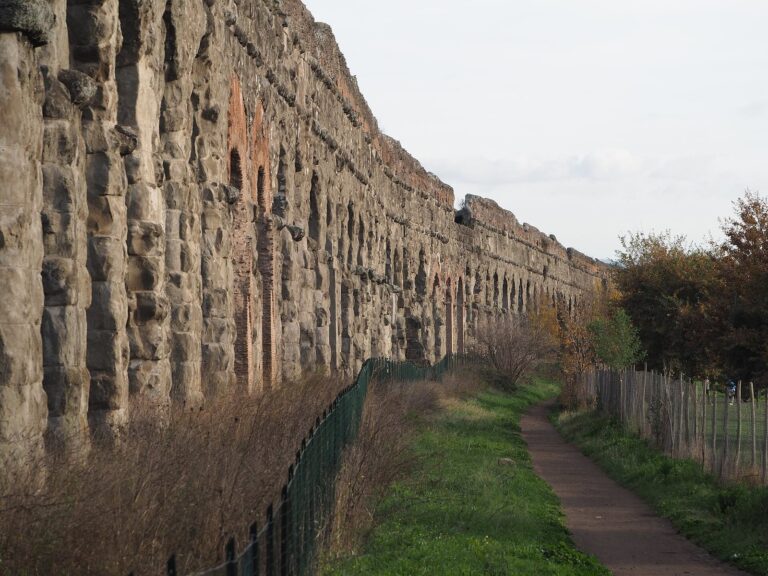
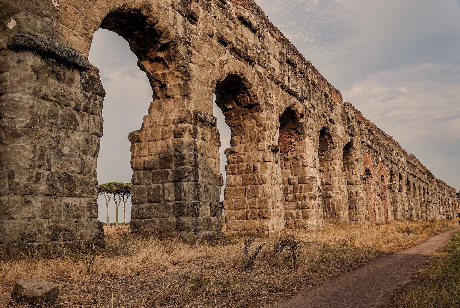
At Capannelle, near the seventh milestone of the Via Latina, the Claudia ran on arcades for about 4.5 km. A surviving stretch in the Park of the Aqueducts carries the paired channels at heights of about 17 to 27.4 m. Its piers measure about 3.35 by 3.10 m and stand roughly 5.5 m apart; the arches span about 6 m. Both channels are about 1.14 m wide and 1.75 m high. The lower Claudia channel is made of squared stone, while the upper Anio Novus channel has net-pattern masonry facing and brick.
At Tor Fiscale, the Claudia crossed above the Aqua Marcia twice, enclosing an area about 300 m long and roughly trapezoidal in shape, known as Campo Barbarico. At Ponte Barucelli, also called Ponte Diruto, two bridges about 8 m apart carried the Claudia on the north and the Anio Novus on the south across the Acqua Nera stream. Built between AD 38 and 52, they were later reinforced with buttresses and joined by three brick arches. Other surviving bridge remains include Ponte sul Fosso della Noce, Ponte San Antonio, Ponte delle Forme Rotte, and Ponte dell’Inferno.
Urban entrance and distribution works
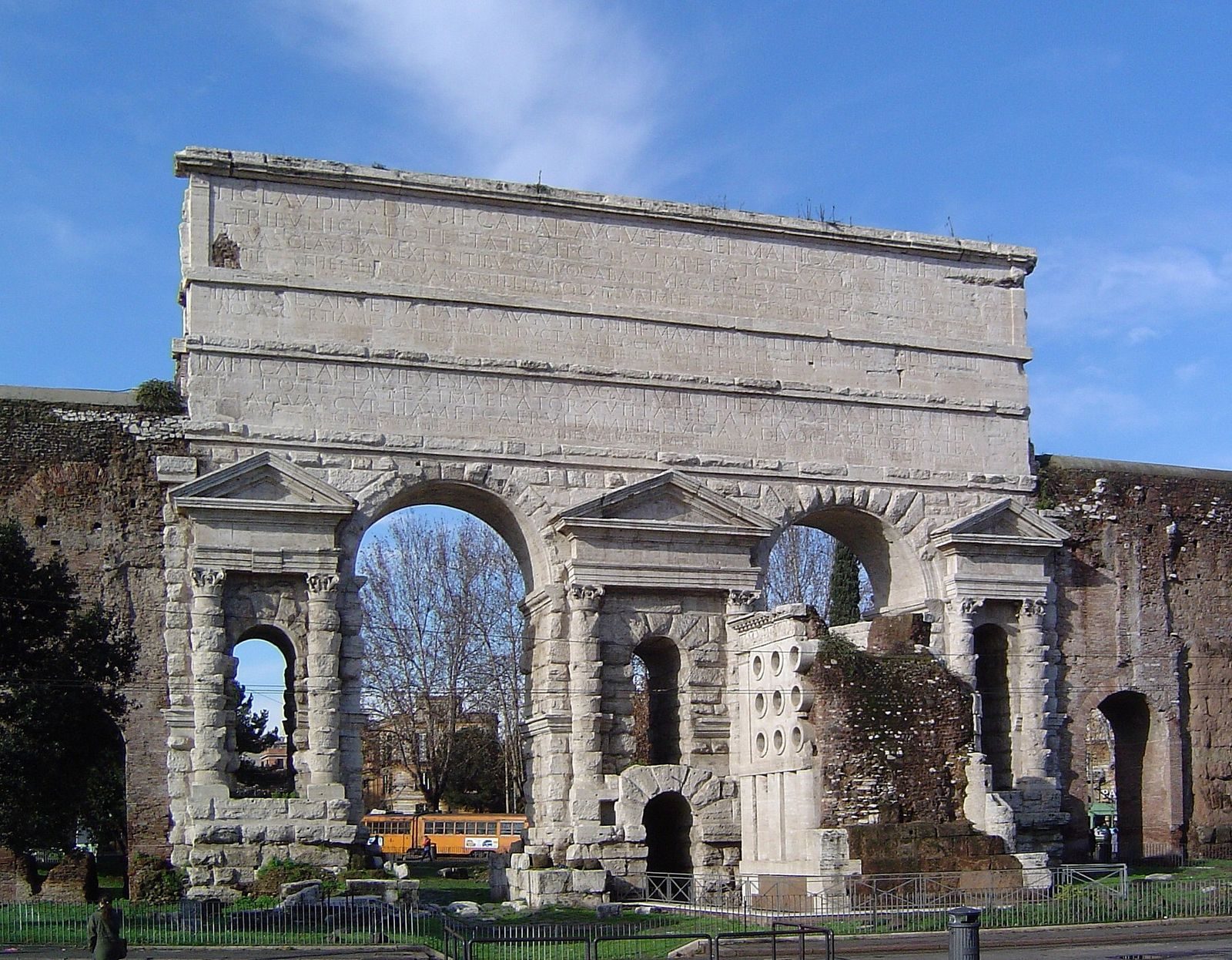
Porta Maggiore and the entrance arch
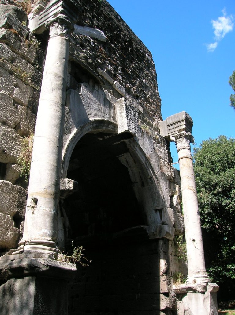
Near Porta Maggiore, the Claudia and Anio Novus passed through a monumental arch. The Aqua Marcia, carrying the Tepula channel, crossed them at this point. Inscriptions were repeated on each face of the Claudia’s entrance arch. The inscription associated with Claudius gives a length of 45 Roman miles, while Frontinus gives 46,406 Roman miles, about 68.7 km, including later repairs and extensions. The aqueduct’s final stretch included about forty arches incorporated into the Aurelian Walls.
Settling basin and terminal tanks
A settling basin filtered larger impurities from the water. The terminal distribution complex stood about 265 m north of Porta Maggiore, in the area known as the Gardens of Pallas. It comprised five large rectangular cisterns, which remained until 1880, and supplied water to 92 secondary distribution tanks.
Branches
Nero’s branch to the Caelian and Palatine
Nero’s branch, later called the Arcus Caelimontani, left the main aqueduct before Porta Maggiore and carried water toward the Caelian and the area occupied by the Domus Aurea, an imperial palace complex. Surviving stretches of its arcades rise about 19 to 22 m, with spans of about 8 m. Domitian extended the branch across the valley between the Caelian and Palatine on arches about 39 m high.
Other branches
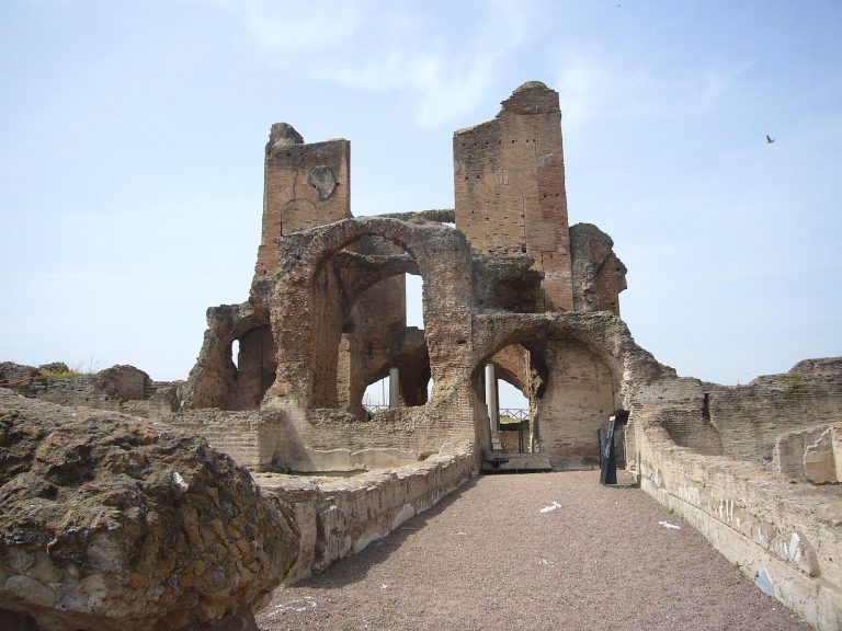
A branch added in the third century carried water to Trastevere from a secondary tank near the Navicella, crossing the Tiber on the Pons Aemilius, now known as Ponte Rotto. Another branch supplied the Villa of the Quintilii on the Via Appia.
Materials and surviving condition
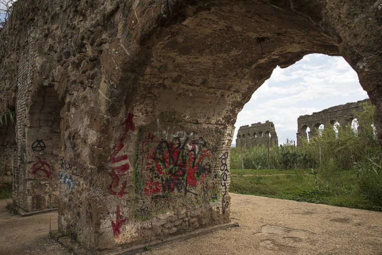
Remains include blocks of peperino, red tuff, and travertine. The church of San Tommaso in Formis was built into the side of the aqueduct. Some sections have been lost or altered: the arch that carried the Claudia across the Via Latina was destroyed during construction of the Aqua Felice, and nearby piers along Vicolo del Mandrione were pierced for the newer aqueduct, which runs below them. Another stretch is entirely lost, possibly because of the Aqua Felice works. Between Tor Fiscale and Porta Furba, surviving sections show extensive removal of squared stone blocks.