Parco degli Acquedotti: Rome’s Historic Aqueduct Park


Site at a Glance
- Rating
- 4.7
- Popularity
- High
- Country
- Italy
- Primary era
- Classical
- External website
- Open
- Eras represented
- Classical, Medieval, Early Modern, Modern
- Civilizations
- Italian, Papal States, Roman
- Site type
- Infrastructure
- Remains
- Aqueduct
On this page16 sections
History
Parco degli Acquedotti is a historic park in Rome, Italy, centered on a network of Roman and papal aqueducts built from the third century BC to the sixteenth century. The area became a major meeting point for Rome’s water channels, which supplied villas, baths, and fountains, and it now forms part of the Appian Way Regional Park.
Roman aqueducts and military history
The aqueduct system developed through successive Roman building projects. The Anio Vetus was constructed between 272 and 269 BC, followed by the Aqua Marcia in 144 BC. Agrippa built the Aqua Julia in 33 BC. Construction of the Aqua Claudia and Anio Novus began under the emperor Caligula in AD 38 and was completed by the emperor Claudius in AD 52. Together, these works created the infrastructure that brought water across the Roman countryside toward the city.
The area also acquired a military role during the Gothic siege of Rome in the sixth century. Vitiges, the Gothic king who led the siege, used the Campo Barbarico, the ground between crossings of the Aqua Claudia and Aqua Marcia, as part of his military position.
Medieval and papal interventions
In 1122, Pope Callixtus II commissioned the artificial Acqua Mariana channel. For centuries, part of the Roman Via Latina lay beneath its watercourse, until modern clearance work brought the ancient road back to view. In the sixteenth century, Pope Sixtus V commissioned the Aqua Felix, built between 1585 and 1590. Its construction destroyed part of the Aqua Marcia, leaving limited remains of that aqueduct visible in the area.
The ruins of Villa delle Vignacce were interpreted in the eighteenth century as belonging to an ancient city comparable to Rome. The area was historically called Roma Vecchia after a nearby estate of that name, a designation that continued to shape its identity.
From informal settlement to public park
During the twentieth century, the area became associated with informal settlement communities. Don Roberto Sardelli worked with residents through School 725, while huts, small eateries, and unauthorized houses appeared around the aqueduct landscape. Rome’s 1965 master plan designated the area for public green space. During the 1970s, authorities expropriated the land and cleared the borghetti, or informal settlements, clustered against the Aqua Felix.
After years of neglect despite restoration work by heritage authorities, concern about degradation and building speculation led local citizens to establish the Committee for the Safeguarding of Parco degli Acquedotti and Roma Vecchia in 1986. With support from intellectuals including Lorenzo Quilici, the committee helped secure the area’s inclusion in the Appian Way Regional Park in 1988. Later work removed unauthorized gardens, restored the hydraulic and landscape features of the Acqua Mariana, and created a cycle-and-pedestrian connection with the Tor Fiscale area.
Remains
The park covers approximately 240 hectares between the Appio Claudio district, Via delle Capannelle, and the Rome–Cassino–Naples railway line. Its physical character is defined by seven Roman and papal aqueducts, which run both underground and on arcades, together with villas, an ancient road, medieval buildings, and surviving countryside vegetation. Umbrella pines and other trees form part of the remaining landscape of the former Agro Romano, the countryside that once extended continuously toward the Alban Hills.
Aqueducts and water landscape
Anio Vetus and Aqua Marcia
The Anio Vetus follows an underground route through the park. Its course extended for approximately 64 kilometres and originally carried about 180,000 cubic metres of water per day. It is described as Rome’s second-oldest aqueduct.
The Aqua Marcia had an approximately 91-kilometre course and carried about 190,000 cubic metres of water per day. It was the first Roman aqueduct to emerge above ground on arcades, and its water was regarded as the best in Rome. Later construction of the Aqua Felix damaged part of its course, leaving only limited remains visible in the park.
Aqua Julia, Aqua Tepula, and Aqua Felix
The Aqua Julia was principally underground and is severely damaged, with sections dismantled and their materials reused in other buildings. The Aqua Tepula, Aqua Julia, and Aqua Felix are superimposed in one part of the aqueduct system. The Aqua Felix runs along one side of the park and remains operational.
Aqua Claudia and Anio Novus
The Aqua Claudia and Anio Novus share superimposed arcades. Their channels run through the park on these stacked structures, forming one of its principal architectural groups. The Campo Barbarico occupies the ground between the double intersection of the Aqua Claudia and Aqua Marcia and another intersection near Tor Fiscale.
A small lake fed by the Aqua Felix gives rise to a stream and waterfall that follow the course of the former Acqua Mariana. Restoration repaired the channel’s hydraulic and landscape features, preserving the relationship between the watercourse and the surrounding park.
Villas, roads, and ancient structures
Villa delle Vignacce
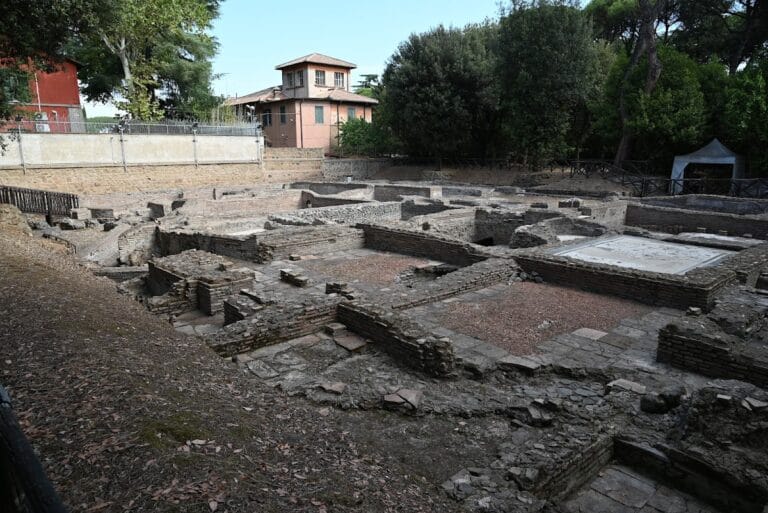
Villa delle Vignacce survives toward the northwest of the park with an attached cistern. Built in stages from the second to the fourth century AD, it is attributed to Quintus Servilius Pudens, a wealthy producer of building materials active during the reign of Hadrian. Inscriptions on moulds and on pipes connected to two channels support the attribution. The villa also preserves the earliest known use of the pignatta technique, which places hollow pottery elements within a building structure to reduce its weight.
Villa dei Sette Bassi
Villa dei Sette Bassi is described as the second-largest suburban Roman villa. It is attributed to a Roman consul or prefect named Septimius Bassus, and its remains form part of the archaeological landscape preserved within the park.
Via Latina
A section of the ancient Via Latina crosses the park with its basalt paving intact. It is one of the few preserved stretches of the road. The paving was formerly concealed beneath the Acqua Mariana channel and was rediscovered during modern clearance work.
Medieval and later buildings
Tor Fiscale
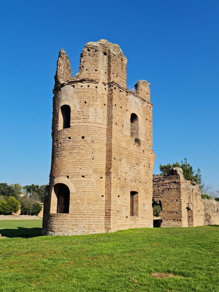
Tor Fiscale is a medieval tower positioned at the intersection of the Aqua Claudia and Aqua Marcia. Its location forms part of the network of crossings and elevated water structures that define the park’s historic layout.
Rural and railway buildings
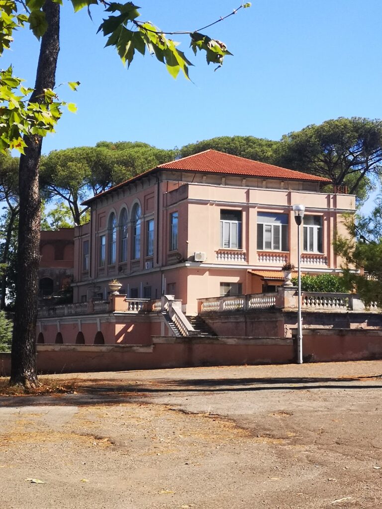
The Casale di Roma Vecchia is a rural building datable to the thirteenth century. The Casale del Sellaretto is an older railway keeper’s house dating from 1862, built along the Rome–Ceprano railway.
The park also contains the Tomb of the Hundred Steps and the parish church of San Policarpo, adding funerary and religious structures to its Roman and later architectural remains.