Cava d’Ispica: An Archaeological Landscape in Sicily
Site at a Glance
- Popularity
- Medium
- Country
- Italy
- Primary era
- Medieval
- Eras represented
- Bronze Age, Classical, Medieval
- Civilizations
- Byzantine, Roman
- Site type
- City
On this page32 sections
History
Cava d’Ispica is a roughly 13-kilometre archaeological valley between Modica and Ispica in southeastern Sicily, Italy. Communities settled here from the Early Bronze Age to at least the fourteenth century, while caves in the northern valley remained inhabited from the eighth century BCE into the early twentieth century. Rural people, including farmers and herders, used its caves and built spaces for different purposes over many centuries.
Early communities and Greek expansion
The beginnings of settlement are uncertain. Archaeologist Biagio Pace attributed the earliest caves to the Sicani, an ancient people of Sicily, while the valley’s caves as a whole belong to a much longer span of use. The Sicels, another ancient Sicilian people, took over some Sican settlements and established new ones. Communities associated with these settlements endured until the earthquake of 1693. Oven-shaped tombs at Scalaricotta are attributed to this period.
During Greek expansion in Sicily, the valley’s settlement remained independent but maintained commercial links with Greek communities. Roman-period traces are difficult to distinguish from later Byzantine material.
Christian and Byzantine use
During periods of religious persecution, local Christians took refuge in caves, adapting existing spaces or cutting small places of worship and decorating them with sacred images. Churches, sanctuaries and burial complexes reflect this Christian use. Byzantine rule, under the Eastern continuation of the Roman Empire, began in Sicily in 535 after the general Belisarius conquered the island for Emperor Justinian. Monastic and ascetic communities later adapted older rock-cut settlements, although the identification of particular complexes as monasteries remains uncertain.
A cave is traditionally associated with Saint Hilarion, who is said to have lived there. The valley was also linked to devotion to Greek saints and to the Virgin Mary as the Odigitria, a Byzantine title presenting her as a guide for Christians.
Medieval settlement and the earthquake of 1693
A papal decree of 1092 refers to a settlement and churches at a place called Hyspicae fundus. The name Spaccaforno appears in papal decrees of 1093 and 1168; the latter assigned the settlement’s churches to the bishop of Syracuse. The modern name Cava d’Ispica comes from the neighbouring town, which was called Spaccaforno until 1936 and is still known locally as Spaccafunnu. For centuries, Ispicae fundus served as a Latin name for the lower part of the territory. A proposed derivation of Ispica from the Greek éis pegàs, meaning “toward the springs,” refers to the valley’s stream.
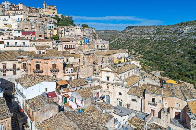
The fortified settlement at Forza was the centre of Spaccaforno and remained associated with the Statella family’s administration for centuries. Its palace was linked first to the Caruso family in the fifteenth century and later to the Statella family. The earthquake of 1693 destroyed the palace and the old settlement at the valley entrance. Much of the population in the southern valley moved to a new Spaccaforno, rebuilt nearby on safer ground. The earthquake also damaged structures within the valley, and a long period of abandonment followed. Cultivation resumed centuries later.
Investigation and later use
Travellers of the eighteenth and nineteenth centuries, among them Jean Houel, the Abbé de Saint-Non, Vivant Denon and Sir Richard Colt Hoare, visited the valley. Its Castello Sicano became a destination on the Grand Tour. Later, archaeologists including Biagio Pace, Paolo Orsi and Holm studied or drew attention to its remains.
Excavations near Baravitalla village took place in the late nineteenth century under the supervision of the archaeological museum authority in Syracuse. In 1982, work at the Larderia burial complex exposed a lower row of niches. In the twentieth century, accumulated deposits were cleared from the entrance to Grotta della Signora to allow exploration. Excavations at Calicantone from 2012 to 2015 uncovered evidence of a settlement abandoned suddenly, and perhaps violently, around 1600 BCE. A late-antique cemetery found west of the valley in 2013 was subsequently placed under archaeological protection. Many finds from Cava d’Ispica and the surrounding areas of Modica and Ispica are preserved at the F. L. Belgiorno Civic Museum in Modica. The rock-cut church of Santa Maria continues to serve for religious functions during Holy Week.
Remains
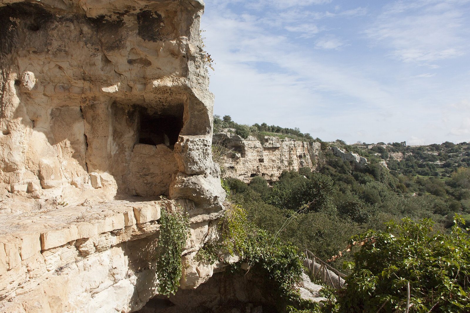
The valley cuts through the limestone Iblean plateau. In places it reaches about 100 metres in depth and more than half a kilometre in width. Its steep sides and branching channels formed through limestone erosion. The remains include caves, dwellings, burial places and churches cut into the rock, as well as defensive structures and a small number of built remains.
Landscape and settlement pattern
Watercourse and valley environment
The stream is called Pernamazzone in its upper course and Busaitone in its lower course. Historically, it ran along the valley floor and could be crossed at only a few points, dividing the valley into two parts. Mediterranean scrub and watercourses shape the landscape. Trees and plants include holm oak, carob, wild olive and dwarf palm; fruit cultivation resumed after the period of abandonment and included medlar, apricot, grape, persimmon, walnut, hazelnut, pistachio and pomegranate. Recorded wildlife includes rabbit, fox, porcupine, hedgehog, wood pigeon, eagle owl and two kinds of snake, the Aesculapian and green whip snakes.
Northern and southern sectors
The northern part, within Modica’s territory, contains numerous caves, dwellings and burial places along rock faces suited to settlement. Defensive positions are more prominent in the southern section, within Ispica’s territory. There, a hard limestone mass projecting into the valley floor resisted erosion by the stream and formed a natural barrier at the southern entrance. A large natural rock block also obstructed the southern passage toward Ispica. Later fortifications in this area have been described as a large-block wall, though that interpretation is uncertain.
Prehistoric settlements and tombs
Baravitalla tombs
Northern Cava d’Ispica contains numerous remains from the second millennium BCE, including oven-shaped tombs with domed or flat ceilings and varying dimensions. A notable tomb at Baravitalla has a trapezoidal entrance framed by nine false pilasters, four on one side and five on the other. Beyond it are an oval entrance chamber and an elliptical burial chamber with an oven-shaped ceiling, an inner chamber and a large niche in one wall. Its elaborate form has prompted the suggestion that it was intended for a prominent person.
Excavations near the village above the tomb in the late nineteenth century yielded globular bone objects, a bone needle or awl and an incised bone fragment. A black globular bone object came from near the so-called Prince’s Tomb. Finds from the park and surrounding areas also include pottery, flint blades and axes, and obsidian knives. The recovered bone objects are held at the F. L. Belgiorno Civic Museum in Modica.
Calicantone
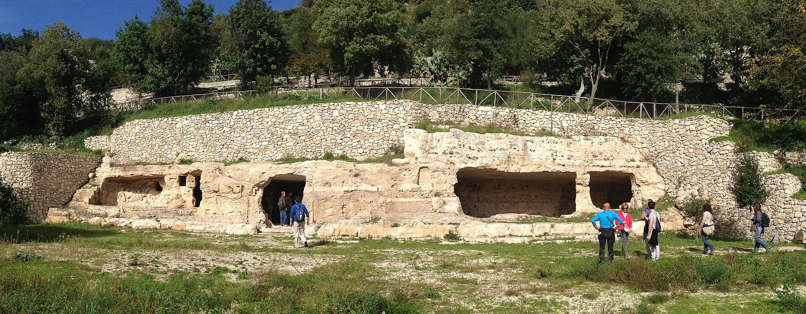
The Calicantone burial ground lies on a rise overlooking the valley, not far from Castello Sicano. Dating to around the twenty-second century BCE, it is associated with the Castelluccio culture, an Early Bronze Age culture of southeastern Sicily. About 100 tombs are cut into the rock. Two have false pilasters on their fronts, while another has a low portico. Excavations in 2012–2015 uncovered an oval hut measuring 10 by 5 metres, 150 objects and human remains. This evidence indicates that the settlement was abandoned suddenly, perhaps violently, around 1600 BCE.
Pernamazzoni and Salinitro
About a kilometre north of Castello Sicano, the Pernamazzoni settlement extends along a vertical rock face and includes several rooms cut into the stone. At Salinitro, tombs and caves rise above one another, with parts of the complex collapsed. The Grotte Cadute are collapsed caves whose exposed interiors reveal medieval dwellings on several levels, continuing the neighbouring structures.
Rock-cut structures and defensive remains
Castello Sicano
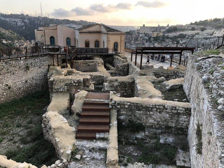
Castello Sicano occupies a limestone cliff about 30 metres high. The complex has four levels connected by interior stairs and exterior stairways; the collapse of the outer stairs exposed upper levels. Most rooms are square or rectangular, with wall niches and openings for doors and windows. Many open onto, or receive light from, a long corridor following the cliff’s outer wall. Steep slopes offered natural protection, while a ditch on the side facing the former slaughterhouse was crossed by a drawbridge. Entry was through a large wooden gate flanked by two smaller doors. Only a few walls survived the 1693 earthquake.
Palace and stable
Excavations at the castle exposed part of the marquis’s palace and the floor of the church of the Santissima Annunziata, which stood within the fortification. The palace occupied its southern side and had an L-shaped plan around a cobbled courtyard. Service rooms and grain bins set into the floor lay on one side; other remains include an asphalt-stone corridor, a room with a Pompeian-red floor and a column base at the northeast corner. Byzantine pottery points to an earlier structure at the site.
The castle stable is a cave measuring about 10 by 10 metres. Rock-cut mangers and holes for tethering animals remain, while an upper area served for storing hay. Storage rooms and a room for armed guards formed part of the complex. Wall holes held wooden beams used to hang weapons, clothing and horse equipment.
Rock-cut gymnasium
A rock-cut gymnasium, a public place for physical training and education in Greek and Roman settings, consists of two connected rooms with benches along their sides. A wall has collapsed in the right-hand room, which also contains basins for washing. The better-preserved left room has Greek seating marks: PRE designated places for elders and NEO for youths. The rooms may have served as a communal meeting place.
Spezieria
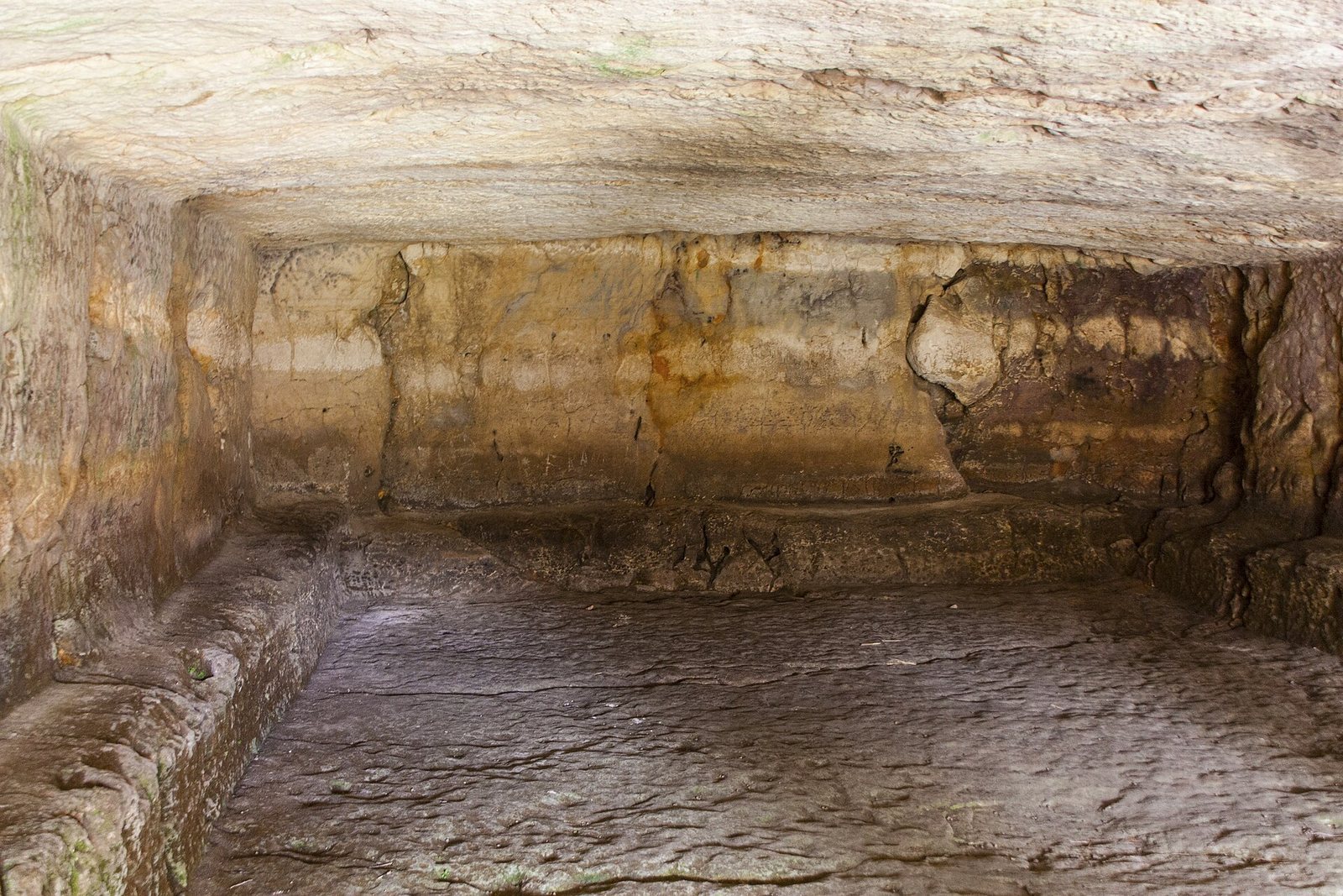
In the western valley, the Spezieria has a partly collapsed entrance leading to a large, roughly rectangular room. Numerous wall recesses may have held shelves, jars or other containers. Three irregular apses, or curved recesses, line one side, and a broad circular bench cut from the rock runs around much of the room. A hole in the limestone floor has been interpreted as a mortar, prompting the suggestion that the cave served as a pharmacy and giving rise to its local name. It may instead have begun as a tomb and later been adapted for another use.
Burial complexes
Larderia catacomb
The Larderia catacomb, an underground burial complex at the northern end of the valley in Modica, forms part of a larger cemetery and covers more than 500 square metres. Its entrance opens into a vestibule, from which three corridors extend. The central corridor runs more than 40 metres into the rock and has three sections. In the first, a passage about 12 metres long and two metres wide contains horizontal burial niches in five tiers. Its lowest tier, buried for centuries, was exposed in 1982.
In the central corridor’s second section, tombs sit on raised platforms bordered by narrow intersecting passages that form a small network connected to the main corridor. Stout columns link the platforms to the ceiling and help support it. The third section has more elaborate tombs, including numerous arched recesses and large sarcophagi in adjoining niches, framed by small columns and rounded or slightly pointed arches. Raised sarcophagus tombs are a notable feature of the complex.
The right-hand corridor is as long as the first section of the central passage and has five parallel rows of burial niches along its left wall. At its far end, two tombs for multiple burials occupy the right wall, with burial cells set both across and along the gallery. The irregular left-hand corridor reflects later use: its niches sit at different levels, and damage has further disrupted the arrangement.
San Marco catacomb
In the southern valley, where the hillside meets the plain, the San Marco catacomb has a main corridor about 40 metres long, with tombs on both sides. A secondary passage branches left of the broad entrance. Three openings in the ceiling light a widened area at the far end, where two canopy tombs survive. The complex contains more than 250 tombs. A separate underground cemetery a few metres away extends along a small corridor. The burial place is associated with a rural community and dates to the fourth or fifth century.
Camposanto
Near the Busaitone and a short walk from Santa Maria, Camposanto is probably a fourth-century Christian cemetery. It contains 60 pit graves, overlapping burial niches and numerous sarcophagi cut into the rock. One area has 25 tombs and a second, extending northward, has 24. A Christian symbol incised on a tomb wall and a Christian monogram within a circular frame in a rear-wall tomb mark its religious character.
Late-antique cemetery west of the valley
About three kilometres from Ispica and 150 metres west of Cava d’Ispica, a cemetery from Late Antiquity, the transition from the classical Roman world to the medieval period, contains about 20 burial niches. They all face east. Cover slabs were found at the cemetery and nearby.
Churches and places of worship
Santa Maria
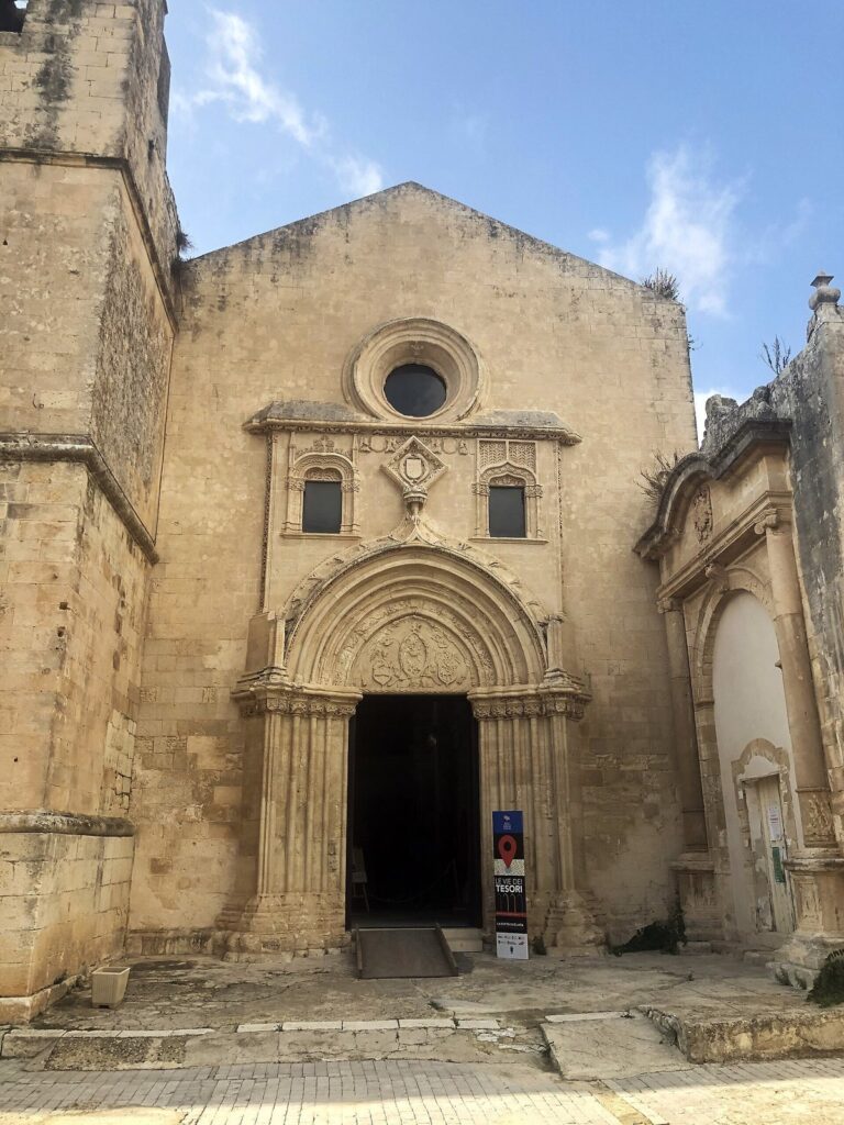
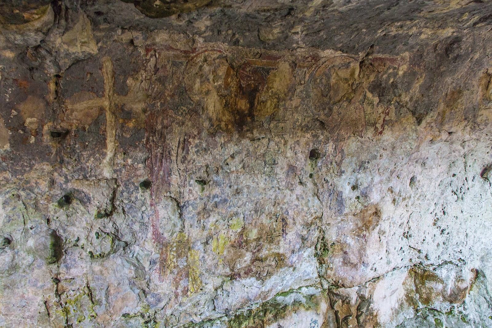
The rock-cut church of Santa Maria stands beside the Grotte Cadute and Camposanto. Its facade has collapsed, but a spiral staircase and traces of a Crucifixion painting survive. The Latin captions lignum mortis and S. Johannes remain with the image. Byzantine paintings also survive in the church, and other interior spaces retain enough evidence for only a partial reconstruction of their original form.
San Pancrati basilica
Above the church of San Nicola, toward Cannizzara, the ruins of San Pancrati include a small basilica dating to the mid-sixth century. Built from large blocks of soft limestone, it had three aisles and a sanctuary with three curved ends. Surviving remains include parts of the outer walls and curved ends, traces of an earlier limestone floor and a later floor made with crushed pottery mixed into mortar.
Grotta dei Santi
At Baravitalla, Grotta dei Santi is a large rectangular cave with paintings of 31 saints. The figures remain visible, though their faces are damaged. Popular tradition attributes the damage to people searching for coins behind the mouths. Paolo Orsi found traces of Greek inscriptions and interpreted a figure dressed as a Byzantine empress as possibly Saint Lucy or Saint Helena.
San Nicola sanctuary
The sanctuary of San Nicola, also called the Madonna’s sanctuary, occupies a cave about 4 by 4.5 metres on the small hill of Cuozzu below Grotta della Signora. Its surviving Byzantine paintings include Saint Nicholas, identified by his beard, mantle and an inscription above his head. Another image shows the Virgin leaning her cheek toward the child, whose face is damaged. A small pit in the floor may have served as a baptismal font.
Sant’Alessandra and the Convento
The rock-cut complex of Sant’Alessandra is generally regarded as a monastery. Near its lower part, by Grotta della Rogna, a nearly erased Byzantine painting may depict the saint. The Convento occupies a difficult-to-reach cliff above the valley floor near the lower Busaitone. A corridor on its upper level opens into small square or rectangular rooms resembling cells, though its identification as a monastery is tentative.
Nearby, a rock-cut oratory dedicated to Santa Alessandra has two rooms. The first contains the remains of a framed painting, probably of the saint. In the smaller room, a circular hole in the rock floor collected water. The water, which is rich in sulfur, was traditionally regarded as a cure for skin diseases; local custom called for leaving a personal garment behind in exchange for healing.
Cave of Sant’Ilarione
The cave associated with Saint Hilarion connects to an ancient stairway cut into the rock that descended to the valley floor.
Other caves
Grotta della Signora
Grotta della Signora is a monumental domed tomb in the northern valley. Subsidence opened a hole about one square metre across in its ceiling, allowing alluvial material to enter and block the entrance. The deposits were cleared in the twentieth century, and pottery fragments were found during exploration. Three small domes in the ceiling may be natural or human-made, and cross-shaped marks are cut into the rock. Earth and stone still cover the floor, which has not been fully explored. If the domes were made by people, the cave may have served Byzantine worship; ritual or domestic use has also been proposed if it was not a burial place.