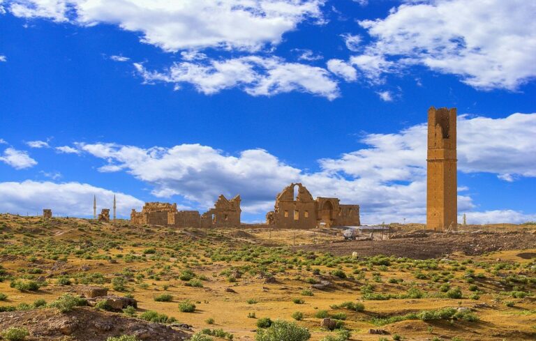
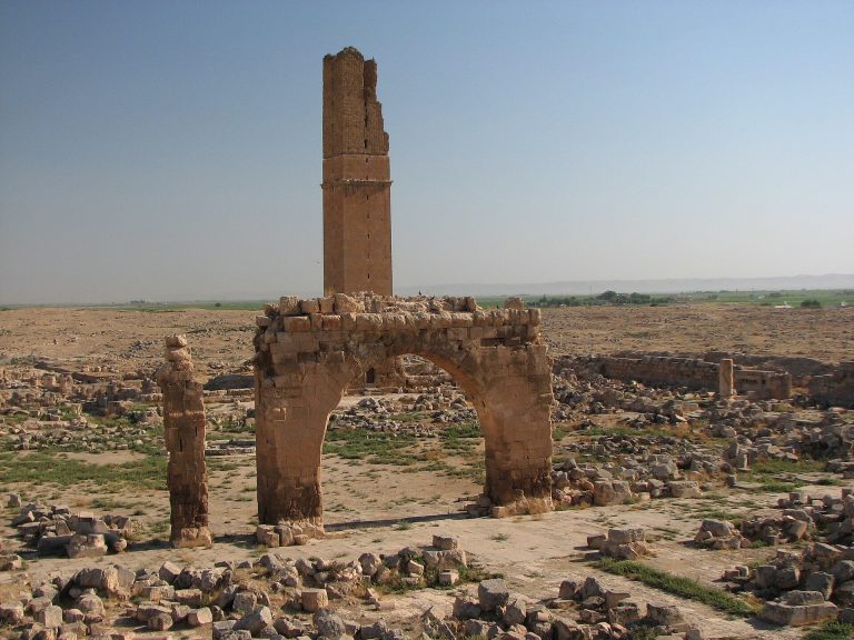
Göbekli Tepe: A Neolithic Site of Monumental Architecture in Türkiye
Site at a Glance
- Popularity
- Very High
- Country
- Turkey
- Primary era
- Stone Age
- Eras represented
- Stone Age, Classical
- Civilizations
- Roman
- Site type
- Religious
- Remains
- Sanctuary
On this page15 sections
History
Neolithic occupation and changing buildings
Göbekli Tepe is a Neolithic archaeological site near Örencik in southeastern Türkiye, occupied by hunter-gatherer communities from about 9500 to around 8000 BCE, or possibly somewhat later. It belongs to the Pre-Pottery Neolithic, an early part of the Neolithic before pottery became common. Its earliest phases are classified as PPNA, the earlier subdivision, and later activity as PPNB, the later one. The site is known for its early monumental architecture, and its development provides evidence for communities living and building together before farming was established.
Radiocarbon dating places the earliest exposed structures around 9500–9000 BCE, with a marked expansion early in the ninth millennium BCE. Initial dates from building fill seemed later than expected from the stone tools, while samples from wall plaster gave earlier results. Later work showed that old wood incorporated into plaster could make its radiocarbon date appear earlier than the construction event. Researchers subsequently developed a broader chronology of about 9500–8000 BCE. A preliminary model that divided the site into a few layers was replaced by a sequence of at least eight phases.
In Phase 1, during the second half of the tenth millennium BCE, the first versions of the large enclosures stood alongside round or oval homes. This combination points to a partly settled way of life. Early in the ninth millennium BCE, Phase 2 brought substantial changes: walls were rebuilt to incorporate the first large, single-block T-shaped pillars, while homes became more numerous and increasingly rectangular.
During Phases 3–5, in the early PPNB, rectangular houses were built and altered in successive episodes on the northern and western slopes. The enclosures were also repaired and modified. Near the end of the early PPNB, a landslide buried lower buildings beneath sediment and domestic debris, probably including discarded material and burials. It badly damaged enclosure D. Stabilization work followed in Phase 5; Building C was rebuilt for the last time, and a terrace wall was added above it to protect against further slides. Another major slide probably led to the abandonment of enclosure D late in the ninth millennium BCE. Other enclosures experienced similar damage and may have been replaced.
Building activity diminished through Phases 6 and 7, from the late ninth into the early eighth millennium BCE. The loss of enclosures B and D may have prompted construction of Building G and the Lion Pillar Building. A further terrace wall was built on the northern slope in a final effort to stabilize it. In Phase 8, small dwellings appeared among the remains of the earlier settlement.
Communal life and the site’s purpose
The discovery of houses, tools, cereal-processing equipment and water-management features has challenged the idea that Göbekli Tepe served only as a sanctuary for nomads with little or no permanent settlement. Its inhabitants were hunter-gatherers who used early forms of domesticated cereals and lived in villages for at least part of the year. The evidence does not establish that they cultivated crops.
Animal bones, including remains of deer, gazelle, pigs and geese, have been interpreted as food from hunted animals prepared for gatherings. Since gazelles were available seasonally, communal or ritual feasts may have taken place when game was plentiful, including between midsummer and autumn. Archaeologist Klaus Schmidt proposed that small groups periodically came together for construction and feasting before dispersing. The structures’ purpose remains uncertain: other interpretations consider them large communal houses where ritual and ordinary activities took place together. Claims that the site was an astronomical observatory have largely been rejected by the excavation team. Schmidt also suggested that the T-shaped pillars represented people, perhaps ancestors, and raised the possibility of shamanic practices; these ideas remain uncertain. Estimates of the workforce also vary, with experiments suggesting that 12–24 people could have built all exposed PPNB structures in under four months, while other interpretations envisage a much larger labor force.
Rediscovery and archaeological work
Before archaeological investigation, the hill was regarded locally as sacred, and a mulberry there is associated with an Islamic pilgrimage. An archaeological survey in 1963, led by Halet Çambel and Robert John Braidwood, recorded the site. Peter Benedict recognized Neolithic tools on the surface but mistook the tops of the T-shaped pillars for grave markers. Long-term cultivation, stone clearance and attempts to break some pillars, probably by farmers who thought they were ordinary rocks, may have disturbed upper deposits.
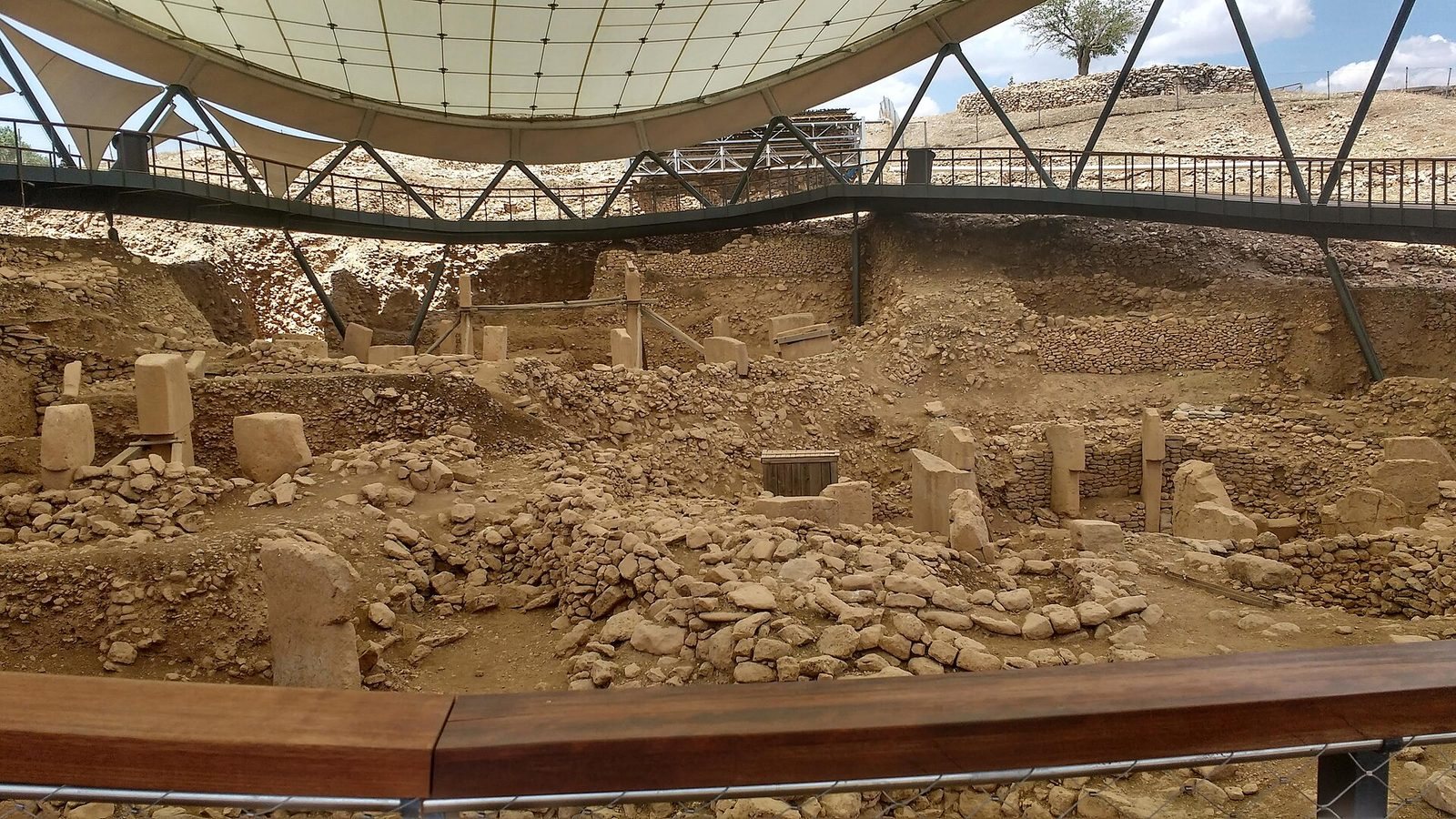
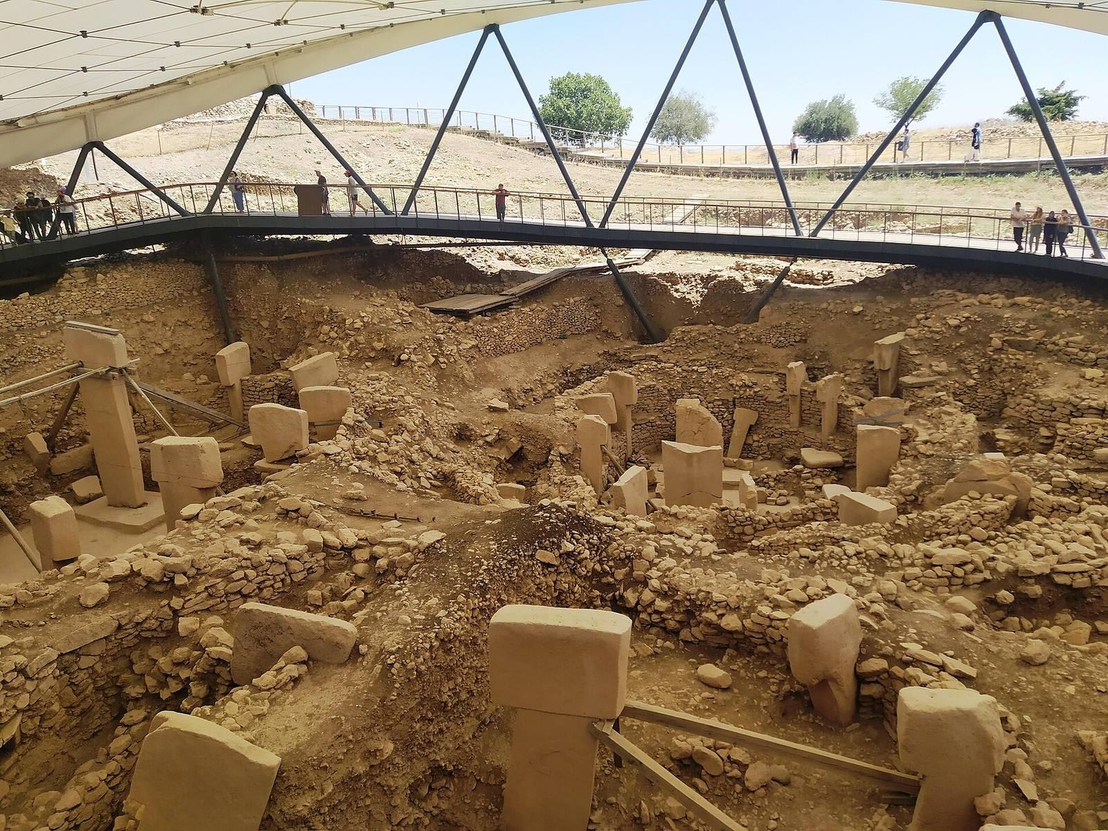
In 1994, Schmidt returned to the site after working at Nevalı Çori. Mahmut Yıldız, whose family owned the land and had reported finds to the local museum, guided him there. Recognizing that the stone slabs could be the tops of ancient pillars, Schmidt began excavations in 1995 and directed the work for the Şanlıurfa Museum and the German Archaeological Institute until his death in 2014. Excavators also found three tombs in the eastern hill group. After Schmidt’s death, Lee Clare coordinated the institute’s research. By 2021, a joint team led by Turkish prehistorian Necmi Karul was concentrating on documenting and conserving exposed areas. About a tenth of the site had been excavated by then, while geophysical surveys indicated at least 20 large enclosures. Göbekli Tepe became a UNESCO World Heritage Site in 2018, recognized for its early monumental architecture, and a protective roof was added.
Remains
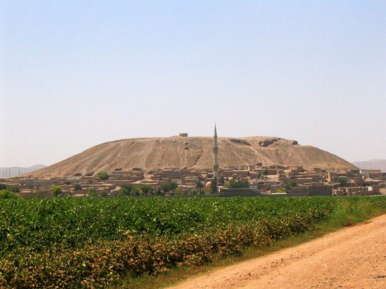
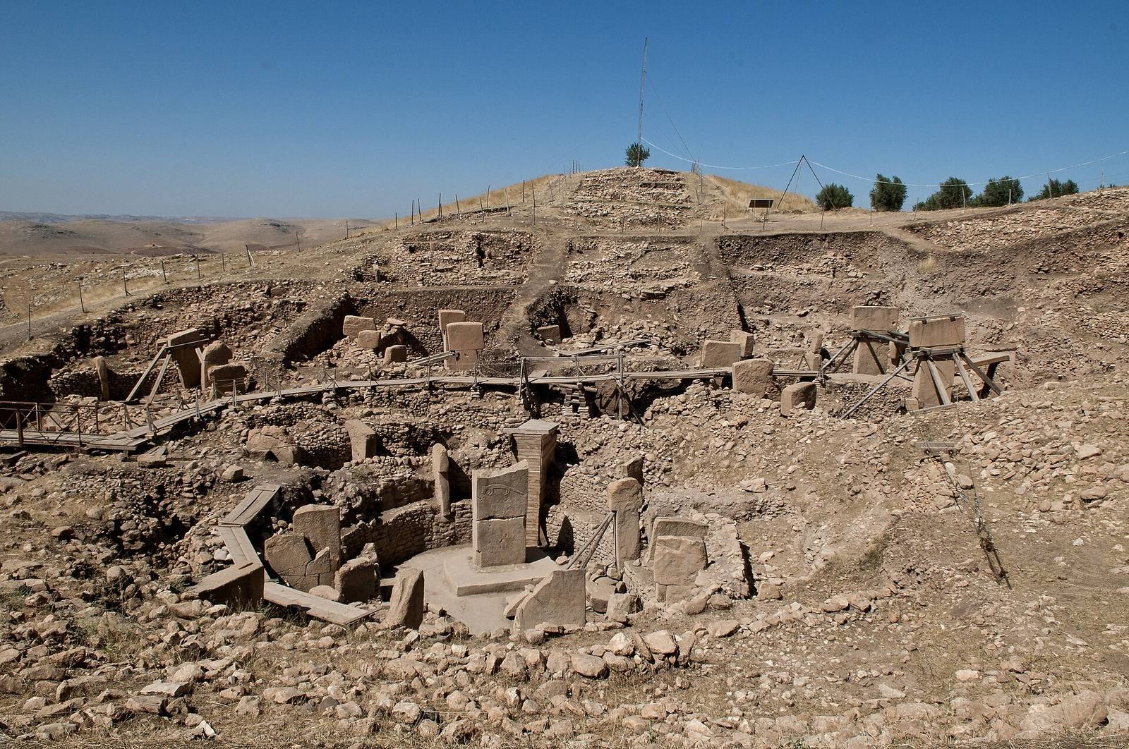
The site covers an artificial mound, or tell, formed through successive occupation and building, on a limestone plateau roughly 760 metres above sea level. The mound is about 15 metres high, 300 metres across and eight hectares in area. Large enclosures, smaller dwellings, quarries and stone-cut cisterns occupy the plateau. Their construction relied on the local limestone bedrock, while the surviving buildings and traces of activity extend across the hilltop and its slopes.
Plateau and water management
The plateau lies in the foothills of the Taurus Mountains and overlooks the Harran plain and the headwaters of the Balikh River, a tributary of the Euphrates. A narrow ridge joins it to the mountains to the north; elsewhere the ground falls steeply into slopes and cliffs. The climate during the Neolithic occupation was wetter than today. Open steppe around the mound supported wild cereals such as einkorn, wheat and barley, as well as wild sheep, goats, gazelles and wild equids. Channels cut into the bedrock directed rainwater to cisterns beneath the site, with a combined capacity of at least 150 cubic metres. The water table may once have stood high enough to feed springs nearer the settlement that are now dormant.
Enclosures and habitation
Circular enclosures
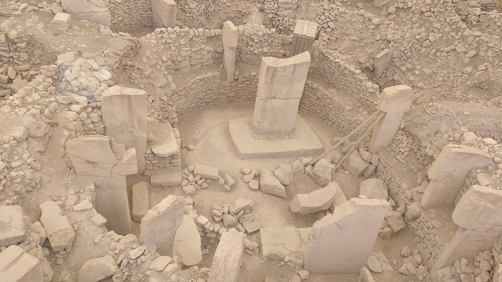
The earliest large enclosures date to the latter half of the tenth millennium BCE and are about 10–30 metres across. Four have been excavated, and geophysical surveys indicate at least 16 more. Their thick inner walls are built of unworked stone, with T-shaped limestone pillars set at intervals. Surveys suggest nearly 200 pillars across the enclosures, with as many as eight in each. Two taller pillars face one another at the centre of each circle, and stone benches for sitting line the interiors. Whether the enclosures were roofed remains uncertain.
Some early enclosure floors were made of terrazzo, a surface of burnt lime; others were cut into exposed bedrock. Pedestals carved in raised relief supported central pillars. Later structures took a rectangular form, with adjoining rooms, polished lime floors and several central pillars up to 1.5 metres high. The rooms date to 8800–8000 BCE. A pair of pillars carved with lions gives the Lion Pillar Building its name.
Domestic buildings
Early homes were round or oval and stood alongside the enclosures. Rectangular plans became more common over time, and during the early PPNB houses also appeared on the northern and western slopes. Some were altered with new interior walls and benches that incorporated T-shaped pillars, creating more rectangular rooms. In the settlement’s final phase, small habitation structures were built among the abandoned Neolithic remains.
Pillars and sculpted imagery
Carved pillars
The pillars were cut from limestone bedrock and are among the oldest known megaliths, large stones used as major architectural elements. Quarry pits about 100 metres from the hilltop supplied the slabs; flint points were used to cut the stone. Pillars could reach six metres in height and weigh up to ten tonnes. Many bear carved animals, including lions, bulls, boars, foxes, gazelles, donkeys, snakes and other reptiles, birds, insects and arachnids. Identifiable animals are often male and shown in aggressive poses. Abstract designs include H-shaped marks, crescents and disks.
Human figures are uncommon among the pillar carvings. Some pillars have arms, hands and loincloths on their lower sections, details that support the interpretation of the T shape as a body and head, though the figures’ identities are unknown. In enclosure D, the central pillars depict human forms with arms, belts and cloth covering the genitals; their sex cannot be identified. A naked woman carved on a slab is a clearly identifiable female image.
Notable carvings and smaller sculptures
Individual carvings include a fox on pillar 10 in enclosure B, and ducks and a boar on pillar 12 in enclosure C. Pillar 27 in enclosure C shows a predator, possibly a feline, attacking a boar. Pillar 43 in enclosure D, known as the Vulture Stone, depicts a headless man with an erect phallus. Other phallic images occur at the site and at other Taş Tepeler, or Stone Hills, sites in the Şanlıurfa region.
Smaller carved stones recovered from the buildings show similar imagery, chiefly animals and mostly male human figures. They include a high-relief animal that may be a reptile, feline or wolverine; boar figurines, a sculpted group of human figures and a figurine of a man with an erect penis. A carved totem from an early PPNB structure measures 192 centimetres long and 30 centimetres in diameter after reassembly. It depicts, from top to bottom, a headless predator, possibly a bear or large feline, with human arms and a neck; a second headless figure with human arms, probably male; and a third figure whose head survives. Snakes are carved along both sides.
Platforms, quarries and excavated finds
Complex E and quarry remains
Outside the mound, an incised rock platform has two sockets that may have held pillars, with a flat bench around it. It is associated with the oldest parts of the settlement and is also called Complex E or the Temple of the Rock because it resembles cult buildings at Nevalı Çori. The bedrock floor was carefully smoothed. One cistern-like pit immediately northwest of the platform has a table-height pin and a five-step staircase; a second nearby pit may also belong to the complex.
Four channels in the southern plateau, each about ten metres long and 20 centimetres wide, mark a quarry where rectangular blocks were cut free from the rock and levered out. The channels may relate to a nearby square building, of which only the foundation survives. That building may have been a Roman watchtower in the Limes Arabicus, a Roman frontier zone and defensive system in the Near East. A small cave in the western escarpment contains a relief of a cattle-family animal. A lionlike figure was found at the western edge of the hill, where concentrations of flint and limestone fragments have led to the suggestion of a sculpture workshop.
Tools and other archaeological finds
More than 3,000 Neolithic tools were recorded during the 1963 survey, mostly made of flint, with a smaller number of obsidian pieces. They include cores, blades, flakes, scrapers, burins and projectile points. Excavation of Space 16, a small building beside enclosure D, yielded nearly 700 tools, among them retouched pieces, perforators, heavy-duty implements and microliths. More than 7,000 grinding stones have been found from across the site’s period of use. Tiny mineral structures formed in plant tissues and preserved in associated soil suggest that some stones processed cereals, although the evidence does not establish whether the grains were wild or cultivated.
In 2017, excavators found human skull fragments with incisions, interpreted as evidence of a Neolithic skull cult, a practice involving special treatment or ritual use of human skulls. Three phallic images on the southern plateau are difficult to date because they lie near quarries from the classical period. The remains of buildings in the lower enclosures also show repeated damage from slope slides, followed by repairs and stabilization, including terrace walls above Building C and on the northern slope.