Sannai-Maruyama Site: A Jōmon Settlement in Japan
Site at a Glance
- Popularity
- Very High
- Country
- Japan
- Primary era
- Stone Age
- Eras represented
- Stone Age, Medieval, Modern
- Civilizations
- Japanese, Jomon
- Site type
- City
On this page16 sections
History
Jōmon settlement, c. 3900–2300 BCE
The Sannai-Maruyama Site is a prehistoric Jōmon settlement in Aomori City, Japan. Occupied during the middle of the Early Jōmon period and the Middle Jōmon period, it belongs to a cultural sequence known for pottery and communities that included both mobile hunter-gatherers and settled villages. The settlement sequence is dated broadly from about 3900 to 2200 BCE, with abandonment placed around 2300 BCE.
Residents first used the area as a temporary hunting and gathering camp, then gradually established a more permanent village. The site’s name joins those of two Aomori City districts: Sannai refers to three ravines, and Maruyama to a circular mountain or mound. The settlement also extends into Yasuda.
Around 2900 BCE, residents shifted from concealed underground storage pits to storage buildings above ground, while longhouses also appeared. The population reached its peak during the Middle Jōmon period. Estimates suggest several hundred inhabitants, and the size of the settlement points to organized communal work. People made extensive use of local resources, planted nut trees around the village, and cultivated chestnuts. Annual plants may also have been grown.
Materials brought from beyond the area indicate exchange with other communities. Jade links the settlement to the Jōetsu region of Niigata, where the stone was produced; amber and obsidian also came from outside the locality.
The reasons for the settlement’s decline are uncertain. Its abandonment may have followed pressure on food supplies as resources diminished during a period of climatic cooling, including the 4.2-kiloyear event, a disruption and cooling phase about 4,200 years ago.
Later occupation and early records
The area saw renewed settlement during the Heian period, when inhabitants built homes partly below ground. A fortification occupied part of the site in the later Muromachi period. These were successive eras of Japanese history, with the Muromachi period associated with medieval Japan.
Records of antiquities at Sannai-Maruyama date to the Edo period, when Japan was under Tokugawa rule. A Hirosaki Domain chronicle by Rikkoku Yamazaki records the discovery of clay figurines on January 2, 1623. In a travel account dated April 14, 1796, Masumi Sugae described roof tiles, jars, and fragments resembling clay figures found near a collapsed old weir in Sannai village.
Excavation and preservation
Keio University and the Aomori City Board of Education surveyed the site between 1953 and 1967. Further excavations by the prefectural and city education boards followed from 1976 to 1987. Investigations resumed in 1992 as preparation began for a planned prefectural baseball stadium. The work revealed the settlement’s extent, and the discovery of the foundations of a large six-pillar building in June 1994 led the prefecture to cancel the stadium project. In August it decided to preserve Sannai-Maruyama as an archaeological park, and some excavated areas were covered again for protection.
About 26 additional test excavations have taken place since 1994, and roughly 40 percent of the site has been excavated. In 1997, the discovery of a long road crossing burial mounds prompted the cancellation of a planned city road. The site and the nearby Jōmon Jiyūkan museum, previously administered separately, were consolidated as one historic site in 2019. The prefectural Sannai-Maruyama Site Center continues excavation and research.
Sannai-Maruyama became a National Historic Site in 1997 and a Special National Historic Site, a designation for particularly important historic places, in 2000. It is the centerpiece of the Jōmon Prehistoric Sites in Northern Japan, a group of sites in Hokkaido and northern Tōhoku. The group was placed on the World Heritage tentative list in 2009, recommended by Japan for inscription in 2020, and inscribed on UNESCO’s World Heritage List in 2021. The prefecture’s collection of excavated objects received Important Cultural Property status, a national designation for culturally important objects, in 2003, with further objects added in 2024.
Remains
Landscape and settlement plan
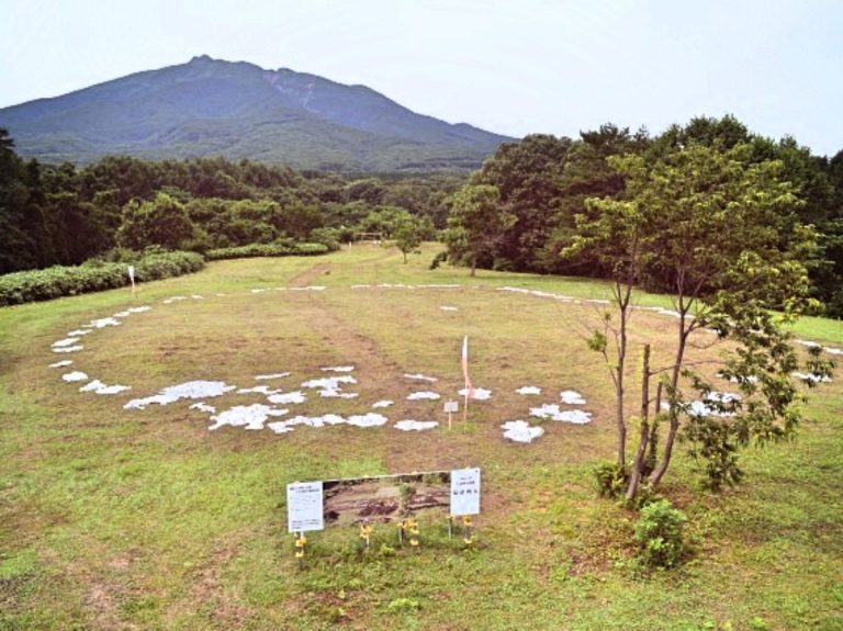
The remains cover about 40 hectares on a raised river terrace roughly 20 metres above sea level, on the right bank of the Okidate River. The site lies near the end of a ridge extending southwest from the Hakkōda Mountains; the surrounding woodland included broadleaf trees such as oak and nut-bearing species. Dwellings, graves, refuse deposits, post-built structures, storage and clay-extraction pits, mounds, and roads form a planned settlement landscape. Its present outline can appear ring-shaped, but dwellings were arranged in non-concentric groups according to function. The apparent circle follows the shape of land selected for the later stadium plan, not the layout of the ancient village.
Buildings
Pit dwellings and longhouses
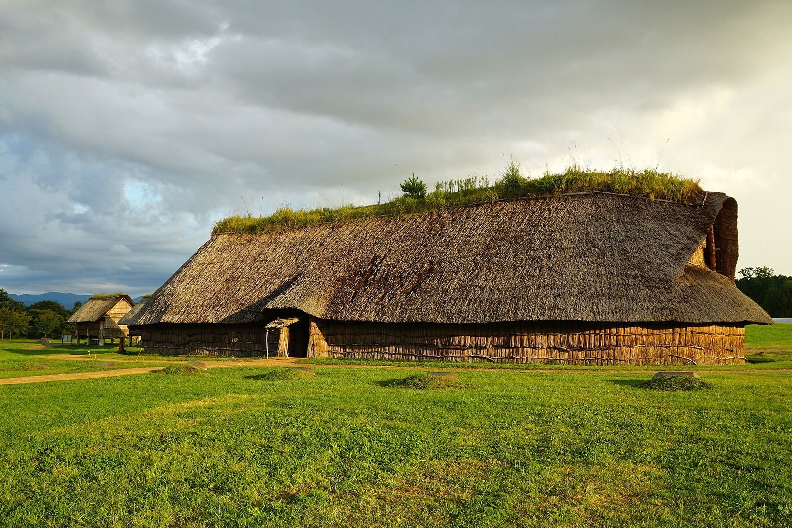
The site is identified as Japan’s largest Jōmon settlement yet discovered. Excavations have found 648 pit dwellings, homes built partly below ground, and about 780 building traces, including more than ten large dwellings. Ordinary examples were generally three to four metres across. Reconstructions show three proposed roof coverings: thatch, bark, and earth.
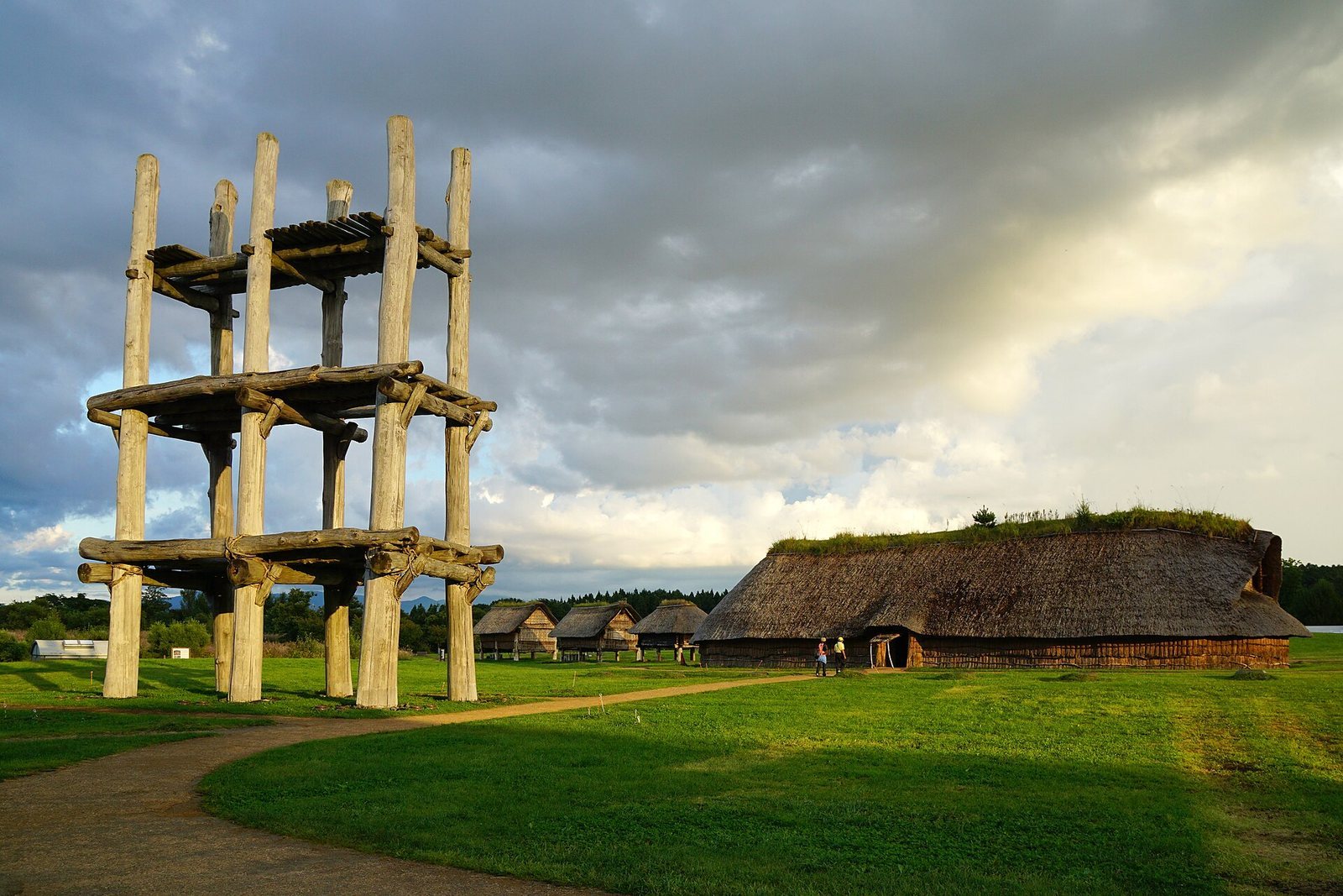
Longhouses were large oval buildings, with the longest identified measuring 32 metres. Their purpose remains uncertain; suggested uses include meeting places, workshops, and living quarters. A reconstructed large pit building measures 32 metres long and 10 metres wide.
Raised-floor buildings
A broad cluster of postholes, spread across an area about 75 metres from east to west and 18 metres from north to south, is thought to mark buildings raised above the ground on supports. Their likely use as storehouses is suggested by the lack of traces of everyday activity around and within the postholes. A reconstruction includes a staircase.
The six-pillar building
Dating to about 2600 BCE, this structure had six chestnut pillars in two parallel rows, set about 4.2 metres apart. Each post was roughly one metre in diameter, while the holes that held them were about two metres wide and two metres deep. Their regular spacing suggests careful measurement; 4.2 metres is a multiple of 35 centimetres, a unit also identified at other sites and possibly used as a shared standard. The pillars leaned inward by about two degrees, and their surfaces had been charred, apparently to slow decay.
Acidic soil damaged much of the structure, but waterlogged ground near a marsh preserved the lower parts of the posts. The original timbers were removed for conservation and replicas put in their place. The building’s form and purpose remain uncertain. Its arrangement has been interpreted as supporting platforms, and proposed functions include a monument, lookout, shrine, observatory, or lighthouse overlooking Mutsu Bay. Its position aligns with sunrise at the summer solstice and sunset at the winter solstice, which may have had a calendrical purpose.
The present reconstruction stands beside the presumed original location as a roofless, three-tier structure. Other interpretations propose either upright pillars alone or a more elaborate building. Postholes for other six-pillar structures from different periods occur across the site, with some overlapping in ways that suggest rebuilding in the same locations and orientations. Other post alignments have been compared with the Ōyu Stone Circles in Akita Prefecture and interpreted as possible evidence of knowledge of celestial movements. Timber structures with some similarities are also known elsewhere in Japan and Eurasia.
Burial grounds and roads
Burials
More than 500 adult burial pits and numerous infant burials in jars have been found. Some graves enclosed by stone circles may have belonged to social elites. Ring-shaped stone burials also occur near the settlement road. One yielded charred wood in 1999 and has been proposed as the remains of an early wooden-coffin burial; its stone arrangement has been compared with one at the Komakino Site.
Road
A road about 12 metres wide extends east for 420 metres from the middle of the settlement, crossing burial mounds. Pit graves lie along both sides. The road and its relationship to the graves and mounds form part of the settlement’s wider planned layout.
Mounds, objects, and environmental evidence
Refuse deposits and artifacts
Two domestic refuse deposits and two large mounds have been identified. The mounds contain discarded material, including objects used in ceremonies. Finds from these deposits include pottery, stone tools, wooden objects, bone and antler items, about 2,000 clay figures, and fragments of baskets and lacquerware. Most pottery was made locally. Flat-bottomed cylindrical pots and slit-shaped earrings have been noted for similarities to objects from the Xinglongwa culture of northeastern China. Many of the clay figures are thin and board-shaped, and only a few have modeled feet.
The Jōmon Jiyūkan museum displays and houses objects collected at the site. The prefecture owns the designated excavated collection, which is kept at the Sannai-Maruyama Site Center.
Plant and animal remains
Plant remains include shells of chestnut, walnut, and horse chestnut, along with perilla, bottle gourd, burdock, and beans. Animal remains include deer, wild boar, hares, and flying squirrels. Hares and flying squirrels make up nearly 70 percent of the described animal remains, while deer and wild boar are comparatively scarce. Fish and shellfish remains have also been recovered.