Souda Fortress: A Venetian Stronghold on Souda Bay
Site at a Glance
- Popularity
- Very Low
- Country
- Greece
- Primary era
- Early Modern
- Eras represented
- Medieval, Early Modern, Modern
- Civilizations
- Venetian
- Site type
- Military
- Remains
- Fort
On this page13 sections
History
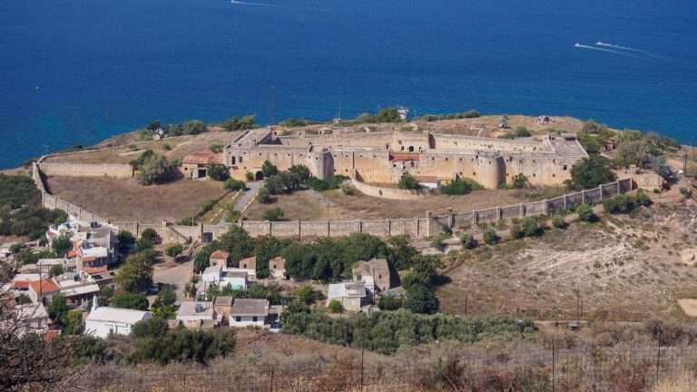
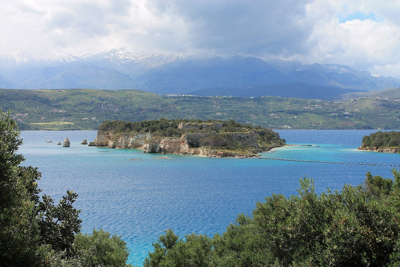
Souda Fortress is a coastal stronghold on Souda Island in Souda Bay, Crete, Greece. A fortress was first built there in the fourteenth century, and the Venetians began rebuilding its defenses in 1573 to control the bay and port.
Venetian construction and defense
The Venetian Republic, a maritime state centered on Venice, directed a major rebuilding under military engineer Latino Orsini. Work continued until 1645. By 1630, the garrison held 44 guns of various calibres and 9,185 cannonballs.
In 1646, after Ottoman forces captured Chania, they attacked the fortress while its defenses were still incomplete. Ottoman artillery destroyed storehouses and barracks, but the defenders did not surrender. Under commander Gerolamo Donà, Venetian forces repaired the fortifications between bombardments.
Refuge and Ottoman conquest
After Heraklion fell in 1669, an agreement with the Ottomans allowed Venice to retain Souda Island. The fortress became a refuge for Cretan rebels and the unofficial capital of the Kingdom of Candia, the Venetian-ruled polity on Crete. It was known as the “Eye of the Kingdom.” Its population reached 600 in 1692 and later rose to 800.
Venice held the island until 27 September 1715, when the fortress surrendered after a 72-day siege during the Ottoman–Venetian War of 1714–1718, a conflict between the Ottoman Empire and the Venetian Republic. The surrender was attributed chiefly to the Venetian Republic’s failure to provide support, rather than to a failure of the fortress’s defenses.
Ottoman rule continued until the empire withdrew from Crete in 1898. The island served as a naval base, and the last 100 Turkish soldiers left the fortifications in November of that year.
Military use in the modern era
During the Second World War, the fortress served as a port supporting British fleet logistics. After the war, the Greek armed forces used its fortifications to defend the port and a nearby naval base. In 1966, military personnel planted trees on the island.
Remains
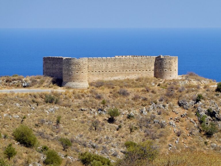
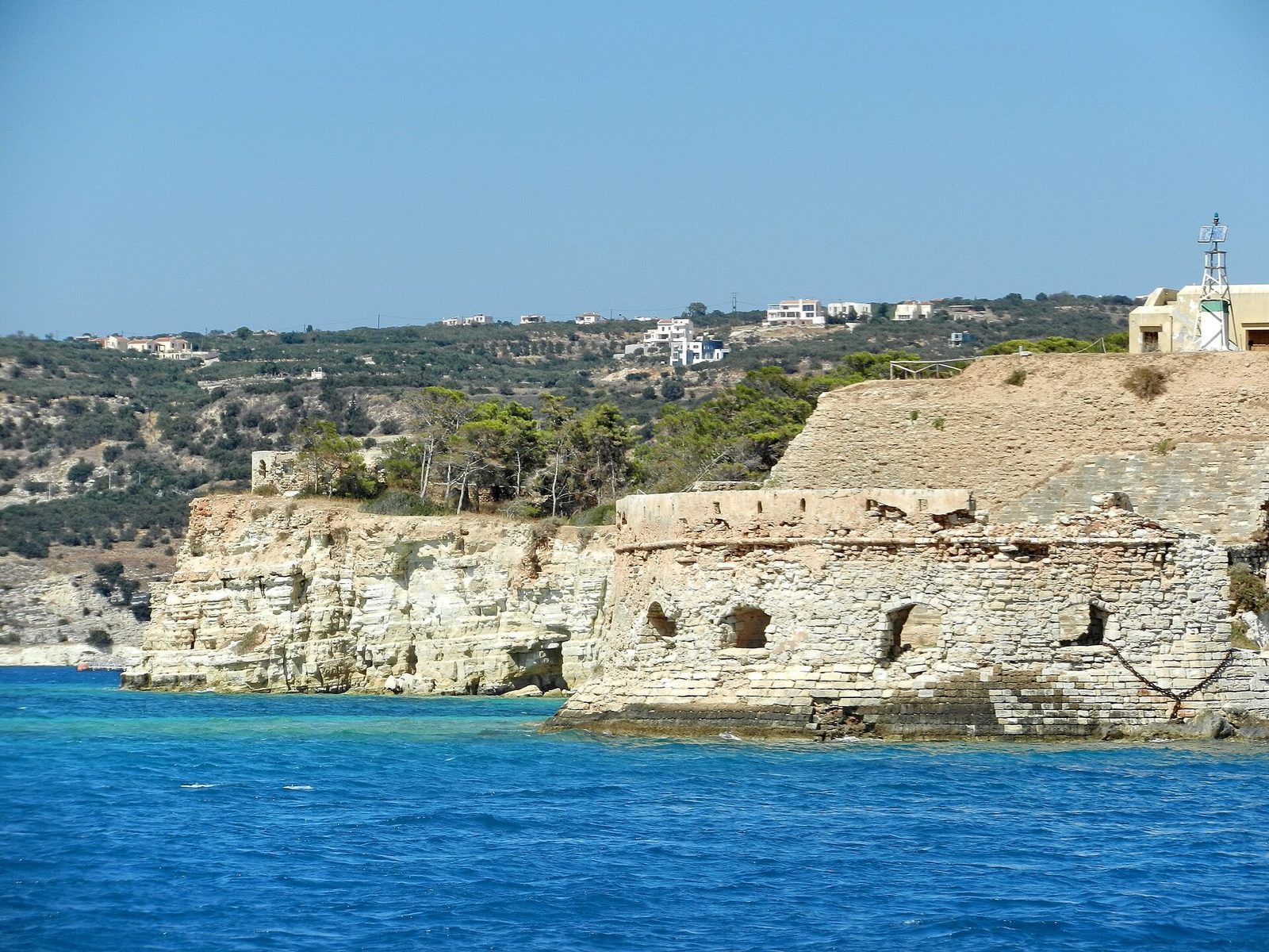
The fortress covered 85 hectares on an island that rises to 29 metres at its highest point. Its defenses followed the shoreline and adapted to the terrain, protecting against attacks from both land and sea. The position commanded a passage 2.6 kilometres wide and 8 kilometres long. Bastions, projecting defensive works that let defenders cover adjoining walls, were linked by straight stretches of wall.
Fortifications and internal layout
Northern entrance and interior
A pier and the Bastion of Michael stood at the northern end. A small gate there led into the island’s interior, where the cemetery, Mocenigo Bastion, and a water cistern were located.
Eastern and southwestern sectors
Barracks, nearby storehouses, a garden, and a church occupied the eastern side. The main entrance was on the southwest side, at Orsini Bastion.
Western sector and services
The western side contained a windmill, ammunition storehouses, and a military training ground. Residences, a hospital, and a prison were also located within the fortress.
Water supply and religious buildings
Reservoirs and drinking water
Reservoirs collected water, including rainwater, and could supply 500 soldiers for eight months. During one siege, Ottoman bombardment led to the discovery of a source of drinking water.
Church of Saint Augustine
A church associated with a monastery was dedicated to Saint Augustine and dated to 1585. During Ottoman rule, it was converted into a mosque dedicated to Sultan Ahmed I, the Ottoman sultan who reigned from 1603 to 1617.
Church of Saint Nicholas
A separate church dedicated to Saint Nicholas was built on the island between 1898 and 1913, when Crete was governed as the autonomous Cretan State.