Saaleck Castle: A Medieval Hill Castle above the Saale River


Site at a Glance
- Rating
- 4.3
- Popularity
- Low
- Country
- Germany
- Primary era
- Medieval
- External website
- Open
- Eras represented
- Medieval, Modern
- Civilizations
- Holy Roman Empire, Margraviate of Meissen
- Site type
- Military
- Remains
- Castle
On this page11 sections
History
Saaleck Castle is a medieval hill castle in Germany, above the Saale River near Naumburg, in present-day Saxony-Anhalt. It was probably built in the early twelfth century, possibly by the Margraves of Meissen, as a counter-foundation to the neighbouring episcopal Rudelsburg. The castle occupied a strategic position on a ridge immediately south of Saaleck and a few hundred metres upstream from Rudelsburg.
Medieval Lords and Episcopal Rule
The free nobles of Saaleck first appear in 1140, when Hermannus advocatus de Salek was named in a document. Later members of the family entered the retinues of the bishops of Naumburg, the landgraves of Thuringia, and the Margraves of Meissen. The latter were territorial rulers in central Germany whose expansion brought them into competition with ecclesiastical powers such as the bishops of Naumburg.
Around 1220, Saaleck passed to the Schenks of Vargula. Rudolf II, a nobleman who served as a cupbearer and held the lordship of Saaleck, became particularly associated with the castle. He served at the court of Hermann I, the medieval landgrave of Thuringia, and later followed Louis IV, another Thuringian landgrave, as a crusader to Otranto.
In 1344, the Schenks of Saaleck sold the castle and its possessions to the bishops of Naumburg. The bishops incorporated the surrounding territory into the Saaleck administrative district of the Naumburg prince-bishopric. Rudolf Schenk of Saaleck-Nebra later served as bishop of Naumburg from 1352 to 1359. In 1396, the bishop pledged the castle back to the lords of Saaleck.
Abandonment and Administrative Change
The central castle was abandoned in 1523, and administrative business subsequently moved to the outer bailey. In 1544, the castle and its administrative district became part of the Naumburg administrative district. Twenty years later, Saaleck Castle, the district, and the Stendorf estate passed to Albertine Elector August I of Saxony, who held the territory as administrator.
An Amtmann, an official responsible for administering a district or estate, continued to live at the castle until 1585. After he moved to Stendorf, the estate was raised to the status of a manor, while the deserted castle fell into decay. Local farmers quarried stone from the ruins until about 1800.
Around 1804, the Stendorf manor and the castle ruins were sold to the landed von Feilitzsch family. They retained the property until the land reform of 1945 in the Soviet occupation zone. Following the decisions of the Congress of Vienna, Saaleck became part of the Kingdom of Prussia in 1815 and joined the newly established Naumburg district in 1818, within the Merseburg administrative region of the Province of Saxony.
Romantic Association and Twentieth-Century Conflict
From the mid-nineteenth century, the student song There Saaleck, Here Rudelsburg helped establish the two neighbouring castles and the Saale valley as a romantic cultural landscape. The association gave Saaleck a lasting place in regional literary and cultural memory.
In 1922, Erwin Kern and Hermann Fischer used a castle tower as their final hiding place after murdering German Foreign Minister Walther Rathenau. Police discovered them on 17 July. Kern was killed during the confrontation, while Fischer committed suicide. Hans Wilhelm Stein, the castle’s lessee who had sheltered the two men, was arrested but acquitted by the State Court on 24 October 1922 for lack of evidence.
On 17 July 1933, the Steel Helmet, League of Front-Line Soldiers, leaders of the Ehrhardt Brigade, the SS, and the SA dedicated a memorial plaque at the castle to Kern and Fischer, whom they regarded as heroes. A memorial stone was erected in the village cemetery later that year after a ceremonial service. It was removed and destroyed in 2000, with the assistance of the Bundeswehr, because increasing numbers of right-wing groups were making pilgrimages to it.
Later Use and Archaeological Investigation
During the East German communist period, the complex served as a residential care home for elderly people. It was unused from 1995 to 2019. Archaeological excavations in 1930 uncovered the castle well, although they did not resolve the medieval relationships between the buildings and defensive works. The surviving castle is included as a stop on the Romanesque Road, a designated cultural-tourism route.
Remains
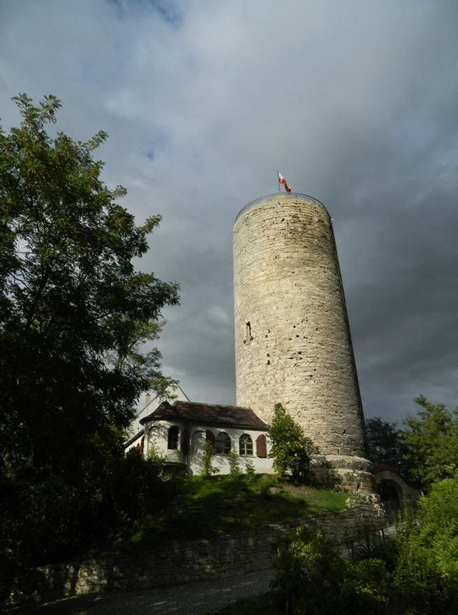
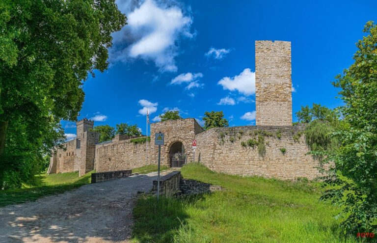
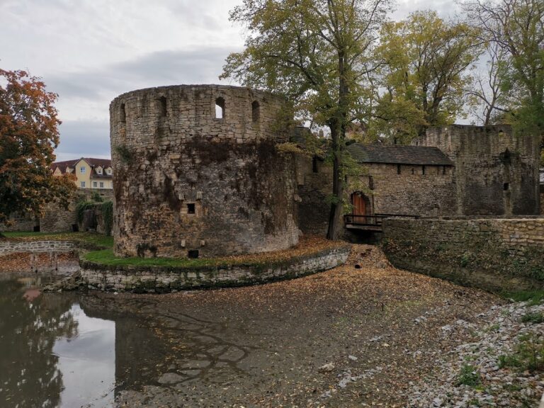
Saaleck Castle stands on a westward-projecting, roof-shaped ridge of Muschelkalk, a hard shell-bearing limestone, at about 172 metres above sea level. The ruin is organized around two prominent round bergfrieds, the principal fortified towers of a medieval German castle. They rise to just under 23 metres and have walls about 2 metres thick. The central castle was enclosed by inner and outer defensive walls, with several residential buildings surviving along the inner wall.
Round Towers
West Tower
The west tower is climbable and preserves features that indicate a habitable residential level. Its masonry includes a medieval garderobe, or castle privy, and a fireplace. A staircase and viewing platform were inserted in the early twentieth century. The original top was not reconstructed, leaving additional space for the platform. Carefully worked masonry, together with the fireplace and garderobe, supports a date in the late twelfth century.
East Tower
The east tower originally functioned as an uninhabited defensive structure. Its core remains Romanesque, while the upper part was rebuilt in the Gothic period or received a renewed outer shell at that time. The survival of the earlier core places the tower within the late twelfth-century development of the castle, despite its later alteration.
Walls, Ditches, and Residential Buildings
The towers and parts of the outer defensive enclosure probably date from the late twelfth century. A moat and outer rampart were built at each of the two narrow ends of the surrounding terrace. On the eastern side of the spur, facing Rudelsburg, additional neck ditches and ramparts strengthened the landward approach. A neck ditch is a defensive trench cut across the narrow connection of a ridge or promontory, often paired with an embankment.
The inner defensive wall enclosed the central castle, and remains of several residential buildings stand along it. The former outer works extended as far as the village of Saaleck, but only limited traces survive and the wider system remains poorly researched. Together, the surviving walls, towers, ditches, and ramparts indicate a castle whose defences adapted the narrow ridge and its landward connections.
Well and Exhibitions
The castle well was discovered during the 1930 archaeological excavations. Its location adds evidence for the practical organization of the medieval enclosure, while the surviving towers contain small exhibitions that present aspects of the castle’s history and remains.