Aqua Virgo: The Ancient Roman Aqueduct Supplying the Baths of Agrippa
Site at a Glance
- Popularity
- Very High
- Country
- Italy
- Primary era
- Classical
- Eras represented
- Classical, Early Modern, Modern
- Civilizations
- Italian, Papal States, Roman
- Site type
- Infrastructure
- Remains
- Aqueduct
On this page15 sections
History
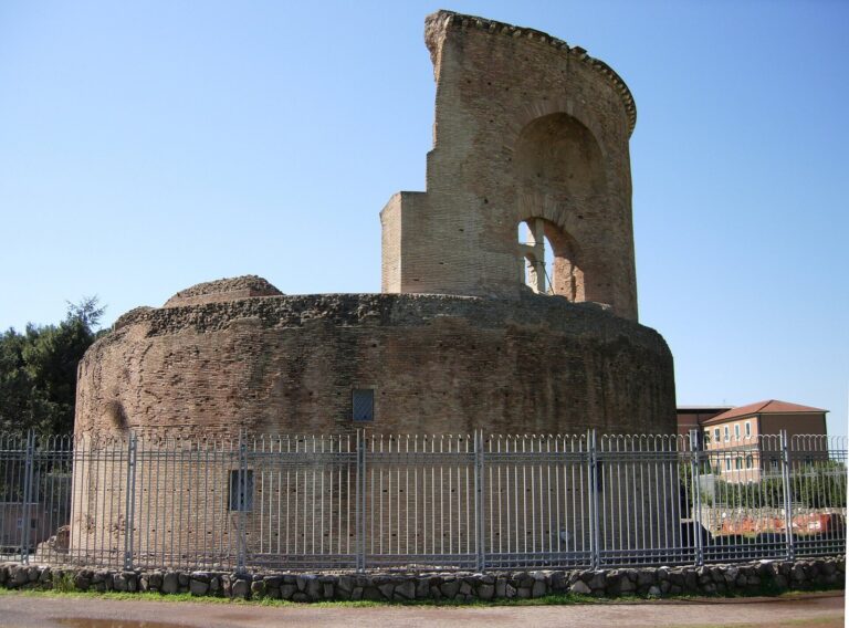
Aqua Virgo is an ancient Roman aqueduct in Rome, Italy, completed by Marcus Agrippa in 19 BC during the reign of Augustus, Rome’s first emperor. It carried water chiefly to the Baths of Agrippa in the Campus Martius, or Field of Mars, and was one of eleven aqueducts supplying the city. At its peak, it could deliver more than 100,000 cubic metres of water a day. Its name, Virgo, means “virgin” and was linked to the water’s clarity and low lime content. The Roman administrator Frontinus repeated a story that a young woman directed thirsty soldiers to springs later used by the aqueduct.
Roman repairs and the Gothic siege
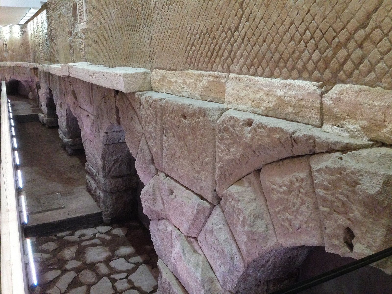
The aqueduct underwent repairs under the emperors Tiberius in AD 37 and Claudius in AD 45–46. An inscription on an architrave on Via del Nazzareno records Claudius’s rebuilding of substantial sections in AD 46, after Caligula had taken stones for an amphitheatre. Further repairs followed under Constantine the Great and Theodoric, a ruler of the Ostrogoths.
During the Goths’ siege of Rome in AD 537, they tried to use the underground channel as a concealed way into the city. The attempt brought the aqueduct’s first major interruption, but it continued to supply water under Byzantine administration.
Medieval repair and later transformation
After the Western Roman Empire declined, the aqueduct eventually fell into disrepair and disuse. Pope Adrian I repaired it in the eighth century. In 1453, Pope Nicholas V undertook an extensive restoration of the channels between the source and their outlets, added secondary conduits beneath the Campus Martius, repaired the Trevi Fountain, and rededicated the water system as Acqua Vergine.
Further alterations to Acqua Vergine’s terminal channels followed during the Renaissance and Baroque periods. In the 1930s, a separate pressurised aqueduct, Acqua Vergine Nuovo, was built. A seventeenth-century interpretation of lead pipes found before the Church of Saint Ignatius, once thought to identify the aqueduct’s final distribution point, has since been questioned.
Remains
The aqueduct combined a spring-fed, mostly underground conduit with an elevated section approaching central Rome. Later branches carried water across higher ground, while the restored Acqua Vergine system linked its channels to fountains around the city.
Collection and ancient conduit
Spring source
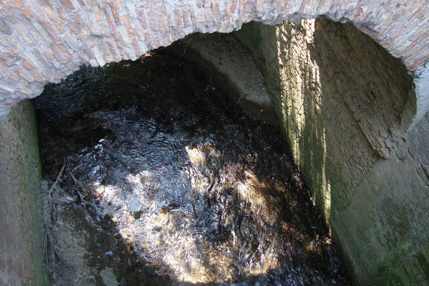
The source lay in a marshy area just before the eighth milestone north of Via Collatina, about three kilometres from Via Praenestina. Springs near the Aniene fed the aqueduct as part of a wider aquifer-and-spring system. Underground tunnels carried the water to a basin that survived until the nineteenth century. A dam controlled its flow into the main channel, and feeder channels added water along the route.
Route through Rome
The conduit ran about 20.5 kilometres, descending only four metres from a source roughly 24 metres above sea level. Its course formed a broad arc from the east before entering Rome from the north. It followed Via Collatina to Portonaccio, crossed Via Nomentana towards Via Salaria, then turned south beneath the Gardens of Lucullus. For about 1.2 kilometres it crossed the Pincian Hill area and Villa Medici. A spiral stair known as the “Pincio snail” descends there to the underground channel, which is also visible beneath the Spanish Steps and at Villa Medici.
Near the Pincian Hill, a settling basin preceded the urban stretch, where the channel ran partly on arches. Many arches were uncovered in 1871, and two stretches survive, including one on Via del Nazzareno. The aqueduct passed through the area of the Trevi Fountain and crossed present-day Via del Corso on an arch later adapted as a triumphal monument commemorating Claudius’s military successes in Britain. A later interpretation traces further arches along Via del Seminario to a point east of the Pantheon. The conduit ended in the Campus Martius, in front of the enclosure of the Saepta Julia, an enclosed public complex.
Secondary supply and distribution
Crossing higher ground
A secondary route supplied the under-served districts VII, IX and XIV, including Trastevere. To cross higher ground around the basin of the Pantheon, water passed through the drainage system of the Baths of Agrippa, an artificial lake called the Stagnum, and an artificial bathing canal called the Euripus. It then crossed the Tiber on the Bridge of Agrippa.
Water allocation
Frontinus records allocations of 200 quinariae, a Roman measure of water flow, to the suburbs, 1,457 to public works, 509 to the imperial household and 338 to private concessions. Eighteen distribution cisterns along the route channelled water to its users.
Acqua Vergine and its outlets
Acqua Vergine Antica
Acqua Vergine Antica follows some channels built by Agrippa’s engineers. It runs underground northeast of Rome beneath Via di Pietralata, crosses Via Nomentana, and continues west through Villa Ada and beneath the western edge of Villa Borghese. It passes through the gardens of Villa Medici, descends the Pincian Hill to Piazza di Spagna, and continues to the Trevi Fountain on the Quirinal Hill.
Acqua Vergine Nuova
Acqua Vergine Nuova approaches from the northeast beneath Via Tiburtina and reaches Porta Pinciana beneath the Pincian Hill, where it divides. One branch connects with Acqua Vergine Antica behind Piazza di Spagna without mixing with its water, then descends towards the lion fountains of Piazza del Popolo. The other runs beneath Galoppatoio and through the Borghese Gardens, turns south towards Piazzale Flaminio, and emerges as a three-arched cascade on the western slope of the Pincian Hill.
Fountains and terminal display
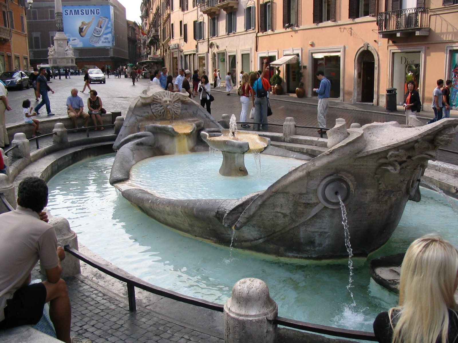
A terminal display fountain stood at Piazza dei Crociferi, designed by the Renaissance architect Leon Battista Alberti. The system’s outlets include the Pantheon Fountain in Piazza della Rotonda, the Colonna Fountain in Piazza Colonna, the Turtle Fountain in Piazza Mattei, the fountain in Campo de’ Fiori, and the Neptune and Moor fountains in Piazza Navona. Other outlets include the fountains of Piazza Venezia, Il Facchino on Via Lata, the Barcaccia Fountain in Piazza di Spagna and Il Babuino on Via del Babuino. The Piazza del Popolo group includes the Pincian cascades, the central fountain’s lions and a sculpture group called the Group of Rome.
Lead pipes near Saint Ignatius
Substantial lead pipes found in front of the Church of Saint Ignatius were once identified as the aqueduct’s final distribution point. That interpretation has since been questioned.