Spanish Walls of Milan: The City’s Defensive Circuit
Site at a Glance
- Popularity
- High
- Country
- Italy
- Primary era
- Early Modern
- Eras represented
- Early Modern, Modern
- Civilizations
- Duchy of Milan, Habsburg, Holy Roman Empire, Spanish
- Site type
- Military
- Remains
- Wall
On this page11 sections
History
The Spanish Walls of Milan formed a defensive circuit around the city in Italy. Built from 1548 to 1562 under Spanish rule, they replaced the medieval walls and served the Duchy of Milan, the state centered on the city, as its principal defensive perimeter until their military purpose ended in the eighteenth century.
Building the circuit
Milan’s governor, Don Ferrante I Gonzaga, ordered the new defenses. Work continued under his successors as the Duchy passed from the rule of Charles V, a Habsburg ruler and Holy Roman Emperor, to that of Philip II, king of Spain. A ceremony marking the laying of the first stone is dated to 22 March 1549, and Archbishop Andrea Minuti noted construction work in October of that year.
Military engineer Giovanni Maria Olgiati planned defenses suited to an age when gunpowder artillery made medieval walls vulnerable to cannon fire. His proposals included strengthening Sforza Castle as a citadel and constructing another castle in southern Milan. The southern fortress was abandoned as too costly; concern about an uprising against Spanish rule may also have influenced the decision. Olgiati had directed work on the medieval walls in 1542.
Construction began between Sforza Castle and Porta Comasina, then continued between Porta Romana and Porta Lodovica. The section from Sforza Castle to Porta Vercellina followed in 1552, and the circuit was finished in 1562. After the ruling court moved to the Ducal Palace, Sforza Castle became a fortified citadel. Its Spanish commander oversaw a garrison that ranged from 1,000 to 3,000 men.
Gates and changing rule
The six principal gates were Porta Orientale, Porta Romana, Porta Ticinese, Porta Vercellina, Porta Nuova and Porta Comasina. By 1796, Milan had twelve main entrances, including subsidiary gates associated with several of these approaches. Porta Tenaglia, near what is now Piazza Lega Lombarda and distinct from Porta Volta, was demolished in 1571. Customs officials collected the city duty on goods entering Milan.
During the Napoleonic period, Porta Orientale was renamed Porta Riconoscenza and Porta Ticinese became Porta Marengo. Later changes commemorated political and military events. Porta Vercellina took the name Porta Magenta after the 1859 battle; Porta Comasina became Porta Garibaldi in 1860, and Porta Orientale became Porta Venezia that same year. Venice remained outside the Kingdom of Sardinia after the Second Italian War of Independence and joined the Kingdom of Italy in 1866, following the Third. Porta Tosa was renamed Porta Vittoria in 1861, recalling the Five Days of Milan, the 1848 uprising against Austrian rule in which insurgents first seized the gate.
New entrances were added as the city and its transport needs grew. Nineteenth-century gates included Porta Sempione, at the site of medieval Porta Giovia and corresponding to the modern Arco della Pace, as well as Porta Genova, Porta Volta and Porta Monforte, the last gate built in Milan. Porta Volta was intended to improve the route to the Monumental Cemetery, established in 1866, and the Comasina road, now Via Carlo Farini. Railway works serving the old Central Station had cut off the older Comasina road, now Corso Como. Barriera Principe Umberto, built in 1864 for the station, was demolished in 1931 and replaced by the modern station of the same name.
Promenade and urban change
After the walls lost their military value, Lombard governor Gian Luca Pallavicini ordered their summit opened as a public promenade in 1750. A proposal to demolish the defenses and reserve a tree-lined walk for nobles was rejected. Between 1783 and 1786, architect Giuseppe Piermarini developed sections near Porta Romana, Porta Ticinese, Porta Vercellina and Porta Orientale as elevated public gardens. The walk served pedestrians and carriages and offered views of the Duomo; from the northern section, visitors could see the Alps and countryside that had not yet been built over.
The promenade also became a setting for urban recreation and literature. A roller coaster operated near Porta Romana in the Monte Tabor area, beside the Osteria Monte Tabor, which poet Carlo Porta frequented. The viceroy and vicereine may have tried the attraction. Ugo Foscolo described walking with Giuseppe Parini along the elevated stretch near Porta Orientale. Stendhal recorded seeing the walls on 10 November 1816 and later used the Alpine view in a scene in The Charterhouse of Parma. Alessandro Manzoni, in The Betrothed, describes Renzo entering the city through Porta Tosa.
Plans for the Foro Bonaparte during the Napoleonic period included a proposal to remove the entire circuit. Alterations and dismantling began in the early nineteenth century to make room for urban development. Demolition accelerated under the Beruto Plan, Milan’s first master plan, implemented from 1889. A proposal made in 1885 for complete removal was modified to call for lowering the walls, with a similar practical effect. Housing spread beyond the former perimeter, and a middle ring road, also known as the circle of the bastions, followed its line. Although the plan initially envisaged parks along the roads, the approved scheme allowed residential construction. Architect and historian Luca Beltrami took part in its implementation and in central-city demolitions from 1889.
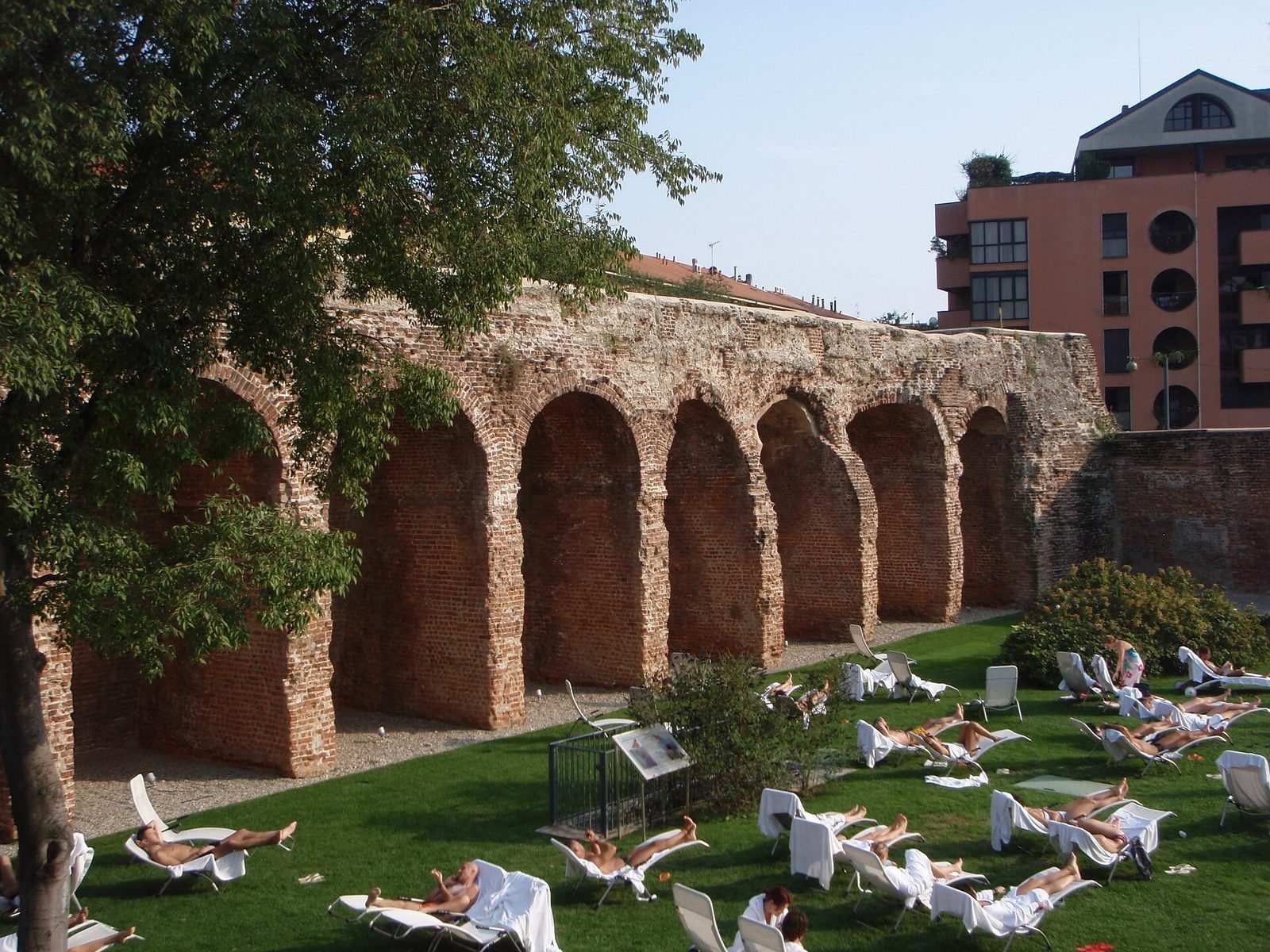
In 1907, the Monte Tabor area became the site of the Art Nouveau Palazzina Ragno d’Oro, built as a departure station for funeral trams to Musocco. It later housed a recreation club run by Milan’s public transport agency and the site is now occupied by Terme di Milano. Demolition of the ramparts beside the old dock at Porta Genova began in January 1919, following a municipal decision made that July. Material from the walls was carried by barge to Conchetta on the Naviglio and used in the roadbed of a new ring road; timber was burned to heat a nearby public bath. Further removals after the Second World War left almost the entire circuit gone.
Remains
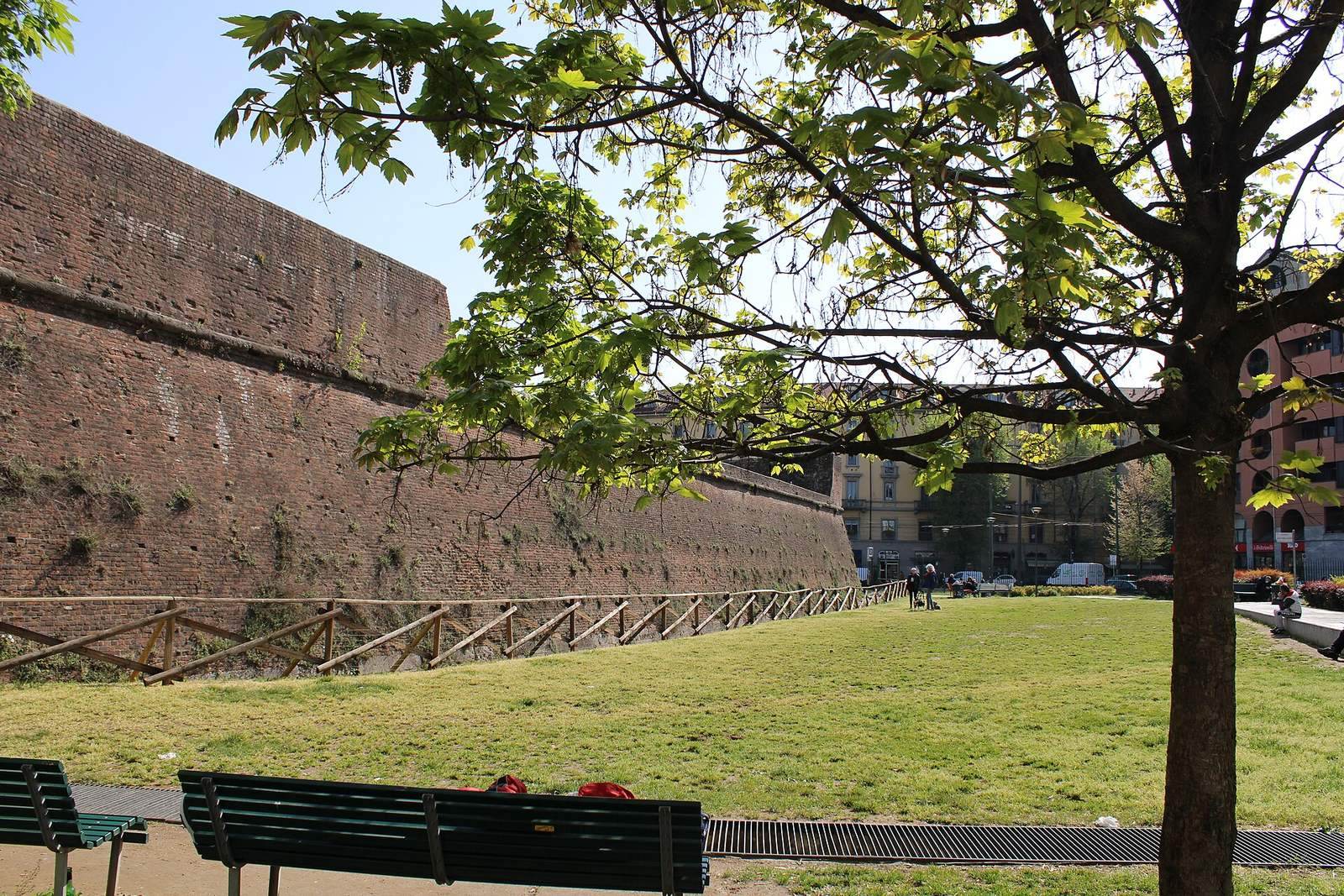
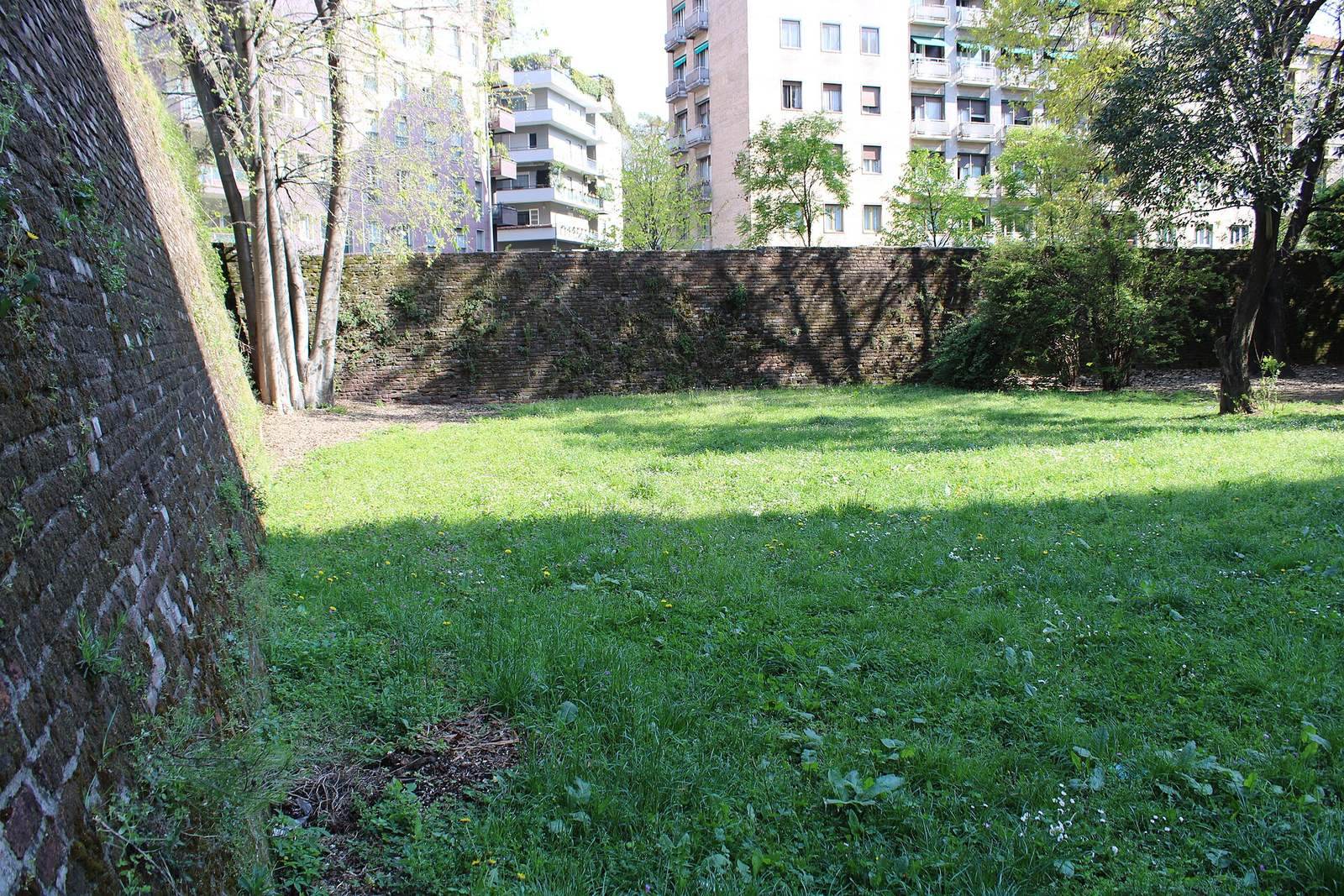
The completed circuit extended for about 11 kilometres and was the most extensive system of walls in Europe at the time. Brick walls, earthworks, towers and curved defensive works formed its artillery-resistant design: the low, massive defenses and sloping earth were intended to deflect cannon fire. In places, waterways served as ditches, including the Olona to the west, the Vetra to the southwest and the Redefossi to the east, which derived from the Seveso.
Gates and promenade
The gates began as controlled openings rather than elaborate monumental entrances. Porta Romana later gained a triumphal arch, built in 1598 for the entry of Margaret of Austria-Styria, a Habsburg archduchess who later became queen consort of Spain. Other gates received more monumental forms during the nineteenth century, when they also served as representative city entrances. The summit walk had benches and two rows of mulberry and horse-chestnut trees. Piermarini’s elevated gardens occupied sections near four of the principal gates.
Surviving sections
Viale Vittorio Veneto
Near Porta Venezia, well-preserved sections along Viale Vittorio Veneto retain the character of the original tree-lined promenade.
Between Porta Romana and Porta Lodovica
Remains between these two gates survive as boundary walls for private residences. Particularly well-preserved stretches stand near Porta Vigentina, along Viale Beatrice d’Este and Viale Angelo Filippetti.
Gardens between Viale Emilio Caldara and Viale Monte Nero
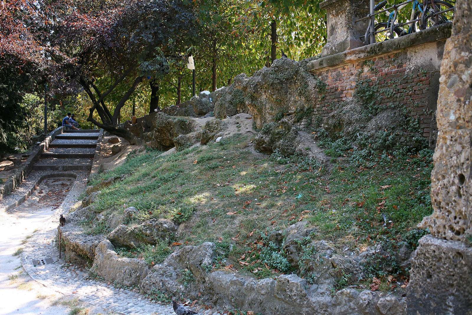
Two small gardens occupy spaces among surviving sections of the walls between these avenues.
Via XX Settembre
Beside the Northern Railway and opposite the Palazzo della Triennale, Via XX Settembre rises in two curves over a surviving section of the ramparts, which retains decorative stonework.