Maiden Tower: A Defensive Tower in Baku, Azerbaijan
Site at a Glance
- Popularity
- Very High
- Country
- Azerbaijan
- Primary era
- Medieval
- Eras represented
- Iron Age, Classical, Medieval
- Civilizations
- Sassanid, Shirvanshah
- Site type
- Military
- Remains
- Tower
On this page14 sections
History
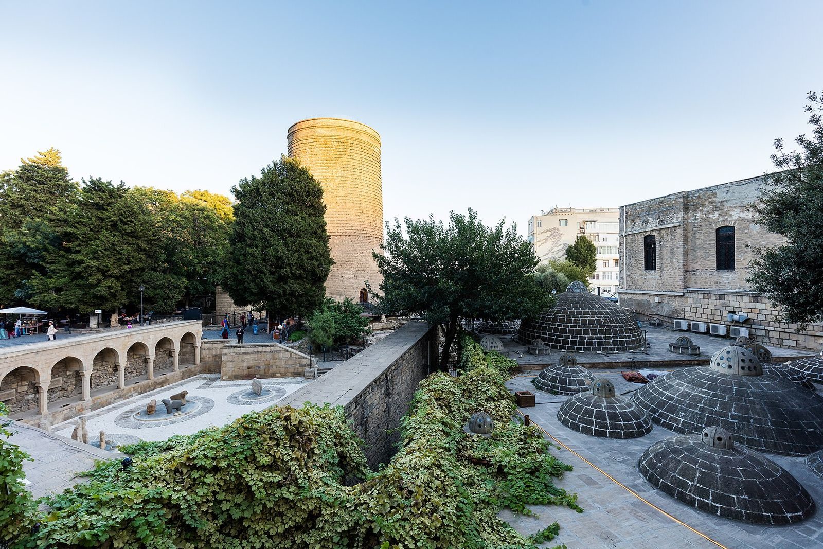
The Maiden Tower is a stone fortification in the southeastern part of Baku’s Old City, Azerbaijan, within the old city’s southeastern defensive line. Much of its construction is usually assigned to the twelfth century, although its date and earliest purpose remain disputed. Its role in Baku’s defences is widely accepted from at least the twelfth century.
Early settlement and disputed origins
The surrounding area was inhabited in the Palaeolithic, the earliest phase of human prehistory, associated with stone tools. As the Caspian shoreline receded during the first millennium CE, newly exposed land was developed between the ninth and fifteenth centuries. This period saw the Old City walls, palace, and Maiden Tower take shape.
Proposals for the tower’s beginnings vary considerably. One identifies an earlier fire temple from the eighth to seventh centuries BCE, while another places an earlier building in the seventh to sixth centuries BCE. Other estimates for the foundations or earliest fabric fall between the fourth and sixth centuries CE. Some interpretations assign work to both the fifth or sixth century and the twelfth century; another proposes that the tower was built in a single phase. Much of the structure is commonly attributed to the twelfth century.
Its original function is also uncertain. Suggested explanations include a Zoroastrian fire temple, where sacred fire had a ritual role, or a dakhma, a structure where the dead were exposed. Other proposals describe a sanctuary resembling a ziggurat, a stepped religious monument associated with ancient Mesopotamia, or an observatory, watchtower, lighthouse, signal tower, or defensive work.
Medieval stronghold and later repairs
From at least the twelfth century, the Maiden Tower formed part of Baku’s defences. In the medieval period, it served alongside the city walls as a stronghold and the chief tower of the fortifications. A twelfth-century inscription names Masud ibn Davud, a medieval figure whose wider identity is uncertain. He has been proposed as the tower’s architect or patron, but the inscription may instead refer to repairs and may have been placed on the wall later.
Conflicts damaged the tower at different times, and it was repaired over the centuries. Restoration is thought to have begun under the Shirvanshahs, the ruling dynasty of the medieval polity of Shirvan. Later repairs during the Baku Khanate, a local polity centred on Baku in the eighteenth and early nineteenth centuries, aimed to strengthen it. In 1806, the tower and other parts of the city walls were reinforced under Russian rule.
Archaeology, conservation, and cultural memory
Archaeological investigation began in the early 1920s. Work in 1962–63 included excavation to a depth of five metres on the ground floor, followed by further investigation and digging in 1963–65. The tower began operating as a museum in 1964, with exhibits on Baku’s historical development. Excavations around it in 1998 revealed remains of a tenth-century mosque, other religious structures, and the basement of a monumental building.
An earthquake in Baku in 2000 damaged the tower and other parts of the walled city. That year, the Maiden Tower became part of the UNESCO World Heritage property known as the Walled City of Baku with the Shirvanshahs’ Palace and Maiden Tower. The property was on the World Heritage in Danger list from 2004 to 2009; conservation work followed, and it was removed from the list by 2010. Further restoration of the tower took place in 2011–13.
Up to about twenty legends are associated with the Maiden Tower. In some, a princess jumps from the tower to escape an unwanted marriage; another tells of a princess who dies while trying to save her fisherman lover from drowning. A further tale describes a fire-haired maiden who saves Baku from besiegers. Some stories are said to have medieval or Islamic roots, while others are linked to pre-Islamic or Zoroastrian traditions, but their historical basis is unestablished. The tower’s name has been connected to these tales or alternatively explained as meaning a lookout tower.
The tower became a prominent Azerbaijani emblem. It appeared on 1- and 250-manat banknotes issued between 1992 and 2006, a 10-manat banknote from 2006, a 50-qəpik coin minted between 1992 and 2006, and a 5-qəpik coin from 2006. The manat is Azerbaijan’s currency, and the qəpik is its subdivision. In 1940, composer Afrasiyab Badalbeyli wrote a ballet based on a Maiden Tower legend; it was the first Azerbaijani ballet.
Remains
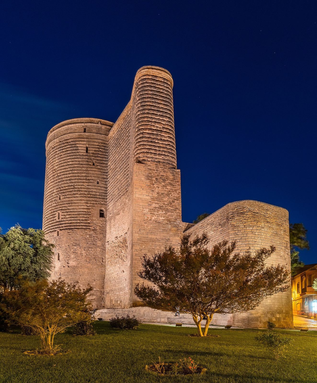
The tower stands on a massive rock outcrop sloping toward the sea, within the southeastern part of Baku’s Old City. Its cylindrical, eight-storey stone structure is about 29 metres high and 16.5 metres across at the base. A substantial projection on the east side rises almost to the summit, giving the structure a plan and profile often compared to the numeral nine.
Tower fabric and interior
The main tower and eastern projection
The tower narrows slightly toward the top, while its interior widens from about 6.25 metres across on the first storey to around 7 metres on the eighth. The first storey is about 3 metres high, and the others average about 2.5 metres. The eastern projection is slightly lower than the main tower and stands on the side from which an attack was most expected. Its purpose is uncertain: it may have braced the structure against the sloping rock, served as a defensive platform, or had another use. A buttress is a projecting structure that supports or braces a wall.
Walls and stonework
Built of stone, including local grey limestone, the walls are about 5 metres thick at the base and 4 to 4.5 metres thick near the top. Large wooden beams extend inward at a point about 14 metres above the foundation. Their purpose is unknown, although they have been linked to an internal structure or to reducing earthquake effects. The storeys are covered by shallow, flat stone domes, each with a central circular opening. These openings align vertically, so the ground-floor level can be seen through the opening in the ceiling of the eighth storey.
Horizontal stone courses project from the exterior from about the third storey upward. Recessed bands on the eastern projection were originally filled with white lime. Diamond-shaped stonework appears inside and outside, with decorative cutting on the upper part of the west face. Gypsum plaster between alternate stone courses creates a black-and-white banded effect. The northwestern surface retains its original finish.
Entrance, circulation, and water systems
Entrance and movement between storeys
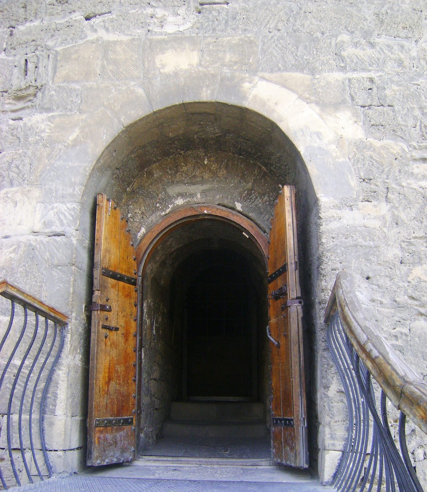
The tower has a single arched entrance, about 1.1 metres wide and 2 metres above the former ground level. The passage once extended across the thickness of the wall and contained several successive doors; traces of this arrangement remain in its vaulted ceiling. Wells once stood outside the entrance. Reaching the raised doorway required a ladder, followed by passage through the doors.
A staircase within the southeastern wall links the second storey to the upper levels. There is no built stairway between the first and second storeys, which were connected by ladder or rope through the ceiling opening. Narrow windows on the south side bring light into the storeys. Narrow defensive openings on the south and southeast sides overlook the sea and also admit air.
Well and drainage
A rock-cut well within the southeastern wall descends from the upper storeys. It is about 0.7 metres across, although its exact depth and opening level are uncertain. Its water was found to be drinkable and not connected to the sea’s level. Foot-holds, 10 to 12 centimetres deep, are cut into the north and south sides, and the shaft widens at about 12 metres down. Material recovered from the well indicates use from the twelfth century onward. A concealed passage from its lower part toward the Shirvanshahs’ Palace has been proposed, but the connection has not been established.
A ceramic drainage system runs within the southwestern wall. From the second to the seventh storey, pipe sections fit together inside a shaft, with a semicircular niche at each level and lime mortar securing the pipes. The sections are about 40 to 45 centimetres long, 25 to 30 centimetres across, and 2.2 centimetres thick. Between the ground floor and the foundations, square ceramic channels measuring 22 by 18 centimetres pass through the wall toward the exterior. Marks left by the potter’s wheel remain visible on the pieces.
Inscription and archaeological remains
Stone plaque
A stone plaque on the exterior sits about 14 metres above the lower entrance. It measures about 4 metres by 0.6 metres and carries two lines of Arabic writing in Kufic, a historic angular script. The plaque’s original position is uncertain.
Underground route and excavated structures
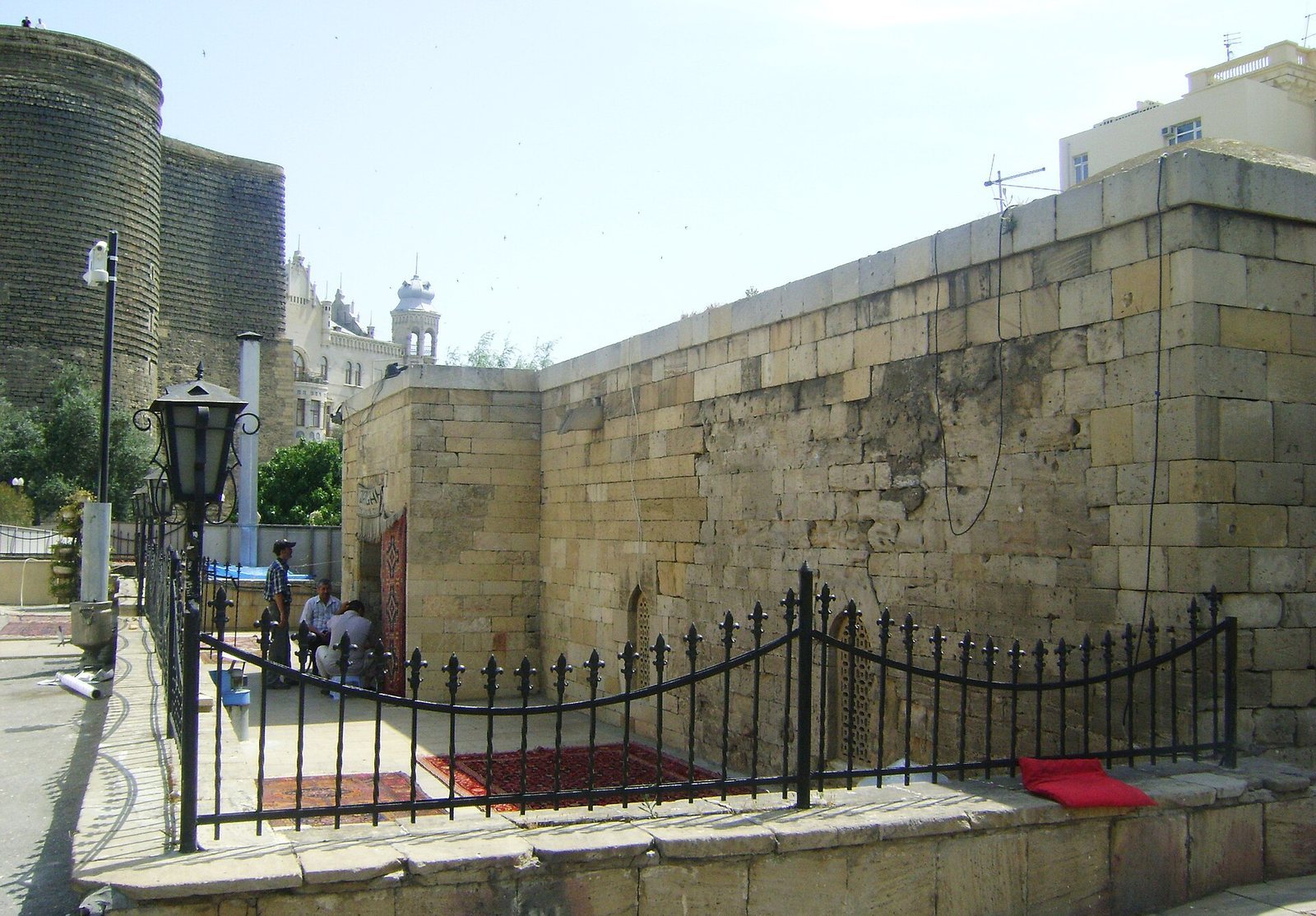
An underground route discovered in 1982 runs north to south east of the main street, from the direction of the Shamakhi Gate toward the Salyan Gate. It passes beneath the fourteenth-century Multani caravanserai, a roadside inn and trading station for merchants and travellers, and continues toward the Maiden Tower. A connection between the route and the tower’s well has been suggested but not confirmed.
Excavations around the tower exposed the basement of a monumental building and remains of a tenth-century mosque and other religious structures. These traces form part of the archaeological remains beneath and around the stone fortification.