Tell Tayinat: An Early Bronze Age and Iron Age Urban Center
Site at a Glance
- Popularity
- High
- Country
- Turkey
- Primary era
- Iron Age
- Eras represented
- Bronze Age, Iron Age, Modern
- Civilizations
- Unclassified
- Site type
- City
On this page17 sections
History
Tell Tayinat is an archaeological settlement mound near Varışlı in Hatay Province, southern Türkiye. It became a major urban center in two distinct periods, the Early Bronze Age and the Early Iron Age, and was the Amuq Plain’s largest settlement during Early Bronze IVB, a subdivision of the Early Bronze Age.
Early Bronze Age
Tell Tayinat’s early urban history has also prompted a tentative identification with Alalahu, a settlement inhabited in the late third millennium BC and named in the archive of Ebla’s Palace G. This proposed identification is distinct from the nearby ancient city of Alalakh, at Tell Atchana.
Early Iron Age kingdoms
In the early twelfth century BC, after the Sea Peoples destroyed nearby Alalakh, Tell Tayinat became the region’s principal urban center. The Sea Peoples were groups associated in ancient Egyptian texts with upheavals around the end of the Bronze Age. Tell Tayinat is generally identified with Kinalua, also called Kunulua, the capital of the Iron Age kingdom of Palistin or Walistin. This was a Neo-Hittite and Aramean state, part of a group of northern Syrian and Anatolian kingdoms that emerged after the Hittite Empire fell. A later successor kingdom, called Patina or Pattin in Assyrian usage, is dated to about 1000–738 BC. Kinalua’s rulers still bore Hittite royal names in the eighth century BC.
Palistin has been linked to the Philistines, an Iron Age people associated with the southern Levant. The proposal draws partly on pottery resembling Philistine ceramics and on large quantities of cylindrical, unperforated loom weights, tools used in weaving. Analysis of the pottery’s mineral composition indicates that it was made locally rather than imported from the Aegean. These finds have prompted suggestions that the settlement had an early Philistine community and may have served as a base for Sea Peoples’ movements. Earlier interpretations instead treated the pottery as imported Aegean luxury goods used by local Hittites.
Several proposed identifications connect Tell Tayinat with biblical places or rulers. It has been suggested as the Calneh named in Genesis and Amos, and as Calno in Isaiah. A Luwian-language inscription naming Taita has also prompted a proposed link with Toi, the biblical king of Hamath. In the biblical account, Toi thanked David after David defeated Hadadezer of Zobah. Gershon Galil advanced the identification, while Israel Finkelstein accepted the existence of a northern Syrian kingdom of Palistin but rejected the proposed connection between its ruler and Toi.
Assyrian rule
As the Neo-Assyrian Empire, a Mesopotamian power expanding westward, grew in the ninth century BC, Patina’s rulers began paying tribute. Around 877 BC, Ashurnasirpal II conquered Kinalua. Its ruler, Labarna, transferred 100 talents each of silver and gold, 100 talents each of tin and iron, 1,000 oxen, 10,000 sheep, linen garments, decorated boxwood couches and beds, ten female singers, the king’s brother’s daughter with a rich dowry, a large female monkey, and ducks. A talent was an ancient weight unit whose value varied by place and period.
In a later campaign, Tiglath-pileser III forced King Tutammu to submit and annexed Patina to Assyria. Kinalua became the center of the Assyrian province of Unqi. Later forms of the city’s name, including Kullani and Kullaniya, were used for an Assyrian district named after it. Assyrian control continued into the reign of Ashurbanipal, dated 669–631 BC.
Archaeological investigations
The University of Chicago’s Oriental Institute excavated at Tell Tayinat for four seasons from 1935 to 1938 under Robert Braidwood. The Institute returned in 1999–2002 to survey and map the site and examine earlier excavations. After a University of Toronto survey in 2003, excavations directed by Timothy Harrison began in 2004; thirteen seasons had been completed by 2016. A major earthquake in 2023 heavily damaged the expedition house and finds storage, although the finds were transferred safely. The Oriental Institute resumed work at the site in 2024.
Remains
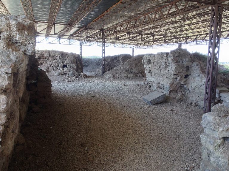
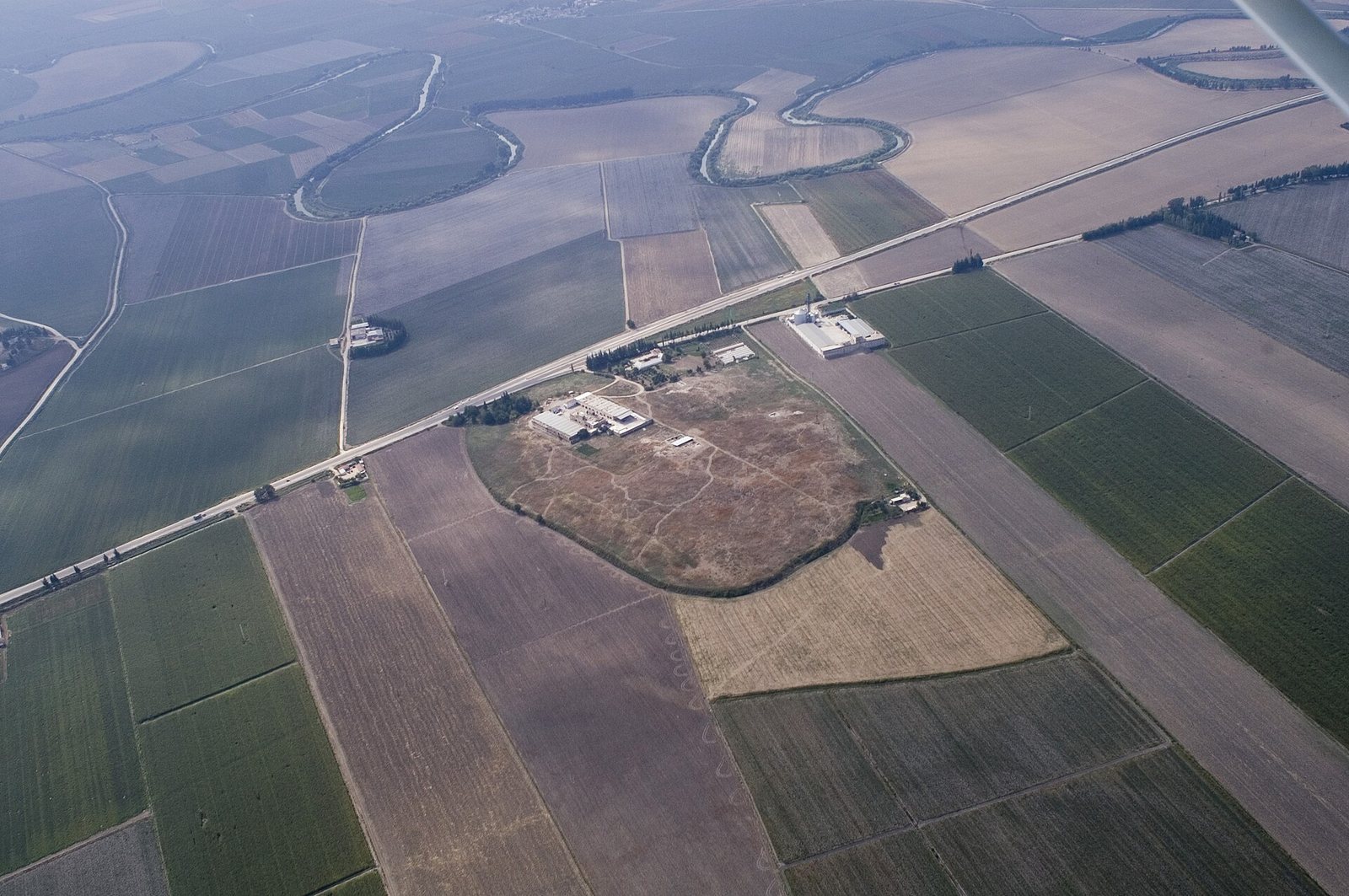
The site occupies a low mound on the east bank of the Orontes River, near a bend at the southwestern edge of the Amuq Valley. It lies about 25 kilometres southeast of Antakya and about 800 metres from Tell Atchana. The upper mound covers about 20 hectares. Floodplain deposits now cover the lower mound, which extends roughly 200 metres north and 100 metres east, with a smaller extension to the southeast.
Early Bronze Age settlement
Mound and settlement extent
Coring and surface collection indicate that the Early Bronze Age settlement covered about 25 hectares. Its archaeological remains lie 3–6 metres deep. Modern bulldozing removed about 550 square metres from the upper mound’s north and east sides. Agricultural activity also damaged part of the site, including during construction of an industrial building in 1950.
Structures and finds
Early Bronze Age structural remains include Phase J, which corresponds to Early Bronze IVB. Red-and-black burnished pottery, often called Khirbet Kerak ware, occurs in Phases H and I, corresponding to Mesopotamia’s Early Dynastic period, an early era of city-states. It became less common toward the end of the final Early Bronze Age phase. The pottery is thought to reflect influence from the Kura-Araxes culture of the southern Caucasus and neighboring regions, which reached the area around 3000 BC.
Finds from the Early Bronze Age include 17 human and animal figurines in a style characteristic of the region, two wheels, copper-alloy fragments, spindle whorls and loom weights used in spinning and weaving, a cylinder seal, and two clay sealings. A cylinder seal is a carved roller used to make an impression in clay.
Iron Age city
Citadel and gate
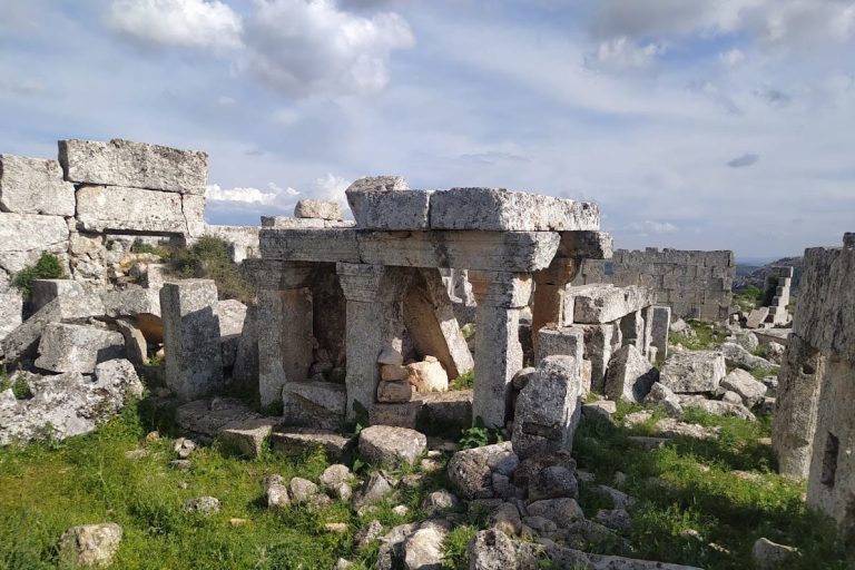
The Iron Age city had a citadel on higher ground, linked to the lower city by a monumental gate complex. The gate led toward the upper citadel and contained the location where a female statue was found in 2017.
Temple precinct
An Iron Age temple was excavated in the sacred precinct. Its plan has been compared with descriptions of Solomon’s Temple in the Hebrew Bible. Building XVI, also within the precinct, had an inner sanctum, where most of the recovered cuneiform tablets were found.
Palaces
Excavations uncovered several large palaces of the bit-hilani type, a monumental palace form associated with northern Syria and Anatolia. Excavators exposed part of an early Iron Age palace of this type in 2005. A wood sample from a palace destroyed by fire around 675 BC yielded a radiocarbon age of 2,625 ± 50 BP. BP means “before present,” with 1950 as the conventional reference point, so this figure is a radiocarbon age rather than a calendar date.
Objects and inscriptions
Tablets and inscribed stones
The first-millennium-BC tablets from the site are written in cuneiform, a wedge-shaped writing system used across the ancient Near East. Most belong to the Iqqur Ipuš menologium, a calendar text organizing observances and auspicious or inauspicious days by month. The assemblage also includes a copy of Esarhaddon’s succession treaty.
A worn stone bearing cuneiform writing was reused by a farmer as a paving stone and later handed over to a local museum. Together with four fragments recovered in a 1930 excavation, it was identified as part of a stele of Sargon II. A stele is an upright stone monument, often inscribed.
Statues
In 2012, excavators uncovered the head and torso of a basalt male figure, surviving to just above the waist. The surviving portion is about 1.5 metres high, and the complete statue is estimated to have stood 3.5–4 metres tall. Its bearded face has eyes inlaid with white and black stone, and its elaborate curls are arranged in rows. The arms extend forward from the elbows, each bearing two lion-head bracelets. The left hand holds a stalk of wheat and the right a spear; a crescent-shaped ornament decorates the chest. A long raised inscription in Luwian hieroglyphs, a script for the ancient Anatolian language, runs across the statue’s back and recounts the accomplishments and campaigns of King Suppiluliuma.
The female statue found in the monumental gate complex in 2017 may represent Kubaba, a goddess worshipped in ancient Anatolia; Kupapiyas, described as Taita’s wife or possibly his mother; or Suppiluliuma’s wife. Harrison suggested that women may have held prominent political and religious roles in early Iron Age communities.
Column bases
A column base from Tell Tayinat is held at the Hatay Archaeological Museum. A carved bull and cherub, a winged protective figure, is also identified as having served as a column base. The museum displays some finds from the site.