Fortifications of Komárno: A Cross-Border Defensive Complex
Site at a Glance
- Popularity
- High
- Country
- Slovakia
- Primary era
- Modern
- Eras represented
- Medieval, Early Modern, Modern
- Civilizations
- Austria-Hungary, Austrian Empire, Habsburg, Hungarian
- Site type
- Military
- Remains
- Wall
On this page18 sections
History
The Fortifications of Komárno are a defensive complex centered at the confluence of the Danube and Váh rivers in Komárno, Slovakia, and extending into Hungary. The system developed through Roman, medieval, and modern periods, with major Habsburg construction from the sixteenth century onward. Its purpose shifted over time, from guarding river routes and defending Vienna to serving as a military base, depot, and, in wartime, a place of detention.
Roman defenses and early medieval settlement
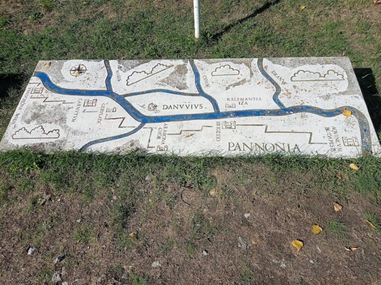
Roman defenses protected both sides of the Danube. On the Hungarian side, the area around Szőny had first been home to a commercially active Celtic settlement and later to Brigetio, a major town in Pannonia, a Roman province. Brigetio flourished from the first to the fourth centuries. Its defenses developed from an earthwork into a stone-walled fort during the second century, and a legion, a major Roman military unit of about 4,000 to 6,000 soldiers, defended the town.
Across the river, near the mouth of the Váh, the Romans built another fort to protect trade along the river and guard against possible attacks from the north. It began as an earthwork and later became a stone-walled camp, defended by a cohort, a subdivision of a legion, of about 480 soldiers from Brigetio’s legion. A find associates the name Celementia with this fort.
Avars, a people who established political power in Central Europe, occupied the former Roman settlement in the sixth century. Magyar settlers entered the region in the early tenth century. Their leader Árpád granted the area to the clan chief Ketel, whose son Alaptolma built a substantial earthwork fortress where the Váh meets the Danube.
The medieval stronghold
The fortress became the seat of Komárom County, founded by King Stephen, Hungary’s first king. Control of the stronghold passed between the king and local nobles. After the Mongol invasion of 1241–42, a stone castle replaced the earthwork in 1265, during the reign of Béla IV. Komárom later grew as a commercial, economic, and military center under King Matthias Corvinus in the fifteenth century, when a modernization of the fortress is also associated with his rule.
Habsburg defenses against Ottoman expansion
After Ottoman forces captured Buda in 1541, Habsburg ruler Ferdinand I ordered Komárno strengthened to help defend Vienna. Construction of the Old Fortress began in 1546 and finished in 1557. Its plan, prepared around 1550, is attributed to Pietro Ferrabosco, an Italian military engineer in Habsburg service. A major flood damaged the defenses in 1570, and restoration work followed between 1572 and 1592 under the builder Urban Süess.
In 1585, forts guarding river crossings were established at the mouth of the Váh and on the opposite bank of the Danube. The Old Fortress resisted an Ottoman siege in 1594. Grand Vizier Sinan advanced on Komárno with an army of about 100,000 after taking Tata and Győr, but the fortress held.
The Habsburg court ordered another expansion in 1663. From that year until 1673, the New Fortress was built as a western extension of the Old Fortress, following a plan by engineer Baron František Wymes. During the same period, the timber palisade defenses near the Váh mouth and on the Danube’s right bank were rebuilt and strengthened. The enlarged complex became an important imperial base and a forward defense for Vienna.
Damage, decline, and renewed investment
A major flood damaged the fortifications in 1682. After Ottoman forces were expelled and Komárno no longer served as a frontier fortress, its military importance declined for a time and maintenance spending fell. Following the uprising led by Francis II Rákóczi against Habsburg rule in the early eighteenth century, the Habsburgs considered dismantling the Old and New Fortresses. Earthquakes in 1763 and 1783 caused further damage, and the fortress was sold at auction in 1784.
The Napoleonic Wars, the early nineteenth-century conflicts led by Napoleon, revived plans for the defenses. Works around the town took place from 1808 to 1815. After Napoleon’s forces occupied Vienna in 1809, Emperor Francis I, who had taken refuge in Komárno, decided to develop it into the Habsburg Empire’s strongest fortified complex, with capacity for 200,000 troops.
From 1827 to 1839, the Old and New Fortresses were modernized, and construction began on the western Nádor Line and northern Váh Line. Five stone-and-brick bastions of the Nádor Line were built between 1839 and 1847. The intended scale of the new defenses reflected the danger perceived by the Habsburg authorities, but the next major conflict interrupted construction.
The 1848–49 war and the siege of Komárno
The Hungarian Revolution and War of Independence of 1848–49 was an uprising against Habsburg authority. When Hungarian forces took control of the fortress, Lieutenant Colonel István Majtényi strengthened it and organized the town’s defense. Lieutenant Colonel Ignác Török, an engineer officer, succeeded him. During a siege in March and April 1849, Török held the fortress with 12,000 defenders for more than a month. A Hungarian spring campaign then broke the siege, as a relief force led by General Richárd Guyon drove the main Austrian troops toward Győr.
General György Klapka took command and, on 28 May 1849, ordered a protected, vaulted fort on Homokhegy. The proposed four-towered work was intended for 1,000 soldiers, but only the tower facing Ács was completed. Klapka also began the Monostori Fort and an earthwork at Igmánd using hurried timber-and-earth construction. Increasingly frequent Austrian bombardment halted this work.
Hungarian and Austrian main forces fought twice in the Komárno area in July 1849. Although the Hungarians won both engagements, neither produced a decisive outcome. After the Hungarian army withdrew toward the Tisza, Klapka’s garrison was isolated. It numbered 18,200 men and had more than 300 guns. The Austrians initially blockaded it with 12,000 men and 75 guns while awaiting reinforcements. Klapka led successful sorties toward Bratislava and Győr, returning with captured supplies.
After the main Hungarian army surrendered at Világos on 13 August 1849, Austrian and Russian forces advanced on Komárno. The fortress continued to resist for another month. Klapka signed its surrender on 27 September in exchange for the defenders’ safe departure.
Completion and changing military role
After the war, the Austrian army resumed construction, incorporating lessons from the siege. The right-bank forts were intended to keep enemy artillery from firing on the left-bank defenses and to protect communication across the Danube. Work that began in 1850 eventually linked the Nádor and Váh lines and the Old and New Fortresses with the Váh-side crossing defenses and the Monostori, Csillag, and Igmánd forts on the Danube’s right bank. Monostori was completed in 1871, and Igmánd, built between 1871 and 1877, completed the chain.
The finished system formed the largest fortified town in the Austro-Hungarian Monarchy and could accommodate 200,000 troops. It did not, however, become the empire’s last line of defense, as attention shifted to the frontier with Russia. Late-nineteenth-century advances in artillery made the forts outdated, and planned modernization did not proceed. Monostori nevertheless remained in use for many years as a training site for Hungarian soldiers.
Division, war, and twentieth-century military use
In 1919, the Czechoslovak army occupied the left-bank forts while the right bank remained Hungarian. The Treaty of Trianon, the 1920 peace treaty that redrew Hungary’s borders after the First World War, formalized the division of the formerly united town. The postwar Paris peace settlement maintained the separation. Between the wars, the Royal Hungarian Army used Monostori as barracks and a training center.
In 1938, the Old Fortress and Csillag Fort became ammunition depots. After Germany invaded Poland in 1939, Csillag temporarily sheltered some Polish refugees. Following the Arrow Cross takeover in October 1944, a Hungarian fascist movement’s seizure of power, Csillag and Igmánd were used as internment camps. Thousands of Jews and Roma were sent from the camps to extermination camps.
After 1945, Soviet forces used Monostori as a major arms depot until their withdrawal in 1991. They also used left-bank forts as barracks. In 1968, Soviet troops occupied the Old and New Fortresses during the suppression of the Prague Spring, a reform movement in Czechoslovakia. Csillag served as emergency housing after the war, then as a vegetable store and cabbage-pickling facility.
Restoration and present status
After the Soviet withdrawal in 1991, the forts returned to state administration. Monostori underwent removal of hazardous materials from 1992 to 1995. The Slovak army continued to use parts of the Old Fortress until October 2000, when the city of Komárno purchased the complex. The left-bank fortifications received a Europa Nostra award for restoration in 1994. Csillag’s vegetable store closed in 2004.
Restoration of Csillag was approved in 2014. The project removed later partitions and alterations, addressed damp and insulation, returned the cannon and firing positions to an earlier form, and added a museum wing. The Slovak fortification system has been a national cultural monument since 1970, with 45 objects included. The cross-border complex was placed on UNESCO’s Tentative List; a joint World Heritage nomination by Hungary and Slovakia was withdrawn in 2008.
Remains
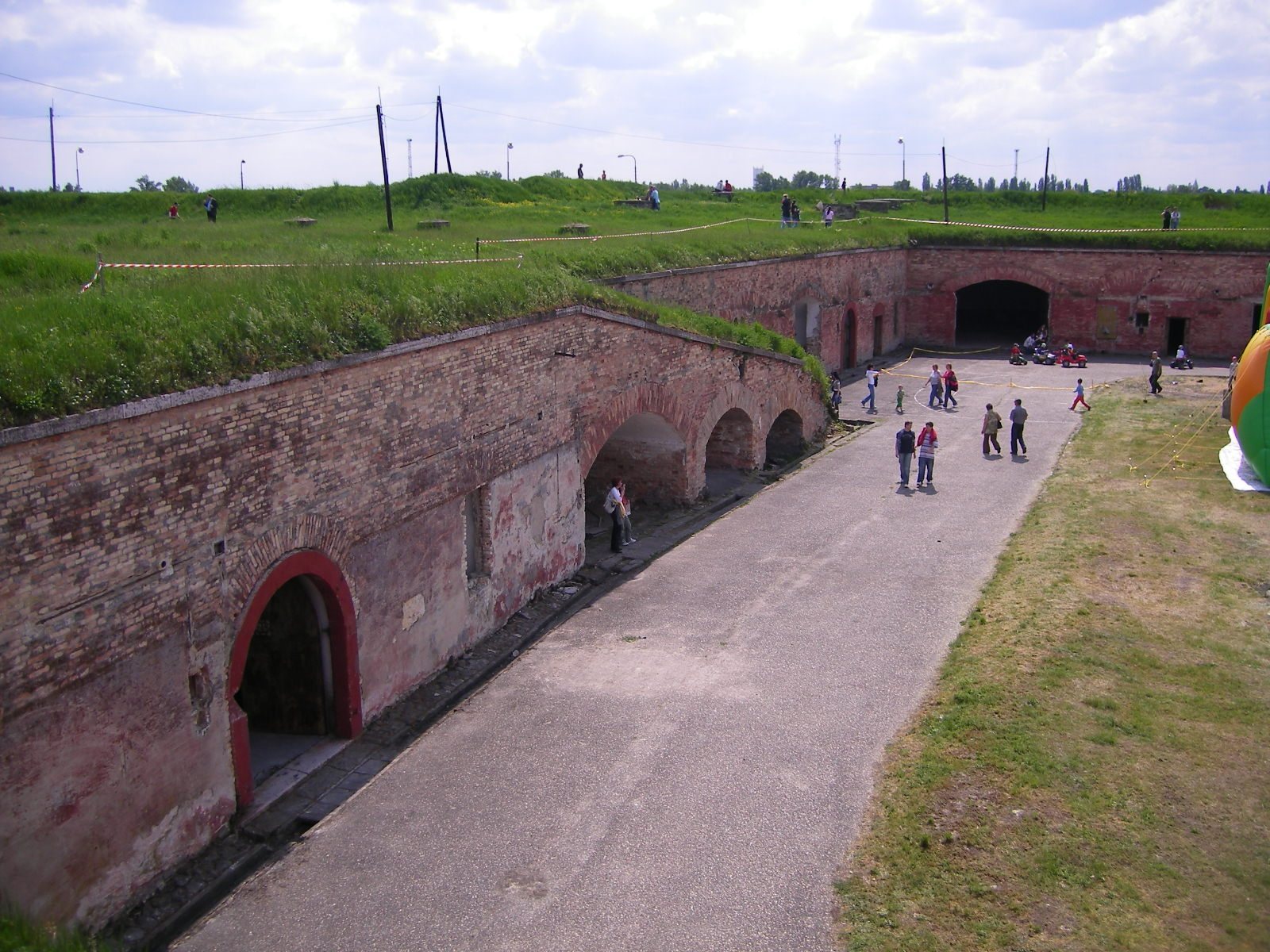
The surviving system is a polygonal complex, built from angled defensive walls and projecting works, spread across the Danube and Váh in Slovakia and Hungary. Its central fortress occupies the wedge where the rivers meet. The wider layout includes the Old and New Fortresses, the Nádor and Váh lines, defenses at the Váh and Danube crossings, and the Monostori, Csillag, and Igmánd forts.
Central fortress and left-bank defenses
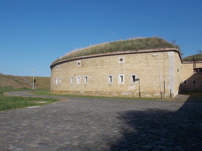
The town defenses combined 16 large bastions, projecting platforms from which defenders could fire along the walls, with connecting walls. These works formed linked lines and river-crossing defenses around the central fortress. Surviving portions differ in form and completeness, from substantial fort buildings to incomplete earthworks.
Old and New Fortresses
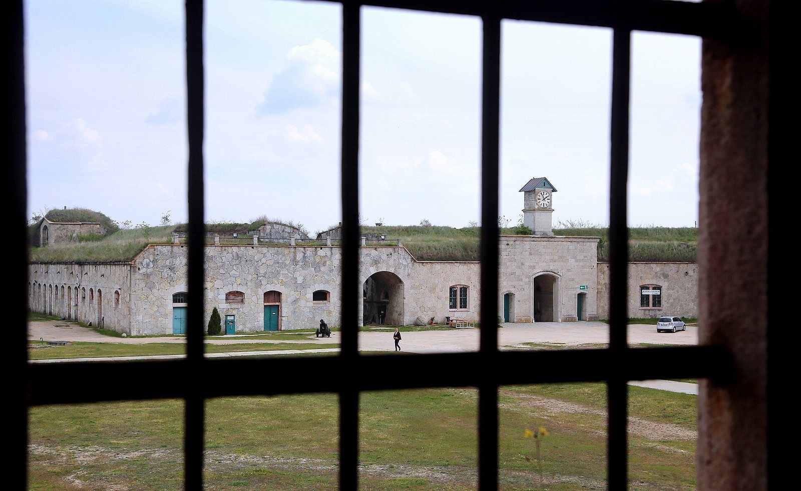
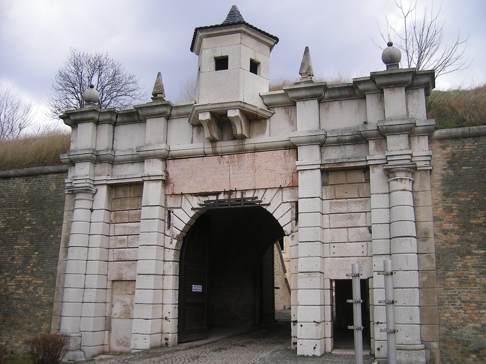
The Old Fortress stands at the Váh–Danube confluence, built over the remains of an earlier castle. The New Fortress is a five-sided work on its western, town-facing side. A Latin inscription on its western bastion reads Nec arte, nec marte, meaning “Neither by stratagem nor by force.” A symbolic female figure known as the stone virgin stands on the watchtower.
Nádor and Váh lines
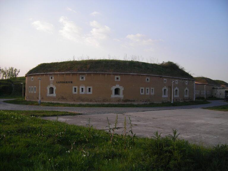
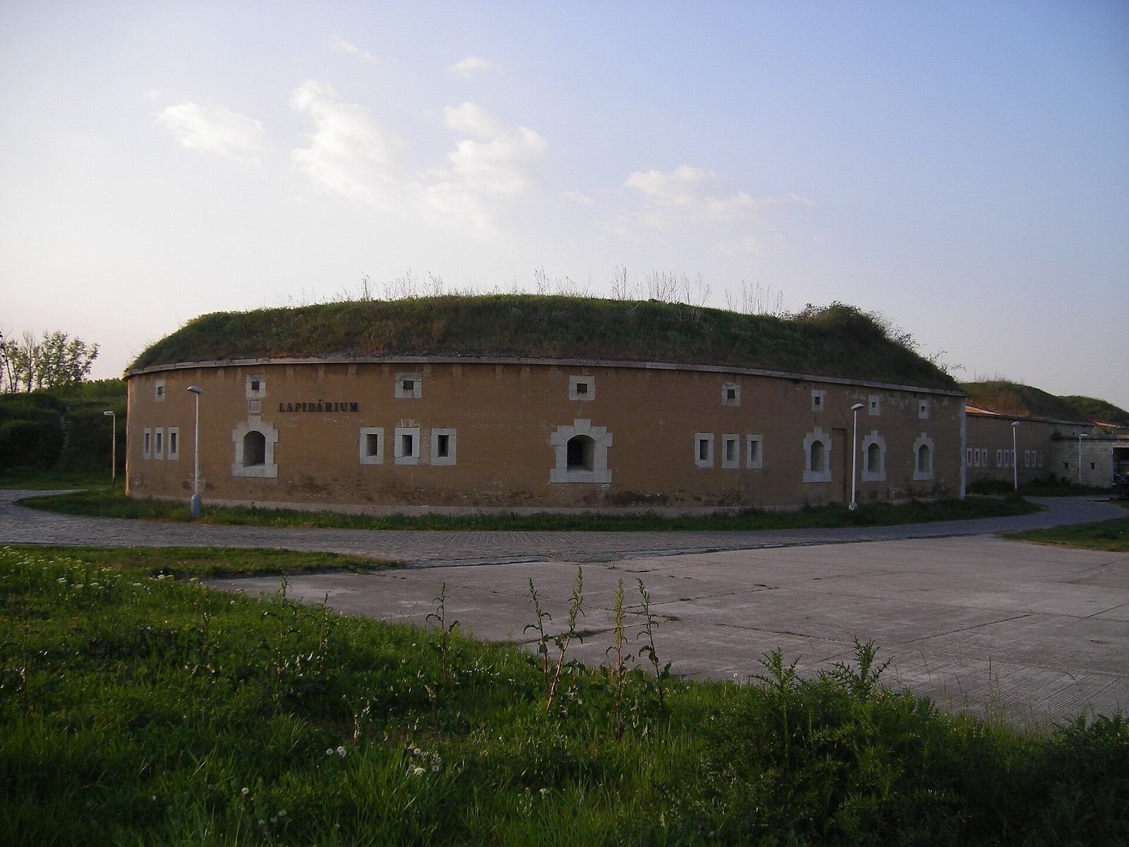
The Nádor Line protected the town’s western side and consists of bastions I–V. To the north, the Váh Line ran along the river’s right bank and comprised six defensive objects, numbered VI–XI; only VI and VII are bastions. Bastion VI also houses a collection of carved stones. Warehouses and production facilities occupy parts of both lines.
River-crossing defenses
The Váh bridgehead, a group of defenses guarding a river crossing, stood on the left banks of the Váh and Danube. Its surviving earthworks are incomplete. On the Hungarian right bank, the Danube bridgehead includes Csillag Fort.
Forts on the Danube’s right bank
The right-bank forts form part of the wider defensive chain across the river. Their locations protected different approaches to Komárom, while their internal arrangements reflect the requirements of artillery defense and the accommodation of troops.
Monostori Fort
Monostori Fort, also called Fort Sandberg, stands on the Danube’s right bank opposite the western tip of Elizabeth Island, where it defended Komárom from the west. It is described as the largest modern fort in Central Europe. One wing held the former bakery, where a restored nineteenth-century oven is associated with the bread museum. The North Bastion’s inner courtyard has particularly strong acoustics.
Csillag Fort
Csillag is surrounded by a water-filled moat. Its name refers to the four-pointed star form associated with its predecessor, the St. Peter’s palisade. The restored and expanded fort has a floor area of 7,000 square meters. Its historic cannon and firing positions have been returned to an earlier form. A museum wing displays 300 plaster casts from the Museum of Fine Arts collection, including casts of the equestrian statues of Bartolomeo Colleoni and Gattamelata, the Laocoön Group, the Venus de Milo, and works by Michelangelo.
Igmánd Fort
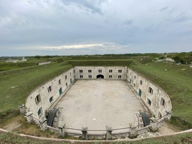
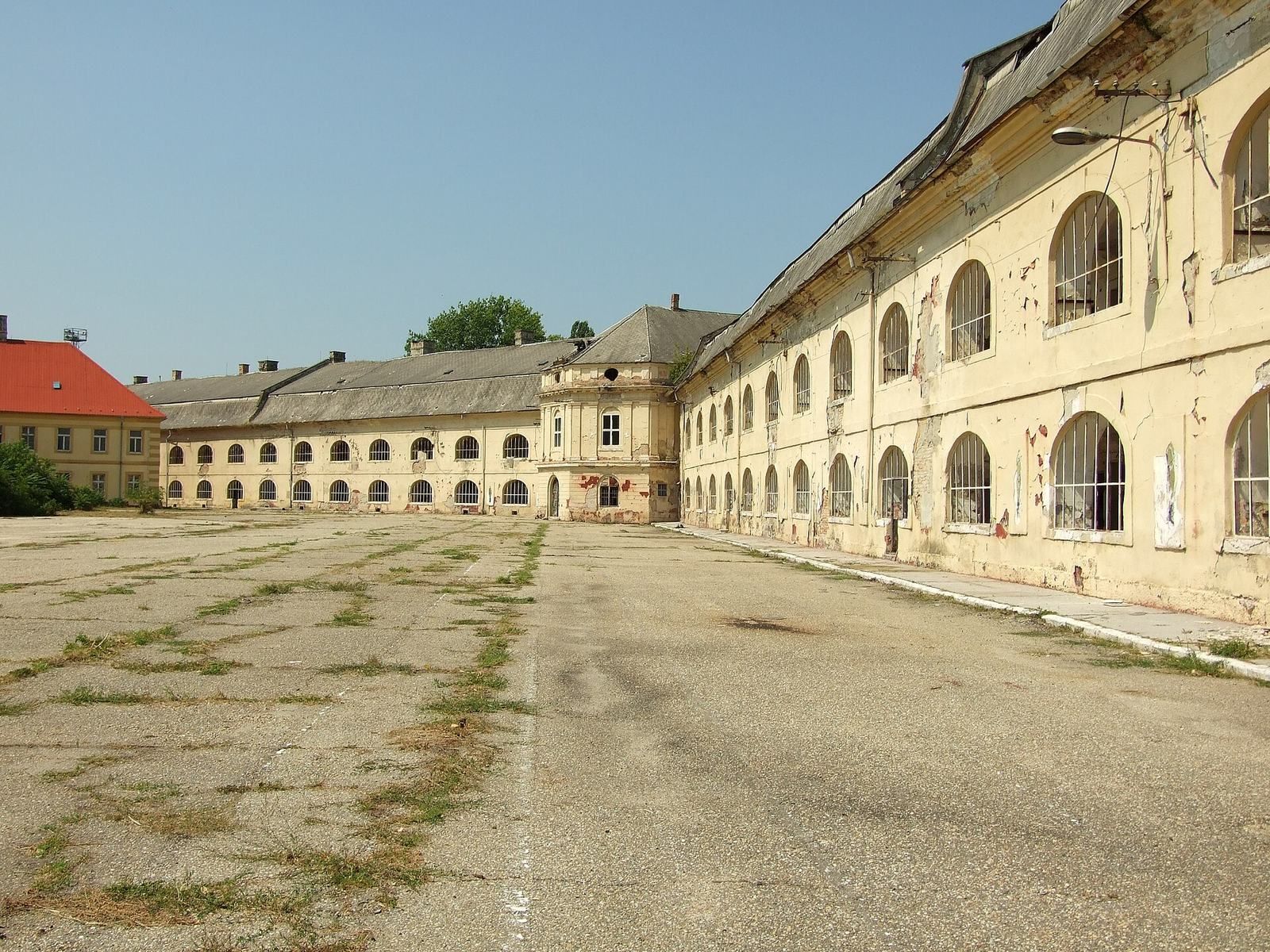
South of the town, Igmánd Fort defended the southern approach. A dry ditch surrounds it, with galleries along the outer side. The fort contains 106 rooms, with 4,600 square meters of usable floor area; its footprint is 6,200 square meters and its built volume exceeds 33,000 cubic meters. Its defensive layout includes traverses, raised barriers intended to reduce the effects of fragments from enemy fire. These remain in their original condition.
Igmánd houses a collection of Roman carved stones, including tombstones, sarcophagi, altar stones, reliefs, sculpture fragments, architectural pieces, and milestones. The former fortifications on both sides of the river now include museums, as well as the stone collection in Bastion VI of the left-bank defenses.