Fort Chailluz: A Fort in Besançon’s Defensive Camp
Site at a Glance
- Popularity
- Medium
- Country
- France
- Primary era
- Modern
- Eras represented
- Modern
- Civilizations
- French
- Site type
- Military
- Remains
- Fort
On this page15 sections
History
Construction of the northern defenses
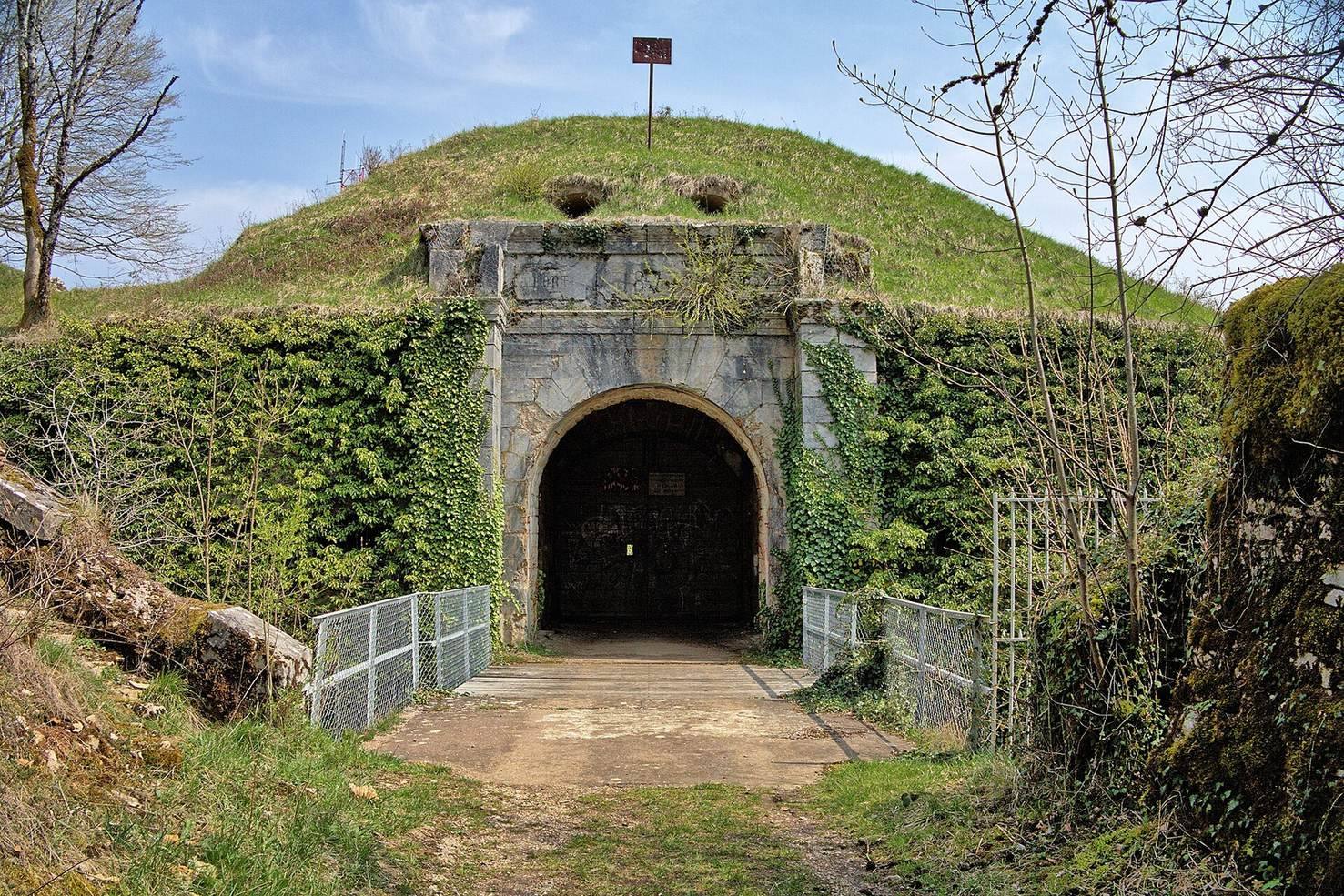
Fort Chailluz was built by France between 1875 and 1878 in Chailluz Forest near Besançon, France. It formed part of the first phase of the fortified camp around Besançon, developed from 1872 to 1880. A hastily built defensive camp had preceded it during the Franco-Prussian War of 1870–71, fought between France and Prussia and their German allies. After France’s defeat and the withdrawal of German forces, French general and military engineer Séré de Rivières led a national border-defense program. Around Besançon, this led to the construction or modification of a redoubt, a small detached fortification, ten forts, and seven batteries.
Fort Chailluz extended the earlier camp northward alongside Fort Châtillon-le-Duc and the Calvaire battery. Their positions responded to the increased range of artillery and helped block the four-kilometer passage between the fort and Thise, east of Chailluz Forest. The fort took its name from the forest where it stands.
Changes and later use
In 1885, explosive shells known as torpedo shells replaced traditional black-powder shells, increasing the fort’s vulnerability to bombardment despite the earth covering its casemates. A concrete barracks was subsequently built underground behind the western ditch wall, between 1890 and 1893. A decree in 1887 assigned the fort the name of François Joseph Kirgener, a French general of division killed by a cannonball on 22 May 1813, near the end of the Battle of Reichenbach during the Napoleonic Wars. Besançon residents also know the fort as the White Lady Fort, after a local legend.
Fort Chailluz was not used in military operations. It was decommissioned after the First World War and occupied by German forces after 1940. The city of Besançon now owns the fort and authorized the installation of a mast carrying telecommunications transmitters inside it.
Remains
Layout and defensive works
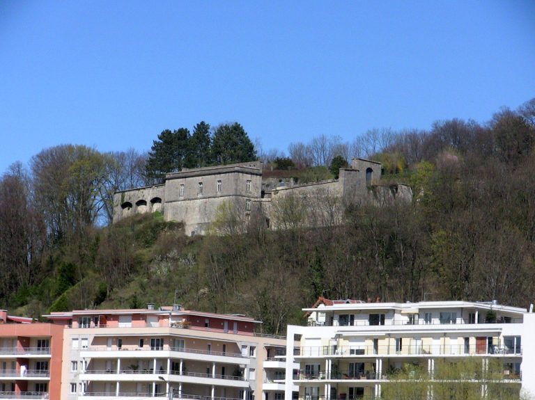
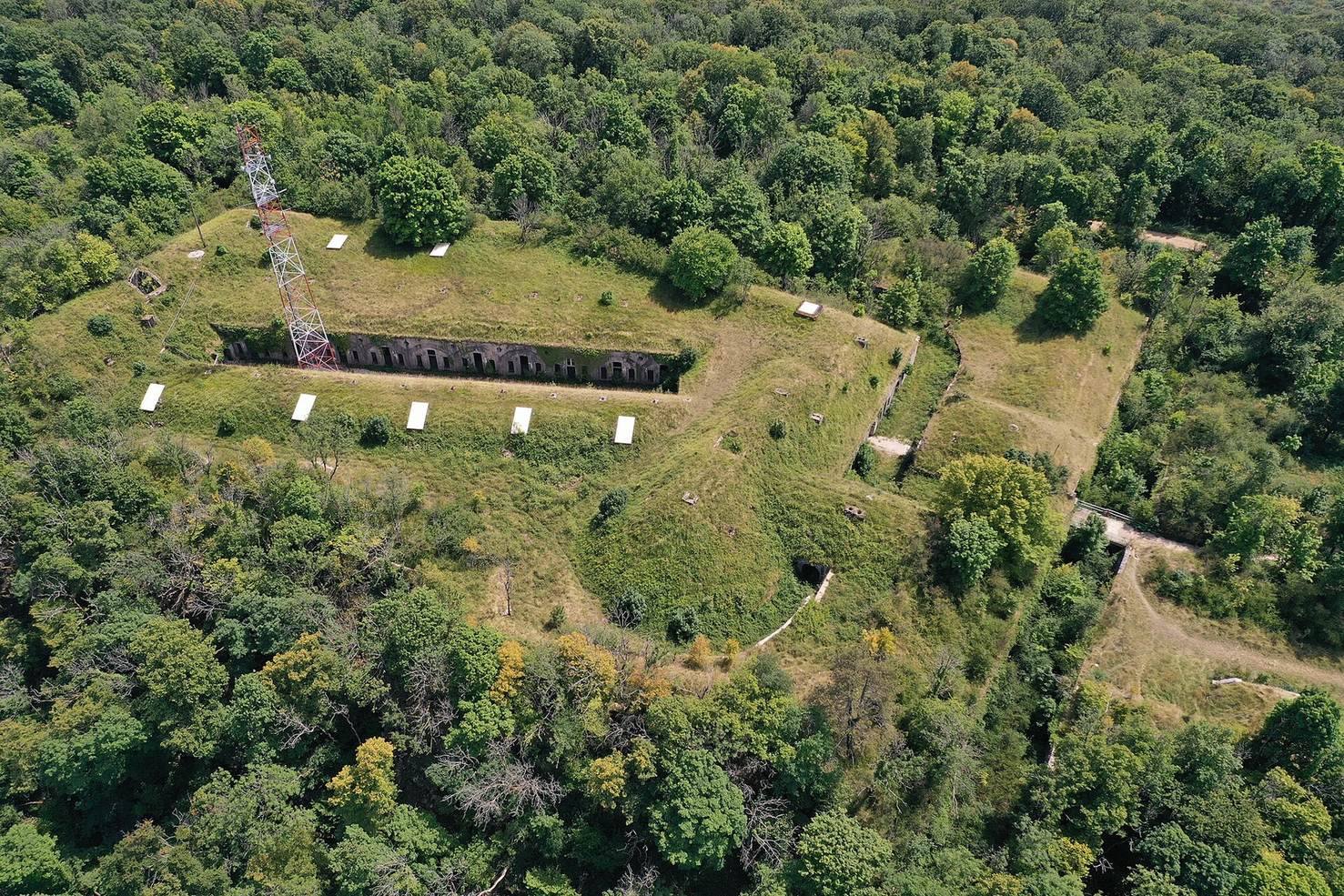
The masonry fort stands at 619 meters on a ridge overlooking the Ognon valley to the south. It has a rectangular plan measuring 210 by 120 meters, with its southern side made up of two angled sections. The northern front follows the Besançon–Bonnay boundary and faces a cliff, so ditches surround only three sides.
Central block and courtyard
The central block held the barracks, powder magazine, food and equipment stores, bakery, and infirmary around a narrow courtyard running east to west for 75 meters. Two rampart roads encircled the block, and its upper level provided an infantry firing position. The fort was designed to house 598 men, including 15 officers, and to carry 25 artillery pieces, ten of them mortars. Its actual garrison and armament varied over time.
Ditches and entrance
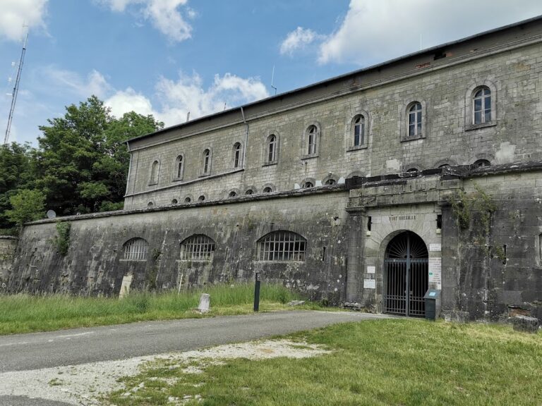
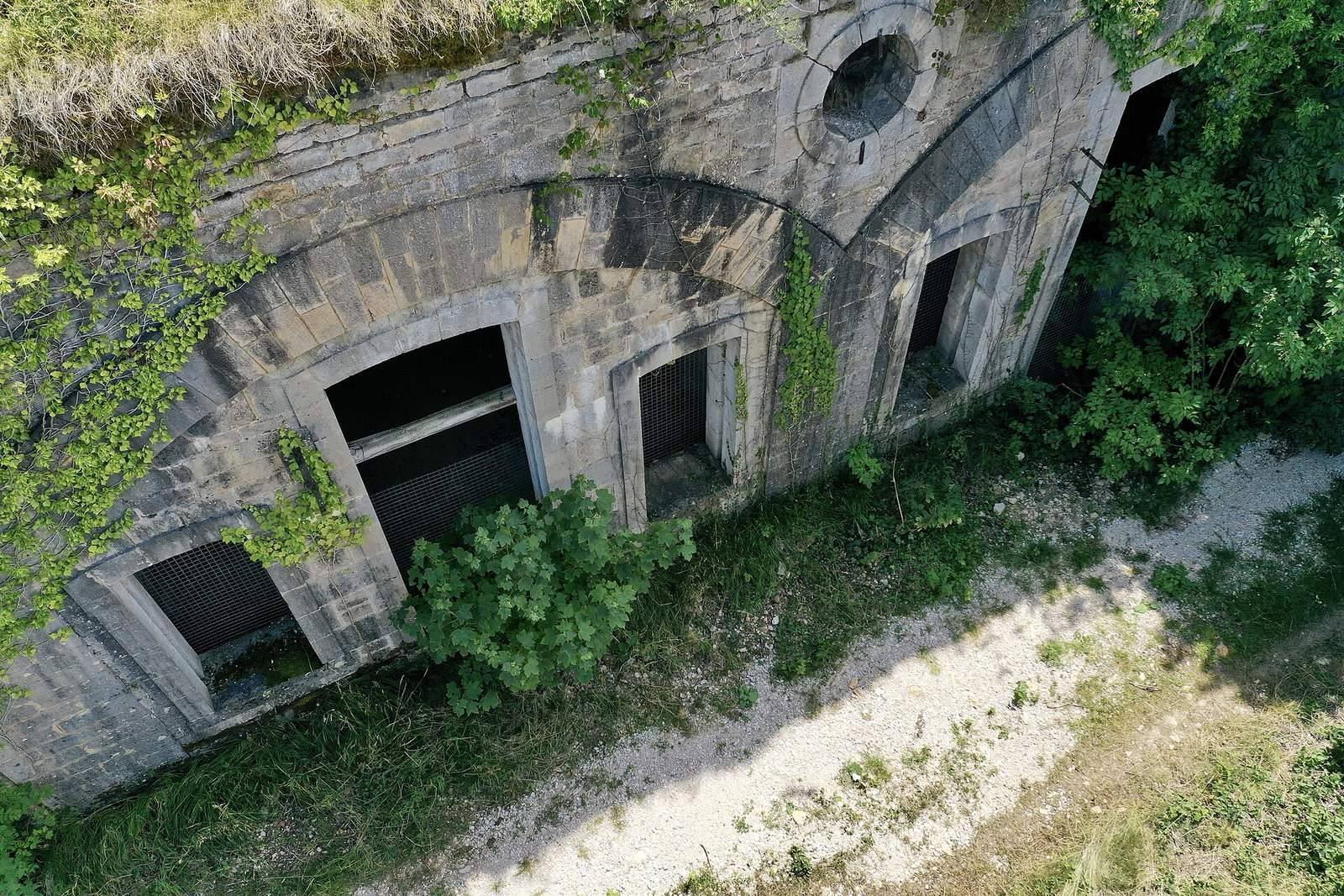
Masonry walls line the ditches, which were defended by two double caponiers, protected structures that fired along the ditches. The eastern and western ditches end at the cliff. A fixed bridge now crosses the western ditch where a drawbridge once stood, and a protected path follows the outer ditch wall. The entrance porch has a defensive chamber above it for an optical signaling post; two visible openings are outlets for two of the post’s four conduits. Defensive loopholes flank the entrance, with further gun openings on either side of the porch. Beside the bridge, a stair and sunken ditch connect to the outer ditch wall. A small passage at the foot of the inner wall leads to the wartime barracks.
Artillery positions
Five long protective earth barriers extended from the central block to shield the garrison’s flanks. Shelters divided the outer artillery positions, aimed mainly east and south, with an additional firing direction to the west. A northern artillery platform, framed by two of the barriers, could be reached from the northern rampart road.
Underground accommodation and signaling
Underground barracks and interior rooms
The underground barracks behind the western ditch wall is made entirely of concrete, with windows facing the ditch. Its ten sleeping rooms were linked by a passage at the rear. Other interior spaces include three gun casemates, enclosed protected chambers for artillery: one served direct fire and two indirect fire. The fort also contains a powder magazine, lamp room, latrines, and a degraded bread oven.
Optical signaling posts
Two posts sent light signals between the fort, Besançon, and more distant fortified places. The western post had four directions: Langres and Cognelot; Dijon, Motte-Giron, and Mont Afrique; Auxonne as a reserve link toward Dijon; and Besançon and Bregille. The eastern post connected toward Belfort and Salbert, and toward Montbéliard and Mont-Bart.
Outworks and access
Auxiliary battery
An auxiliary battery beside the entrance faced the northern plain. It had two firing platforms and a vaulted shelter covered with earth.
Powder magazines and batteries
The fort’s associated outworks included the Montarmots and Fourche powder magazines, both built as underground caverns in 1889. The Fourche battery, an earthwork dating to about 1890, lies close to the Fourche magazine. The Charrière powder magazine was constructed as a semi-cavern in two stages, in 1886 and 1892; a nearby earthwork battery dates to about 1890.
Approach road
A strategic road approached the fort from Montarmots, partly following existing forest tracks and partly newly built. Designed to keep its gradient at or below 12 percent, it climbed 90 meters through four bends. Outside the built-up area, the route measured 7.5 kilometers and served the fort’s associated magazines and batteries.