Forum of Vieux-la-Romaine: Civic Center of Roman Aregenua
Site at a Glance
- Popularity
- Medium
- Country
- France
- Primary era
- Classical
- Eras represented
- Classical
- Civilizations
- Roman
- Site type
- Civic
- Remains
- Forum
On this page21 sections
History
The Forum of Vieux-la-Romaine is a Roman civic complex at Vieux, France, built in the early second century as part of Aregenua, the administrative center of the Viducasses, a people of Roman Gaul. Aregenua was founded in the first century, probably during the Augustan age, the rule and immediate era of Rome’s first emperor, Augustus. The town covered an estimated 30 to 37 hectares and may have had about 5,000 inhabitants.
Urban growth and the forum
Aregenua developed under the emperors Tiberius and Claudius. Its growth was supported by privileges including exemption from Rome’s land tax and Latin rights, a set of privileges granted to some communities under Roman rule. The earliest Roman-style public buildings appeared around AD 120 to 140. In the second and third centuries, the town acquired public monuments, baths and houses, including the House with the Grand Peristyle, a home arranged around a columned courtyard. By the third century Aregenua was also known as Civitas Viducassium, a term for the organized territory and its principal town.
The forum was constructed in the early second century, altered later in that century, and further embellished during the first third of the third century, when Aregenua was flourishing. Its decoration was enriched as the city reached the height of its development.
Third-century crisis and later use
Aregenua joined the Gallic Empire, a breakaway Roman government in the western provinces during a period of imperial instability and external pressure. Two dedications to consuls serving the regime of its founder, Postumus, were placed on an altar to Mars, the Roman god of war. They date to AD 263 to 267. Invasions and the city’s lack of a defensive wall accompanied a period of decline. Several districts were abandoned from the middle of the third century, although some craftspeople remained active, and new construction had ended by the century’s close.
At the end of the third century, parts of the forum were converted to butchery, replacing some public buildings. The trade, chiefly involving cattle and pigs, continued into the fourth century. Early in that century, metalworking workshops took the place of houses near the House with the Grand Peristyle. Roads were renewed and extended, and a new street cut through the house. Around AD 400, a major reorganization of the Western Roman Empire’s administration transferred Aregenua’s regional role to Bayeux. The town then belonged to the territory administered from Bayeux.
Late antique and medieval settlement
Four Christian funerary inscriptions from the fifth to seventh centuries reflect the growth of Christianity as the settlement became more rural. Aregenua experienced renewed activity under the Merovingians, a Frankish ruling dynasty that governed much of Gaul in the early Middle Ages. Numerous graves from the seventh and eighth centuries mark this revival. The town declined again during the medieval period, while its inhabitants shifted northward. The site nevertheless remained inhabited.
Discovery and archaeological investigation
The first known discoveries at the site date to the sixteenth century, when the Thorigny Marble, an inscribed Roman monument associated with the local civic figure Titus Sennius Solemnis, came to light. Excavations in the seventeenth century exposed ancient and medieval remains in the southern village. Systematic work is recorded from 1697, followed by investigations in 1703 led by Nicolas-Joseph Foucault, a royal administrator for the Caen district.
C.-A. Gervais’s excavations in 1828 revealed baths and a gymnasium, and further campaigns followed between 1839 and 1861. In 1840, François Besongnet and Charles Gervais concluded that the forum lay elsewhere on the site. Arcisse de Caumont surveyed exposed walls that March and identified three rows of steps belonging to the council house. Antoine Charma’s 1859 excavations produced detailed plans and descriptions of the forum’s marble decoration, though he attributed frescoes to baths rather than to a council building or civic hall. A plan drawn by Georges-Aimar Lavalley-Duperroux during this period was rediscovered in the Calvados departmental archives in 1991.
In the early twentieth century, Maurice Besnier used nineteenth-century records to investigate the forum’s location. Two small test trenches excavated in 1972 yielded artifacts dating from the first century, including objects associated with the reigns of Tiberius and Nero, through to the mid-fourth century. Christian Pilet identified two groups of baths in 1977 and proposed a different location for the forum. Excavations in 1982 confirmed part of its position, while aerial photography in 1987 and 1989 clarified traces of walls.
An electrical survey in 2005 helped establish the forum’s location and produced three interpretive maps. Shortly before 2006, the Calvados departmental council acquired the Champ des Crêtes parcel and designated it an archaeological reserve. Excavations there in 2007 produced an overall plan and located the council house. Further research began in 2008 and continued over several years. A nine-year excavation program revealed the eastern part of the complex.
Remains
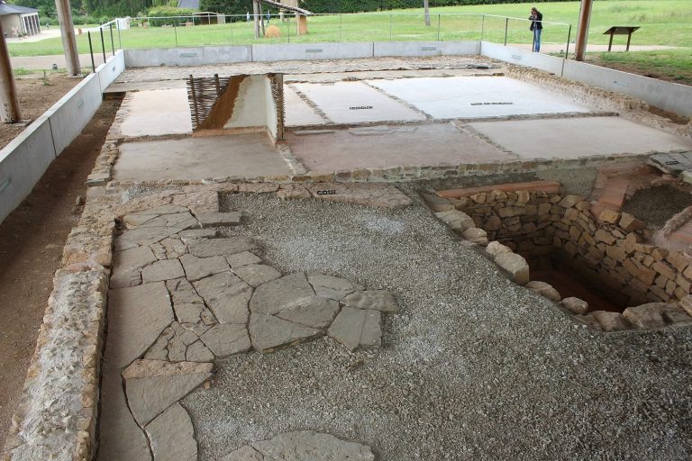
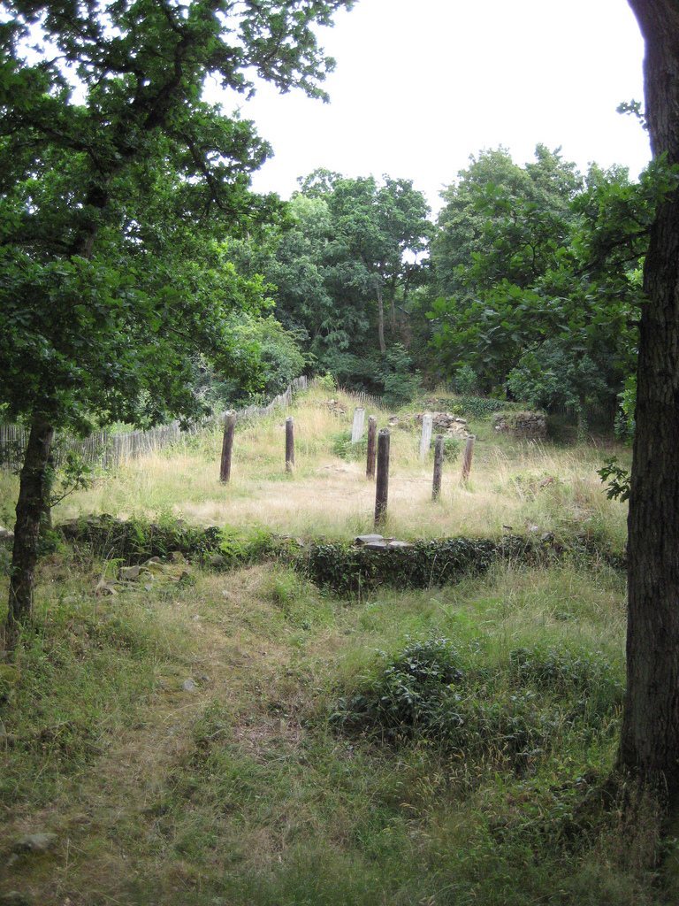
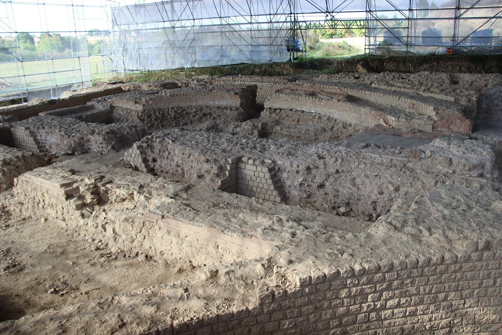
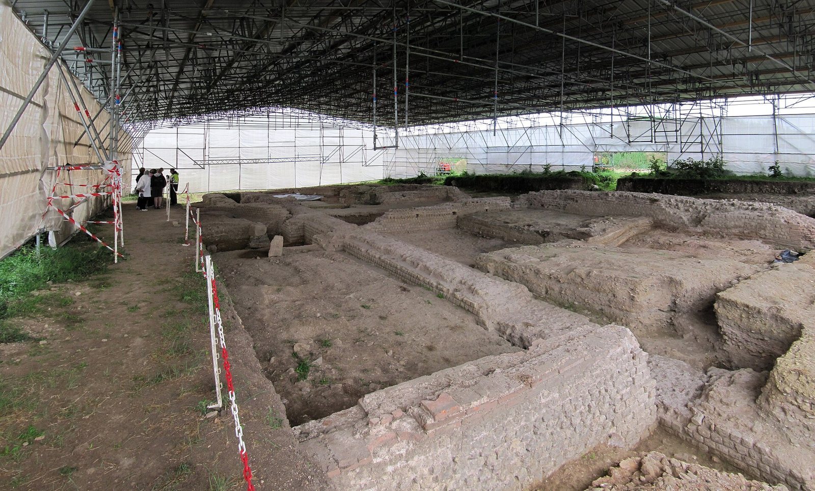
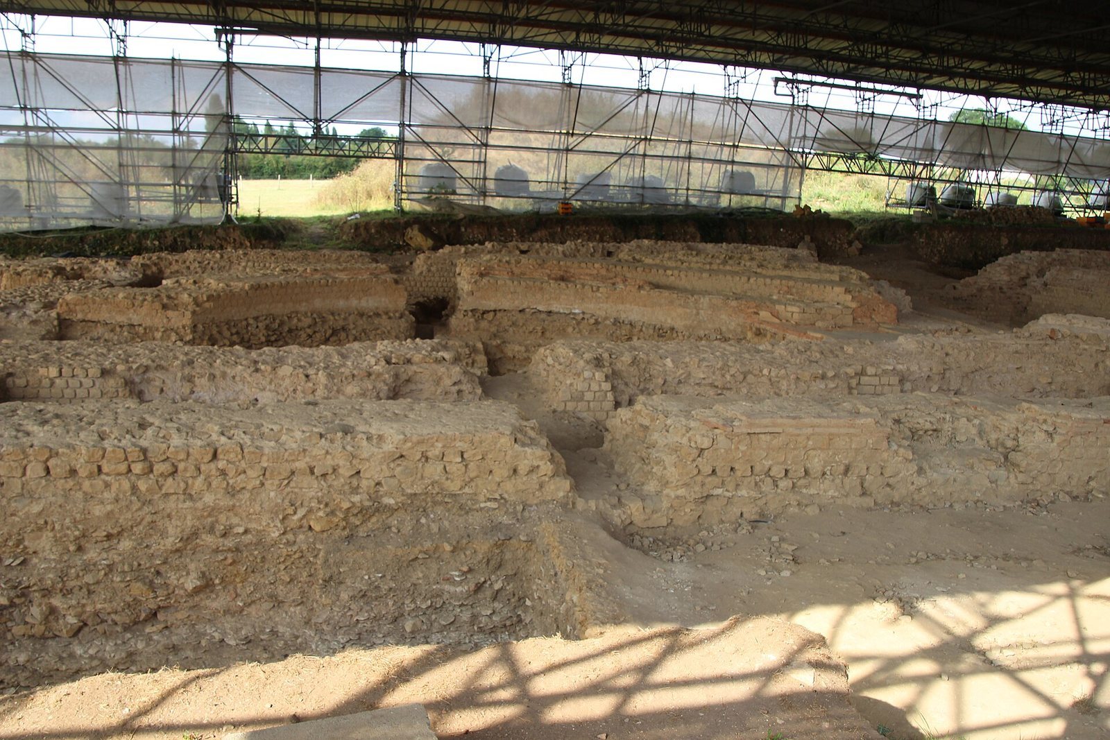
The forum occupies the edge of a plateau above the La Guigne valley, on a south-facing slope. Its rectangular plan and surrounding streets organize a complex of public buildings, shops and covered walkways. The Champ des Crêtes archaeological area covers four hectares.
Forum plan and commercial spaces
Overall layout
The forum measures 115 by 51.5 metres and lies outside the geometric center of the Viducassian town. Two east-west streets provided access along its long sides. One remains visible, and traces of several north-south streets have also been identified. Blocks around the civic complex measure about 50 by 60 metres, while those toward the town’s edge are roughly 90 metres square. This difference has prompted the suggestion that the town’s original nucleus may lie beneath the civic buildings, with the forum retaining an early position beyond the geometric center.
Central square and surrounding shops
The central square measures 68 by 21 metres. Its western part appears to have been sacred, while the eastern part served public uses. Shops of fairly regular widths, about 5.9 to 6.2 metres, bordered the square, separated from it by roofed, column-supported walkways. The northern shops and walkways were modified over time; their southern counterparts appear to have changed little. Electrical prospecting also traced an area measuring 85 by 50 metres, with a covered walkway and shops along its southern side.
Excavated shops
Two shops excavated in 1982 along the western part of the north-south street axis each covered about eight square metres, measuring roughly four by two metres. A woven-branch wall and a wooden partition divided them. One may have sold grain and tableware; the other was a pottery shop, where excavators found workable clay and a potter’s kiln. A gutter and sidewalk ran in front of the shops.
Sacred and civic buildings
Temple area
The western, sacred part of the square contained a temple, probably built in the second half of the second century. It appears to have measured 12.5 by 11 metres, with walls about 1.25 metres thick; its eastern wall was built of Vieux marble. A three-sided covered walkway may have framed the area. The temple’s dedication remains uncertain: possibilities include Mercury, associated with commerce; Sucellus, a Gaulish deity; Vulcan, the god of fire and metalworking; or the imperial cult. Part of an altar refers to Vulcan and the imperial cult. Two third-century clay molds for figures of Mercury and Sucellus were found in a marble-working workshop.
Council house
The civic council house was built and enlarged in stages. Its first room measured about 12.4 by 9.1 metres. Near the end of the second century, it was expanded to approximately 12.15 by 14.6 metres, and its painted and marble-like decoration was renewed. This phase continued into the second half of the third century. The eastern front was later shifted by about 1.5 metres, leaving a room roughly 14.8 by 14.6 metres. A substantial surrounding wall had buttresses on the east. During a second-century enlargement, the eastern wall was lowered and a replacement built farther out, extending the courtyard by about three metres.
Platform and steps
The earlier eastern wall was reused as a platform, with niches for statues of deities. Its surface consisted of limestone slabs joined with mortar containing tile fragments. Three semicircular rows of steps formed part of the platform. The west front rested on a supporting course of Caen stone. A statue of Titus Sennius Solemnis, a prominent local political figure, probably stood in the forum during the third century; that identification rests on the Thorigny Marble.
Vestibule and adjoining rooms
A vestibule west of the forum and south of the council house linked the two public spaces. Measuring about 9 by 5.9 metres, it suffered severe ground subsidence that damaged its floor. Major repairs, including a replacement floor, appear to date to the second half of the second century. In the late second or early third century, a monumental entrance about 4.1 metres wide, made of local marble, led from the vestibule into the council house.
The council house floor was concrete made with gravel mortar. Frescoes were planned for its southern and western walls, though their subject is uncertain. South of the building, a passage measuring 9 by 4 metres had a pink-mortar floor and led to a room accessible only from the council house. The room may have served as an archive for public records.
Painted and marble-like decoration
Council-house fragments
Plaster fragments recovered from backfill left by nineteenth-century excavations help reconstruct the council house’s colorful, marble-like decoration. About 36,280 pieces, dating from the second half of the second century and mostly attributed to this building, have been found. The designs included red resembling porphyry, yellow imitating Chemtou marble, pink and green resembling antique green marble. Fragments preserve details such as the shadow of a candelabrum base, part of a garment and a panther skin. Decorative materials came from across the Roman world, including marble from Skyros, Allier, Chemtou and Phrygia, oil shale from the Autun region, and limestone from the Pyrenees.
Room IV gallery painting
North of the council house, Room IV had a Caen-stone support beneath its columns and a mural along the upper façade of its gallery. The painting was about 12 metres long and 0.66 metres high. Its surviving lower section has a beige and khaki base topped by a white stripe, together about 25 to 27 centimetres high. Above these bands, diamond- and disc-shaped panels imitate yellow Chemtou marble, red porphyry and green marble. The upper part of the painting was destroyed in a fire in the middle of the third century, after which the gallery west of the council house was reorganized.
Other buildings in the forum district
Buildings identified by survey
A building northeast of the Champ des Crêtes baths had marble floors and a semicircular recess, or apse. A separate structure measuring about 27 by 14 metres may have been a temple. A large public hall for civic business, or basilica, has also been proposed as part of the complex.
Bath buildings
Two bath buildings have been identified in the district. One stood about 60 metres northeast of the building exposed in the earliest excavations. The larger bath complex measured about 90 by 50 metres and appears to have had separate areas for men and women. Its facilities included hot, warm and cold rooms, gymnasiums, heated floors and pools.
The larger baths were associated with the local benefactor Sollemninus, who laid their foundations and arranged in his will, made in the late second or early third century, for the complex to pass to the city. His son Titus Sennius Solemnis completed the construction in AD 234 and left the city revenues to support it.
Excavations in 2007 exposed part of the forum’s central square, including stones and blocks of Vieux marble. The site’s preserved streets, public spaces and buildings make it possible to study the arrangement of Aregenua’s civic center in detail.