Stanegate: A Roman Military Road and Frontier in Northern Britain
Site at a Glance
- Popularity
- High
- Country
- United Kingdom
- Primary era
- Classical
- Eras represented
- Classical
- Civilizations
- Roman
- Site type
- Infrastructure
- Remains
- Road
On this page11 sections
History
Stanegate was a Roman military road and early frontier in northern Britain, United Kingdom. It was probably laid out during the governorship of Agricola, from AD 77 to 85, and served as the empire’s northern boundary around the turn of the first and second centuries. The name Stanegate, meaning “stone road,” dates from after the Roman period.
Agricola and the early frontier
Early forts along the road were built of timber and earth and stood about a day’s march apart, roughly 14 Roman miles or 21 kilometres. Corbridge, Carlisle, Vindolanda, and Nether Denton belonged to this early phase. As governor and military commander in Britain, Agricola used the road to move troops and supplies during campaigns in Caledonia, the Roman name for what is now Scotland. The road’s forts also formed a line of military support in northern Britain.
The Roman historian Tacitus describes Agricola’s fourth campaigning season as a period of consolidating earlier conquests and fortifying the land between the Forth and Clyde. In Tacitus’s account, this confined opposing forces to a separate island. The Stanegate belonged to the wider system of routes and military positions supporting Roman operations in the north.
Withdrawal and reinforcement
In AD 87, Emperor Domitian sent Legio II Augusta, a legion of citizen soldiers, and most auxiliary troops, who served alongside the legions, from the Scottish Lowlands to the Dacian War. As Roman forces withdrew from Scotland, the frontier gradually shifted south to the Stanegate line between the Tyne and the Solway Firth. The withdrawal was complete by AD 105. Forts in the Lowlands and at Gask Ridge were abandoned and apparently destroyed by their own garrisons, leaving layers of burning. Newstead and Ardoch were briefly occupied again under Antoninus Pius.
In AD 105, Emperor Trajan transferred further auxiliary troops to the Stanegate and strengthened its defences. New forts shortened the intervals between major forts to about half a day’s march, while additional forts and watchtowers reinforced the boundary. In the west, Roman positions faced the Selgovii. An earthwork may have been built there during Trajan’s reign before Hadrian’s Wall replaced it. The Roman military presence persisted despite the view that the land beyond the frontier was sparsely settled, because the authorities considered a substantial defensive force necessary.
From frontier to supply road
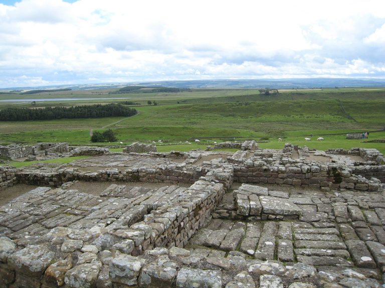
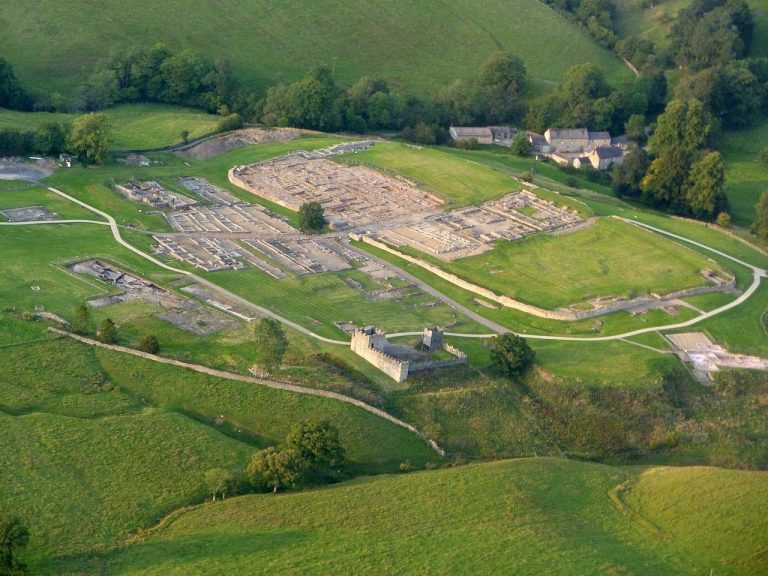
After Hadrian’s Wall was completed in the mid-second century, the Stanegate no longer served as the frontier. It remained an important supply route for the Wall’s forts and the principal east–west link during the Wall’s construction and occupation. Stanegate forts probably acted as supply depots, monitored movement near the Wall, and guarded approaches from both north and south. They also supported troops building the Wall. Concern about securing enough fodder for animals indicates that traffic along the road remained heavy. Soldiers continued to occupy Vindolanda and Magnis throughout the Roman occupation of the north.
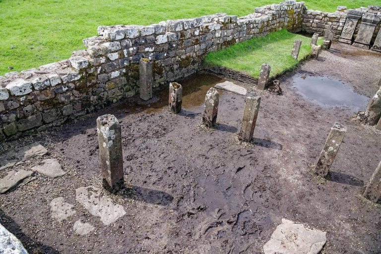
Writing tablets excavated at Vindolanda by archaeologist Robin Birley between 1973 and 1993 provide evidence of military life. One tablet indicates that about two-thirds of the soldiers and five of the six centurions, officers in the Roman army, were usually away from the fort. This pattern suggests that the northern frontier faced relatively little military threat at the time.
Later use
Vindolanda remained occupied after Roman rule, making continued use of the road probable. Cuthbert, a seventh-century Christian missionary and bishop of Hexham, may have travelled along it on a journey to Carlisle.
Much of the route later became part of the medieval Carelgate, or Carlisle Road, which began at Corbridge market and joined the Stanegate west of Corstopitum. When the older road deteriorated until coaches and wagons could no longer use it, General George Wade built a new Military Road in 1751–1752. This followed the Jacobite rising of 1745 and the plundering of Carlisle, and replaced parts of the Stanegate. The modern B6318 follows this later road in places.
Remains
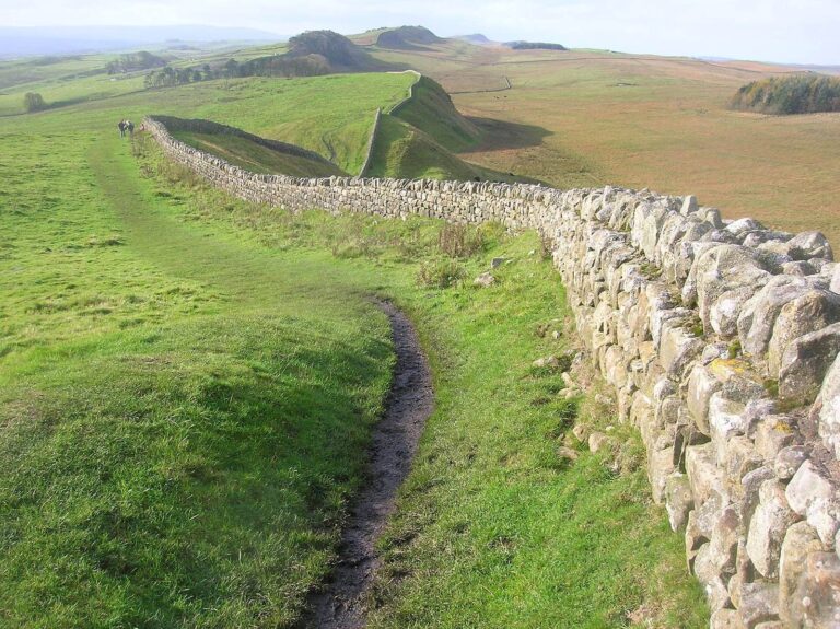
The Stanegate ran for about 61 kilometres from Corstopitum at Corbridge to Luguvalium at Carlisle, following an east–west course through hilly country and across the Tyne, Irthing, and Eden valleys. It passed close to the later line of Hadrian’s Wall, which lay farther north. Its course bends more than that of many Roman roads, following easier gradients in places; later alterations adapted sections more closely to the terrain.
Course and road construction
At Corbridge the road met Dere Street, the Roman route running north from York. West of Corbridge it crossed the Cor Burn and followed the Tyne’s north bank towards the North Tyne near Wall. A bridge probably carried it across the North Tyne to Newbrough. From there it ran alongside the South Tyne to Vindolanda, passed just south of the fortlet at Haltwhistle Burn, then turned to Magnis at Carvoran, where it met the Maiden Way from the south. From Magnis it followed the Irthing past the fortlet at Throp to Nether Denton, then continued by Castle Hill at Boothby and Brampton Old Church. After crossing the Irthing near Brampton, it passed through Irthington and High Crosby and crossed the Eden near Carlisle’s cricket ground before ending at Luguvalium, on the site of Carlisle Castle.
The road’s full extent is uncertain. It may have continued about 7.2 kilometres west of Carlisle to the fort at Kirkbride, overlooking Moricambe Bay. A large temporary fortified camp, about two hectares in area, lies there, and a river port may have been called Portus Trucculensis. Laser-based terrain imagery also indicates a western extension. To the east, proposals extend the route from Corbridge towards Newcastle, known in Roman times as Pons Aelius, and possibly to the fort at Washing Wells near Whickham. The suggested forts at Wreckenton and Washing Wells do not establish a continuous frontier line to the coast.
Road construction varied along the route. At Corbridge, an examined section was 6.7 metres wide, with covered stone drains on both sides. Its foundation included a 150-millimetre layer of larger stones topped by 250 millimetres of gravel. At Haltwhistle Burn, the road was about 8 metres wide, excluding its drainage ditches; its surface combined stone paving with several layers of gravel. The Stanegate was substantially wider than the military road later built near Hadrian’s Wall.
Forts and frontier stations
Forts and fortlets
The identified military sites, from east to west, include Corstopitum, Newbrough, Vindolanda, Haltwhistle Burn, Magnis, Throp, Nether Denton, Castle Hill at Boothby, Brampton Old Church, and Luguvalium. The arrangement suggests a pattern in which larger forts for cohorts, smaller Roman military units, alternated with smaller forts and additional stations. Newbrough covered less than 0.4 hectares and stood about 12.1 kilometres from Corbridge and 9.7 kilometres from Vindolanda. Nether Denton covered about 1.2 hectares, roughly 7.2 kilometres from Magnis and 39.4 kilometres from Corbridge. Brampton Old Church was about 9.7 kilometres west of Nether Denton and 49.1 kilometres from Corbridge; around half of its fort lies beneath Old St Martin’s church and graveyard.
Watchtowers and other installations
Watchtowers stood beside the road or on nearby heights, where they could oversee the ground between military positions and transmit signals by light and smoke. Pike Hill and Walltown Crags later became towers in Hadrian’s Wall. Other proposed installations include small forts at High Crosby and Castlesteads, and western stations at Burgh and Kirkbride.
Visible sections
A large cutting marks the Stanegate at Crosby-on-Eden. Near Carlisle Airport, a curved corner of a Roman marching camp, a temporary fortified camp for troops on campaign, is visible at the southern edge of the runway near its western end. A substantial stretch of the ancient road remains in use as a minor modern road between Fourstones and Vindolanda. Another section north and west of the Vindolanda excavation area can still be driven.