Housesteads Roman Fort: Vercovicium on Hadrian’s Wall

Site at a Glance
- Rating
- 4.6
- Popularity
- Medium
- Country
- United Kingdom
- Primary era
- Classical
- External website
- Open
- Eras represented
- Classical, Early Modern
- Civilizations
- Roman
- Site type
- Military
- Remains
- Fort
On this page26 sections
History
Housesteads Roman Fort, ancient Vercovicium, is an auxiliary fort in the United Kingdom near Hexham, on the central sector of Hadrian’s Wall in Northumberland. Built by the Romans around AD 124 during the early imperial frontier period, it controlled the valley of the Knag Burn and defended the northern frontier. The fort was occupied for nearly three centuries, from about AD 122–124 until around AD 400, and is regarded as one of the best-preserved and most extensively displayed Roman forts in Britain.
Foundation on Hadrian’s Wall
Hadrian’s Wall began in AD 122 on the orders of the emperor Hadrian. The first work at Housesteads consisted of Turret 36B, a small watchtower between milecastles, and the broad foundations of the Wall. A change in plan led to the turret’s demolition and the construction of a stone fort over the earlier works, probably around AD 124. Housesteads was among the earliest forts established along the frontier.
The site occupied the eastern end of the Whin Sill crag, between the valleys of the Knag Burn and Bradley Burn. Its position commanded the valley and made the northern approach difficult. The fort replaced Vindolanda, an earlier frontier centre on the Stanegate road about 3 kilometres to the south-west. Nearby sandstone and limestone sources supplied building materials, and Roman quarries and lime kilns operated around the fort.
Construction began before Hadrian’s Wall was continued westward beyond Housesteads and Milecastle 37. A cremation burial in the north-west corner suggests that the fort may have been built more than a year before this section of the Wall was completed.
Garrison and religious life
Housesteads remained occupied when the emperor Antoninus Pius ordered the construction of the Antonine Wall in Scotland. Much of the garrison of Hadrian’s Wall moved north, but soldiers continued to occupy Housesteads, and the Tungrian cohort returned after the Antonine Wall was abandoned from about AD 160.
The garrison changed over time. During the second century it included a double-strength auxiliary infantry cohort whose original identity is uncertain, together with a detachment of Legio II Augusta, one of the Roman legions stationed in Britain. Around AD 205–208, the fort contained Cohors I Tungrorum, nominally 1,000 soldiers, the smaller formation known as the numerus Hnaudifridi, and the Frisian cavalry unit Cuneus Frisiorum. In late antiquity the garrison belonged to the limitanei, the frontier troops assigned to the defence of the Roman borders.
Religious activity formed an important part of life at the fort and its settlement. Inscriptions record dedications to Cocidius, a deity worshipped in northern Britain, as well as dedications made by Tungrian soldiers. Seven or eight temples and at least three shrines stood in or near the settlement. Their cults included Mars Thincsus, the Alaisiagae, Mithras, Silvanus, Cocidius, the Matronae, and probably a water deity.
Rebuilding and late Roman change
The fort was repeatedly repaired and altered during the late second and third centuries. Major rebuilding phases occurred around AD 197, 296, and 367, but the layout generally followed the original Hadrianic plan rather than being radically redesigned. Foundation instability required repairs to the north and south walls, while changes to gates, towers, barracks, and the main buildings reflected the changing needs of the garrison.
The civilian settlement, or vicus, reached its greatest extent between the late third and early fourth centuries. Incursions late in the fourth century led to its large-scale abandonment, and some residents probably moved into the fort, occupying buildings no longer needed by the reduced military force. The headquarters building became an armoury and smithy in the fourth century, while the hospital and granary were converted into accommodation for civilians.
The latest known inscription from Housesteads dates to AD 300. It is a fragmentary dedication to the reigning emperor, probably associated with Building XV near the east gate. The Notitia Dignitatum, a late Roman administrative document listing imperial offices and military commands, provides the last written record of the garrison. Around AD 400 it may have numbered only 200–300 men. By about AD 407, as Roman rule in Britain collapsed, part of the regular garrison withdrew, and the last Romano-British inhabitants probably left around AD 430. Some repairs may have continued after the military departure.
After Roman rule and archaeological investigation
Post-Roman activity included a possible early Christian chapel or burial chapel and a stone-lined burial place. The fort later became a ruin used for grazing and hunting. During the sixteenth and seventeenth centuries, the area was associated with Border Reivers and was known as a refuge for cattle thieves and raiders. A fortified farm building, or bastle, was built within the south gate during the sixteenth century. The modern name Housesteads comes from Housesteads Farm, a name recorded in the early modern period; the eighteenth-century farmhouse supplied the present site name.
Antiquarian interest grew during the eighteenth century. An unidentified visitor recorded the extent of the vicus in 1708, Alexander Gordon described its streets in 1724, and William Stukeley visited in 1725. His sketches and description brought the ruins to wider attention, and he called the site the “Tadmor of Britain.” John Hodgson directed trial excavations between 1822 and 1831, recording the remains in notebooks and illustrations.
John Clayton acquired Housesteads in 1838 as part of his Roman Wall Estate. He cleared later buildings and helped establish an early programme of excavation and conservation intended to prevent stone robbing and preserve the Wall monuments. Further excavation took place from 1898 to 1910, and R. C. Bosanquet produced the first overall plan of the fort in 1904. Eric Birley investigated the vicus in the early 1930s, although only six of its 27 known buildings were completely excavated. In 1945, Frank Simpson and Ian Richmond investigated the north wall and identified the foundations of Hadrian’s Wall and Turret 36B.
G. M. Trevelyan acquired the fort in 1930 and transferred it to the National Trust, which established a museum for the finds. A museum opened in 1951, the same year that conservation of the standing walls began. Later investigations by D. Smith, Durham University researchers under John Wilkes, Charles Daniels, John Gilliam, and James Crow clarified the fort’s plan and surrounding remains. James Crow identified a Roman water conduit in 1976, examined the terraces near Housesteads Farm in 1987, and investigated the Wall gate at the Knag Burn in 1988. Peter Hill’s 1995 mortar analysis showed that construction of the gates had been interrupted twice.
Archaeological work has revealed inscriptions, sculptures, animal bones, temples, and parts of the civilian settlement. A geophysical survey of the vicus took place in 2003. The fortifications and some internal buildings have been excavated and conserved, while most vicus foundations were reburied. The National Trust owns the site and English Heritage manages it. Hadrian’s Wall, visible directly from the fort, forms part of a UNESCO World Heritage Site. The Housesteads Museum, built in 1936 over a Roman vicus house and redesigned before reopening in 2012, presents finds from the military and civilian communities.
Remains
Fort layout and defences
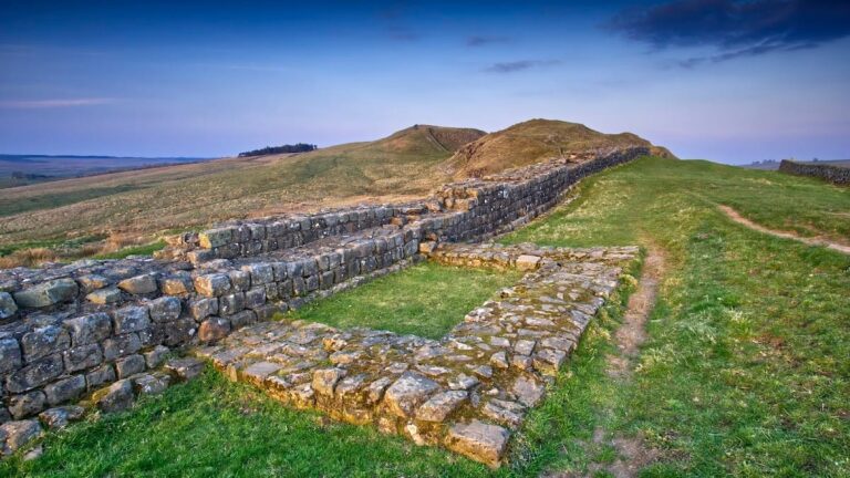
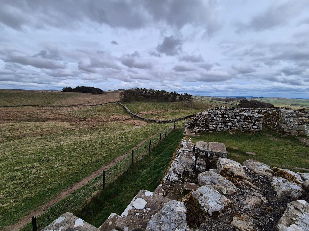
Housesteads occupies the eastern end of an approximately 1.6-kilometre-long crag. The ground descends towards the south and west, while a steep natural escarpment forms the northern edge. The stone-built fort is roughly rectangular with rounded corners, measures about 180 by 110 metres, and covers more than 2 hectares. Its long axis runs east to west, more precisely from east-north-east to west-south-west, an unusual orientation for a fort on Hadrian’s Wall.
The northern wall also formed the northern boundary of Hadrian’s Wall. The fort projected beyond the Wall on its southern side, while the steep terrain kept its northern forepart within the line of the frontier. Here the Wall was built in a narrow form on broad foundations, and its stone was later reused in the fort’s northern wall. The internal streets, the via principalis and via praetoria, divided the interior into three sectors. The central sector contained the headquarters, two granaries, the commander’s house, and the hospital. Barracks occupied the eastern and western sectors.
Walls and towers
The fortification wall is almost completely exposed and conserved. It is about 1.3 metres wide, with a rubble core faced on both sides by dressed sandstone blocks bonded with lime mortar. An earth ramp roughly 6 metres wide stood behind it, supporting the wall and providing a wall-walk. The wall may originally have reached about 4 metres in height.
A retaining wall about 1.4 metres wide was added for approximately 300 metres behind the unstable northern wall during the late second century. The earth ramp was rebuilt behind it. When the northern wall and retaining wall collapsed between the north gate and the north-east corner tower around the middle of the fourth century, an earth bank and timber palisade replaced them in that stretch.
Square corner towers stood inside the fort, with entrances at ground level. Some contained hearths, while the south-east tower included a bakery with two ovens. The north-east tower was replaced during the second century by a structure set slightly farther west and joined directly to Hadrian’s Wall. The Hadrianic fort had interval towers on the western parts of its north and south walls. Four smaller towers were added along the east side during the fourth century. Some later towers were rebuilt in timber. They may have been about 10 metres high, although their upper form, roofs, and parapets remain uncertain.
Gates and roads
Gates occupied all four sides. Each had two passages divided by a central pier and flanked by square towers containing guard rooms. The gates stood slightly behind the wall line and could be closed by double-leaved wooden doors. Architectural fragments suggest that a wall-walk ran above the passages.
The north gate is especially well preserved. Its central pier survives to five courses of stone, and a tank behind the western tower collected roof water. Because the northern slope was unsuitable for wheeled vehicles and difficult for riders, the western passage was later improved with a stone ramp and a higher threshold. The eastern passage was blocked with masonry and reused stones, including part of a Jupiter altar now held at Chesters Museum. From the fourth century, frontier traffic probably used the separate Wall gate at the Knag Burn.
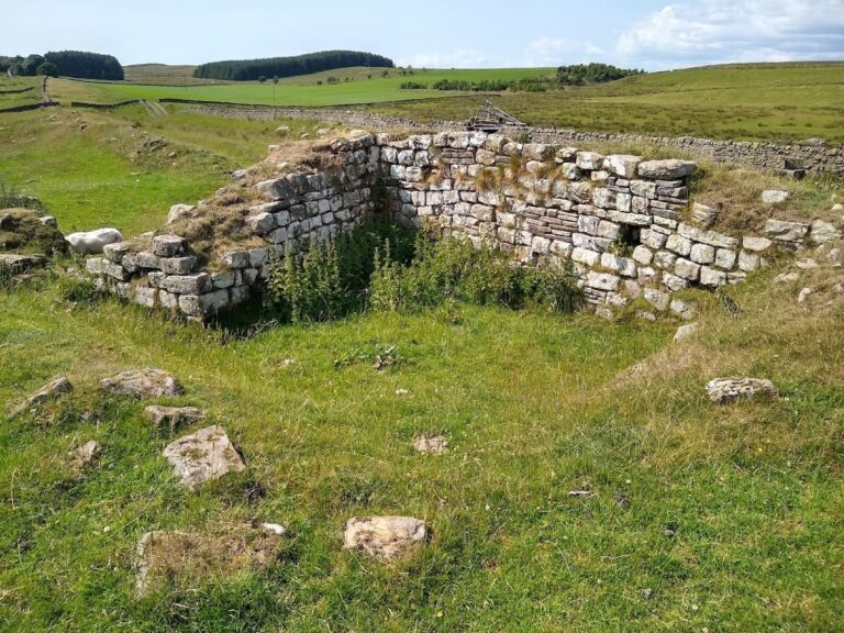
The south gate connected directly with the granary and north gate along the via principalis. One passage was later blocked, and the sixteenth-century bastle was built over the eastern tower. The gate ruin was used for corn drying during the seventeenth and eighteenth centuries. The west gate is also well preserved. The via decumana led from it towards the hospital, but both passages were blocked by the late Roman period. The southern passage retains a Severan-period threshold and door-stops, while its guard rooms later received heating.
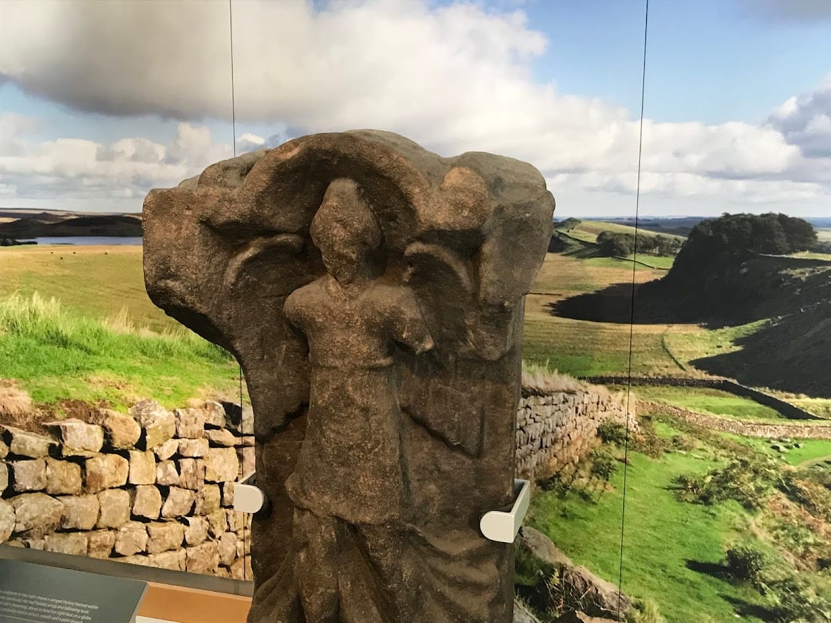
The east gate, or main entrance, was the porta praetoria. The via praetoria led from it to the headquarters. Pivot stones, wheel ruts, and thresholds survive, together with a late channel beneath the passage. A relief of Victoria found in the gate in 1852 probably belonged to a decorated panel above the outer arch. The southern passage was later blocked and may have become a guard room, while the south tower was used for storage.
Wall gate and water supply
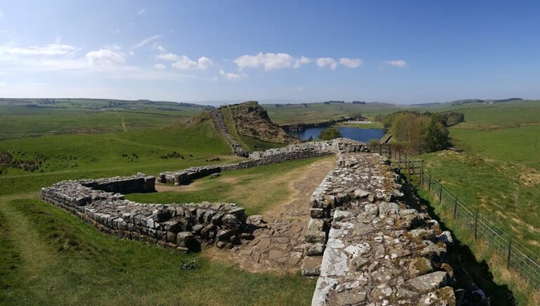
Turret 36B stood about 30 metres west of the north gate, between the fort wall and Building VI. It was demolished when the fort was constructed, but its foundations remain visible. A military road ran along the south side of Hadrian’s Wall and connected the east and west gates. From the west gate it continued towards Milecastle 37, about 400 metres away.
The Wall gate at the Knag Burn was established in the fourth century in a valley east of the fort because the north gate was unsuitable for wheeled traffic. The Knag Burn passed beneath the Wall through an opening west of the gate, one of the few extra-mural Wall passages not located at a milecastle or fort.
Housesteads had no stream running through the fort and depended mainly on collected rainwater. Seven cisterns stood along the defences. Built from reused stone slabs, they were sealed with lead between the joints and waterproof mortar on their floors, and some were secured with iron clamps. Several collected roof runoff from towers, while others received water from the streets. The largest, beside the south-east corner tower, held more than 2,000 litres. Water could also be obtained from the Knag Burn during dry conditions.
Military buildings
Barracks
Thirteen barrack blocks occupied the fort. These long rectangular buildings followed the fort’s east-west axis and stood in facing pairs around small courts. Sandstone foundations supported superstructures probably made with timber framing and wattle-and-daub partitions. Front verandas rested on timber or stone posts, and drainage channels ran along their fronts.
Each block normally contained ten two-room soldiers’ units, or papiliones. Larger head buildings at the ends housed the centurion and optio. Buildings XIII, XIV, and XV were fully excavated and remain visible. Building XIII probably dates from about AD 124 and remained in use for nearly two centuries. Its ten units could accommodate a centuria of approximately 80 men. A stone tank between the building and the north wall collected roof water, while the internal rooms were repeatedly altered during the second and third centuries.
Building XIV was rebuilt in the late third century after its earlier structure was demolished. It contained five small chalet-like huts for ordinary soldiers, a larger hut for an officer, and a smaller workshop. Narrow passages separated the huts, most of which had individual hearths. They may have housed two soldiers each. Buildings IV and XV may instead have served as a smithy and an armoury or store. Building XV, near the east gate, was extensively rebuilt in the late third century and became a large storehouse.
Headquarters building
The principia, the administrative headquarters of the fort, originated during the foundation period and was rebuilt in the third and fourth centuries. It was a single-storey building of approximately 632 square metres, set on an artificial terrace because of the slope. Its rooms included an eastern forecourt and aisle, a cross-hall or basilica, and western offices surrounding the flag shrine.
The entrance opened eastwards onto the via praetoria. The forecourt originally had colonnades on three sides, later blocked during rebuilding. Six columns separated the eastern aisle from the cross-hall, which was probably higher and covered by a pitched roof. The hall accommodated assemblies and military drill and contained a raised tribunal from which the commander addressed the troops.
The western rooms contained administrative offices and the aedes, the shrine for the unit’s standards, an imperial statue, and altars to the chief Roman gods. A treasury occupied another room, although the underlying rock prevented the construction of a basement. Heating was later installed in the western range, which may also have gained an additional storey and been used for weapons storage. More than 800 iron arrowheads were found there, some retaining fragments of wooden shafts. A large relief of Mars discovered near the entrance probably belonged to a larger stone panel.
Commander’s house and hospital
The praetorium, or commander’s house, was a multi-phase atrium residence built around an internal courtyard in an Italic-Mediterranean style. The north, west, and part of the east wing belonged to the Hadrianic phase, while the south and further east wing were added in late antiquity. The eastern entrance was probably protected from the prevailing wind, and the building had no upper storey.
Rooms around the courtyard included living quarters for the commander and his family, a kitchen with a masonry table-hearth and oven, a dining room heated by a hypocaust, a latrine, service accommodation, and stables. Waste from the latrine flowed through a drain. Finds included coins, a gold seal ring, and fragments of glass vessels. An apse in adjoining Building XI may have belonged to a bath.
Building XI, north of the commander’s house and west of the headquarters, is interpreted as a hospital, or valetudinarium. Its second-century form was rebuilt in the third century and consisted of four wings around a courtyard, probably surrounded by a low colonnade. A long room in the north wing may have served for treatment, while smaller rooms occupied the other sides. A latrine stood in the south-west corner. The arrangement and sanitary installations, together with a tombstone for Anicius Ingenuus, a Tungrian medical officer, support the hospital interpretation.
Granary and bath
Building VIII was a free-standing granary. A large single structure was later divided lengthwise into two equal units, each with its own walls and roof. It stood at the highest and driest point of the fort, with massive walls supported by fifteen pilasters. Raised wooden floors rested on rows of stone pillars, and slit openings in the lower walls allowed air to circulate beneath stored grain and other goods. Two entrances with loading ramps opened onto the via principalis.
The visible remains belong mainly to the late third century and represent four building phases. The structure may have held grain, food, weapons, or supplies collected as the annona militaris, the provisioning system for the army. In the late fourth century, a small bath was inserted into its north-east corner, probably replacing the bath outside the fort. One room contained a changing area and cold bath, while another held a heated bath over a hypocaust. Stone supports for the raised floor survive, as does reddened limestone from the furnace that heated water in a bronze cauldron.
Latrine
The communal latrine stood in the south-east corner at the lowest point of the fort. Its rectangular building had four outer walls, a U-shaped drainage channel, and a central stone platform. The entrance was on the east, and the roof probably sloped northwards. The channel fell about 1.5 metres over a distance of 1 metre and carried rainwater around the platform. Three higher cisterns supplied flushing water, while two lead-sealed overflow channels crossed the north wall before the outlet reached the area beside the south-east tower.
Beam holes show that seats were fixed along the north and south sides. Two stone troughs and two water channels on the platform were used to rinse cleaning implements. A further latrine may have occupied the unexplored south-west part of the fort.
Civilian settlement and religious buildings
The vicus and annex
The vicus extended south, east, and west of the fort in a broad arc. Its buildings clustered along a north-south road connecting the fort with the Stanegate. Twenty foundations were exposed during work in the 1930s, although the settlement’s exact foundation date is unknown. Houses, smithies, shops, stables, and taverns stood on artificial terraces. Most were simple one-storey strip buildings with wattle-and-daub walls on rubble foundations, while some were built entirely of stone. One substantial building had a west wall up to 1.8 metres thick at its base.
A 105-by-97-metre annex south of the west gate was densely built and bordered by the southern ditch and additional ditches on its other three sides. Its access may have been through a single gate. The conserved foundations of six buildings remain visible near the south gate, while foundation trenches mark others near the east gate. The building called the Murder House contained the skeletons of a middle-aged man and woman beneath a clay floor behind a probable shop. A broken sword or knife point lay between the man’s ribs. Their deaths took place shortly before AD 367, but the circumstances and the identity of whoever buried them are unknown.
Bathhouse and spring sanctuary
The extra-mural bathhouse stood about 90 metres east of the fort on a terrace above the Knag Burn. It measured approximately 10 by 8 metres, although a 1932 probe showed that it extended about 4.5 metres farther north. Later stone robbing badly damaged the building, and one wall survived to ten courses. It probably served both soldiers and civilians. Its remains are now mainly identifiable from aerial images, and the small bath installed in the granary probably replaced it.
The nymphaeum, or spring sanctuary, lay south of the settlement on Chapel Hill. Its small semicircular cult area measured about 4.8 by 3.9 metres and was enclosed on the north-west by a curved stone wall. A spring emerged about 2 metres below ground and was enclosed by four large stone slabs. Two uninscribed altars were found there, while coins and pottery indicate use from the middle of the second to the early fourth century.
Temple of Mars Thincsus
A small round temple of Mars Thincsus and the Alaisiagae stood on Chapel Hill. Its rough foundations were made from rubble mixed with earth and building debris, and its walls were probably timber framed. The interior measured about 3.9 metres across and covered approximately 5.4 square metres.
A relief-decorated stone arch over the entrance showed Mars, his companions, and Victoria. The temple was built in the early third century over a workshop probably destroyed during an incursion around AD 196. Its altars included dedications naming Beda, Fimmilena, Baudihillia, and Friagabis.
Mithraeum
The Mithraeum, a sanctuary of the Roman mystery deity Mithras, was discovered west of Chapel Hill outside the fort in 1822 and first excavated by Robert Bosanquet in 1898. It measured about 14 by 5.45 metres and was partly sunk into the ground. Its brick walls survived to a maximum height of approximately 66 centimetres and were plastered only on the east side.
An eastern vestibule opened into the main room, which had a 2.65-metre-wide central aisle and raised side benches about 1.65 metres wide. At the rear, a sanctuary niche contained altars and a relief of Mithras. The brick floor included a 2.33-metre-wide and 0.75-metre-deep recess. Water flooded the building for a prolonged period, probably from a spring to the north, which fed a masonry basin with two overflow channels. A charcoal layer probably represents a roof destroyed by fire.
The central Mithraic image, the tauroctony, showing Mithras killing a bull, was shattered, and the heads were removed from statues of the torchbearers and Aion. A relief showing Mithras’s birth from an egg surrounded by the zodiac remained largely intact and was positioned so that light could reach it from behind. An altar dedicated around AD 252 to Mithras by Gallus and Volusianus was found in 1900. Finds from the sanctuary are displayed at the Blackgate Museum in Newcastle upon Tyne.
Matronae shrine and surrounding landscape
A shrine to the Matronae, mother goddesses worshipped in parts of the Roman western provinces, stood south of the Wall ditch and east of the fort, between the Knag Burn and the eastern road to the Stanegate. Two altars were found there, one dedicated to the gods and goddesses and another to the mother goddesses of the Tungri.
Roman agricultural terraces survive on the surrounding hills, especially south of Housesteads. A metalworking workshop stood outside the east gate south of the military road, while lime kilns operated between the eastern fort wall and the Knag Burn. A quarry north-east of the fort at the western end of Kennel Crags supplied stone. Two Roman cemeteries have been identified, one south-west of the Mithraeum and another between the Stanegate road and the Knag Burn, south-east of the Matronae shrine.
Post-Roman remains and museum collections
Christian chapel and burial place
A possible early Christian chapel or burial chapel was excavated in 1898 between Buildings I and VII. It measured approximately 6 by 10 metres and had an unusually western apse. Its floor consisted of roughly fitted large stones and sandstone slabs, while the western apse wall was best preserved. The building has disappeared, but a stone-lined burial place found in a water tank north of it, west of Turret 36B, probably dates from the fourth to eighth centuries. This burial supports the interpretation of the apsidal building as a Christian burial chapel that may have been built by the late fourth-century garrison and used after the Roman military departure.
Bastle and later agricultural use
A bastle survives beside the south gate. This two-storey fortified farm building combined livestock accommodation on the ground floor with living space above. Its surviving features include stone steps and narrow windows. During the seventeenth century, a corn-drying installation was inserted into a gate guard room, preserving evidence of the fort’s later agricultural use.
Finds and interpretation
The site museum contains excavated finds and sculptures from Housesteads. Objects from the fort and its surroundings include altars, inscriptions, jewellery, tools, weapons, sculptures, arrowheads, coins, and animal bones from cattle, sheep, pigs, and red deer. A winged statue of Victoria was found near the fort. Together with the conserved buildings, these remains present the military and civilian communities that occupied this section of Rome’s northern frontier.
Nearby sites