City Walls of Florence: A System of Defensive Circuits
Site at a Glance
- Popularity
- High
- Country
- Italy
- Primary era
- Medieval
- Eras represented
- Classical, Medieval, Early Modern, Modern
- Civilizations
- Carolingian, Grand Duchy of Tuscany, Holy Roman Empire, Republic of Florence, Roman
- Site type
- Military
- Remains
- Wall
On this page30 sections
History
The City Walls of Florence are successive defensive circuits in Italy, beginning with a Roman enclosure built around 30–15 BCE for the colony of Florentia. Each expansion responded to changes in the city’s population, political standing, and military needs. The circuits are sometimes counted as six, but the total is disputed: some accounts exclude a separate Byzantine wall and do not treat the strengthening traditionally linked to Matilda of Tuscany as a new circuit, while other counts include a sixteenth-century reinforcement.
Roman Florentia and early medieval defenses
Archaeological excavation places the first Roman circuit around 30–15 BCE, earlier than previously thought. Florentia had about 2,000–2,500 inhabitants, perhaps rising to 10,000 at its most prosperous. As Roman rule declined, the defenses fell into disrepair and the city’s population contracted sharply. By about 550, after invasions and abandonment of parts of the settlement, Florence had roughly 1,000 residents.
In 550, Narses, a general of the Byzantine Empire, the eastern continuation of the Roman Empire, entered Florence with a Greek army and left a garrison. A separate Byzantine-era circuit may have followed, but it is also possible that defenses consisted of repairs to Roman walls or temporary works. Around 870, as the population grew to an estimated 4,000–5,000, a new circuit was probably established. Norman raiders had sailed up the Arno around 825, and Hungarian incursions affected northern Italy in the tenth century. Florence’s bishop and the count governing for the emperor may have promoted the new defenses.
The circuits of 1078 and 1172–1175
Florence’s defenses were strengthened in 1078, during a period of population and economic growth. Tuscan margraves, territorial rulers, increasingly resided in the city. Florence also served as the margraviate’s capital under Godfrey of Lorraine. The struggle between the papacy and the Empire formed part of the political background. Matilda of Tuscany, a powerful ruler involved in that conflict, acted as an arbiter, while fear of an attack by Holy Roman Emperor Henry IV and his German knights may also have encouraged the work.
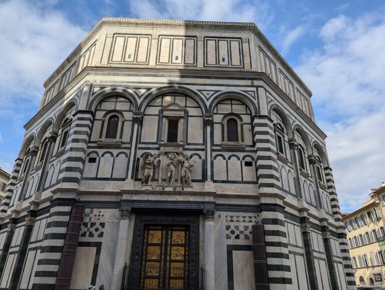
The city’s population was then estimated at 12,000–15,000, and building space was crowded. The circuit brought the Baptistery of Saint John and Santa Reparata within its defenses, as well as Altafronte Castle, which guarded the river port. Fortified family towers became more common as internal disputes intensified. Dante later referred to this boundary as the ancient circuit in the Paradiso.
Between 1172 and 1175, Florence’s self-governing commune began another circuit to take in growing suburbs along the old approach roads. The population had reached about 25,000–30,000. The expansion took place amid conflict in northern Italy associated with Holy Roman Emperor Frederick Barbarossa’s campaigns. Rural newcomers sought shelter in the suburbs, while some wealthy families built tower-houses beyond the earlier boundary because the old city was crowded and often unsanitary. The new enclosure nearly doubled the area and turned the city’s overall alignment by about 45 degrees. Florence eventually covered about 75 hectares and had an estimated 35,000–40,000 inhabitants.
In Oltrarno, the district across the Arno, the first defenses were a hurried enclosure rather than a masonry wall. After the Ghibellines, a faction associated with support for the Empire, were expelled in 1260, their tower-houses were demolished and some of their materials reused in later walls. An extension at the end of the thirteenth century carried the boundary as far as Via del Campuccio.
The great communal circuit
The commune began a much larger circuit in 1282 or 1284. It is traditionally attributed to Arnolfo di Cambio, with Andrea Pisano, Giotto, and other artists and architects also thought to have taken part. Florence’s population was at least 80,000 in 1280 and may have approached 100,000 early in the fourteenth century. The new boundary enclosed expanding suburbs and religious centers belonging to the Humiliati, Franciscans, Dominicans, Sylvestrines, Servites of Mary, Augustinians, and Carmelites.
Construction demanded major expenditure, but tolls on goods entering and leaving the city also made the gates a source of municipal income. Wars and other disruptions delayed the work, which was completed in 1333. Population growth slowed thereafter. Florence had nearly 100,000 inhabitants around 1350, then lost an estimated 30–50 percent of its population. It did not return to that level until about 1850. The slower growth left extensive space within the circuit available for cultivation, grazing, and gardens.
Medici-era defenses
The expulsion of the Medici in 1527 raised fears of military retaliation, and Florence’s walls were considered inadequate against artillery. In October 1528, Michelangelo inspected the exposed hill at San Miniato. The following January, he joined the Nine, the committee responsible for the city’s defense, and became chief commissioner of fortification works. He directed defenses near San Miniato, but the urgent threat and limited time restricted the work. After fleeing to Venice in 1529, he returned under a guarantee of immunity.
The siege began in October 1529, and Florence proved poorly prepared for firearms. Papal and imperial forces retook the city in August 1530 and restored Duke Alessandro de’ Medici. Michelangelo went into hiding, although the pope soon urged him to resume his work. After the republic fell, Alessandro commissioned military engineer Antonio da Sangallo the Younger to build the Mongibello bastion and Fortezza da Basso using contemporary methods. From 1534, the defenses developed into a bastioned system, with projecting works designed for artillery.
Under Cosimo I de’ Medici, the defenses were strengthened, particularly during the 1554 war against Siena. The Oltrarno line was doubled, and the city walls reinforced. Except for Porta San Niccolò, gates were lowered to make them less vulnerable to cannon fire and fitted with gun openings and defensive ramparts. Tuscany’s pacification soon made Cosimo’s inner Oltrarno defenses obsolete, and parts of that line were dismantled by 1571.
Under Cosimo’s son Ferdinand I, Bernardo Buontalenti built Forte Belvedere on the southeastern hill, opposite the low-lying Fortezza da Basso. The fortresses were intended to resist outside attack and to control a city that had previously rebelled against Medici rule. A covered route through the Vasari Corridor, Palazzo Pitti, and the Boboli Gardens gave the Grand Duke a way to reach Forte Belvedere in an emergency.
Demilitarization and urban transformation
In the eighteenth century, Grand Duke Pietro Leopoldo progressively demilitarized Tuscany, and military structures were abandoned or adapted only in part. New passages were opened in the eighteenth and nineteenth centuries, including Porta Nuove at the end of Via della Scala. Florence was the capital of Italy from 1865 to 1871. Beginning in 1870, Giuseppe Poggi’s urban renewal replaced the thirteenth-century walls north of the Arno with the Viali di Circonvallazione. In Oltrarno, avenues were laid alongside the walls.
From 2004, rows of bulbs were installed along old gates for Christmas lighting. The work involved drilling and inserting anchors, which drew criticism on the television program Striscia la Notizia. The heritage authority said it would investigate.
Remains
The surviving evidence belongs to several circuits rather than to one continuous wall. Their former lines can often be traced through Florence’s street plan, while archaeological remains, monumental gates, towers, and substantial wall stretches preserve parts of the defenses. The circuits differed in shape and scale, from the compact Roman enclosure to the broad medieval boundary and the later artillery works.
The Roman circuit
Enclosure and street plan
The Roman wall enclosed a roughly quadrangular area of about 20 hectares, with a perimeter near 1,800 metres and sides about 400 by 500 metres. Its northern course ran approximately from present-day Via dei Cerretani toward Piazza del Duomo; Via del Proconsolo marks part of the eastern alignment, and Via Tornabuoni part of the western. The southern side ran parallel to the Arno, outside the regular street grid. At the center of the grid, the forum lay at present-day Piazza della Repubblica, where the main north–south and east–west streets met. The north–south route followed the old Via Cassia. Large baths occupied the southern part of the walled area, and a theater lay beneath Palazzo Vecchio.
Walls, gates, and excavated traces
Brick walls stood on concrete foundations averaging two metres thick, with internal frame-like reinforcements. Towers with circular bases lined the circuit, especially near its four gates. Porta Praetoria stood to the north near the beginning of present-day Borgo San Lorenzo; Porta Decumana was on Via Calimala to the south. Porta Principalis Dextra lay at Borgo degli Albizzi to the east, and Porta Principalis Sinistra on Via degli Strozzi to the west. A ditch supplied by the Mugnone ran near present-day Via dei Fibbiai and Via del Castellaccio, probably discharging not far from Ponte Vecchio.
Excavations in 1994 uncovered a circular tower foundation on Via del Proconsolo, between Badia Fiorentina and Piazza San Firenze. Another tower was excavated in 1986 at the corner with Via Alighieri. A buried wall section is covered by the road, with its line marked in the asphalt and explained by a nearby panel.
Proposed Byzantine circuit
Possible alignment
If a separate Byzantine circuit existed, it may have shifted the defenses several dozen metres north, east, and west of the Roman line. The proposed route incorporated the tower-cistern of Hadrian’s Baths to the southwest, the Capitol to the northwest, and the theater to the southeast. Its eastern course has been associated with Via Sant’Elisabetta and Via de’ Cerchi; its northern course with Via del Campidoglio, Via dei Tosinghi, and Via delle Oche. The proposed western line followed Via dei Vecchietti and Via dei Sassetti, while the southern section, now lost, crossed the area of Piazza della Signoria. Suggested gates lay farther inward than the Roman entrances. The alignment remains uncertain.
Tower of Pagliazza
The circular-based Tower of Pagliazza, built from sandstone blocks and mixed materials taken from ruined Roman monuments, lies at the center of the proposed alignment. Archaeologists have questioned whether it belonged to the city walls and whether a distinct Byzantine circuit existed.
Carolingian circuit
Route and gates
The probable Carolingian circuit reused the Roman alignment to the east and west, turned north to leave out the future episcopal precinct, and extended south almost to the Arno. From near present-day Piazza Antinori, its route followed Via del Corso, Via del Campidoglio, Via dei Tosinghi, and Via delle Oche, then continued east along Via del Proconsolo and Via dei Leoni. From Piazza dei Giudici it ran south toward Via Lambertesca, followed that street and Borgo Santi Apostoli, and turned west along Via Tornabuoni. Its four gates were Porta Aquilonia on Via Roma, Porta Orientalis at Via del Proconsolo and Via del Corso, Porta ad Pontem on Via Por Santa Maria, and Porta Occidentalis at the junction of Via Tornabuoni and Via Strozzi.
Reused fabric and the margravial palace
Surviving sections of Roman wall may have been incorporated into this circuit, and some gates may have retained earlier positions. The Palazzo del Margravio stood just outside the defenses, approximately on the site of the present Archbishop’s Palace.
The 1078 circuit
Alignment and openings
This irregular quadrilateral had rounded corners that helped direct Mugnone water through the defensive ditches. Its northern side followed Via dei Cerretani from the corner of Via dei Rondinelli to Piazza del Duomo. The eastern line continued along Via del Proconsolo and Via dei Leoni to the Arno at Piazza dei Giudici; on the west, it curved by present-day Piazza Santa Trinita and followed Via Tornabuoni and Via dei Rondinelli. Openings on the north included the Alloro postern, a smaller subsidiary gate, the Porta del Vescovo, formerly Porta Aquilonia, and the Visdomini postern. To the east were Porta San Piero, formerly Porta Occidentalis, the Garbo, Pera or Peruzza, and Teuzo posterns, and the Santa Maria gate on Via Por Santa Maria provided access to the bridge. The western gates were Porta Rossa and Porta San Brancazio.
Enclosed landmarks
At the eastern end of the circuit stood Altafronte Castle, approximately where Palazzo Castellani now stands. The defenses also enclosed the religious complex of the Baptistery of Saint John and Santa Reparata.
The 1172–1175 circuit
Expanded outline and gates
Archaeological evidence for this circuit is scarce, but it indicates construction with river stones and reused material. The route can be followed in the present street layout. It extended north to include San Lorenzo for the first time, changing the outline from a roughly cardinally aligned quadrangle to a lozenge-like shape turned about 45 degrees. Northern entrances included Porta San Lorenzo on Via dei Ginori, the Spadai postern at the end of Via Martelli, Porta Balla on Via dei Servi, the Albertinelli postern on Borgo Pinti, and Porta San Piero or San Pierino at Piazza Salvemini. Along Via Verdi and Via Benci, where a ditch crossed the defenses, were Porta Ghibellina, Porta d’Isola d’Arno or San Simone, and Porta dei Buoi.
The route continued by Via dei Vagellai and Via dei Saponai, then ran near the Arno along Via Lambertesca, Borgo Santi Apostoli, and Via del Parione. Its openings there included the Arno postern, also called Porticciola, at Piazza Mentana, the Altafronte postern at Piazza dei Giudici, Porta Santa Maria, and the Carraia postern at Piazza Goldoni. To the west, the walls followed Via dei Fossi, Via del Giglio, and Via del Canto dei Nelli, with gates at Porta alla Carraia and Porta a San Paolo on Via Palazzuolo, as well as the Trebbio, Baschiera, and Campo Corbolini posterns.
Oltrarno enclosure
In Oltrarno, house walls without outward-facing openings and a quickly erected palisade formed the first defenses. The enclosure linked the gates from Via San Niccolò, where Porta Vecchia was later built, past the hill behind the buildings at Piazza dei Mozzi, where Porta Romana or Santa Lucia dei Magnoli stood, to Porta di Piazza at Piazza San Felice in Piazza. At first, it continued along Via Maggio to a gate at Piazza Frescobaldi, before Ponte Santa Trinita was built. Later it enclosed Santo Spirito to the east, followed Via Mazzetta and Via Sant’Agostino, and continued along Via dei Serragli to Porta Pisana or San Jacopo and the river by Ponte alla Carraia. A subsequent extension reached Via del Campuccio and included a gate on Via dei Serragli.
The great communal circuit
Wall scale and construction
The large municipal circuit enclosed about 430 hectares, compared with about 75 hectares within the preceding circuit. It extended roughly 8.5 kilometres and stood about six metres high, with 63 towers and 12 monumental gates. The gates were described as reaching 100 Florentine braccia, a historical measure equal here to about 35 metres, in height. North of the city, a diversion of the Mugnone supplied the moat.
Gates and wall defenses
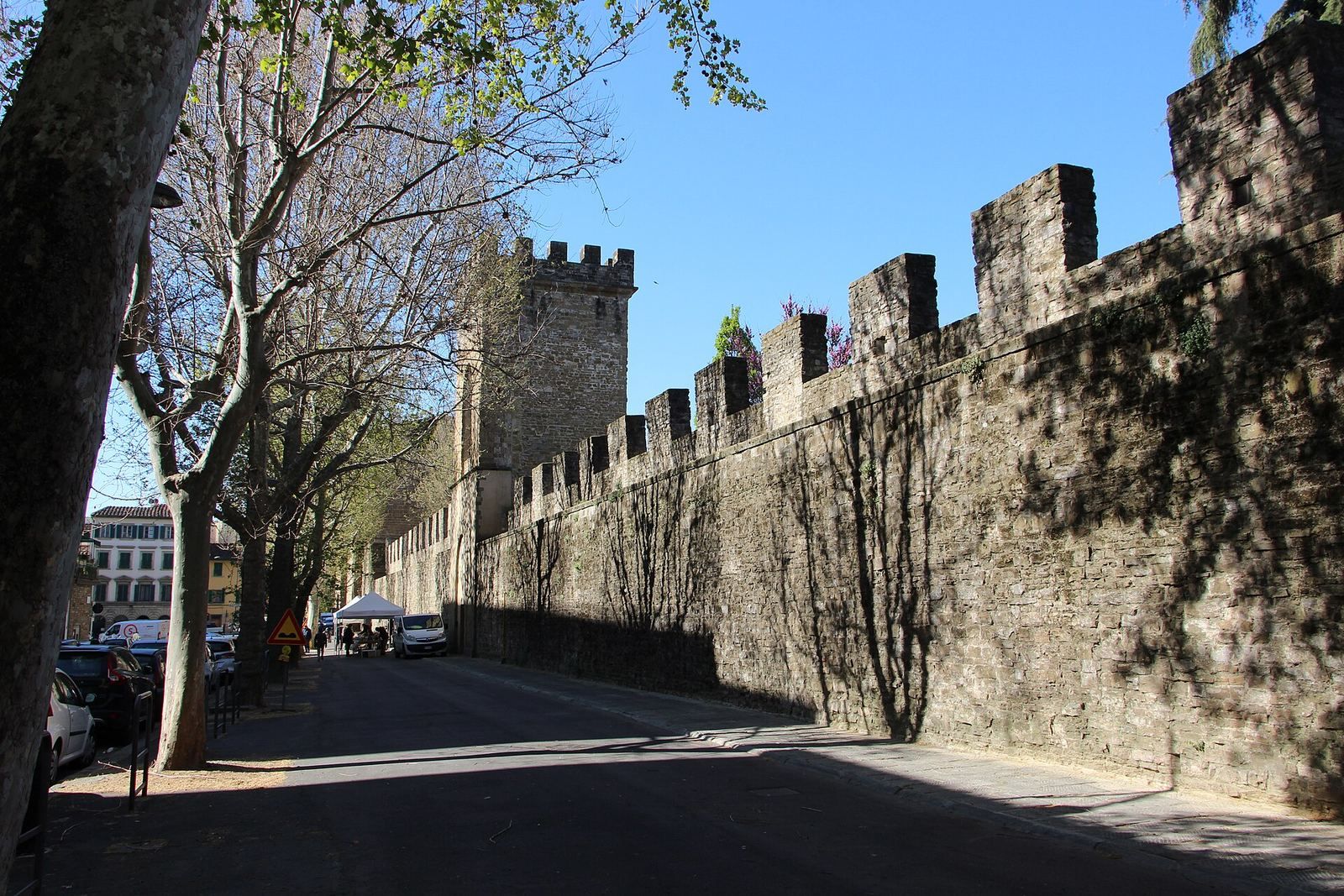
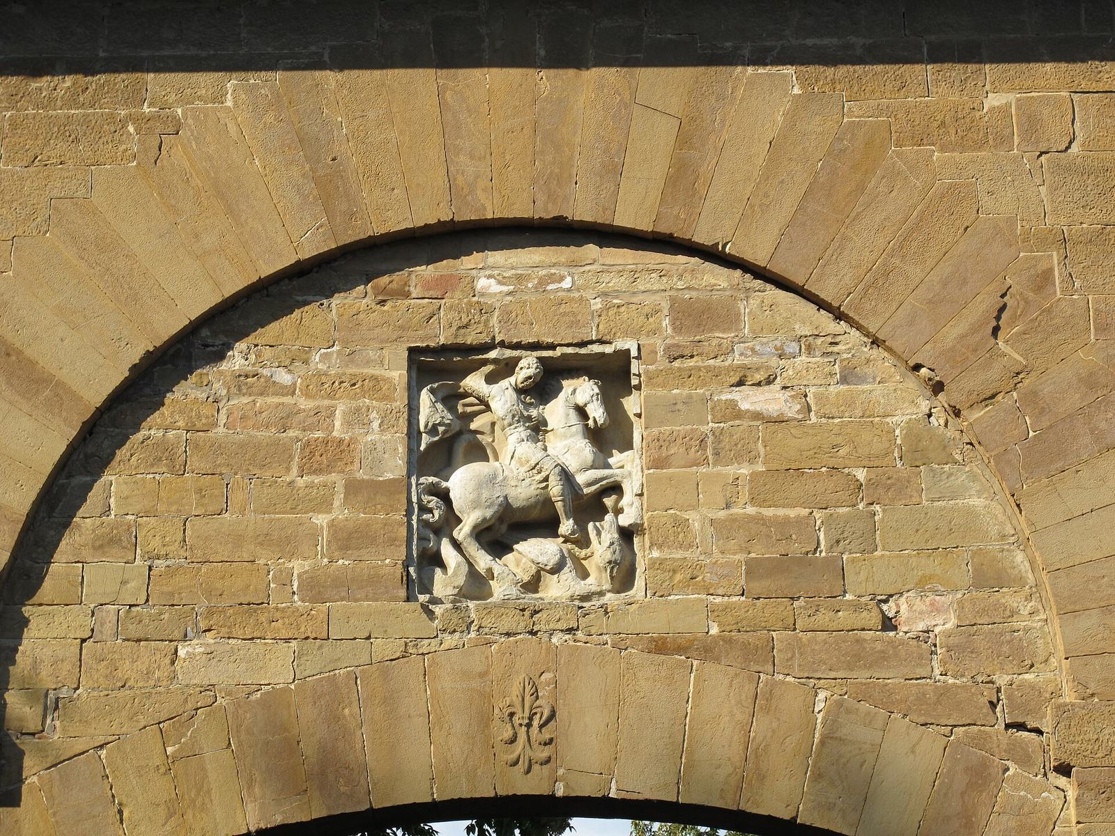
Each major gate had an outer defensive work and a drawbridge over the moat, and also served as a customs house. Lions and civic emblems adorned the exteriors, including the Florentine lily, the people’s cross, papal keys, and the Guelph eagle. The arched spaces above many portals contained frescoes of protective sacred figures, often the Virgin and Child with angels and saints. A patrol route ran along the top of the walls behind their rectangular crenellations, the raised blocks with gaps between them. Frequent openings in the walls allowed defenders to drop pitch or boiling oil onto attackers. Much of the enclosed land remained green, used for crops, grazing, and gardens.
Sixteenth-century fortifications
Michelangelo’s emergency works
Michelangelo’s proposals included secondary defensive lines, protected chambers called casemates, and enclosed defensive works known as redoubts. He envisaged masonry construction, and some plans survive as drawings at Casa Buonarroti. Under the pressure of the siege, defenses near San Miniato instead took the form of hastily raised earthworks reinforced with coarse fibers, straw, and unfired bricks. These emergency works did not realize the larger modernization program he had proposed.
Bastions and the Oltrarno line
The Mongibello bastion stood at present-day Piazza Piave. Cosimo I’s bastions included the Serpe, which defended the Arno’s right bank to the west, San Gallo around the gate of the same name, and Tre Canti at the corner of present-day Viale Gramsci and Viale Mazzini. All were dismantled in the nineteenth century. The San Giorgio bastion, also called Fonte della Ginevra, survives near Forte Belvedere and may have been designed by Michelangelo.
Cosimo I’s additional Oltrarno defense ran east–west near San Pier Gattolino and partly followed the twelfth-century circuit. The older wall remained in place, leaving an agricultural strip between the two lines. Sections of the inner walls survive in Torrigiani Garden.
Forts and the covered route
Forte Belvedere occupied the southeastern hill, while Fortezza da Basso stood in the lower ground to the north. The covered route connecting the Vasari Corridor, Palazzo Pitti, and the Boboli Gardens provided a protected link toward Forte Belvedere.
Nineteenth-century survivors
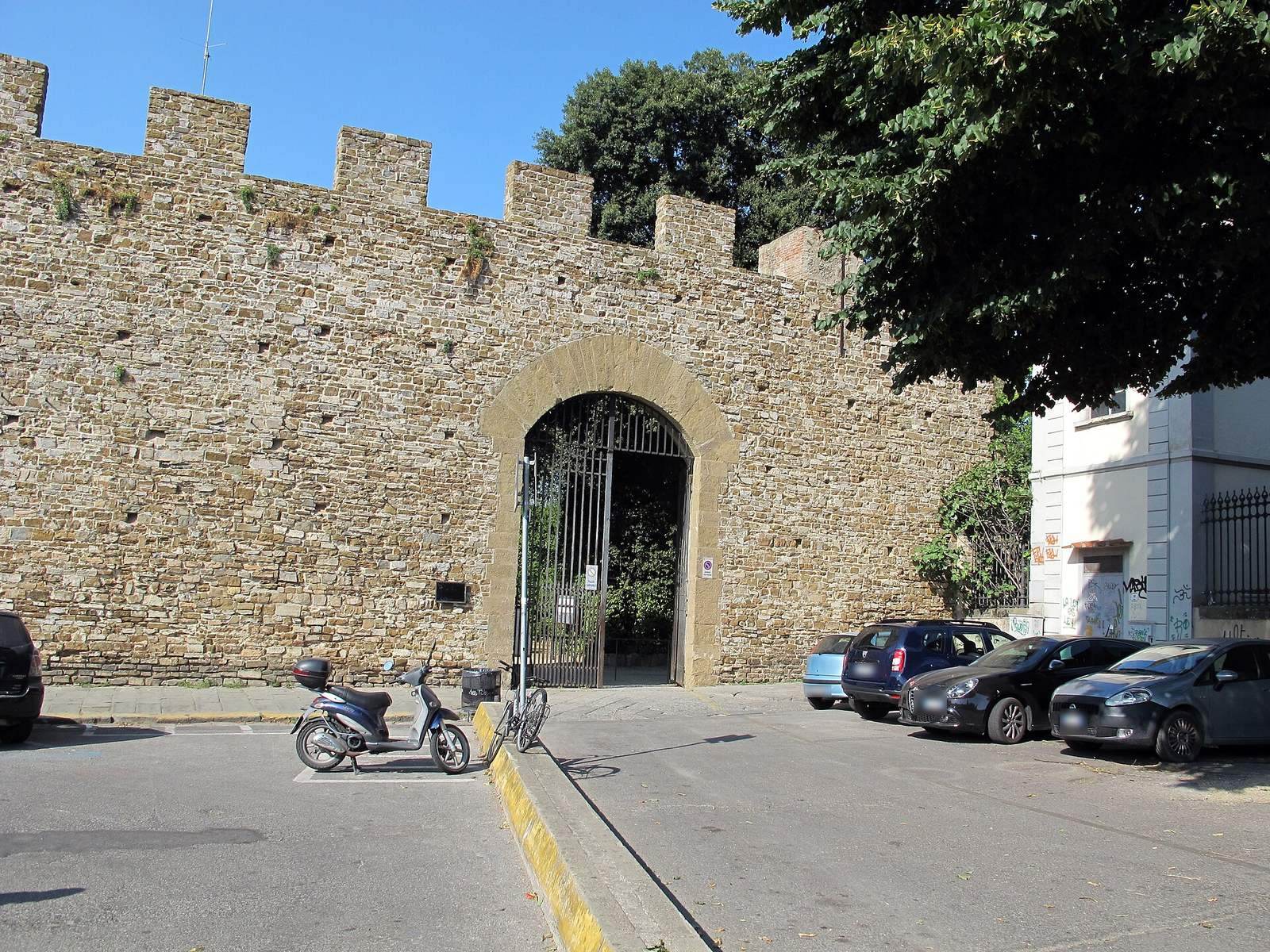
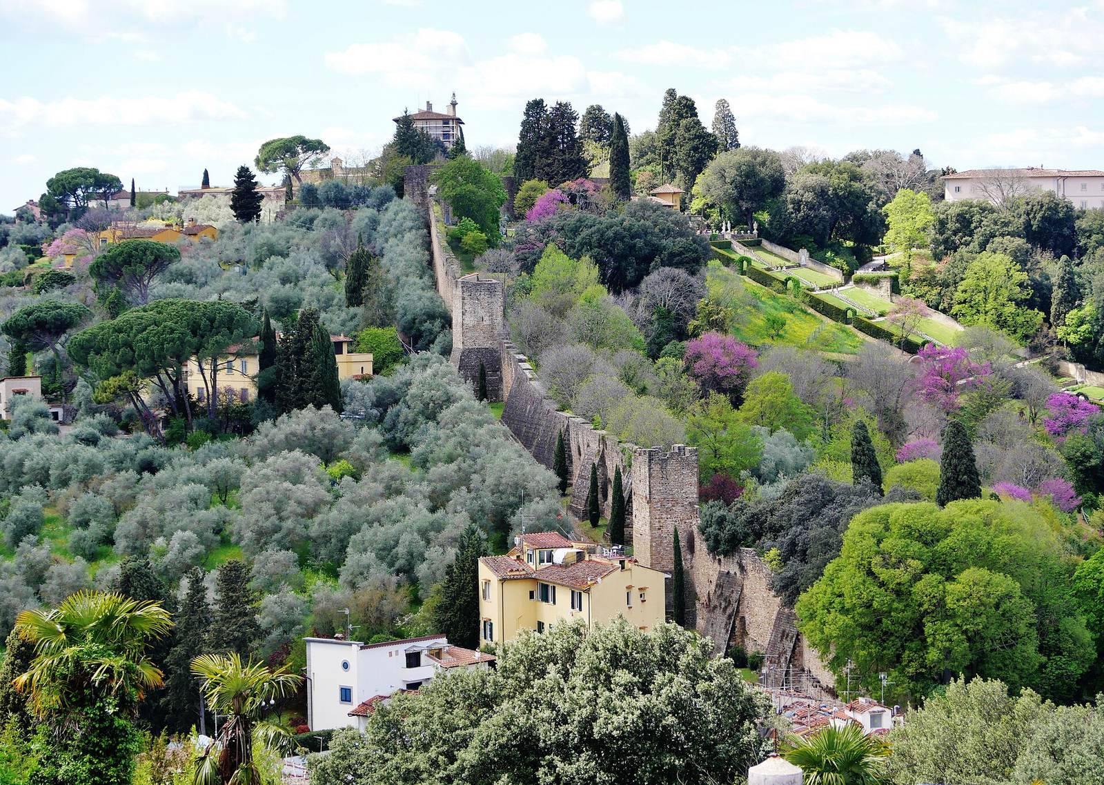
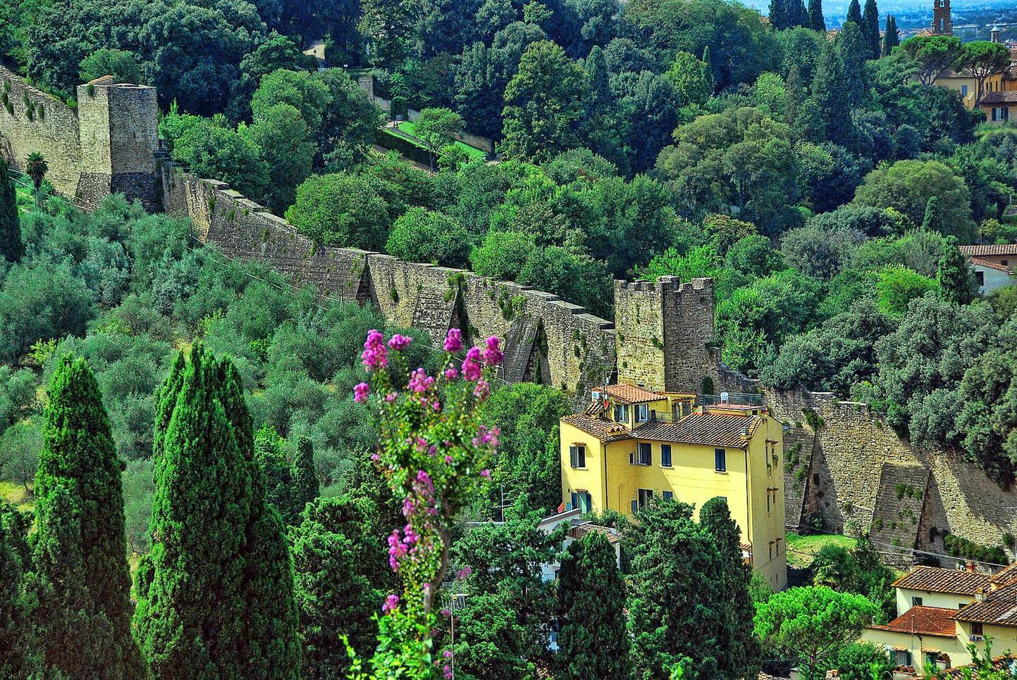
The north-bank walls were replaced by the Viali di Circonvallazione, laid out in the style of Parisian boulevards. Some towers and monumental gates remained and were incorporated into redesigned squares, including Piazza della Libertà and Piazza Cesare Beccaria. In Oltrarno, the avenues follow the wall line, where substantial, well-preserved stretches are still visible. Viale dei Colli forms part of the wider avenue ring to the south.