Gebel el-Silsila: An Ancient Egyptian Quarry and Sacred Landscape
Site at a Glance
- Popularity
- High
- Country
- Egypt
- Primary era
- Bronze Age
- Eras represented
- Bronze Age, Iron Age, Classical
- Civilizations
- Egyptian, Roman
- Site type
- Economic
- Remains
- Quarry
On this page25 sections
History
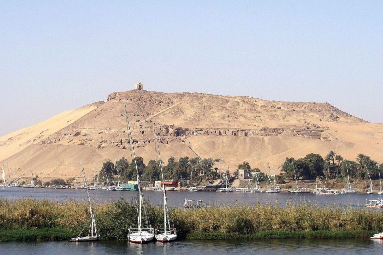
Gebel el-Silsila is an ancient Egyptian quarry and archaeological landscape on both banks of the Nile in Aswan Governorate, Egypt. Its sandstone supplied major temples and monuments, while its shrines and burials reveal a sacred landscape and a community connected with quarrying.
Early activity and the growth of quarrying
Human activity at Gebel el-Silsila predates its major stone industry. Prehistoric graffiti appears on both banks, and a predynastic cemetery lies on the east bank. Quarrying was under way by the Middle Kingdom, an era of ancient Egyptian history dated to about 2055-1650 BCE, and became increasingly important as builders turned to sandstone.
This shift away from mud-brick buildings faced with limestone was established by the New Kingdom, about 1550-1070 BCE. The quarries at Gebelein could not supply enough limestone for growing construction needs, while sandstone’s strength allowed builders to span longer distances with lintels. Extraction at Gebel el-Silsila continued through the New Kingdom, the Late Period, the Greco-Roman era, and into modern times.
New Kingdom quarrying and religious life
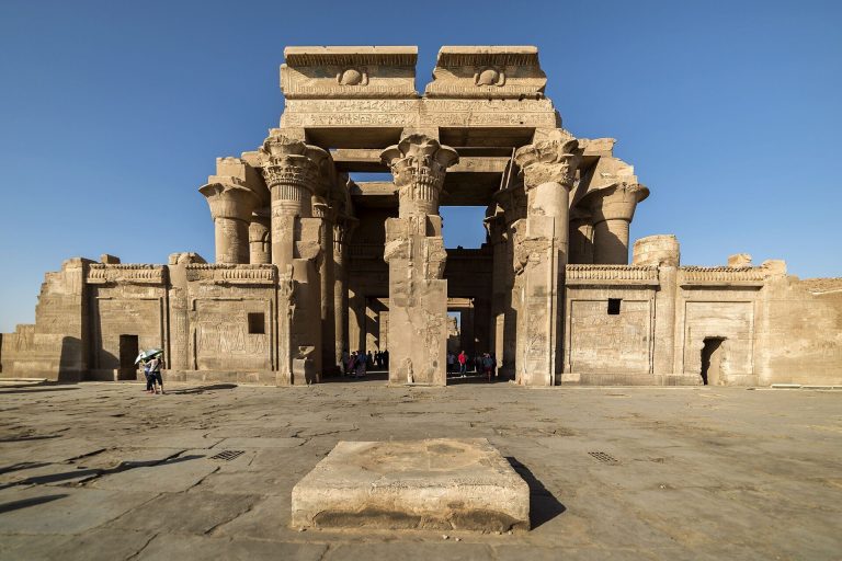
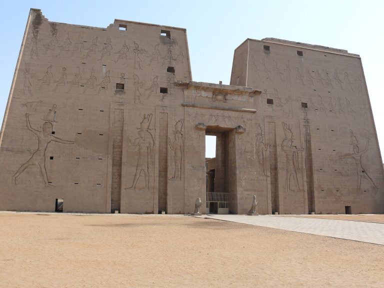
Gebel el-Silsila became a major source of stone for Egyptian building projects. Its sandstone went to temples at Karnak, Luxor, Medinet Habu, the Ramesseum, Dendera, Edfu, Kom Ombo, and Esna. Theban mortuary temples, which served rulers’ funerary cults, also used stone from the site from the time of Mentuhotep II. Akhenaten’s construction at Luxor and Amarna drew on these quarries as well.
Quarrying went hand in hand with religious and administrative activity. Officials overseeing stone extraction built shrines, and quarry workers lived in a settlement on the east bank. Burials from the nearby necropolis indicate that the population included families living at or near the quarries, rather than consisting only of temporary workers.
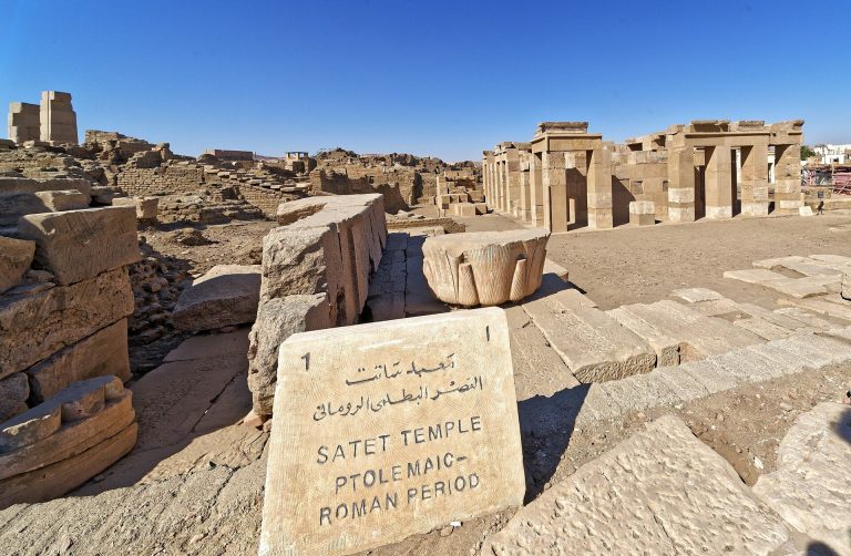
Sobek, an Egyptian deity associated with crocodiles and water, was the principal god of the site. Gebel el-Silsila formed part of the Kom Ombo nome, an ancient Egyptian administrative district. Its sacred landscape included chapels, shrines, rock-cut monuments, and the Temple of Sobek, also known as the Temple of Kheny.
Royal monuments and the Speos
The rock-cut temple called the Speos, meaning a temple cut into rock, was first created in the 18th Dynasty, particularly during Hatshepsut’s reign. It was substantially recut and redecorated under later Ramesside rulers, those of the 19th and 20th Dynasties. Graffiti from the Greco-Roman, Christian, and subsequent periods shows that people continued to mark the monument. Images of Sobek of Kheny were also deliberately defaced in an attack on this regional form of the god.
Commemorative monuments connect the quarry landscape with officials serving under Hatshepsut and Thutmose III. They include shrines and memorial tombs without bodies, known as cenotaphs, associated with User, Minnakht, Sennufer, Nehesy, Hapuseneb, and Senenmut. Inscriptions about Senenmut reflect Hatshepsut’s changing status: one calls her the “King’s First-born Daughter,” while others depict her as pharaoh. Later officials commemorated at Gebel el-Silsila included Panehesy, vizier to Merenptah, and Paser, vizier under Ramesses II.
Royal monuments record activity under rulers from Hatshepsut and Thutmose III through Amenhotep III, Akhenaten, Horemheb, Seti I, Ramesses II, Ramesses III, Ramesses V, Merenptah, Seti II, and Shoshenq I. An inscription from Akhenaten’s reign describes quarrying stone for the great Benben at Thebes, a sacred stone associated with solar worship. The opening of that quarry was overseen by the king’s sculptor, Bek.
Later phases and archaeological research
Quarrying and other activity continued beyond the New Kingdom. Possible stables on the east bank have been interpreted as facilities that supplied horses to Roman Caesars. The Temple of Kheny has early Thutmosid phases, possibly including Hatshepsut’s reign, followed by phases associated with Amenhotep III, the 19th Dynasty, and Roman times. Older records identified the remains as a destroyed Ramesside temple, partly because a stone block bore the royal name of Ramesses II.
The temple was rediscovered beneath sand and debris in 2015. It had been mapped by Ludwig Borchardt after being recorded between 1906 and 1925, but later became obscured. The Gebel el-Silsila Archaeological Project, established in 2012 by Egypt’s Ministry of Tourism and Antiquities and Lund University, has carried out excavation, inscription recording, biological study of human remains, digital documentation, and conservation. Its work has redated the Speos to Hatshepsut’s reign, recorded and analyzed thousands of inscriptions, and strengthened understanding of Gebel el-Silsila as both a sacred landscape and an industrial center.
Remains
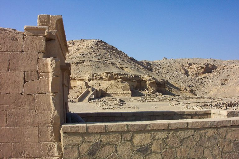
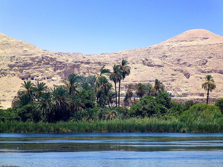
The site occupies both banks of the Nile where sandstone cliffs narrow the river to less than 400 metres across. More than 120 quarries, along with temples, shrines, royal inscriptions, and a necropolis, form a dispersed archaeological landscape shaped by centuries of extraction and religious activity.
Quarries and extraction landscape
Quarry faces and workers’ structures
The quarries consist of cut faces, trenches, spoil heaps, and blocks left unfinished during extraction or shaping. Some quarry walls rise to 40 metres. The east bank has 49 identified quarries; Quarry 34, the largest, has been surveyed in seven sections and contains 54 stone huts. The sandstone was valued for its quality and ease of extraction. East-bank stone is chiefly bound by quartz, while west-bank sandstone contains more carbonate mineral cement. Lighter and darker stone occurs on both sides, reflecting differences in iron-rich minerals.
Marks of quarrying and transport
Quarry marks and carved images help explain how stone was worked and moved. Some images have been interpreted as devices for lowering obelisks with ropes, and another depicts sandstone blocks being transported to temple sites. These features, together with the unfinished blocks and extraction cuts, preserve evidence of stone production on an industrial scale, especially during the 18th and 19th Dynasties.
West-bank temples and memorials
The Speos
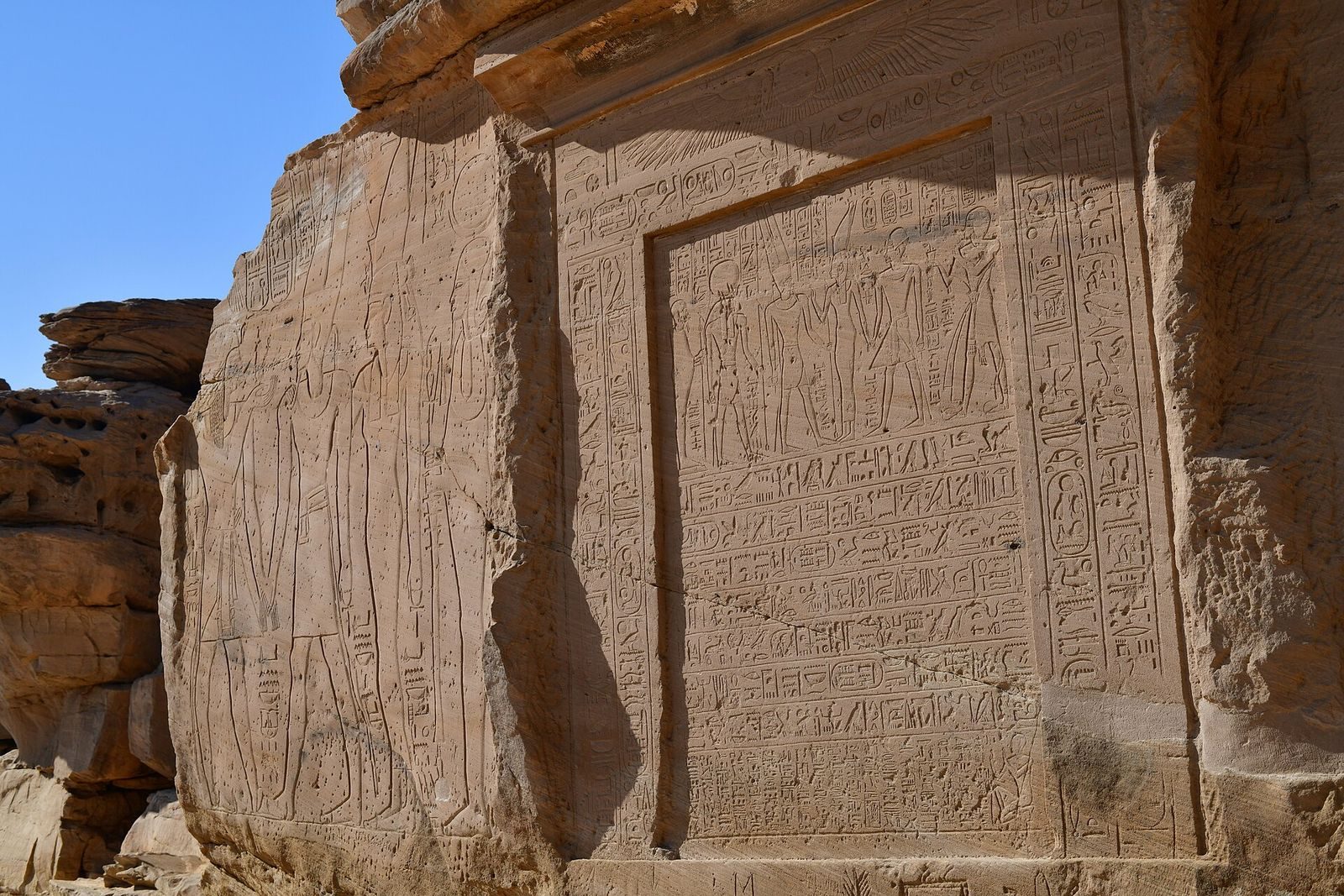
The Speos is dedicated to seven divine or royal figures: Amun, Mut, Khonsu, Sobek, Taweret, Thoth, and Horemheb. Its carved scenes show Ramesses III presenting Maat, the principle of truth, order, and justice, to Amun-Re, Mut, Khonsu, and Sobek, and in another scene to Anhur-Shu. Ramesses II appears with his vizier Neferronpet, offering Maat to Ptah and Sobek. A stele above the central doorway shows Seti II before Amun-Re, Mut, and Khonsu.
Panehesy’s southern chapel
The southern chapel at the Speos entrance is associated with Panehesy. Its stele shows Merenptah, Queen Isetnofret, and Prince Sety-Merenptah, who later became Seti II. Panehesy is depicted worshipping the king.
Paser’s northern chapel
The northern entrance chapel is associated with Paser. Its doorway stele depicts Ramesses II, Queen Isetnofret, and Princess-Queen Bintanath. The king offers Maat to Ptah and Nefertem.
Royal stelae south of the Speos
Four large royal stelae stand south of the temple. One shows Ramesses V before Amun-Re, Mut, Khonsu, and Sobek; another depicts Ramesses III offering Maat to Amun-Re, Mut, and Khonsu. A stele dated to year 21 of Shoshenq I shows Mut leading the king and his son Iuput before Amun-Re, Re-Harakhti, and Ptah.
Officials’ cenotaphs and shrines
South of the royal stelae are cenotaphs for the Scribe of the Treasury of Thutmose, the Overseer of the Seal of Min, an official named Maa, and the Scribe of the Nome Ahmose. User’s shrine lies to their north and records members of his family, including his father Amethu, also called Ahmose. Closer to the river are shrines associated with Minnakht, Sennufer, Nehesy, Hapuseneb, and Senenmut. Their inscriptions and memorials are linked mainly with the reigns of Hatshepsut and Thutmose III.
Shrines and stelae at The Pure Water
Three further rock-cut shrines are associated with Seti I, Ramesses II, and Merenptah. A stele of Ramesses III depicts him offering wine to Amun-Re, Re-Harakhti, and Hapi and gives year 6 of his reign. An adjoining stele shows Horemheb worshipping Seti I. The ancient name for this area was “The Pure Water.” Between the shrines of Merenptah and Ramesses II, another stele shows Merenptah and a son, probably Sety-Merenptah, offering Maat to Amun-Re in Panehesy’s presence. The son’s name is damaged.
The Temple of Kheny
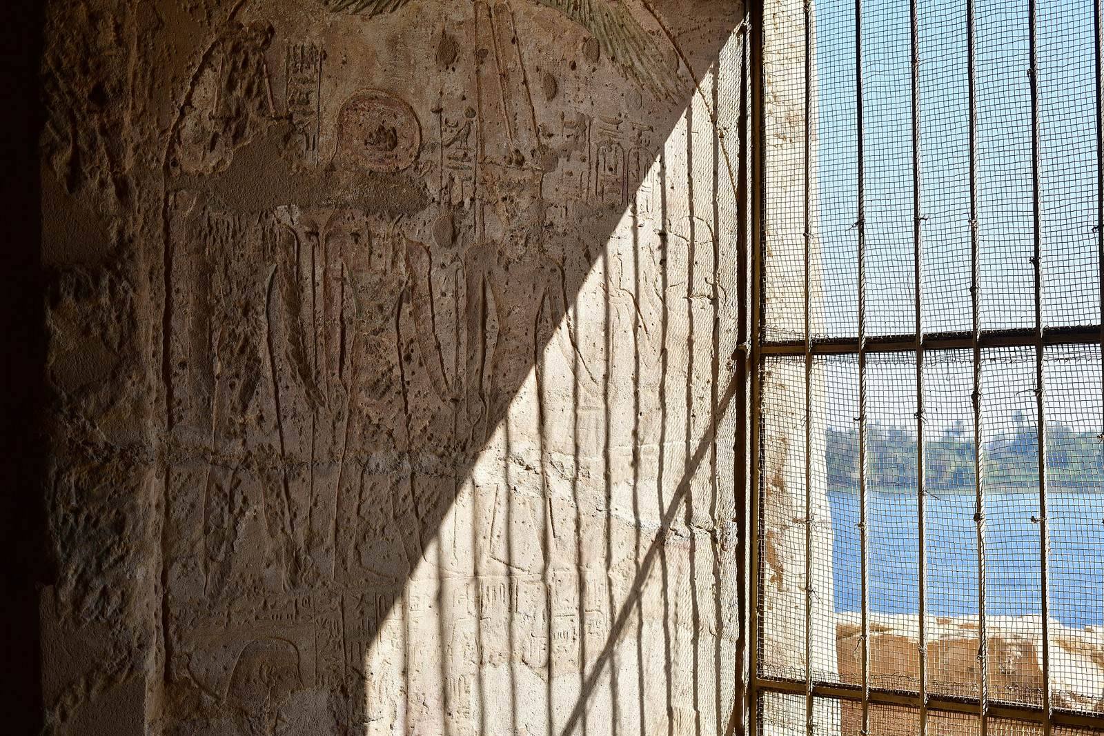
The Temple of Kheny stands on a sandstone outcrop near the northern edge of the east-bank site, below a colonial-era pump station. The Nile lies to the west, agricultural land borders the site to the north and east, and a modern canal runs south of it. Measuring about 80 by 40 metres, the complex follows a west-to-east axis, with its principal entrance facing the river.
Surviving features include foundations, traces visible at the surface, dressed floor levels, column bases, internal divisions, and a central platform. Builders used sandstone and limestone, with granite details and mud-brick construction also present. Limestone relief fragments stand out in this sandstone quarry setting. Excavations recovered nearly 3,000 fragments of relief, including blocks and inscribed pieces bearing royal names.
Other east-bank monuments
Amenhotep III shrine
A shrine of Amenhotep III has stelae on three sides. One shows an accompanying figure identified as the official Amenhotep, whose title was “Eyes of the King in the whole land.” A damaged stele dated to year 35 of the king’s reign depicts him before Amun-Re and calls him “beloved of Sobek.”
Stelae of Akhenaten and Seti I
One east-bank stele shows Akhenaten, named in its inscription as Amenhotep IV, before Amun-Re. Another, from early in his reign, depicts him offering to Amun beneath a winged sun disk. A Seti I inscription dated to year 6 shows the king before Amun-Re, Ptah, and a goddess. Another carving depicts Hapi, a fortress commander, worshipping the king’s royal name.
Kiosk and flood basin
A kiosk of Amenhotep III stands north of the quarry. A basin southwest of the kiosk was used when the Nile flooded. Other features across the east bank include gallery quarries, marks recording Nile levels, rock drawings from different periods, and two unfinished ram-headed sphinxes.
Ram-headed sphinx
A joint Swedish-Egyptian team uncovered a sandstone sphinx with a ram’s head and a lion’s body in 2019. Dated to Amenhotep III’s reign, it measures 16.4 feet long and 11.5 feet high. Finds associated with it included a rearing cobra emblem worn by Egyptian rulers, called a uraeus, and hundreds of inscribed stone fragments.
Necropolis
Rock-cut chamber tombs
Excavations begun in 2016 have recorded more than 80 burials containing at least 180 people; 33 rock-cut tombs have been excavated. Chamber tombs generally have one or two undecorated rooms and one or more burial chambers, or crypts, cut into the bedrock floors. Some retain parts of their original lids. Dressed slots in the entrance jambs held stone sealing slabs. Many tombs are reached from a quarried courtyard by steps descending into a roughly cut, squared chamber.
The excavated chamber tombs had been looted and left open, most since antiquity. Those disturbed in ancient times were later covered by as much as three metres of Nile silt, windblown sand, and fallen quarry debris, contributing to poor preservation.
Burials in fissures and beneath cliffs
Other burials are rock-cut crypts or the remains of infants and young people wrapped in textile or reed and placed in natural fissures or beneath cliff overhangs. Some were covered with bricks or laid in stone-lined burial structures. The burials include women, children, infants, and adult men. Study of the human remains found high infant and child mortality; the clustering of burials suggests family households living at or close to the quarry.