Kaymaklı Underground City: A Cappadocian Refuge and Settlement
Site at a Glance
- Popularity
- High
- Country
- Turkey
- Primary era
- Classical
- Eras represented
- Bronze Age, Iron Age, Classical
- Civilizations
- Hittite, Phrygian, Roman
- Site type
- City
On this page11 sections
History
Early excavation and Christian expansion
Kaymaklı Underground City is a subterranean settlement in Kaymaklı, Nevşehir, Türkiye, within the historical region of Cappadocia. The earliest cutting into the hillside may date to about 1300 BCE, during the Hittite period. Excavation of Kaymaklı and Derinkuyu is generally placed in the eighth century BCE, under Phrygian rule. Xenophon, a Greek historian and writer of the fifth and fourth centuries BCE, mentioned underground dwellings in the region, though he did not identify Kaymaklı itself.
Early Christian communities expanded the complex as a refuge from persecution and invasion. About 8,000 Christians fleeing Roman persecution found shelter there. From the seventh century onward, people also sought protection from incursions by the Umayyads and Abbasids, successive Islamic caliphates whose expansion brought military incursions into parts of Anatolia. Excavation and enlargement continued over centuries, creating a complex that extends through kilometres of galleries.
Names and modern history
The settlement was formerly called Enegüp and was later known to Greeks as Enegobi. After population movements in 1924, its name became Kaymaklı. A municipality was established there on 7 February 1919. Following the Greco-Turkish population exchange, a postwar transfer involving Greek Orthodox residents of Turkey and Muslim residents of Greece, Greek residents left and Kaymaklı became a village again in 1925. Approval to establish a municipality was granted on 4 January 1951.
The underground city was discovered in 1964, and part of it was subsequently opened. In 1985, Kaymaklı was included in the UNESCO World Heritage property covering Göreme National Park and the Rock Sites of Cappadocia, a designation recognizing places judged to have outstanding universal value.
Remains
Layout and levels
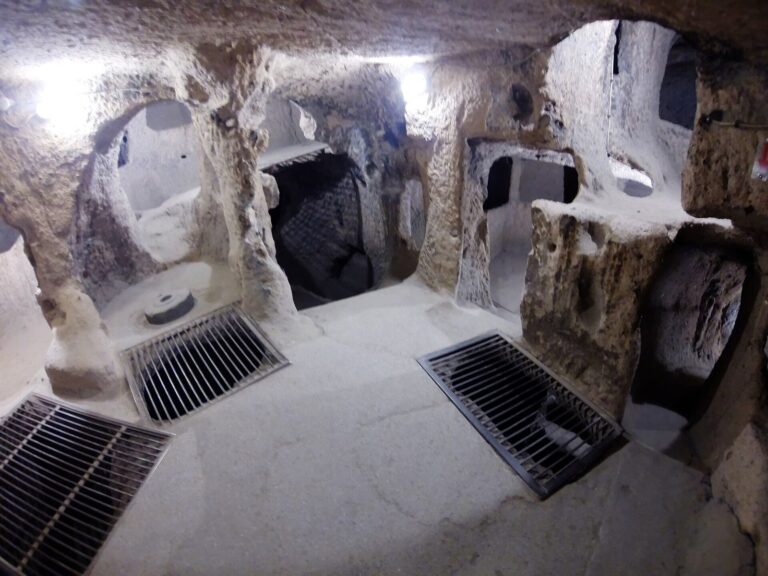
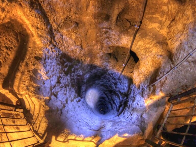
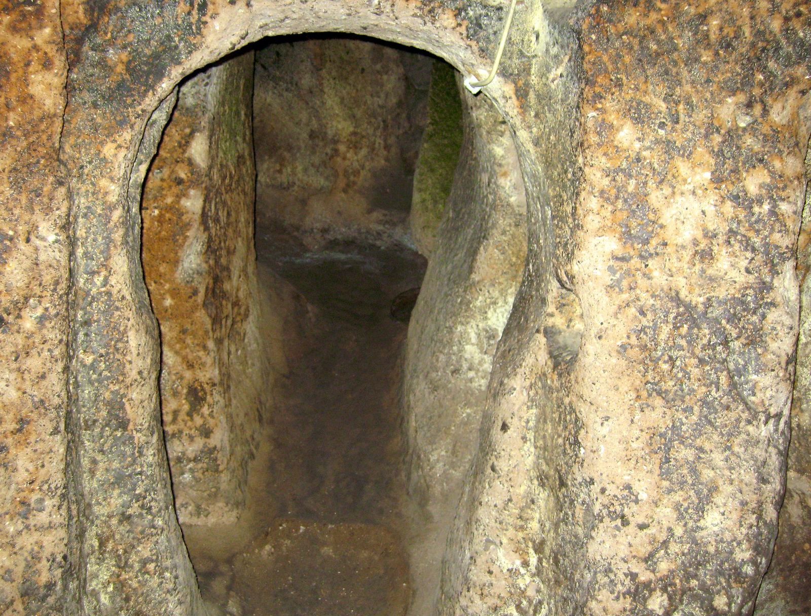
The settlement is carved into a hillside of porous, crumbly tuff, a rock formed from consolidated volcanic material. Houses are arranged around roughly 100 tunnels, some used for storage, stables, and barns. Compared with Derinkuyu, Kaymaklı’s tunnels are lower, narrower, and more sloping. Rooms and open spaces are organized around ventilation shafts. Four levels descend to about 20 metres underground, while a further four appear to extend below them. Kaymaklı is among the largest underground settlements in the region.
Upper levels
Entrance-level rooms and church
A small stable stands at the entrance on the uppermost level. A passage to its left leads to a church and is closed by a millstone-shaped stone door; rooms to the right were probably used as dwellings. The stone doors were made from rock harder than tuff, brought in from outside through openings that were later sealed. They measure about 55 centimetres thick and 1.65 metres in diameter, and weigh approximately 500 kilograms.
Second-level church and tombs
A church on the next level has a nave, its main central space, and two apses, recessed sanctuary spaces. A baptismal font, a basin used for Christian baptism, stands opposite the apses, and stone benches line the walls. Names inscribed on tombs correspond to names found near the church, supporting the interpretation that the graves belonged to religious figures. Other rooms occupy this level as well.
Lower levels
Third-level workspaces
The third level contains storage rooms, wine and olive presses, and kitchens. It also holds a relief-decorated block of andesite, a volcanic rock, interpreted as a vessel for smelting copper. The block was cut from an andesite layer within the complex and has 57 holes, each about 10 centimetres across. Copper ore was placed in the holes and repeatedly hammered. The ore probably came from a mine between Aksaray and Nevşehir, also used by the Neolithic settlement of Aşıklı Höyük.
Fourth-level storage
The fourth level is divided into several rooms and includes a large area for storing clay jars. The extent of this storage has been interpreted as evidence of economic stability and an intention to shelter a large population.