Robinson’s Arch: A Herodian Overpass to the Temple Mount
Site at a Glance
- Popularity
- High
- Country
- Israel
- Primary era
- Classical
- Eras represented
- Classical, Modern
- Civilizations
- Roman
- Site type
- Infrastructure
- Remains
- Bridge
On this page14 sections
History
Herodian construction and Temple access
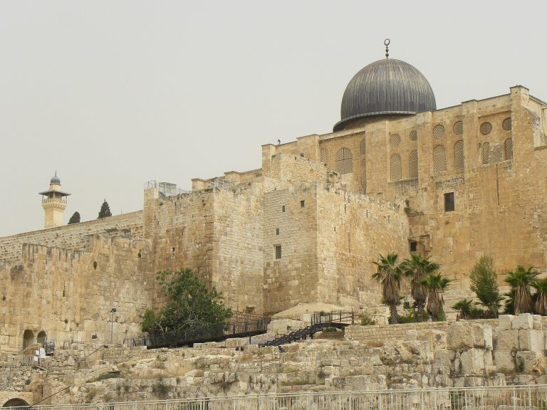
Robinson’s Arch is the remains of a monumental overpass at the southwestern corner of the Temple Mount’s western retaining wall in Jerusalem, Israel. Herod the Great, Rome’s client king in Judea, included it in his renovation and expansion of the Second Temple, the Jewish sanctuary in Jerusalem before its destruction by Rome. The project was announced in 20–19 BCE. The arch carried a monumental stairway and elevated street, connecting the Lower Market across the Tyropoeon Valley to a gate opening onto the Royal Stoa at the southern end of the Temple Mount platform.
This route served heavy public traffic to and from the Royal Stoa, a large hall used for commercial and legal affairs. The overpass stood beside a major intersection: a public square opposite it faced the Temple’s principal Hulda Gates, while shops lined the street through the Lower Market. Herod had built the Royal Stoa on an extension of the Temple Mount. Some people did not consider that extension sacred, allowing ordinary activities in the hall. The stepped street was about as wide as a modern four-lane highway.
Entrances and wartime destruction
Josephus, a first-century Jewish historian, described four western entrances to the Temple Mount enclosure. One gate is conventionally associated with Robinson’s Arch, though its position in Josephus’s list is uncertain: modern archaeologists commonly count it as the fourth from the left, while he may have counted from right to left. The Mishnah, an early compilation of Jewish oral law whose tractate Middot discusses the Temple, says only one western gate remained in use; the others may have been sealed. The identity of the Kiponus Gate is disputed. Benjamin Mazar proposed that it was Barclay’s Gate, also called the Mughrabi Gate, to the left of Robinson’s Arch. Other interpretations place it at Chain Gate, beneath which a bridge was supported by what is now called Wilson’s Arch. Warren’s Gate also served as an entrance, and its concealed passage is now used as a cistern about 11.5 metres below the present surface.
Josephus also described a bridge broken by insurgents during the rule of the Hasmonean dynasty, a Jewish ruling family, in the time of Pompey, the Roman general whose intervention brought Judea under Roman influence. The bridge may have led to an entrance that was later closed. A separate gate from the Antonia Fortress, a fortress beside the Temple precinct, was not normally used by the public. During the First Jewish–Roman War, the revolt against Roman rule that ended with Jerusalem’s capture in 70 CE, the Temple porticoes beside the fortress were demolished because of fears that Roman troops might use this entrance.
The overpass was destroyed during the Roman capture and sack of Jerusalem in 70 CE, only decades after its construction. The destruction is traditionally attributed to Roman forces, though another interpretation assigns it to Zealot defenders, Jewish insurgents who had taken and fortified the Temple Mount. Demolishing Robinson’s Arch and the viaduct at Wilson’s Arch made the Temple platform harder for besiegers to reach. Some defenders continued to resist in the Upper City for a month after the Romans breached Jerusalem.
Rediscovery, excavation, and modern prayer
The English artist and architect Frederick Catherwood noticed the remains before Edward Robinson identified them in 1838. Robinson connected the structure with a bridge described by Josephus and argued that it showed the great age of Jerusalem’s enclosure walls. Charles Warren investigated the site in 1867–1870 and initially interpreted a large stone support west of the wall as part of a bridge spanning the valley. Excavations led by Benjamin Mazar in 1968–1977 established that it supported a single large arch. Work directed by Ronny Reich and Yaacov Billig in 1994–1996 further exposed the collapsed complex, and Eli Shukron also took part in archaeological work at the site.
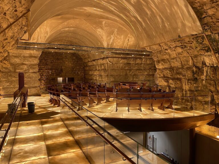
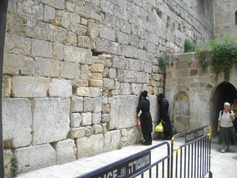
In 2003, Israel’s Supreme Court instructed the government to prepare the area for alternative, non-Orthodox prayer after women were barred from reading the Torah or wearing traditional prayer shawls at the Western Wall plaza. The area opened for services in August 2004 and has been used by Reform and Conservative groups and Women of the Wall activists. Some participants have considered the arrangement inadequate, citing restrictions on worship and access at the archaeological site and what they regard as unequal treatment. In April 2013, Jewish Agency chairman Nathan Sharansky proposed renovating the area below the arch for worship at all hours. Disputes over governance followed, and the government announced that a future appointed council including non-Orthodox representatives would oversee the prayer area.
In 2017, Israel’s High Court ruled that women could read from the Torah at Western Wall services unless the government showed good cause to prohibit it within 30 days. It also ruled that the government could no longer argue that the Robinson’s Arch area provided access to the Western Wall as grounds for opposing non-Orthodox prayer. In 2018, former Jerusalem district archaeologist Dan Bahat petitioned the court to halt construction at the site, warning that it could destroy archaeological evidence of the Temple’s destruction in 70 CE.
Remains
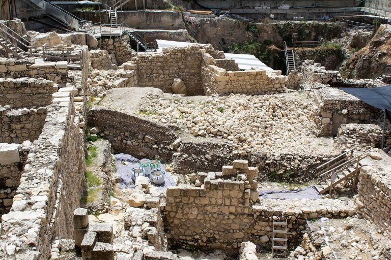
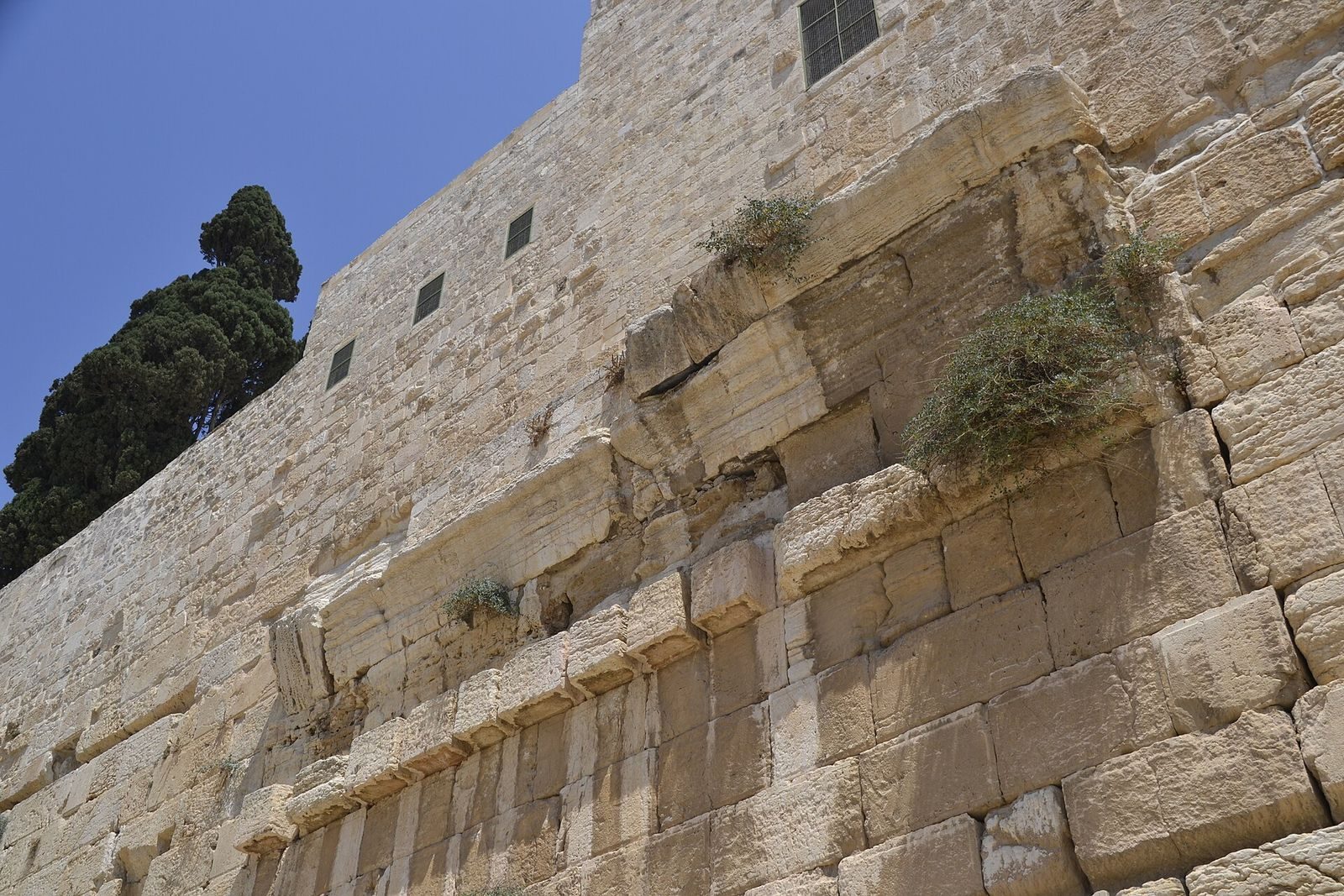
The surviving complex occupies the Temple Mount’s southwestern corner, where the retaining wall, a massive arch, and structures supporting an elevated stairway formed a route from the ancient street to a gate on the platform above. Built of local limestone, the remains include the arch’s western support, parts of the elevated street, stair stones, and evidence of associated buildings and vaulted supports.
The overpass and its supports
Arch and elevated street
The arch was incorporated into the western retaining wall, which formed its eastern support. It stood 12 metres north of the wall’s southwestern corner. Its span was about 15 metres and its width 15.2 metres; its recorded height is 21.25 metres, and it rose about 17 metres above the ancient street. The stepped street extended more than 35 metres over the arch and seven additional arches, carrying the approach toward the gate at the top of the Temple Mount platform.
Wedge-shaped stones formed the arch’s curve, rising from support blocks carved with a tooth-like pattern. Those cuts have been interpreted as part of a system for supporting wooden construction molds, though the pattern was also common regional decoration. Packed earth, rather than costly timber, is considered the likelier support used to shape the arch. At the point where it rose from its eastern support, four courses of stone survive: one row of support blocks and three rows of the curved arch stones.
Western support and vaulted structures
The western pier, a thick masonry support, measures 15.2 metres long and 3.6 metres wide and survives to a height of 5 metres. Four hollow spaces at its base may have been small shops opening onto the Herodian-era street. Stone lintels, horizontal supports above openings, remain in place and are arched to ease the weight pressing down from above.
The same support formed the eastern outer wall of a monumental building. Mazar suggested that it might have been Jerusalem’s archive, which Josephus mentions. South of the building, six piers supported vaulted spaces, or arched ceilings, and decreased in height along a distance of 35 metres. The building, vault supports, and arch carried the stairway from the street up to the Temple Mount gate.
Stairway and gate
Numerous stone steps have been found near the arch, with some still joined together. Fragments from the gate at the top of the overpass suggest an entrance about 5 metres wide, but do not establish whether it had one, two, or three openings.
Excavated finds and later features
Street deposits and collapse remains
The ancient street lay well below the level at which the remains were first identified, beneath destruction debris and later fill. Excavations below the street near the arch recovered three oil lamps of a type common in the first century CE and 17 identifiable coins, several struck by Valerius Gratus in 17/18 CE. These finds place construction of the arch and nearby wall sections after that date; the arch may not have been completed until at least 20 years after Herod’s death. Considerable remains of the overpass complex survive in the Jerusalem Archaeological Park, including collapse debris, stairs, and stones from rounded handrails. Some excavated stones remain visible where they were found.
Roman milestone
A Roman milestone, a stone marker used to identify a route or distance, was found south of the Temple Mount. It was fashioned from a handrail from the arch’s stairway and bears the names of Vespasian and Titus, Roman commanders during the revolt who later became emperors. The reused stone indicates that the arch had been destroyed by no later than 79 CE.
Isaiah Stone
The Isaiah Stone lies below the arch and carries a partial inscription in an early Hebrew script, based on a passage from the biblical book of Isaiah. Its wording refers to rejoicing and bones flourishing like grass, while the biblical passage refers to bodies. The inscription is tentatively dated to the fourth through eighth centuries CE, although a date as late as the eleventh century has also been proposed. Interpretations connect it either with a period of hope for Jews or with nearby graves.
Prayer platform
The prayer platform below the arch is named Ezrat Yisrael. Completed on 25 August 2013, it covers 4,480 square feet and was designed for prayer at all hours.