Castle of Castelo Bom: A Frontier Fortress in Portugal

Site at a Glance
- Rating
- 4.4
- Popularity
- Low
- Country
- Portugal
- Primary era
- Medieval
- Eras represented
- Medieval, Early Modern
- Civilizations
- Portuguese
- Site type
- Military
- Remains
- Castle
On this page14 sections
History
Castle of Castelo Bom is a medieval frontier fortress in Castelo Bom, Portugal, overlooking the Côa River and its crossing. Its hilltop position made it part of the disputed Ribacôa borderland between Portugal and the Kingdom of León during the twelfth and thirteenth centuries. The site later became a Portuguese stronghold, was repeatedly reinforced, and remained connected to the defense of the eastern frontier into the early modern period.
Early occupation and the Ribacôa frontier
Archaeological evidence places a prehistoric hillfort on the summit during the Bronze Age. A late Bronze Age pistiliform sword, named for the distinctive shape of its blade, was found at the site and later transferred to the Guarda Museum. The strategic location above the Côa River makes continued occupation from that period possible, although that continuity is not certain.
In the twelfth century, Castelo Bom was under Leonese control as part of the contested Ribacôa frontier. It later passed to the Portuguese Crown as the dowry of Isabel of Aragon, known as the Queen Saint, when she married King Denis in 1282. Denis ruled Portugal from 1279 to 1325 and sought to consolidate the eastern frontier while organizing settlements through royal charters.
Portuguese consolidation
In 1296, Denis granted Castelo Bom a charter, a royal document defining the settlement’s rights and obligations. Portuguese control of Ribacôa was confirmed the following year by the Treaty of Alcañices, an agreement with León that settled possession of several disputed frontier territories. After the treaty, Denis ordered the reconstruction and strengthening of Castelo Bom and other castles in the region. Work on the castle and the town enclosure continued into the early fourteenth century.
The settlement’s formal inquiry of 1496 counted 234 inhabitants. A population survey carried out in 1527 recorded just under 396. These figures reflect a settled community inside the fortified enclosure during a period when Castelo Bom continued to serve both as a town and as a defensive position.
Sixteenth-century repairs
During the sixteenth century, Francisco de Anzinho and Garcia Fernandes worked on the fortifications. King Manuel I renewed the town charter in 1510 and ordered repairs to the castle and enclosure. The work began in 1512 under João Ortega, master of works from Penamacor, and the mason Pero Fernandes. Rui de Andrade initially supervised the project before the king dismissed him.
War, decline, and conservation
During the Portuguese Restoration Wars, the conflict in which Portugal defended its independence after the 1640 revolt against Spanish rule, Castelo Bom served as an important frontier-defense post. It also provided refuge for the governors of Beira. The Viscount of Vila Nova de Cerveira and Marquis of Ponte de Lima held the office of chief magistrate, or alcaide-mor. Two artillery pieces were installed, and a bastioned tower containing a jail was built.
The castle was mentioned in the parish memoirs of 1758. During the Portuguese invasion of 1762, part of the wider Seven Years’ War, the town and castle were besieged and conquered. Napoleonic troops later destroyed the castle during the Peninsular War. After the municipality of Castelo Bom was abolished in 1834, the town and its defenses entered a period of decline, and the remaining fortifications progressively deteriorated.
The castle was designated a National Monument in 1946, a Portuguese statutory status recognizing national cultural importance. Clearance of the village gate began in the 1940s. By the 1950s, the keep still stood, but a private individual demolished it while intending to build a shelter for a donkey. Conservation later included consolidation of the cistern and the surrounding area by 1966.
In 1987 and 1988, when parts of the remains were buried, the Directorate-General for Buildings and National Monuments prepared a restoration study for the castle and historic urban center. A rehabilitation program for historic-center façades was also undertaken through the Aldeias Preservadas project, and an overlook was constructed north of the site in 1999.
A tradition connects Castelo Bom with the frontier strongholds represented by the seven golden castles on Portugal’s national arms and flag. The proposed group includes Castelo Bom, Castelo Mendo, Almeida, Alfaiates, Sabugal, Vilar Maior, Castelo Rodrigo, and Castelo Melhor, settlements whose frontier status was confirmed through the Treaty of Alcañices. This identification remains a theory rather than an established fact.
Remains
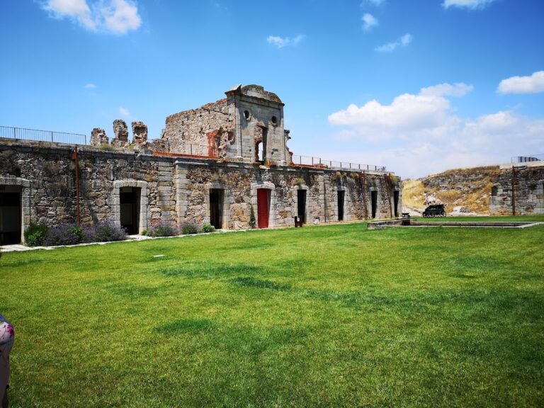
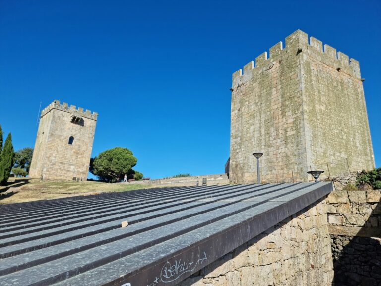
The castle occupies the summit of a rocky hill at about 725 metres above sea level, above the Côa River and its crossing. Granite masonry forms an organic, irregular plan that is nearly rectangular. The fortifications enclosed the settlement and were reinforced by an irregular outer defensive enclosure, or barbican, whose curved face followed part of the town wall. Surviving wall lines remain especially continuous on the east, northwest, and northeast sides, although they have lost their raised parapet sections and contain several breaks.
Enclosure and defensive structures
Town walls and barbican
The castle had two lines of walls. On the western side, steps connected the spaces between them, while the wall-top walkways provided routes for defenders. The parapets included raised merlons, particularly on the northeast, where both box-shaped and pyramid-shaped forms survived in the historic arrangement. Parts of the walls support attached buildings, some of which incorporate masonry apparently reused from the fortifications.
The barbican had its own wall-top walkway, merlons, and cruciform loopholes. A circular tower stood at its southern end, while a smaller rectangular tower occupied the northern side beside a gate. Another false gate lay to the east. The inner gateways had rounded openings and covered balconies with machicolations, projecting openings through which defenders could attack people below the wall or gate.
Porta da Vila and towers
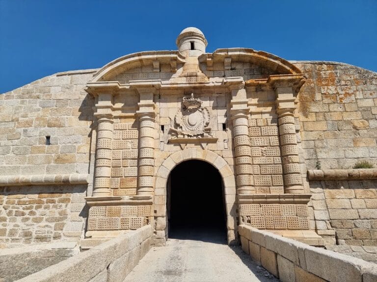
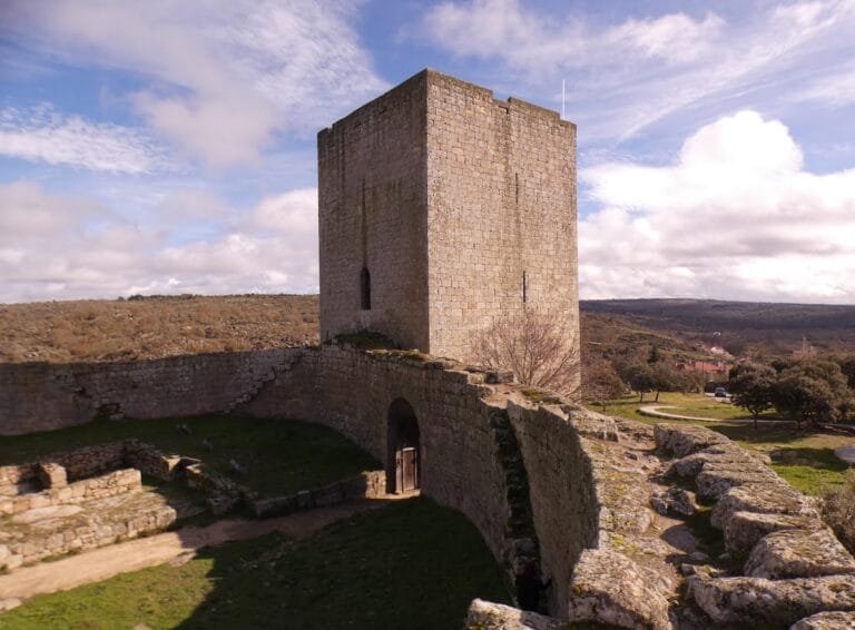
The Porta da Vila opens through the eastern barbican. Its uneven paving leads beneath a pointed outer arch and through a round-headed inner opening. The passage has a vaulted ceiling and stone pivots for the doors. A stone stairway built against the inner face of the walls led up to the wall-top walkway and the square keep, the castle’s principal fortified tower. The keep is now ruined, and ruined rectangular towers stood to its west and north.
Duarte de Armas’s Book of Fortresses, produced around 1509 by the Portuguese military surveyor and illustrator, shows the castle at the southern end of the town wall. His drawing depicts an irregular castle and barbican, a western keep beside a central courtyard, a rectangular eastern tower with a dungeon, and another rectangular tower by the northern gate. It also shows earthworks, a cistern, a shaded house, and other dependencies. A rectangular tower facing the interior retained partly ruined pyramid-shaped merlons.
Settlement and civic markers
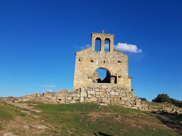
Within the enclosure were single-family houses arranged around a church with a bell tower in the southern sector. Smaller chapels occupied the southwestern and southeastern areas. From the southern side, the castle had visual contact with the castles of Almeida and Castelo Rodrigo. A stone bearing the former town’s coat of arms is set into the southern wall line, probably after being moved from its original position.
Water supply and military installations
Poço do Rei cistern
The southern cistern, locally called the Poço do Rei or King’s Pool, has a rectangular plan and a tiled covering. Its only opening is a doorway. Inside, two arches support a vaulted ceiling. Conservation work consolidated the cistern and the area around it by 1966.
Powder magazine
The powder magazine, also known as the revelim, rebolim, rebolinho, or polvorim, is a circular structure built of stone and masonry. A doorway opens on its western side. Its form reflects the castle’s continued military use during the period when artillery strengthened frontier defenses.
Poço da Escada and Poço d’El Rei
The Poço da Escada and Poço d’El Rei served the defenders. The Poço da Escada, in Largo do Poço da Escada, has an irregular square plan and masonry walls. A nine-step stairway made from stone slabs descends toward the water in the southeast.
The Poço d’El Rei occupies the square of the same name. It is a large rectangular masonry reservoir covered by a terrace and reached by two frontal flights of stairs with a landing between them. Two square openings with stone guards admit light, while a vaulted ceiling covers the interior. Together with the southern cistern and the powder magazine, these surviving features preserve part of the castle’s defensive and logistical organization.
Nearby sites