Wachenbuchen Castle: An 11th-Century Lowland Castle in Germany
Site at a Glance
- Popularity
- Low
- Country
- Germany
- Primary era
- Medieval
- Eras represented
- Medieval
- Civilizations
- Holy Roman Empire
- Site type
- Military
- Remains
- Castle
On this page9 sections
History
Wachenbuchen Castle is an 11th-century lowland castle site in Maintal-Wachenbuchen, Germany. Built of timber and earth, it followed the motte-and-bailey form, centered on a motte (a raised earthen mound) and a bailey (an enclosed castle area). The castle is tentatively associated with the Buchen family and, if that identification is correct, may mark the beginnings of the later lordship of Hanau.
Origins and the Hanau lordship
The earliest recorded reference to nearby Wachenbuchen, Mittelbuchen, and Lützelbuchen dates to 1 June 798. A donation to Lorsch Abbey, a Benedictine monastery in present-day Hesse, names the settlements together under the designation marca bucha.
From 1122, documents issued by the archbishop of Mainz refer to counts who used the name von Buchen. The brothers Dammo and Siegebodo von Buchen appear as witnesses. In 1143, Dammo adopted the name von Hagenowe, associated with Hanau, and his son Arnold did the same. Arnold appears in 21 documents from 1144. The establishment of Hanau Castle seems to have coincided with a move of the lordship’s seat. That castle, founded by the presumed lord of Wachenbuchen, began with a similar layout and was repeatedly expanded and altered over roughly 700 years.
From 1166/68, the family of Dorfelden succeeded to the lordship. Its members first took their name from nearby Dorfelden Castle and, from 1191, from Hanau Castle. Dammo the Younger of Hanau is last mentioned in 1175. If Wachenbuchen was the castle of the Buchen family, it may have stood near the origins of Hanau’s later rule. The later Büchertal administrative district, a core area of that lordship, probably covered much the same territory.
Fiefs and decline
From 1222, records show the castle being granted as a fief to retainers of lower noble rank, men serving the castle who held land in return. Marquard von Buchen is the first named recipient. Inheritance divisions later fragmented the fief, and a possible additional bailey to the southwest may relate to this process.
The castle lost its military importance during the 13th century. Knights and noble squires who continued to use the name von Buchen seem to have lived mainly as estate owners and probably stayed at the castle only rarely. Pottery sherds from the 14th century provide the latest evidence of its use. The castle probably then fell into decay and supplied stone for nearby settlements.
Identification and investigation
The association of the ruins with the Buchen family became a historical convention in the mid-19th century. Official maps used the name Castle of the Buchen Family from 1856, although the identification remains uncertain. An excavation by the Hanau History Society in the 1920s or 1930s was largely unpublished. Topographic work and aerial-photo analysis in 1993–94 refined understanding of the castle’s layout and indicated a later building phase. The castle site and archaeological monuments around it are protected under Hessian monument-protection law.
Remains
Earthworks and setting
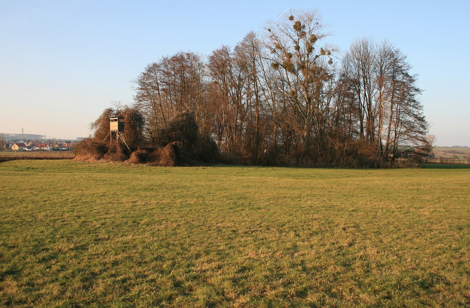
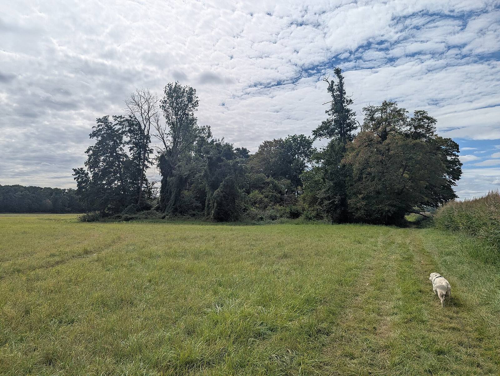
The surviving earthworks lie about 600 m southeast of Wachenbuchen’s edge, at an elevation of 108 m, in a wet meadow roughly 200–300 m from the forest. A small stand of trees now covers much of the site. A Roman road from Hanau to Friedberg passes about 200 m to the east. The castle plan includes a southern tower mound, a bailey mound to its north-northwest, and several enclosing moats.
Residential tower mound
The southern mound is the remnant of the castle’s residential tower mound. It rises about 2 m above the leveled ground, or 2.6 m relative to the moat. Its surviving summit measures about 6 by 10 m, is partly wooded, and has eroded substantially. The mound is thought to have been much larger and higher. A reconstruction estimate gives a base of about 40 by 50 m and a height of around 5 m, which would have supported a summit of roughly 20 by 28 m. The tower on this raised ground formed the castle’s central area and served as both residence and principal defensive tower.
Bailey mound
North-northwest of the tower mound, the roughly rectangular bailey mound has somewhat rounded edges. It stands about 1 m high and measures around 40 by 60 m. Service and farm buildings are thought to have occupied this area. Stone finds suggest that some buildings may later have been built or enlarged in stone. Digging has heavily disturbed the mound.
Moats and later enclosure
An inner moat about 10 m wide lay between the bailey and the tower mound, enclosing both parts of the castle. It remains well preserved among the trees. A second moat surrounded the whole complex about 10 m farther out; its circumference exceeds 400 m, and it joins the inner moat south of the castle near the tower mound. An outer bank probably stood between the two moats.
In the southwest, another moat cuts across the outer one and encloses an area interpreted as a later bailey. The outer moat is indistinct in this area, probably because it was leveled during the Middle Ages. The outer bank may also have been flattened when the later bailey was constructed.