Stanwick Camp: A Brigantian Fortified Centre
Site at a Glance
- Country
- United Kingdom
- Primary era
- Classical
- Eras represented
- Classical
- Civilizations
- Celtic
- Site type
- Military
- Remains
- Wall
On this page8 sections
History
Stanwick Camp is a major fortified centre associated with the Brigantes, a major Celtic people of northern Britain, in the United Kingdom. During the early Roman occupation of Britain, it served as a principal fortification of their kingdom, Brigantia. Its defences developed in three stages: an enclosure around The Tofts was begun about AD 40, an extension to the north followed around AD 50–60, and a further expansion came around AD 72. Stanwick is sometimes called an oppidum, meaning a substantial fortified settlement, though the term is not consistently applied to the site.
Political struggle and competing interpretations
The role of Stanwick in the conflict between the Brigantian queen Cartimandua and Venutius, a leader opposed to Roman power, remains uncertain. They were married until their relationship broke down sometime after AD 51. The dispute has been linked to Cartimandua taking Vellocatus, Venutius’s charioteer and armour-bearer, as her lover, and to her handing the British resistance leader Caractacus over to the Romans. During the governorship of Aulus Didius Gallus, who governed Britain from AD 52 to 57, Venutius rebelled against Cartimandua and her Roman allies. The timing and circumstances of his eventual defeat are unclear.
Sir Mortimer Wheeler proposed that Venutius made Stanwick his stronghold after the split, gathering supporters of resistance to Rome there. Excavations led by Percival Turnbull and Colin Haselgrove instead supported the interpretation that it was Cartimandua’s estate, perhaps also the Brigantes’ original tribal capital. Imported luxury goods were among the evidence for this court-centred interpretation.
Roman and later phases
The fortification is assigned a foundation in the 40s and abandonment in the 70s. After the Roman occupation, people gradually moved to Roman settlements such as Piercebridge, although a small community remained at Stanwick. Anglo-Saxon groups later had cult sites in the surrounding area.
Wheeler excavated at Stanwick in the summers of 1951 and 1952; this was his last major archaeological excavation in Britain. Durham University excavations directed by Turnbull and Haselgrove followed from 1981 to 1986. Stanwick is a scheduled monument, a site protected under British law. The place-name may derive from the Old Norse steinvegges, meaning stone walls; an alternative explanation comes from the Anglo-Saxon words stān, meaning stone, and wic, meaning settlement.
Remains
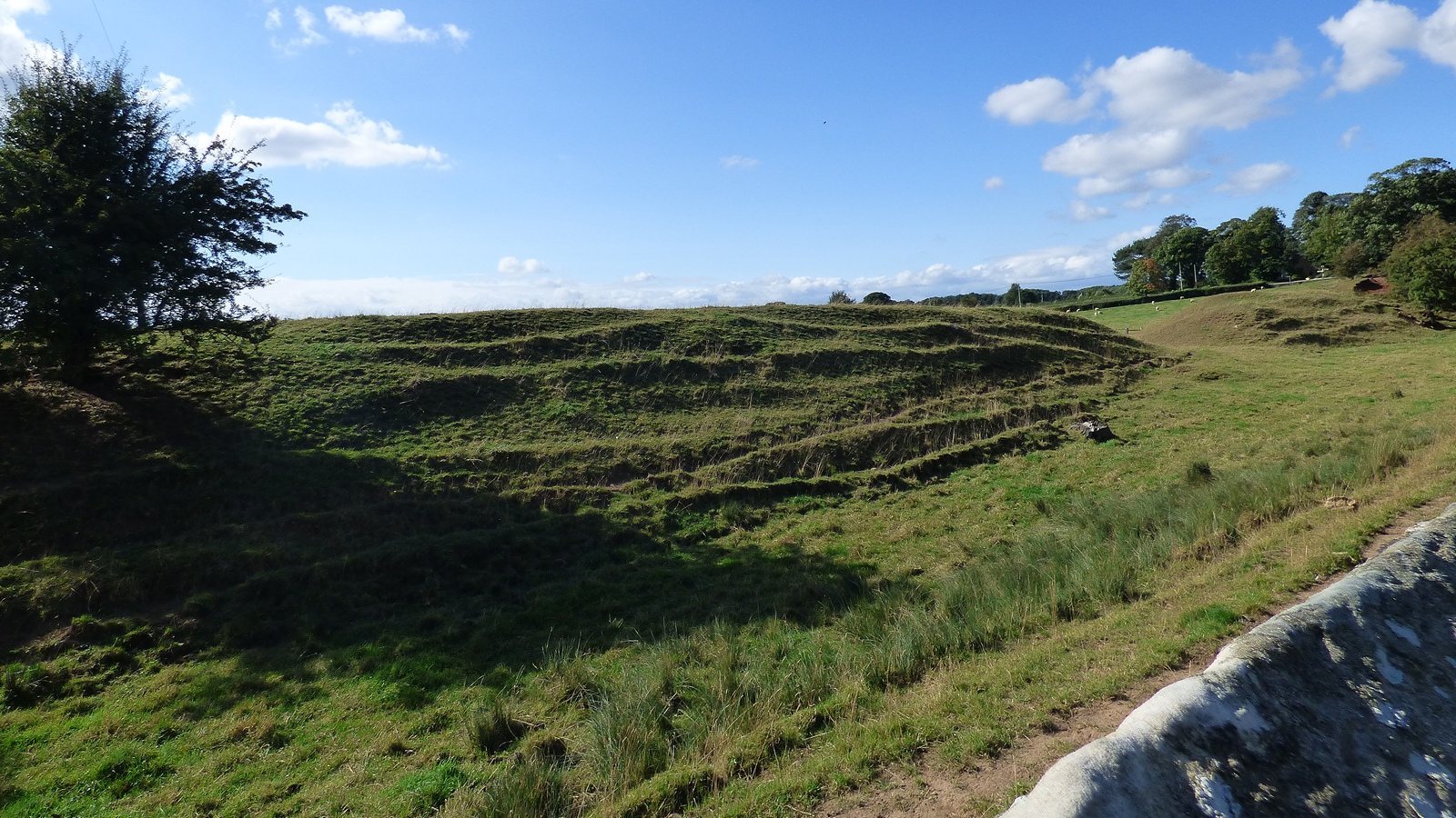
Stanwick’s surviving defences form an extensive earthwork system of ditches and raised banks, or ramparts. They enclose approximately 300 hectares and surround the village of Stanwick St John. The ditches and banks extend for more than nine kilometres, while the outer circuit measures about ten kilometres. In places, the banks rise to almost five metres.
Enclosures and outer defences
The earliest enclosure occupied the low hill known as The Tofts and covered about 17 acres, or 7 hectares. The northern enclosure extended across more than 130 acres, or 53 hectares, and the southern addition covered about 600 acres, or 240 hectares. The excavated plan also includes a subdivision of the inner area. Turnbull and Haselgrove argued that the outer ditches and banks were probably built first, in the mid-first century AD, and that their great length would have made the circuit difficult to defend.
Wheeler’s Wall
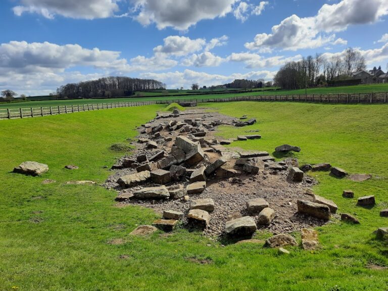
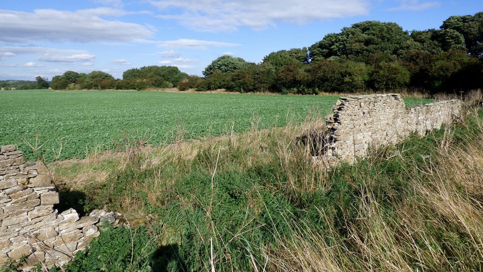
Excavation exposed a 15-metre length of ditch cut into the limestone. Stones that had fallen into it allowed Wheeler to partly rebuild a three-metre section of retaining wall made of dry-laid stone, without mortar. Known as Wheeler’s Wall, the preserved section stands about 60 centimetres above the existing rampart. Wheeler estimated that the original wall may have risen about five metres above it. English Heritage preserves the reconstructed section.
Finds beside the north-western gate
At the end of a ditch beside the site of the main north-western gate, excavators found an Iron Age sword in an unusually well-preserved ash-wood scabbard. Nearby lay a skull from a severed head, bearing substantial wounds that appear to have been made by an axe or sword. Wheeler suggested that the sword and skull may have been displayed at the gate as trophies or warnings.
Burial and imported objects
Excavations between 1981 and 1986 uncovered an adult male burial behind a rampart. A horse’s head had been carefully placed on the body.
Imported finds included pottery from southern Gaul and the Rhine region, glass vessels from Germania and Italy, and wine-storage jars. These objects provide material evidence for the luxury goods associated with Stanwick.