Venetian Walls of Nicosia: A Renaissance Defensive Circuit
Site at a Glance
- Country
- Cyprus
- Primary era
- Early Modern
- Eras represented
- Early Modern, Modern
- Civilizations
- British, Ottoman, Venetian
- Site type
- Military
- Remains
- Wall
On this page14 sections
History
The Venetian walls of Nicosia are a Renaissance-era defensive circuit in Cyprus, built by Venetian authorities between 1567 and 1570. They replaced earlier fortifications and became the principal defenses tested during the Ottoman capture of the city in 1570.
Medieval defenses
Nicosia’s first fortification was a castle built in 1211, when the Lusignan dynasty ruled Cyprus. King Peter I added the Margarita Tower in 1368. Peter II later built the first defenses around the whole city and had the tower demolished. These medieval walls belonged to the Frankish, or Latin Christian, order of the Crusader era. By the sixteenth century they were in poor condition, after damage in attacks by Genoa and the Mamluks, a military ruling class that governed Egypt and neighboring territories.
Venice’s new circuit
Cyprus came under the Republic of Venice in 1489. Although Venetian officials recognized Nicosia’s need for stronger defenses, they initially made few improvements. Ottoman expansion raised the stakes: Ottoman forces took Preveza in 1537, captured several Venetian possessions in 1540, and seized Tripoli in 1551. Their naval victory at Djerba in 1560 added to Venetian concern. The Ottoman siege of Malta in 1565 prompted Christian states around the Mediterranean to strengthen their defenses, and Venice gave priority to Cyprus, Candia, the Venetian-era name for Heraklion, and Corfu.
In 1562, Venice sent military engineer Ascanio Savorgnan to inspect Cyprus’s cities. Nicosia’s distance from the coast, and the difficulty of transporting building materials there, led him at first to advise against fortifying it. By 1567, Sultan Selim II’s interest in Cyprus had made the island’s defense more urgent. Venice then commissioned Giulio Savorgnan, Ascanio’s brother, and Francesco Barbaro to plan a new circuit. Giulio had recently completed the walls of Candia, but Venice recalled him ten months after construction began; his assistants carried on the work.
The new line enclosed much less ground than the fourteenth-century defenses. A shorter perimeter was easier to defend and could be arranged as an ideal circle, drawing on Renaissance interest in classical models and planned forms. Building it required extensive demolition, particularly south of the new line, where buildings as far as five kilometres away were cleared. Houses along the proposed southern ditch, many occupied by Greek residents, were removed along with monasteries and churches, including the Dominican monastery and Orthodox religious houses. Structures inside and outside the circuit were also taken down for materials and to open defensive sightlines. The Pedieos River was rerouted beyond the city to reduce flooding and supply the ditch. Enslaved people provided labor for the works, whose design drew on ideas associated with the Roman writer Vitruvius and Francesco I Sforza, Duke of Milan.
The Ottoman siege of 1570
Ottoman forces under Piyale Pasha invaded Cyprus on 1 July 1570 and began their siege of Nicosia on 22 July, before the defenses were complete. The ditch was unfinished and too shallow. Before the attack, the Ottomans gained control of the river that fed it and diverted its water. They positioned artillery on higher ground south of the city, which gave them a view over the defenders. The wall had been placed close to this rise to preserve the circular plan, although engineers had considered setting it farther back.
Nicosia fell on 9 September, after fewer than fifty days of resistance. Ottoman forces broke through at Podocattaro Bastion, killed the defenders, and captured the remaining inhabitants. After the siege, Lala Mustafa Pasha left a garrison of 4,000 soldiers and 1,000 cavalry in the city.
After the conquest
The Ottomans repaired the fortifications, but Nicosia declined. By the early seventeenth century, breaches and decay had left the city practically undefended. The southern bastions had suffered heavy bombardment in 1570; the extent and causes of later changes to the northern sections are unclear.
Nicosia began to revive in the mid-nineteenth century, and the walls still enclosed it when Britain occupied Cyprus in 1878. An opening near Paphos Gate was cut in 1879, with further openings added during the twentieth century. On his survey of the island, British officer and surveyor Horatio Herbert Kitchener labelled the opening toward present-day Eleftheria Square “Limassol Gate,” although it was not one of the original entrances. The circuit’s circular form also appears in the flag of Nicosia in the Republic of Cyprus and the emblem of North Nicosia in Northern Cyprus.
Remains
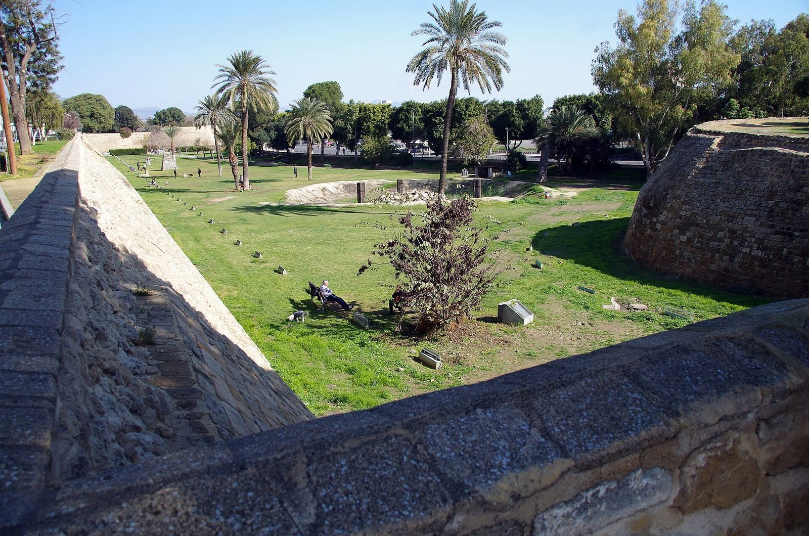
The surviving circuit is roughly circular, with a perimeter of about five kilometres and walls approximately 12 metres high. Its centre lies near the former Cathedral of St Nicholas, now in the northern part of the city. Eleven projecting defenses and the wall sections between them shape the enclosure, while a broad ditch runs outside it.
The ring and its defenses
Wall line and ditch
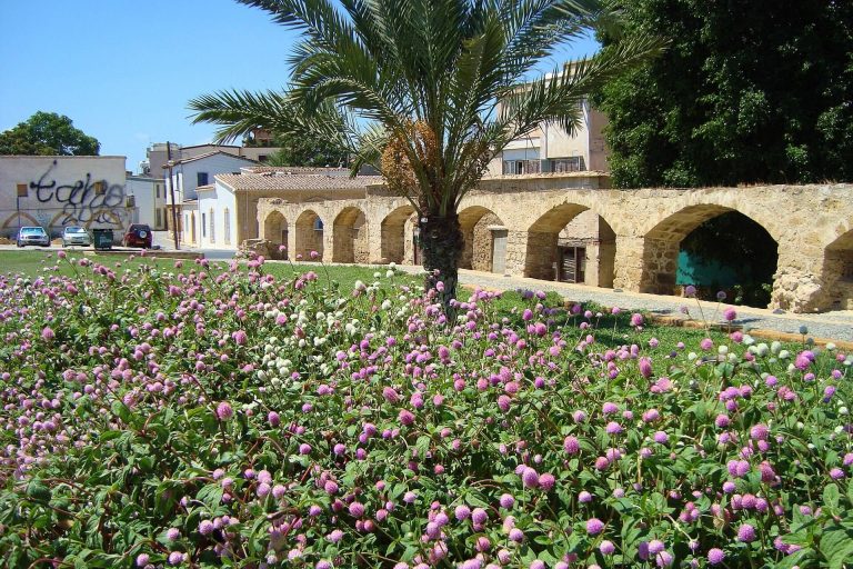
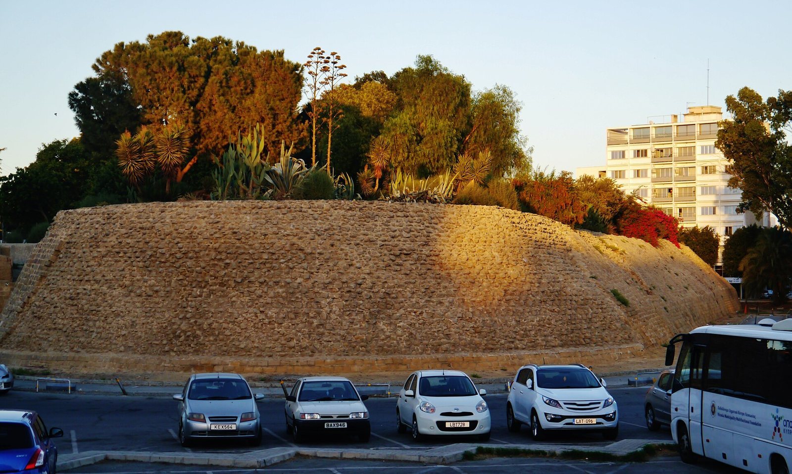
The ditch was about 80 metres wide and was intended to carry water from the Pedieos River. It now accommodates sports grounds, public gardens, outdoor sculpture displays, parking, and other urban uses.
Bastions and wall construction
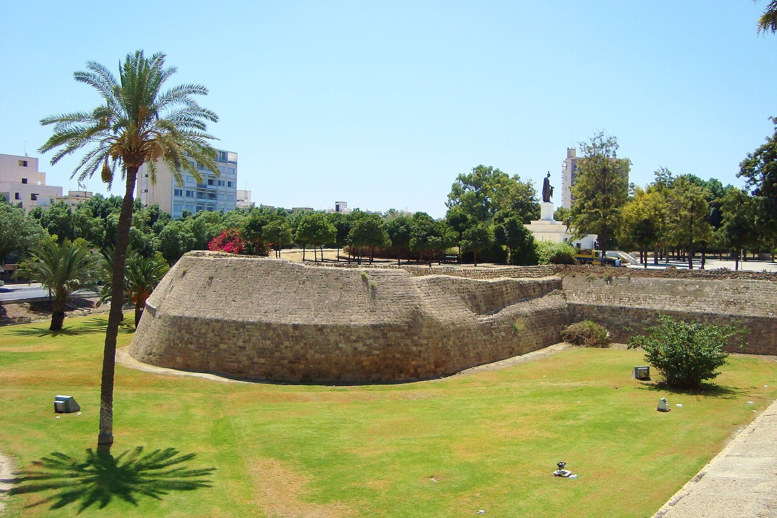
A bastion is a projecting defensive structure built to provide positions along a wall. The eleven have heart-shaped plans, and rounded projections called orillons shield their flanks on the ditch side. Starting clockwise from the Famagusta military entrance, their names are Caraffa, Podocattaro, Costanza, D’Avila, Tripoli, Roccas, Mula, Quirini, Barbaro, Loredan, and Flatro. The names honor Italian families who contributed to construction. Caraffa through Tripoli lie in the southern half of the city; Roccas through Loredan are in the north, while Flatro lies in the United Nations buffer zone and is the best-preserved bastion.
The bastions have earth-filled interiors, with outer faces and tops made of cut stone. The connecting curtain walls, meaning the stretches between projecting defenses, have stonework below and adobe, or sun-dried earth brick, above. Ottoman repairs replaced the adobe with stone. Bastion heights differ: Barbaro, including its orillons, is the lowest and was consequently the easiest to capture. The perimeter remains largely intact, though some portions appear unfinished or rebuilt. A projecting course of stones at the orillon of Podocattaro is the only section that survives in its original form.
Gates
Shared design
The three original entrances are Paphos Gate, also known as Porta San Domenico; Famagusta Gate, also called Porta Giuliana; and Kyrenia Gate, also known as Porta del Proveditore. Their positions beside neighboring bastions made them easier to defend. Each opening is 3.12 metres wide, with an inner opening 5.34 metres high and an outer opening 3.2 metres high. All three had drawbridges. Ottoman inscriptions and the tughra, an Ottoman ruler’s calligraphic emblem, of Sultan Mahmud II, dated 1820, appear above each gate.
Famagusta Gate
The most massive of the three entrances, Famagusta Gate also stands at the lowest elevation above sea level. Its original vaulted passage has undergone little alteration. Three vaulted corridors pass through the gate: the central one is the highest and widest and leads to a cylindrical chamber. The chamber’s outer entrance is narrower than the entrance on its city side, while the two side corridors have very small openings. A small doorway leads from the chamber toward the ditch, shielded by Caraffa’s orillon. The gate and its adjoining rooms have been restored and serve as Nicosia Municipality’s cultural center.
Kyrenia Gate
Kyrenia Gate has a short passage beneath a round arch, with a domed guardroom on a square plan above it. On the south wall, a marble panel bears a Latin inscription dated 1562. A later carving, “GVRI 1931,” beside it marks the road’s opening and the gate’s closure. On the north wall, a marble panel above an arched entrance carries two lines of Quranic verses, calligraphed by Hattat Sheikh Feyzullah Dede of the Mevlevi Sufi religious order and dated 1820/21.
Paphos Gate
Paphos Gate has a pointed-arch entrance. A worn marble plaque above it bears Mahmud II’s tughra, while a nearby sandstone inscription reads “VR 1879,” marking the date of the new road into the city. Paphos and Kyrenia gates were later widened for modern traffic: the Paphos opening was enlarged on one side, and the Kyrenia opening on both sides.