Badajoz Bastioned Enclosure: A Historic Fortification System in Spain
Site at a Glance
- Country
- Spain
- Primary era
- Early Modern
- Eras represented
- Medieval, Early Modern, Modern
- Civilizations
- Almohad, Crown of Castile, Spanish, Taifa of Badajoz
- Site type
- Military
- Remains
- Wall
On this page31 sections
History
The Badajoz Bastioned Enclosure is a fortified urban defense system in Badajoz, Spain, whose bastioned circuit took shape under Spanish rule from the late seventeenth century. Projecting defensive works and thick walls designed for artillery extended a much older network of Islamic and medieval defenses. Badajoz’s position on routes between Castile and Andalusia, and between the Iberian interior and Lisbon, close to the Portuguese frontier, gave it a lasting military role. Its preserved wall perimeter, including the Alcazaba, measures 6,541 metres; the enclosure is Spain’s longest walled circuit and, after Elvas, the second-largest fortified complex on the Iberian Peninsula.
Islamic and medieval foundations
Prehistoric occupation and an earlier Visigothic settlement preceded the city’s foundation by Ibn Marwan in the ninth century. Ibn Marwan, an Andalusi ruler, began Badajoz’s first fortifications, including mortar-built walls. His grandson, Abd Allah Ibn Muhammad Ibn Abd al-Rahman, restored the defenses in 913. In 1030, Abdallah ibn al-Aftas, the first ruler of the Aftasid dynasty, rebuilt them. The Aftasids governed the independent Muslim kingdom, or taifa, of Badajoz.
The Alcazaba, a fortified citadel within an Islamic-period city, was built in 1169, with some parts dating to the early Almohad period. The Almohads were a North African Muslim dynasty that ruled parts of the Iberian Peninsula in the twelfth and thirteenth centuries. Abu Yahya ibn Abi Sinan ordered the last restoration under Muslim rule in the early thirteenth century. The Islamic enclosure grew over time, while the city expanded beyond its early walls, particularly to the west and south.
From the thirteenth to the sixteenth centuries, the site also served as a Christian castle. Badajoz’s first cathedral was built over the former palace mosque, and fortified houses occupied the enclosure. A medieval wall built from rammed earth, probably under the Almohads, was extended. Near the end of the fifteenth century, during the rule of Isabella I of Castile and Ferdinand II of Aragon, known as the Catholic Monarchs, a pentagonal enclosure was built. The older defenses eventually proved inadequate against advances in artillery.
A contested Portuguese frontier
After conflicts between Castile and Portugal in the fourteenth century, a long period of peace followed. In 1580, Philip II moved his court and most of his army to Badajoz for eleven months during the incorporation of Portugal into the Spanish Monarchy. Portugal’s revolt and renewed independence in 1640 returned the city to a prominent frontier role. The Portuguese Restoration War, the conflict in which Portugal secured independence from the Spanish Monarchy, continued until 1668, when Spain recognized Portugal’s independence in the Treaty of Lisbon.
On 23 June 1658, Portuguese troops captured the fort at the bridgehead in a night attack. The Armada regiment retook it at considerable cost, including the deaths of several captains and the Marquis of Lanzarote, Badajoz’s governor. Portuguese forces regrouped at Vado del Moro, fortified their position and renewed the siege. The Crown and the city’s authorities responded to the renewed threat by strengthening Badajoz’s defenses.
Work on new defenses began in 1642, initially through improvised works and successive alterations to existing fortifications. The Fort of San Cristóbal was among the first new outer works. Badajoz became a major strategic stronghold on the Spanish-Portuguese frontier and the seat of the Captaincy General of the Royal Army of Extremadura, a senior military command. A letter sent in 1643 by the Count of Santiesteban to Secretary Pedro Coloma judged the region’s defenses, supplies and weapons inadequate and described Badajoz’s existing walls as ineffective. The Alcazaba’s elevated position offered the most defensible starting point for further works.
The bastioned system and eighteenth-century sieges
Between 1690 and 1700, work began on a new bastioned enclosure that extended earlier defenses. The authorities adopted a system associated with the French military engineer Sébastien Le Prestre, Marquis of Vauban, whose approach used angled, projecting works to resist artillery. The fortifications were not completed as one orderly project. Repairs and improvements accumulated over successive phases.
During the War of the Spanish Succession, a conflict between supporters of Archduke Charles of Austria and Philip of Anjou over the Spanish throne, Charles’s supporters besieged Badajoz in 1705. Their artillery, positioned across the Rivillas stream near La Picuriña and the Hermitage of San Roque, breached the defenses at the Bastion of San Pedro. French reinforcements prevented an assault. The defenders then strengthened this sector with the Ravelin of San Roque, a detached defensive work in front of the main walls, and an outer fort first called the Fort of the Prince and later the Fort of La Picuriña.
The Peninsular War
French forces occupied Badajoz in 1811 and began digging countermines, underground galleries intended to intercept enemy mining, between the Bastions of Santiago and San Vicente. General Menacho was killed defending the city that year. Brigadier Imaz succeeded him and surrendered Badajoz to the French. On 19 February, the Battle of Gévora ended in a French victory over Spanish forces.
French sieges and assaults in 1811 and 1812 destroyed the Bastion of the Trinity, later rebuilt in the last third of the twentieth century. During the 1812 assault, forces led by the future Duke of Wellington captured Badajoz, leaving the Bastion of Santa María in ruins. In the third assault, British troops led by General Thomas Picton entered the area of the Bastion of San Pedro and suffered heavy casualties. The fighting also left lasting marks on several fortifications.
Later changes and preservation
Until the mid-twentieth century, the city gates opened at dawn and closed at dusk. They controlled passage and collected tariffs on certain goods entering the city. At the Puerta de Palmas, toll collection took place at a side entrance in the later period; earlier, it occurred midway across the Palmas Bridge, where two small tower-like guard structures stood. The Puerta de Palmas also served as a prison in the early nineteenth century and was restored in 1960.
Other changes reshaped the defenses. A bullring built inside the Bastion of San Roque in 1818 was later replaced and demolished; the later bullring was destroyed in 2006, and a conference centre was built on its site. The Bastion of San Juan, which held a cavalry barracks known as Cuartel de la Bomba, was demolished in the 1950s to open road access to central Badajoz. The Puerta Nueva, designed by military engineer Martín de Gabriel, was begun in the late seventeenth century, opened in 1765 and demolished in 1962. Its buried foundations were found in the early twenty-first century.
A memorial inscription to General Menacho was placed where he died in 1852. A monument designed by Captain Julio Carande and made by marble workers Almendro and Zoido was inaugurated on 2 May 1893. The Bastion of the Trinity was rebuilt in the late twentieth century. The city council acquired the Fort of San Cristóbal from the Ministry of Defense in 1973, and restoration work there took place in January 2014. The enclosure is designated a Spanish Asset of Cultural Interest as a historic-artistic ensemble, with declaration dates of 1931 and 1962.
Remains
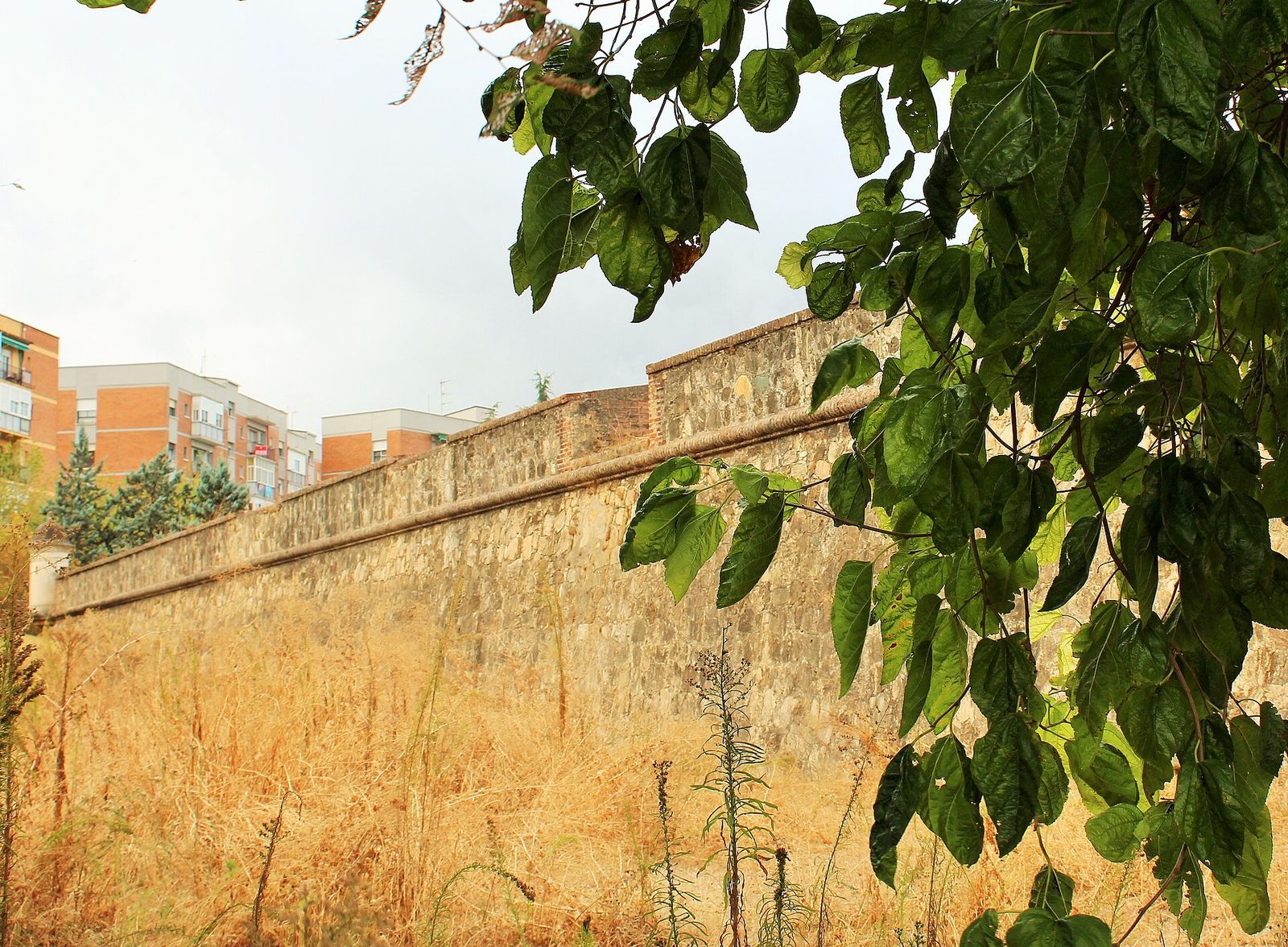
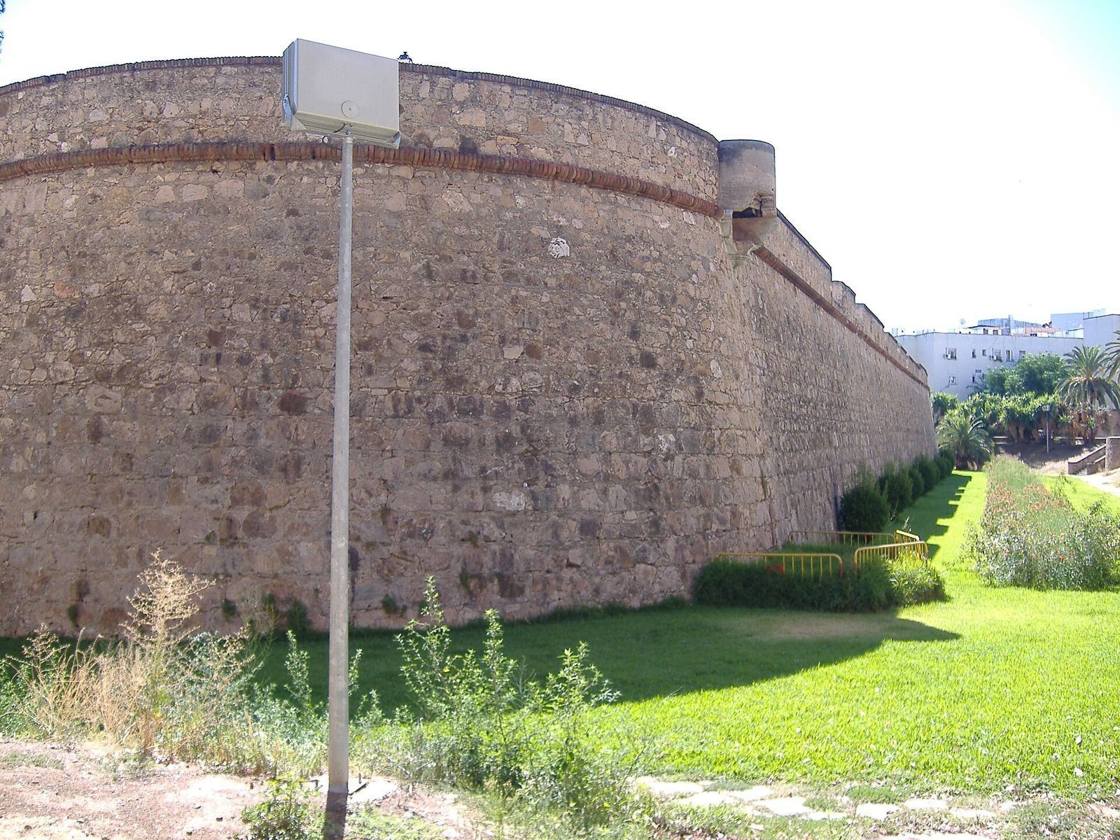
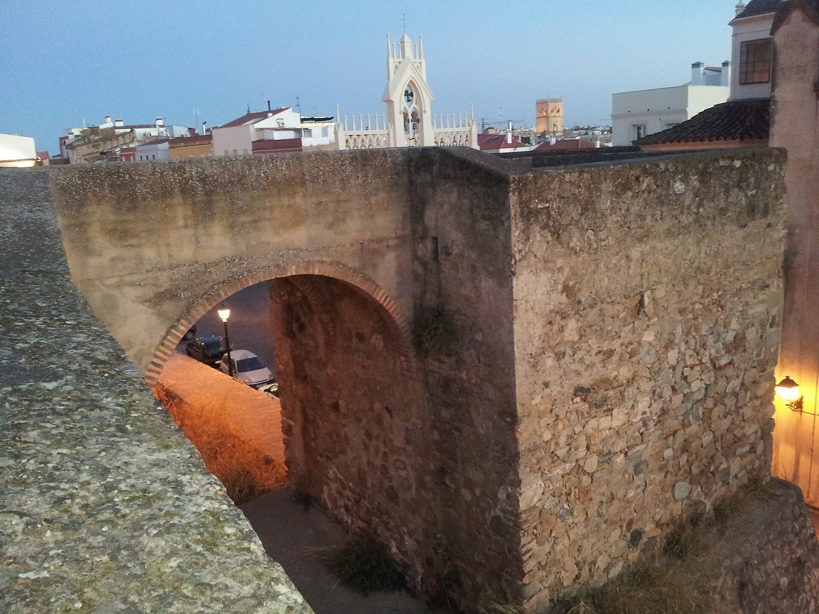
The surviving complex brings together the Islamic citadel, earlier wall sections, the later bastioned circuit and detached outer defenses. The main enclosure follows the left bank of the Guadiana from the Alcazaba, passes the Bastions of San Vicente and Puerta de Palmas, then runs west and south by San José, Santiago, San Roque, Santa María and the Trinity, before turning northeast to the Alcazaba by way of San Pedro. The defenses combine masonry, cut stone, brick and concrete from different building and rehabilitation phases. Their walls are lower and thicker than earlier defenses, with sloping outer faces intended to deflect cannon fire. A curved brick pattern decorates the outward face of the walls.
The Islamic citadel and earlier defenses
The Alcazaba and the Cerca Vieja
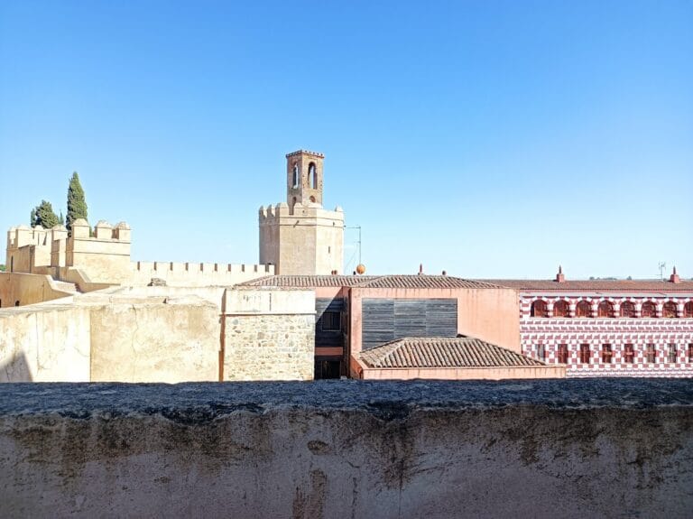
The Alcazaba occupies Cerro de la Muela and contains the remains of the rulers’ administrative and residential quarter, an alcázar, a mosque and a large library. At about eight hectares, it is described as the largest citadel of its type and period in Europe and the world. More than 1,300 metres of its wall survive. The earlier Islamic enclosure, known as the Cerca Vieja, extended from the Alcazaba and covered about 50 hectares, with approximately 6,000 metres of wall. Important sections of this older defense remain.
Watchtowers and medieval walls
Five former city watchtowers survive, including Espantaperros and Los Rostros. Many of the towers date mainly to the twelfth century and remained in use until the Peninsular War. Sections of medieval walls also remain near the Bastions of the Trinity and Santiago, where the later circuit was built partly over their foundations.
The bastioned circuit
San Antonio and the Calatrava underground works
The Semibastion of San Antonio joined the eastern side of the original Alcazaba to the later circuit. Its construction closed the old Alpendiz Gate, which was replaced by a small secondary entrance. Earth and stone, including material from the Torre Vieja, filled the work; the older tower was cut down and buried inside it. Excavations at the end of the twentieth century uncovered a substantial part of that tower. The semibastion was built over the San Salvador neighborhood and now stands beside a modern park.
The seventeenth-century Calatrava underground works consist of tunnels and chambers built in this area when the semibastion was constructed and the Alpendiz Gate closed. Their strong walls and vaulted ceilings suited their use as troop accommodation and military stores.
San Pedro and the Trinity
The Bastion of San Pedro faces the Rivillas stream in the eastern enclosure, between San Antonio and the Trinity. The Puerta de Mérida stands between San Pedro and San Antonio. San Pedro dates to the final decades of the seventeenth century and is among the earliest bastions, along with the Trinity. Bases of its former sentry turrets remain. In 1772, a gallery linking rifle openings was added along its right flank. The interior is badly deteriorated.
The Bastion of the Trinity occupies the site of the medieval Torre del Canto at the northeastern corner of the enclosure. The thirteenth-century Trinitarian convent stood inside the work before its destruction, and its stones were reused when the bastion was rebuilt. The convent’s position shaped the layout, leaving the bastion’s interior at a lower level than the ground outside. Cannon openings remain on all sides, together with rifle slits at mid-height and an internal passage linking the riflemen to one another and to the enclosure. A public park inside the bastion contains Juan de Ávalos’s sculpture Fallen Hero and four bronze statues of the Evangelists.
Santa María and San Roque
The Bastion of Santa María, also called La Laguna, lies between the Trinity and San Roque. Its outer moat could be flooded using water held back by small dams on the Rivillas, turning much of the walled city into an island. The 1812 assault left the bastion in ruins. A British soldiers’ cemetery survives in part between its moat and the Trinity. Santa María has fourteen cannon openings, four at the front and five along each side, as well as rifle galleries added during rebuilding. Two corner sentry turrets remain. Cannonball impacts form the date 1812 on this bastion and the Trinity. Buildings, especially to the southeast, and dense vegetation now obscure much of the fortification.
The seventeenth-century Bastion of San Roque stands between Santa María and the former Bastion of San Juan. It was strengthened in the eighteenth century with sixteen cannon openings, four along the front and six on each flank. Rifle galleries and slits also occupy its left flank. The surviving remains lie between Estadiu Street and Ronda del Pilar.
Santiago, San José and San Vicente
The Bastion of Santiago is a pentagonal seventeenth-century work modified in the eighteenth century. Its western end has an orillon, a rounded projection that protects a wall or small gate. Sentry turrets once stood at the corners and on the orillon; the one on the orillon remains. A section of an older wall, uncovered during construction of a car park, can be seen at points on Santiago’s northwest flank and from inside the car park. A tenth- or eleventh-century Muslim cemetery was also uncovered there. A small gate built in the late nineteenth century as a service entrance was used instead for storage.
The Bastion of San José began in the last third of the seventeenth century. Its connecting wall to San Vicente survives and was altered and extended in the eighteenth century. Eight cannon openings cover the approaches: four face Santiago, two face the detached outwork and two face the wall toward San Vicente. Between 1772 and 1777, the bastion was thickened against artillery and fitted with two rifle galleries. Both galleries remain, although the one on the left flank is close to collapse. Part of the protected route outside the defenses also survives here. San José experienced relatively few sieges and less artillery damage than other parts of the enclosure.
The seventeenth-century Bastion of San Vicente protected the northwest side of San José. It retains a rounded projection at its left end, as well as large-calibre cannon openings on the projection, above a small gate and along the flank facing the Guadiana. Sentry turrets stand at wall corners and on the projection.
The Puerta de Palmas semibastion
The Semibastion of Puerta de Palmas, also known as the Bastion of Tears, is the surviving defensive work associated with the gate. Its two walls meet at an angle, with one facing the Guadiana and the other running west toward San Vicente. Three cannon openings high on the western wall cover the moat and the approaches to San Vicente.
Gates and bridges
The Puerta de Palmas and its bridge
Built around 1460, the Puerta de Palmas originally linked the historic centre with the old bridge over the Guadiana. It was first called the New Gate; after a different gate was built in the seventeenth century, it became known as the Puerta de Palmas. The structure now stands isolated in Plaza de los Reyes Católicos, with access to the bridge from two side streets. Its inner face has two round, battlemented towers joined by a lower entrance with a shallow arch. A stone cord runs below each tower’s battlements, while three semicircular arches span above the entrance and connect the towers with a terrace. The central arch has recessed panels and a Renaissance niche containing an image of Our Lady of the Angels, flanked by relief angels. The outer face has concentric arches, geometric panels and medallions of Charles I and Philip II. An inscription dates the gate to 1551, during Philip II’s reign. Its Renaissance design combined defense and access control with the symbolic character of a triumphal arch.
The associated Palmas Bridge is the oldest bridge over the Guadiana at Badajoz. An inscription marks its completion in 1596, during Philip II’s reign and the governorship of Diego Hurtado de Mendoza. Another interpretation places an earlier bridge at the site around 1460 and associates its destruction with a major flood in 1545.
The Puerta de Mérida and the Puerta de la Trinidad
The Puerta de Mérida originally belonged to an Almohad-period wall, slightly farther east, on the old road from Talavera to Mérida. Travellers had to cross the Rivillas along this route. In the seventeenth century, the gate was moved between San Pedro and San Antonio and flanked by two large square towers. Quarrying outside it created a steep slope; the gate was walled up and remains inaccessible from the outside. Its outer arch is made of large granite blocks, including wedge-shaped stones reused from the earlier gate. The arms of Charles V, originally displayed on the old gate, and those of the Count of Montijo appear above it. A chapel to the Virgin of Tentudía and guard accommodation formerly stood over the entrance.
The Puerta de la Trinidad was built of cut granite in 1680 to replace an earlier gate. It is set into a flank of the Trinity bastion rather than midway along a wall, a position criticized as a design error. Cannon openings for heavy artillery occupy the wall above it. The passage runs through a wall about twelve metres thick beneath a broad barrel vault. Its plain inner face has spiral motifs and the construction date. A small secondary gate opened onto the moat and also drained rainwater.
The Puerta del Pilar
The Puerta del Pilar was built in 1692 in the southwestern defenses between San Roque and San Juan. A sloping defensive approach protected the exposed gate, and a covered way, a protected route outside the main wall, linked it to the Fort of Pardaleras for troop relief and the movement of ammunition, food and water. Openings for a drawbridge’s lifting mechanism and grooves for its chains remain, making this the enclosure’s only gate with reliable evidence of a drawbridge. The drawbridge was later replaced by a fixed bridge.
The gate is a long vaulted passage, slightly longer than the wall is thick, with semicircular-arched faces, pediments and three spheres in Baroque style. The outer face bears the Count of Montijo’s arms; the inner face holds a statue of Our Lady of the Pillar, which he donated. Bishop Marín de Rodezno led a procession bringing the statue from the cathedral. The gate also displays the arms of Charles II and inscriptions marking its inauguration and dedication. Two columns outside may have supported religious images. Carvings and drawings made by stonemasons and soldiers survive on the exterior columns. A restoration in the late twentieth century retained the Baroque features, royal arms and bridge-chain grooves.
The Puerta de San Vicente
The Puerta de San Vicente stands outside the main enclosure on the right bank of the Guadiana, at the north end of the Palmas Bridge and east of the bridgehead hornwork. Built around 1665, it served as a principal entrance for more than two centuries. A covered way connected it to the Fort of San Cristóbal. The gate’s semicircular-oval opening leads to a barrel-vaulted passage. Above it, a square projecting turret has openings in its floor through which defenders could fire down at the entrance, as well as an access terrace. A room served as the guardhouse. A small masonry bridge on two square columns topped with stone balls crosses the moat beneath the hornwork. The gate ceased to function after the bridge deck was extended across the hornwork in the late nineteenth century.
Pajaritos, Pelambres and the New Gate
The Puerta de Pajaritos lies beneath a tower containing the Hermitage of Pajaritos, also called the Hermitage of the Orioles. Its date is uncertain: it may have Islamic origins, with a bent passage to impede attackers, or it may have been built in the sixteenth century. The later Vauban-period works retained it. Its passage has a barrel vault supported by granite blocks and closed at both ends with brick arches. A small passage led to a room probably used by the guards. The gate is partly buried and walled up, and for a time served as a sewer. Local tradition connects its name to a 1546 painting by Luis de Morales, The Virgin of the Little Bird, said to have been displayed there. The painting is now at the Church of San Agustín in Madrid. Another possibility is that the gate held a carved Virgin and Child, now at the Church of San Agustín in Badajoz.
First mentioned in the early sixteenth century, Pelambres Gate took its name from the nearby tanners’ guild and served to carry waste out of the Tanners’ neighborhood. It stood between the Puerta de Palmas and the New Gate, giving access to the river and the Mafra fountain. It may have been set between two small towers or within a larger tower that remained until the late eighteenth century. After nearby gates opened, it served as a sewer or overflow outlet. It was sealed in 1886 when a wall joined the Redondo Battery to the Puerta de Palmas. Earth and stone raised the inner street level; traces of the outlet’s lintel remain on the outer wall at ground level.
The New Gate, also called the Carriages Gate or River Gate, had a double entrance, an outer rounded structure, a guardroom and an access ramp. Its opening led to the closure of Pajaritos and Pelambres to traffic. Designed to resemble the Pilar Gate, it had a shallow arch, flanking columns and a cornice. Its buried foundations were found in the early twenty-first century.
Outer forts and detached defenses
The Fort of San Cristóbal
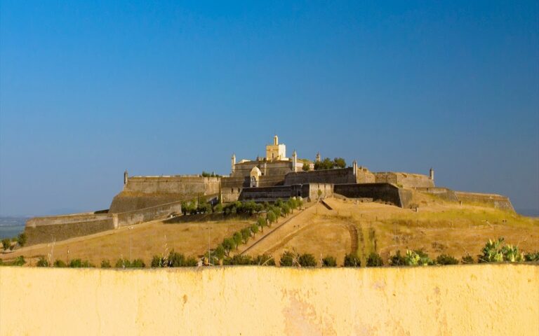
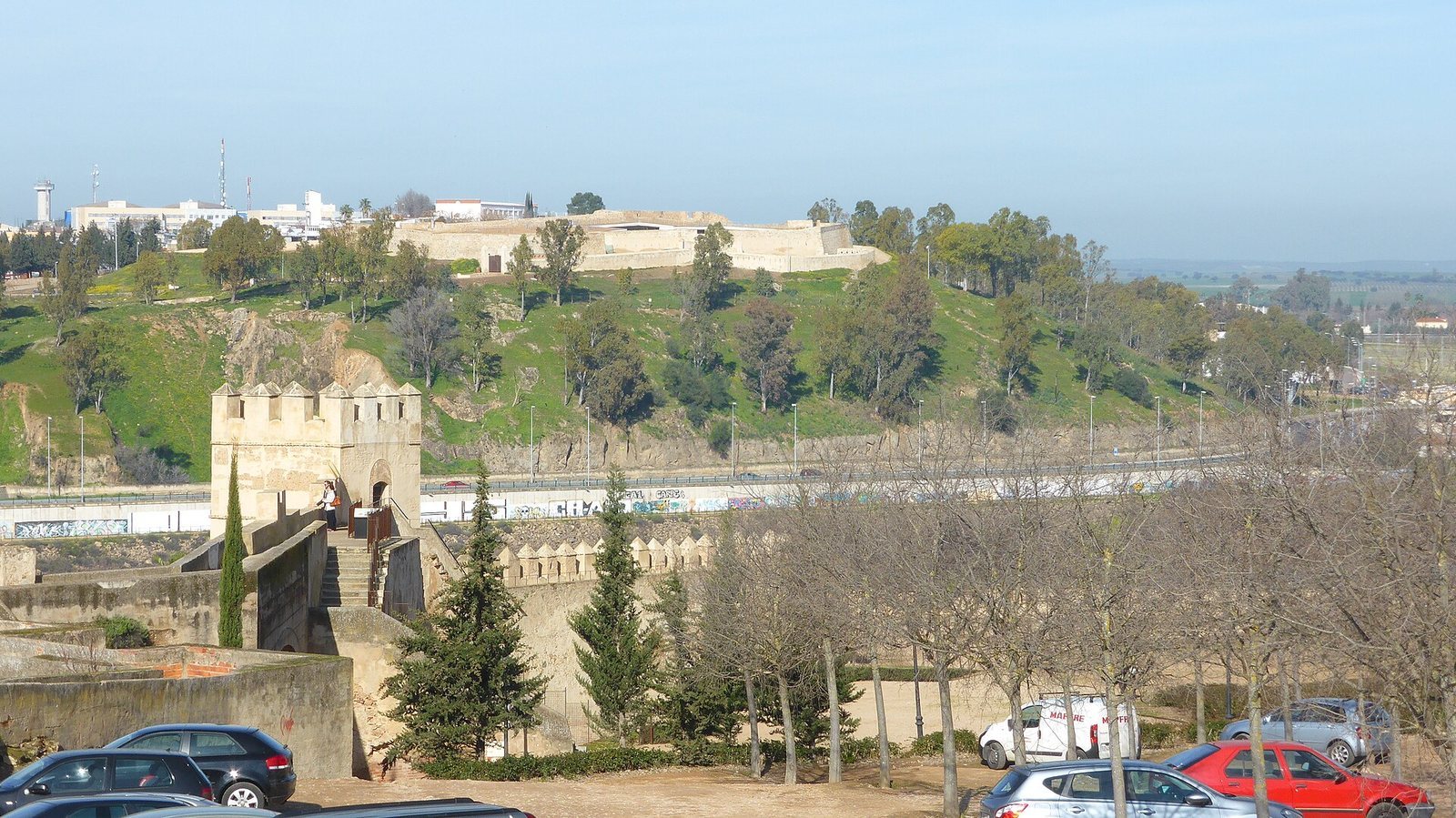
The Fort of San Cristóbal stands on Cerro de San Cristóbal, on the right bank of the Guadiana. The hill had previously held the palace of the Dukes of Orinaza, and Ibn Marwan had considered founding Badajoz there. Begun in 1642 during the Portuguese Restoration War, it is the only outer fort of the system that survives complete in its original form. Its plan is rectangular, with two small bastions to the north and two half-bastions, projecting works with a reduced face, to the south. A detached triangular fortification protects the wall between the northern bastions. An artillery wall joins the southern works where this outwork meets the fort.
The fort had cannon openings for twelve guns and room for about 300 riflemen. A stone-lined moat surrounds the walls, with another wall and a patrol route above it. Rebuilding strengthened the old walls with stone and added five outer crescent-shaped works along the exposed northern side. Repairs during the war incorporated the earlier medieval wall. Sections of the covered way linking the fort to the Puerta de San Vicente survive.
The bridgehead hornwork
A hornwork is an outer fortification made of two projecting works joined by a wall. Begun in 1642 beside the north end of the Palmas Bridge, on the Guadiana’s right bank, the bridgehead hornwork has two half-bastions linked by a central wall. Its defenses included a moat, a troop assembly ground, protective walls, a sloping approach, a guardroom, an officer’s room, three sentry turrets and cannon openings. The Puerta de San Vicente was its only gate. Routes from there led toward Alburquerque, Elvas and Campo Maior, while a covered way linked the position to San Cristóbal. Remains of the eighteenth-century Rana fountain survive nearby. In 1868, the bridge deck was extended over the hornwork to create a continuous route toward the street connecting the city with the railway station.
La Picuriña and Pardaleras
The Fort of La Picuriña, first called the Fort of the Prince, was built in 1705 as an isolated outer defense northeast of the Trinity, between the Sierra de San Miguel and the Rivillas. Most of the fort was demolished in the 1970s, while a few structures remain in semi-ruinous condition. Its defenses included a moat, a drawbridge, a covered way to Badajoz, a triangular assembly ground and twenty cannon openings around the perimeter wall. Sentry turrets stood at the corners, and low openings allowed defenders to fire into the moat.
The Fort of Pardaleras was one of the outer works south of the city, opposite the Puerta del Pilar. Its position allowed it to cover the Calamón stream, La Picuriña and Cerro del Viento, an approach often targeted by besiegers. In the twentieth century, its site became a preventive and correctional prison. The Museum of Contemporary Art of Extremadura and Ibero-America later occupied the site, retaining the prison’s characteristic cylindrical building.
Las Cuestas and other outer works
The Fortified Line of Las Cuestas stood northwest of the city along the right bank of the Cuestas stream, in the area called Cuesta Colorada. Portuguese forces attacked it on several occasions. The works were later razed; three small forts and about 500 metres of trenches remain. The central fort had a pentagonal plan, with bastions and half-bastions at its corners.
Other outer forts included Las Mayas, Cerro del Viento, Vado del Mayordomo, Vado del Moro, San Miguel, San Gabriel, San Gaspar and Telena. Many were built hastily, relying on moats and stakes for defense. Some had covered trenches linking them to other positions. During sieges, attackers sometimes captured these works and used them to press closer to the city.
Ravelins, moats and defensive infrastructure
The ravelins
A ravelin is a detached, usually triangular work placed in front of a fortification. The Ravelin of San Roque, built in the later eighteenth century, lies between Ricardo Carapeto Avenue and the Rivillas and defended the Puerta del Pilar. A covered way linked it to La Picuriña. The ravelin protected the sector between San Pedro and the Trinity. Its nearly equilateral triangle has its base toward the enclosure and its point facing outward. The base was left undefended to discourage attackers from using the work if they captured it and to allow defenders to withdraw. The structure is lower than the main walls and has a covered earthwork and protective wall. Modified in the early twenty-first century, it retains original features beside the stream, where they are visible in a park; buildings largely conceal the opposite side.
The Ravelin of the Auditorium stands between San José and San Vicente, protecting their connecting wall. It is a low triangular work with its point directed outward. A small gate in San Vicente, protected by a rounded projection, linked the ravelin to the upper part of the bastion and the city interior. Its popular name reflects its position beside the Ricardo Carapeto Municipal Auditorium. The triangular ravelin inside San Cristóbal has its outward point facing northwest, toward the direction of attack by the Portuguese army.
Moats, rifle galleries and covered routes
Moats surrounded the enclosure, its outer forts and its detached works. Some had masonry outer slopes; at the Trinity and the San Roque ravelin, water could be used to flood them. Moats remain around almost all preserved wall sections. Their outer slopes survive at San Pedro, Santa María, the bridgehead hornwork, San Cristóbal and the San Roque and Auditorium ravelins.
Rifle galleries were built inside bastions in the late eighteenth century to plans by engineer Pedro Ruiz de Olano. Small openings in their walls allowed defenders to fire toward the moats. Partitions divided the galleries into firing cells, with thicker walls after every three positions to limit artillery damage. Covered ways ran around the moats and linked the city to outer forts and detached works, allowing protected movement and firing from behind walls. Sloping earthworks concealed these routes from attackers. Surviving sections lie near the Trinity bridge and Mérida Gate, at San Cristóbal, by the Palmas Bridge hornwork, around the San Roque ravelin, in front of San Vicente, at the Auditorium ravelin and near Santa María’s moat. Assembly grounds, protected by cross-walls and stakes, stood at several bastions, beside the San Roque and Auditorium ravelins and in the bridgehead hornwork.
Countermines and listening works
French forces began digging countermines between Santiago and San Vicente in 1811. A possible entrance to a counter-mine remains in the moat of the Trinity or the San Roque ravelin. A listening well beside the Trinity has a passage descending from the patrol route to a chamber, with steps built against the wall. It was used to listen for enemy mining and is provisionally dated to the 1770s. Some small stores or powder magazines may also have served as listening wells.