Kasbah of the Udayas: A Historic Citadel in Rabat, Morocco
Site at a Glance
- Country
- Morocco
- Primary era
- Medieval
- Eras represented
- Medieval, Early Modern, Modern
- Civilizations
- Alaouite, Almohad, French
- Site type
- Military
- Remains
- Citadel
On this page22 sections
History
The Kasbah of the Udayas is a fortified citadel on a hill at the mouth of the Bou Regreg in Rabat, Morocco. It became an Almohad military base and part of a planned imperial capital, then served under later Moroccan rulers as a stronghold and residential quarter.
Early Outposts and the Almohad Citadel
The headland may have offered local Berber communities a refuge or a place to watch the river. Use as a lookout over the port during the Roman period is also possible. In the 10th century, the Umayyads of Córdoba, a Muslim dynasty based in Córdoba, or their Zenata Berber allies established a fortified religious outpost in the area against the Barghawata, a Berber confederation with a state to the south. Its exact position is uncertain.
Around 1143–1145, the Almoravid emir Tashfin ibn Ali built a ribat, a fortified religious outpost, at the present site while fighting the Almohads. The Almohads, a North African dynasty that succeeded the Almoravids, defeated them and destroyed the outpost. In 1150 or 1151, the first Almohad caliph, Abd al-Mu’min, established a citadel there with a palace and mosque. An underground canal brought water to the area and helped support settlement. The citadel served as a military base overlooking the river mouth and a starting point for campaigns into al-Andalus, the Muslim-ruled parts of the Iberian Peninsula.
Imperial Capital and Decline
Caliph Yaqub al-Mansur incorporated the Kasbah into a much larger plan for a fortified imperial capital called Ribat al-Fath, also associated with the name al-Mahdiyya. He extended the city walls beyond the older citadel and began major construction, including the Kasbah’s monumental gate. By 1197, walls had been completed along two sides; the Atlantic coast and Bou Regreg formed the other boundaries.
After Yaqub al-Mansur died in 1199, the capital project remained unfinished. The Kasbah was largely abandoned and its palaces and infrastructure deteriorated. The Marinids, a later ruling dynasty, favored Fez, while Salé gained importance. The Kasbah nevertheless retained a role in watching the coast.
Morisco Settlement and the Corsair Republic
In 1609, Philip III of Spain ordered the expulsion of the Moriscos, Muslims of Iberian background. Thousands settled in and around the Kasbah, among them the Hornacheros, a group from Hornachos; later arrivals enlarged the community. In 1627, settlers established the autonomous Republic of Bou Regreg, also called the Republic of Salé. The Kasbah became a base for corsairs, armed maritime raiders who attacked merchant ships and enslaved or sold captured crews. Christian captives were sold near the Kasbah at Souk El Ghezel.
The republic remained outside central government control until 1666, when the Alaouite sultan Moulay Rashid took the area and brought the corsairs under his authority. The Kasbah then returned to service as a stronghold of central rule.
Alaouite Rule and the Udaya
Sultan Moulay Ismail settled members of the Udaya guich tribe, a group serving the sultan’s military, in the Kasbah partly to counterbalance other regional tribes. In the late 17th century he had a palace pavilion built there; it later served for a time as a religious school. The southwestern part of the Kasbah developed during the Alaouite period, especially in the 18th century.
During the 18th century, Sultan Mohammed ben Abdallah oversaw extensive restoration of the Old Mosque. Ahmed el-Inglizi, described as an English corsair, carried out the work. The sultans also reinforced the Kasbah’s defenses: major works took place under Mohammed ben Abdallah from 1757 to 1789, followed by further fortification under Moulay Yazid from 1790 to 1792.
The Kasbah’s association with the name Udaya dates to the 19th century. In 1833, after a revolt by the tribe in the Fez region, Sultan Moulay Abderrahmane moved the Udaya to Rabat. Tribal leaders settled inside the Kasbah and other members nearby. The tribe served as a military force and imperial guard.
Protectorate, Preservation, and Social Change
When the French Protectorate began in 1912, Marshal Hubert Lyautey, France’s first resident-general in Morocco, selected Rabat as the administrative capital and ordered the Kasbah’s preservation. Rabat’s access to the Atlantic and proximity to Casablanca informed the choice; Fez and Marrakech were considered less suitable for security and political reasons. Restoration began in 1914, with local master craftspeople including Hadj Driss Tourouguy.
In 1915, the former palace pavilion became an ethnographic museum. Its collection grew to include jewelry, musical instruments, ceramics, Qur’ans and manuscripts, some dating to the 12th century, as well as costumes, silks, and carpets. In 2006, the institution became the National Jewellery Museum. The Andalusian Garden was created between 1915 and 1918 on the site of the pavilion’s former public square or parade ground.
During the 20th century, the Kasbah changed from a military-garrison community into a neighborhood that also included senior state officials and a bourgeoisie. Families associated with the Hornacheros and Udaya maintained influence through administrative positions. Endogamous family alliances helped preserve property and the neighborhood’s social character, and some families kept ancestral houses after moving to residential areas farther away. Under Protectorate-era social conventions, modesty and voluntary seclusion shaped the lives of bourgeois women. The bathhouse offered a place to socialize, while roof terraces enabled communication between houses. The Kasbah entered UNESCO’s Tentative List in 2006 and became part of the World Heritage property “Rabat, Modern Capital and Historic City” in 2012.
Remains
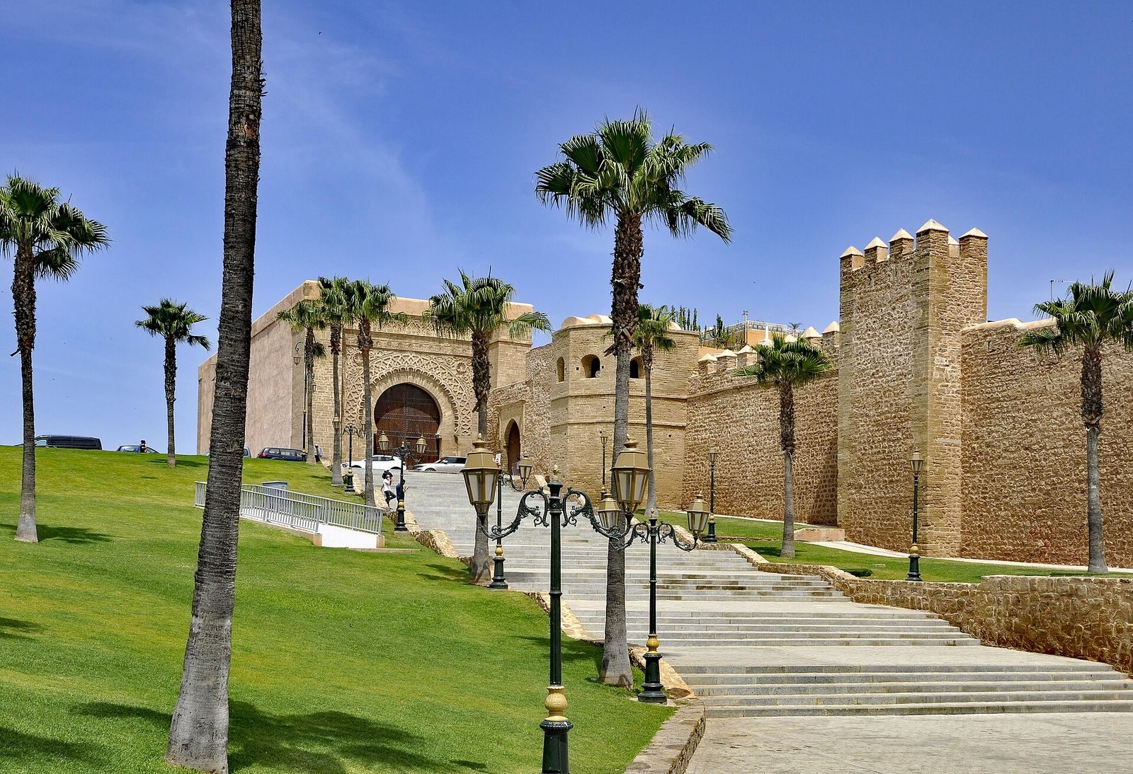
The Kasbah occupies a hill overlooking the Bou Regreg mouth, opposite Salé and beside Rabat’s Medina. Its principal enclosing walls date to the 12th century and are built mainly from ochre-colored Salé stone, a calcareous sandstone. The Atlantic coast and river define two sides of the site. Almohad-period fabric predominates in the north, while the lower areas reflect 18th-century Alaouite construction. In the upper northern quarter, the Street of the Mosque runs from Bab Oudaia to the semaphore platform, passing the Old Mosque. The southern area contains the former palace pavilion, the Andalusian Garden, and the Café Maure with its terrace.
Walls and Main Gate
Enclosing Walls
The walls extend beyond the older citadel and meet the coast and river, which serve as natural boundaries. Their stonework and the different character of the northern and lower quarters reflect the Kasbah’s development across the Almohad and Alaouite periods.
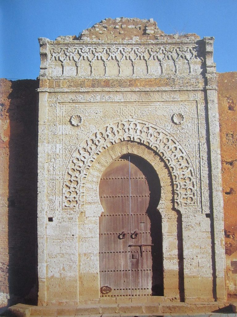
Bab Oudaia
The Great Gate, Bab Oudaia or Bab al-Kbir, stands uphill and faces Rabat. Its outer façade faces southeast toward the city, while the inner façade faces northeast toward the Street of the Mosque. Both sides have elaborate carving around a horseshoe-shaped arch. Interlacing geometric lines frame a Qur’anic inscription in Kufic, a formal style of Arabic script, alongside floral patterns, palm-like forms, and scallop-shell shapes. S-shaped carvings at the lower corners may represent eels. Three chambers create a bent passage through the gate. It was mainly ceremonial and had limited defensive value because it stood inside the city walls; unlike Bab er-Rouah in the western city wall, it had no flanking towers.
Old Mosque and Minaret
Old Mosque
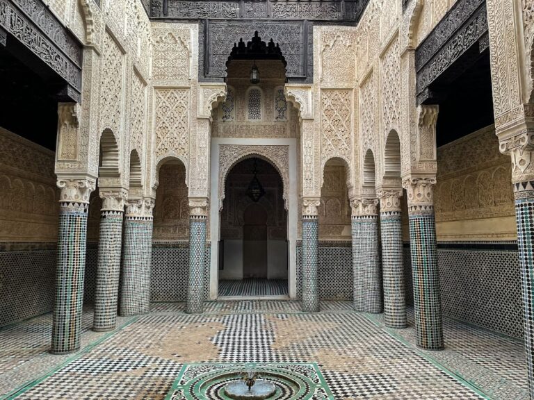
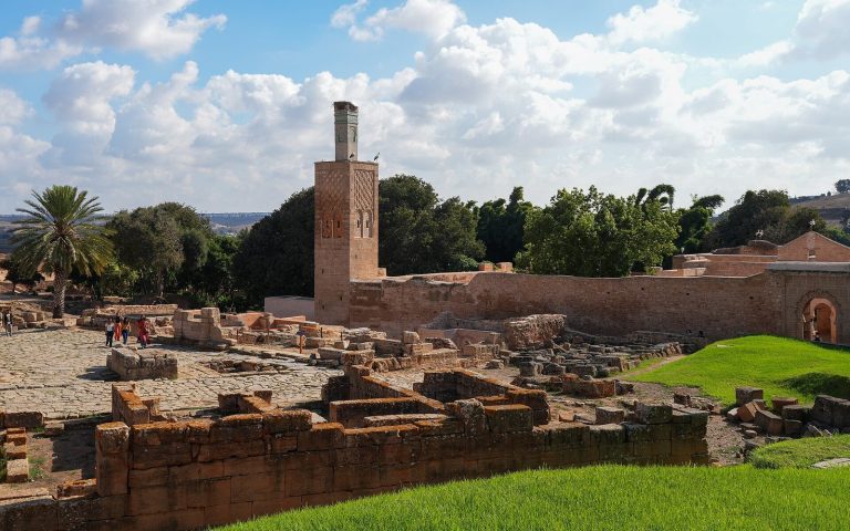
The Old Mosque, Jama’ al-’Atiqa, is the oldest surviving building in the Kasbah. Its irregular plan measures about 26.5 by 25 metres. Stone forms most of the exterior, while the interior arches are brick. Four horseshoe-arched doorways lead into a rectangular courtyard, with galleries on three sides and a prayer hall to the south and southeast.
The prayer hall has a T-shaped plan with seven aisles running across the prayer-direction wall. The central aisle is wider than the others and aligns with the prayer niche. The prayer direction faces mostly south rather than toward Mecca, following an older tradition. White walls and arches contrast with Moroccan mosaic tilework on the lower walls and carved stucco above. The prayer niche has elaborate stucco decoration of recent date.
Minaret
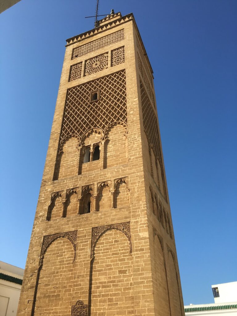
The stone minaret stands behind the mosque’s southeastern prayer-direction wall. It was originally separate from the mosque and joined to it in 1940. Its square shaft measures about 4.55 metres on each side and has shallow decorative arches set into the wall.
Palace Pavilion and Garden
Palace Pavilion
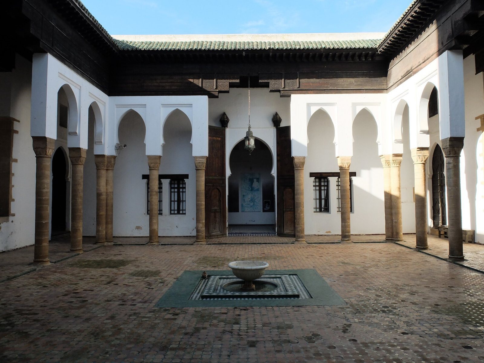
The former pavilion of Moulay Ismail is arranged around a main courtyard and includes an exterior tower. Its rooms include a vestibule decorated with mosaic tilework and a chamber in a former bathhouse.
Andalusian Garden
The formal garden beside the pavilion is enclosed by walls and towers. Inspired by gardens of al-Andalus, it contains bougainvillea, citrus trees including orange and lemon, and oleander.
River Defenses and Signaling Works
Semaphore Platform
A broad platform at the Kasbah’s northeastern edge overlooks the river and served for semaphore signaling. A warehouse was later built on the platform; it is now used as a school and carpet workshop.
Sqala and River Tower
Below the platform to the north is the Sqala, a coastal fortification and artillery platform. About 25 metres upriver to the east, a round tower has openings for four cannon facing the river. The tower rises only about three metres above the water and is screened from view by the Sqala.
Residential Fabric
Streets and Houses
A princely residence stands on the Kasbah’s western side. The surrounding neighborhood has narrow, winding streets that often end in dead ends, and traditional houses with Andalusian influences. Upper façades are generally limewashed white and lower walls painted blue. Some doors have carved-stone surrounds, while windows may be protected by wrought-iron grilles.
Household Layout
Houses are arranged around central patios. A skifa, a bent entrance passage, screens the interior from the street. Roof terraces form an interconnected upper level between homes, and the neighborhood also contains a bathhouse.