Castra of Osterburken: A Roman Frontier Fort Complex in Germany
Site at a Glance
- Popularity
- Medium
- Country
- Germany
- Primary era
- Classical
- Eras represented
- Classical, Modern
- Civilizations
- German, Roman
- Site type
- Military
- Remains
- Fort
On this page23 sections
History
The Castra of Osterburken was a Roman frontier-fort complex at Osterburken, Germany, on the Obergermanic-Raetian Limes, the Roman frontier system between the Rhine and Danube. Its cohort fort was occupied from around AD 160 until no later than 259/260, serving security and surveillance along the frontier.
Establishing the garrison
The precise date when the frontier and its garrison were established remains uncertain. Historian Géza Alföldy proposed that this section of the frontier was developed around AD 155, during the governorship of Gaius Popilius Carus Pedo. Timber from the sanctuary of soldiers assigned special duties was felled in the winter of 159/160, while other timber from Osterburken dates to AD 161. These dates support a Roman military presence by about 160; substantial troop activity much earlier is considered increasingly unlikely.
From around AD 160, the cohort fort was associated with Cohors III Aquitanorum, a unit of Roman citizens combining mounted and foot soldiers. The cohort had previously been connected with the frontier forts at Stockstadt and Neckarburken. Its garrison at Osterburken continued until the end of Roman control of the Limes in 259/260.
Expansion and frontier crisis
During the reign of Commodus, probably between AD 185 and 192, Legio VIII Augusta built an annex against the cohort fort. It was likely intended for the Numerus Brittonum Elantiensium, a smaller auxiliary unit thought to have transferred from Neckarburken. The annex also reinforced the older fort’s exposed hillside side as danger along the frontier increased. The Britons had previously been stationed at Neckarburken alongside Cohors III Aquitanorum, and the centurion Veranius Saturninus left a dedication at both garrisons.
A period of danger affected Osterburken during the 230s. In AD 233, Germanic forces overran parts of the frontier. The latest dated dedication from the soldiers’ sanctuary dates to AD 238. Inscriptions associated with Cohors III Aquitanorum and the latest coin from the cohort bath belong to the reign of Philip the Arab, AD 244–249. The frontier posts were abandoned or lost by 259/260 at the latest. Evidence from Osterburken points to a violent end in the middle of the third century, although it does not establish the exact date of the fighting.
Life after Roman frontier control
Roman control did not mark the end of activity in the area. Coins of Claudius Gothicus, who ruled from AD 268 to 270, and Constantius II, whose reign lasted from AD 337 to 361, as well as brooches, indicate later activity. A hoard deposited in the late fourth or early fifth century suggests that people were again living and working beside the Kirnau after Alamannic settlement. The Alamanni were a confederation of Germanic groups in late antiquity.
Rediscovery and investigation
Antiquarian interest in the Roman remains began early. Christian Ernst Hanßelmann saw a lime kiln at the fort, and an inscription of Legio VIII Augusta was found while ploughing in 1717 or 1718. In 1840, Karl Wilhelmi described excavations at the fort and settlement, along with coins, objects, and stone monuments already known at the time. By the nineteenth century, wall rubble was visible, while stone robbing and looting had damaged the site.
Excavations by the Mannheim antiquarian society in 1867 established that the site contained two forts. The Reich Limes Commission carried out major investigations in 1892–1893 under Karl Schumacher. The annex was conserved during the nineteenth century, but the original fort was built over without major excavation; Schumacher criticized the quality of the annex’s conservation. Further investigations of the forts took place in 1991 and 1992.
The cohort bath, discovered in 1826, was examined during rescue excavations in 1973 and 1983 and more extensively in 2004–2005 under archaeologist Klaus Kortüm. Bath II was uncovered during building work in 1976, and much of it was exposed between 1976 and 1980. A local historical association supported its preservation, and the town placed it beneath a protective structure linked to the Roman museum. Bridge construction over the Kirnau revealed the soldiers’ sanctuary in 1982; Egon Schallmayer directed further rescue excavations in 1983, 1984, and 1986. Finds from the sanctuary prompted an expansion of the museum at Bath II. More than 100 cemetery graves were investigated in campaigns in 1964 and 1972, and between 1977 and 1979.
Since 2005, the forts and associated archaeological remains have formed part of the UNESCO World Heritage property of the Obergermanic-Raetian Limes. They are also protected as cultural monuments under Baden-Württemberg law.
Remains
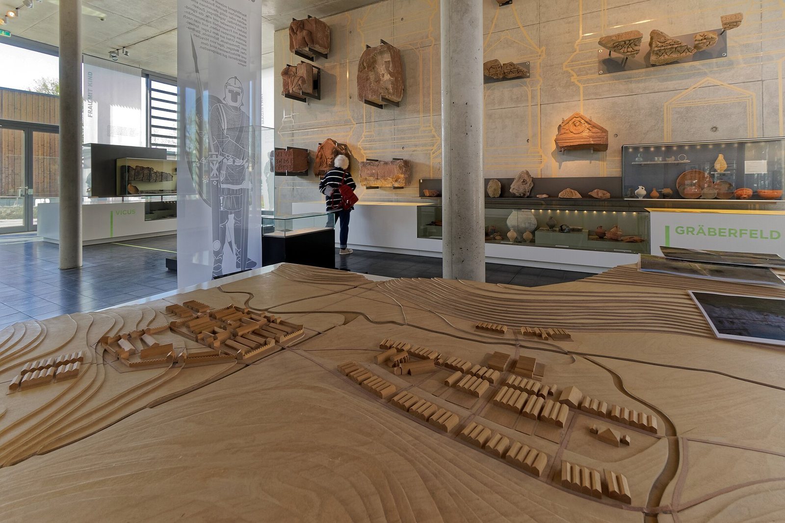
The site occupies the Kirnau valley floor and adjoining slopes, on the valley’s southern side at about 275 metres above sea level. The cohort fort stood about 500 metres from the frontier and approximately 455 metres west of the frontier road. The river bordered its northwestern side, while a stream approached from the northeast. Although the wet, flood-prone valley restricted views to the north and south, the frontier crossing could be seen to the northeast. Watchtowers on the northern and southern slopes could relay signals, but the southern slope also gave potential attackers a height advantage. The site’s principal structures were stone-built forts, with baths, a sanctuary, civilian settlement areas, and a cemetery nearby.
Fortifications
The cohort fort
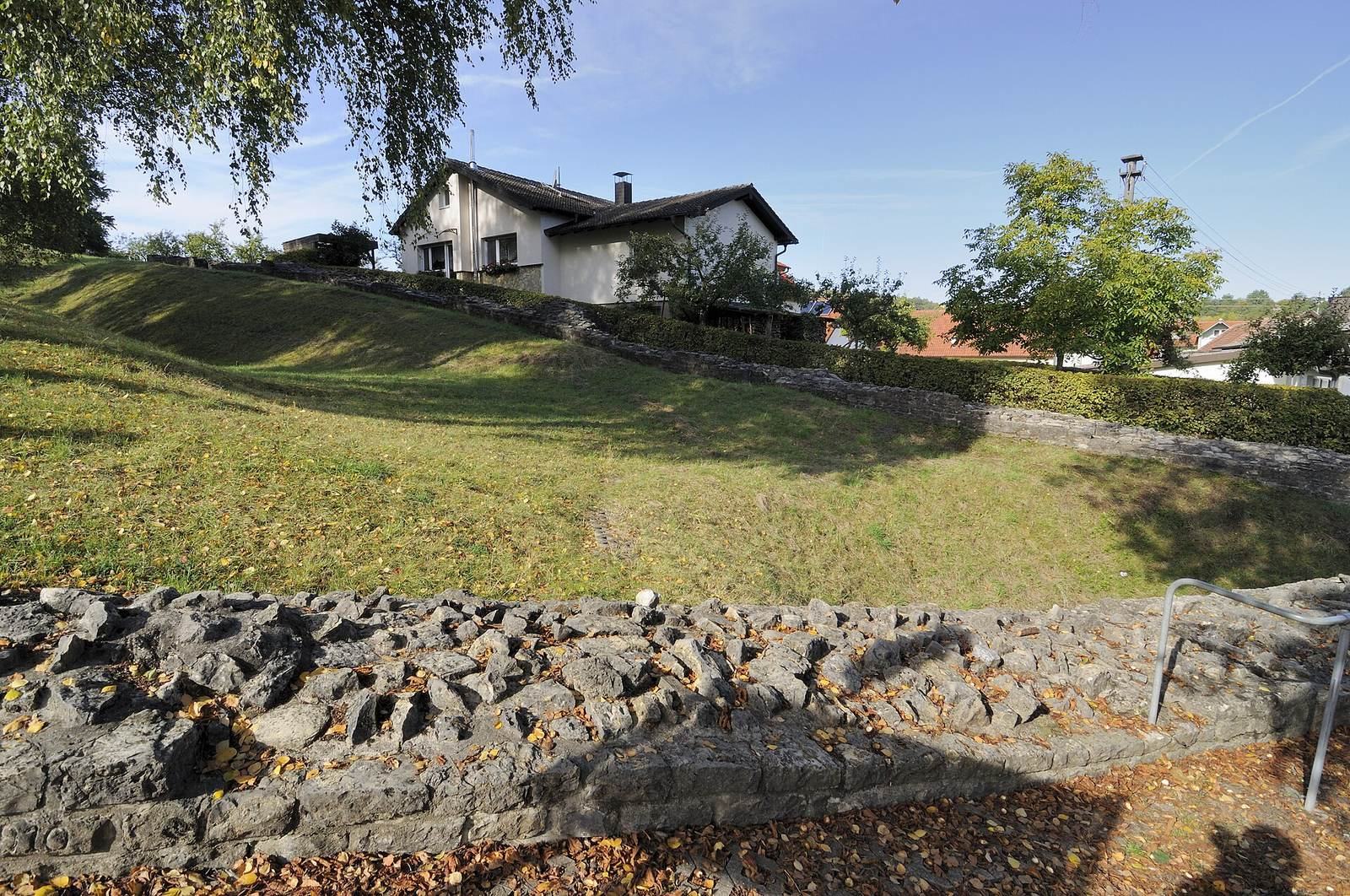
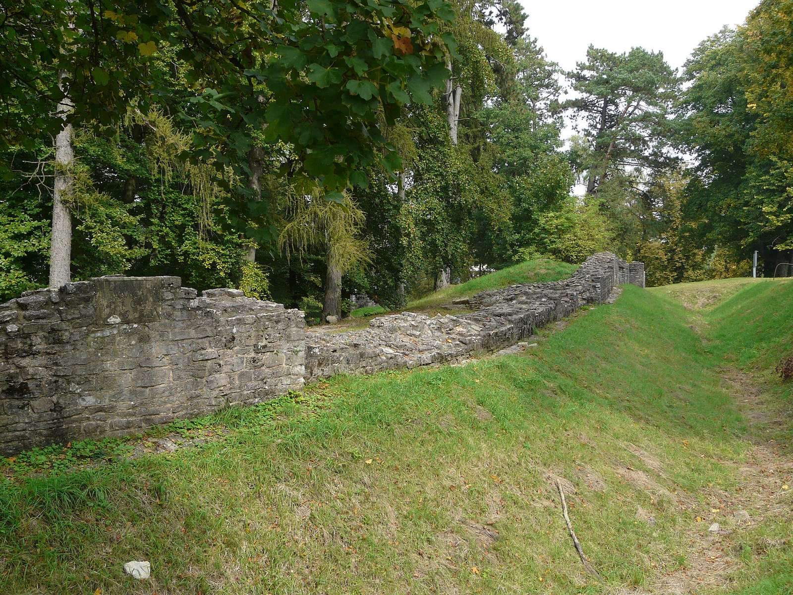
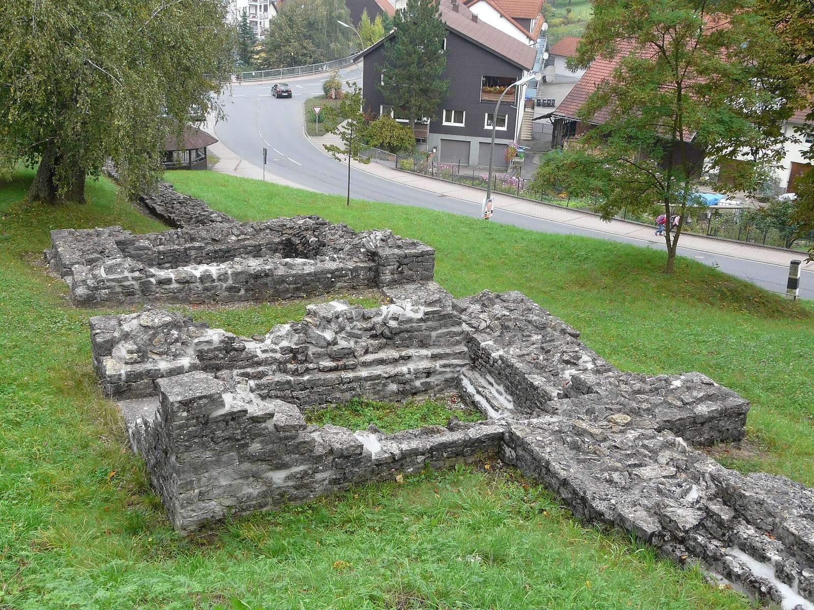
The cohort fort was a stone enclosure measuring 186 by 115 metres and covering 2.14 hectares. Its long sides followed the course of the Kirnau, and its front faced northeast. The rounded-corner plan had a gate in each side and a projecting rounded watchtower at every corner. The limestone wall retained plaster marked with painted lines representing masonry joints. Today, most of the fort is concealed, with its southeastern defensive wall the principal visible remnant.
Gates and defensive works
Pairs of towers flanked the gates. The main northeastern entrance was 8.3 metres wide and may initially have had two passages, one of which was later blocked. The rear northwestern gate had a single passage. A ditch cut across the approach to the southeastern gate; a 2.5-metre strip of ground between ditch and wall meant that access there required a wooden bridge. At this side, the ditch measured 7 metres across and 2 metres deep. Four intermediate towers stood along the two long walls, and some had more than one building phase. Another rectangular tower occupied the uphill wall in the forward part of the fort.
A ditch probably surrounded the cohort fort. On the landward side between the fort and annex, excavation in 1991 found a maximum width of 10.5 metres. The present Hagerstrasse broadly follows the Roman route between the northeastern and southwestern gates.
The annex
The annex adjoined the cohort fort’s southeastern flank and extended up the steep slope. The ground rises about 22 metres between the two southeastern gates. Its irregular, trapezoidal enclosure covered 1.35 hectares. The steep ground constrained the placement of buildings; surviving interior features include a small circular pit, short wall sections, and an intermediate tower of the older fort that was altered after the annex was built.
The annex’s perimeter wall is largely conserved. Its foundations were 2.30–2.40 metres wide, narrowing to about 1.60 metres in the rising masonry. An earth bank behind the wall reinforced it and provided a walkway along the defenses; one surviving section measures 7 metres wide. Each of the three gates had a single passage, 3.22–3.62 metres wide, flanked by two towers that projected only slightly beyond the wall. The southern corner tower may be a later addition and contains herringbone-pattern masonry. The southeastern gate may also have received later reinforcement on its inner side.
Fort interiors and civilian settlement
Headquarters and possible granary
The largest known interior building was the headquarters, placed near the centre of the cohort fort and measuring 38.5 by 45.8 metres. A shrine occupied a rear room. Its solid rectangular apse, a rounded-ended recess, projected beyond the back wall and had a U-shaped interior. Foundations and grain discovered in the forward part of the fort, northwest of the headquarters, may belong to a granary.
A building inscription found in the inner face of a southeastern tower at the main gate names Primius Montanus, a centurion of Legio XXII. The stone suggests that this legion carried out building work at the fort, though it cannot be dated precisely. A separate, badly damaged inscription of Cohors III Aquitanorum says that the unit restored or rebuilt a structure whose identity is unknown.
Civilian settlement and route
The civilian settlement associated with the fort extended into several areas: southwest of the cohort fort’s rear gate, in front of the annex’s southeastern exit, and on both sides of the Kirnau northeast of the main gate. From that gate, a road followed the river toward the frontier. Baths and other public facilities stood along the route, and civilians also used the baths.
Religious remains
Soldiers’ sanctuary and spring
The sanctuary used by soldiers assigned special duties stood close to the Kirnau, where repeated floods covered it with 3.5 metres of river sediment. The persistently damp deposits preserved plant remains. Beneath the sanctuary’s temple was a stone enclosure around a spring, with an image of a nymph and a dedicatory inscription. Its position beneath the temple shows that the spring structure preceded the timber associated with the later sanctuary.
Mithras relief
A relief of Mithras, a deity worshipped in a Roman mystery religion, was found in 1861 on the Kirnau’s right bank at Bofsheimer Straße, together with two altars without inscriptions. The relief’s base carries a dedication stating that Mercatorius Castrensis had the image erected on his property. A copy is held in the Osterburken Roman Museum.
Bath complexes
Bath I, the cohort bath
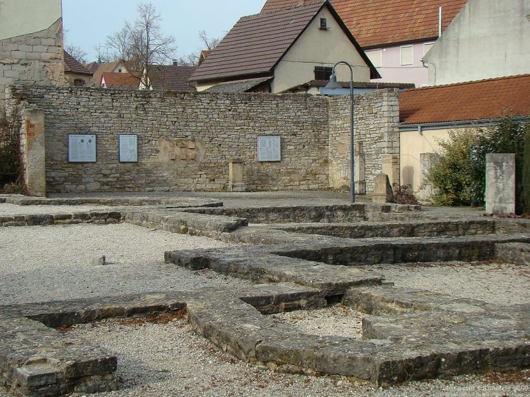
Bath I stood about 140 metres east of the cohort fort’s main gate and was almost four times the size of Bath II. Its masonry survived unusually well despite disturbance from the medieval town ditch. The foundations are outlined in paving in the museum forecourt and an adjacent street. Tree-ring dating places the felling of the earliest substantial oak roof-support posts in late AD 164. Brick stamps show that Legio XXII supplied bricks for the underfloor heating system in the warm room, while stamped bricks from Legio VIII were used in the hot room.
This row-type bath arranged its rooms in sequence. Visitors entered a large northern reception hall used for changing, exercise, and other activities. The hall was first built in timber and rebuilt in stone around AD 190. Wooden posts supported the roof in both phases, with replacements made once during the stone phase. The hall may have been reduced in size in the third century.
From the hall, bathers reached a cold room on the west, with a cold-water basin whose floor lining was completely renewed and whose size may later have been reduced. Two long, rectangular sweating rooms lay to the east. A narrow doorway south of the cold room led to the first of two warm rooms; the second warm room could also be entered from the first sweating room. Underfloor heating in the smaller first room rested on sawn limestone-tufa supports, while the second used brick supports. A rectangular niche on the east side of the second room may have held a hot-water basin.
The hot room stood south of the warm rooms and was about the same size as the second one. A basin set into a masonry recess on its west side appears to have remained in use until the bath closed; another basin stood on the south. A doorway on the east led to a long timber-framed side room, possibly used for massage or showering. Around AD 190, that room was demolished and its doorway blocked as the ground behind the bath was raised substantially. Other alterations affected the heating and floors. A timber furnace room attached to the south wall heated the hot room. Late Roman red-gloss tableware and a silvered coin of Philip the Arab are among the latest finds from the bath.
Bath II, the smaller bath
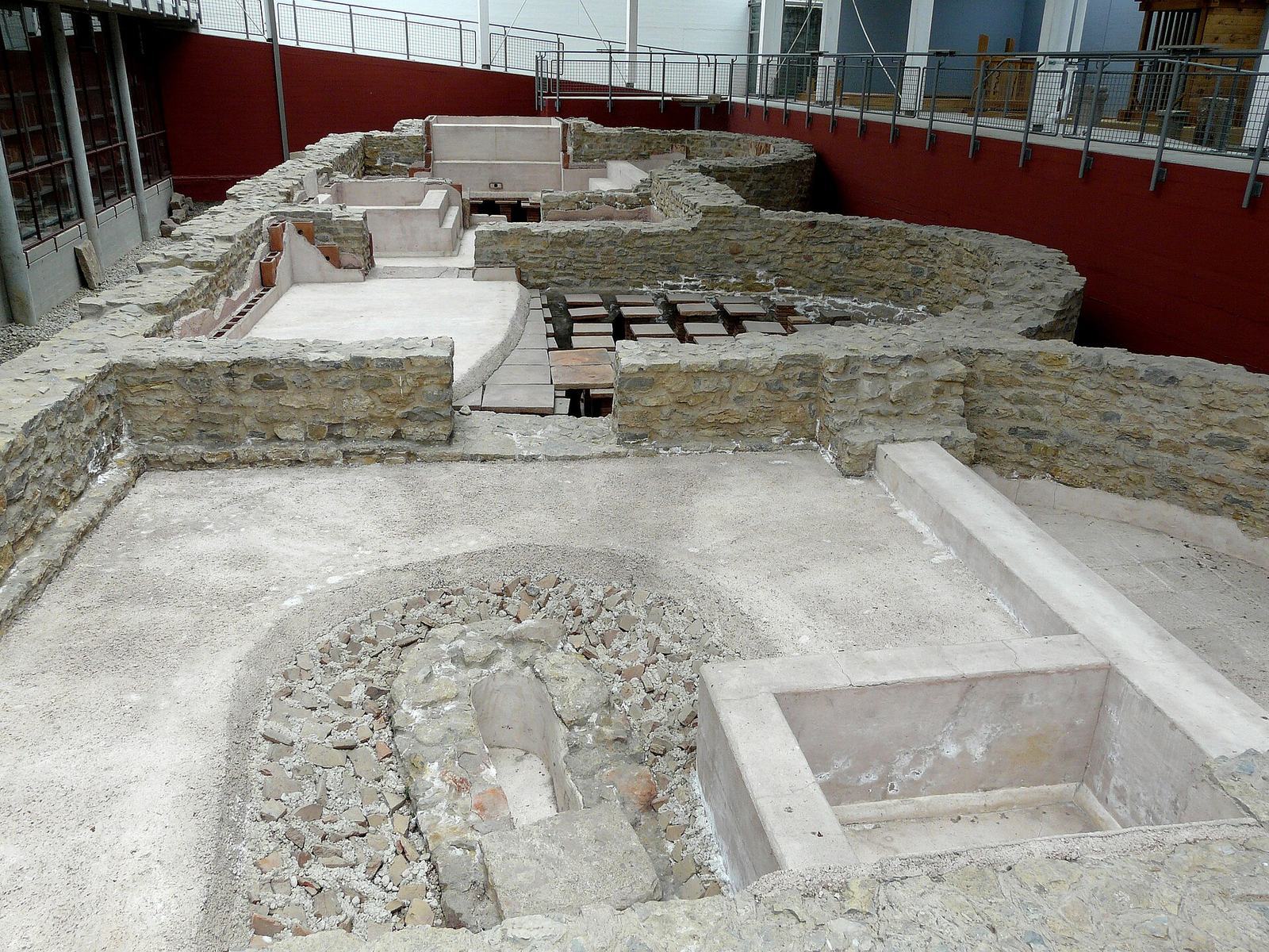
Bath II stood about 40 metres west of Bath I and roughly 100 metres from the cohort fort’s northeastern gate. Probably built for the smaller auxiliary unit between AD 185 and 192, this row-type complex included bricks stamped by Legio VIII. Its remains are largely protected beneath a shelter.
The entrance was at the northwest, through a changing room that was only partly excavated. Beyond it, the cold room had a semicircular apse and a bath along its south wall. A drain began there and ran beneath the changing room to the outside. Two adjoining heated rooms north of the cold room and changing room served as sweating rooms, accessible from both. East of the cold room, a warm room had a southern apse built as part of the room itself. It contained no bath and was used for massage and relaxation.
Farther east, the first and smaller hot room contained a hot-water bath, with its furnace behind the northern wall. The largest and easternmost hot room had a semicircular southern apse with a cold-water bath, and an eastern rectangular niche holding a hot-water bath. Another furnace stood immediately north of the niche. In the first half of the third century, the eastern end of this wing was abandoned along with its baths and furnace, and the passage leading into it was blocked. A largely heated, apsed building immediately northeast follows the same alignment as Bath II. It may belong to the same building phase and have served a related purpose, although its function is uncertain.
Cemetery and archaeological finds
Cemetery at Affeldürn
The cemetery lay at Affeldürn, north of the fort and civilian settlement, across the Kirnau. More than 100 graves were excavated. Most were cremations; the smaller number of inhumations included children’s graves. Two horse burials were also found. Grave goods included oil lamps, bowls, plates, jugs, jewellery, glass vessels, and coins. A large tomb building had been recovered in the nineteenth century. The excavated part of the cemetery was later built over.
Evidence of fighting
Excavations in 1991 and 1992 found traces of fighting in the ditch between the forts. In the latest Roman layer, the 1991 work uncovered the remains of at least three adults together with animal bones, pottery, fallen fort-wall rubble, and burned timber from interior buildings. A helmet fragment showed clear signs of violence. Earlier discoveries at the annex’s western edge included two people left where they died: one had a bent arrowhead nearby, while a young adult lay partly beneath fort-wall debris. Other finds in the area included coins, belt fittings, a silvered bronze brooch, arrowheads, a small triangular projectile bolt, and large charred timbers. Swords, spearheads, and arrowheads were recovered from the annex ditch during conservation work in 1896–1897.
An iron helmet from the fort, once held by the Mannheim museum, had a raised brow guard, a strongly lowered neck guard, large ear openings, and rounded ear guards formed from the helmet bowl. Its cheek pieces were missing when it was found. Two rivets fastened the large brow guard above the rim. The helmet developed from the Weisenau type and was dated to the mid-third century; it was classified as equipment for an auxiliary infantry soldier.
Late antique hoard
A hoard found in the old fort ditch contained 327 silver coins, most of them freshly minted. The latest coins were issued under Severus Alexander, whose reign lasted from AD 222 to 235. Their presence shows that the ditch had ceased to be maintained and was at least partly filled by then. The hoard’s date coincides with the frontier crisis of AD 233.
A separate hoard deposited in the late fourth or early fifth century contained 53 iron objects associated with Germanic farming and household life. Among them were agricultural tools, livestock bells, a ploughshare, cauldrons, fire chains, and other kitchen equipment. The assemblage also included two long swords unlike Roman forms and six sickles that had been partly repaired.
In 2014, a reversible metal framework shaped like a Roman fort gate was erected at the site to suggest the structure’s height and outline.