Pech Maho: An Ancient Fortified Trading Post in France
Site at a Glance
- Popularity
- Medium
- Country
- France
- Primary era
- Iron Age
- Eras represented
- Iron Age
- Civilizations
- Unclassified
- Site type
- Military
- Remains
- Fortified Town
On this page16 sections
History
Pech Maho is an ancient fortified trading post at Sigean, France, occupied from the sixth to the third century BC and probably inhabited by the Elisycs, an indigenous people of western Europe. It served as a maritime trading station, military outpost, and center of political and spiritual authority. The settlement stood beside navigable water with access to the sea, near the mouths of the Aude and Berre rivers and a ford on the presumed Heraclean route, an ancient route said to connect Italy and Iberia. Its position helped the Elisycs monitor their frontier with the Sordes and defend their territory and capital at Montlaurès, associated with Narbonne.
Occupation and Mediterranean Exchange
Archaeologists distinguish three successive occupation phases. The earliest lasted from about 575 to 475/450 BC. Pottery imports from Etruria, Ionia, Athens, and Carthaginian communities, alongside handmade local vessels, show that the settlement was already connected to a wide trading network. Greek cultural influence was strong in these early centuries, and local potters also made vessels inspired by Greek forms.
In the second phase, about 475/450 to 325/300 BC, imports included pottery from Athens, Massalia, the Greek community at modern Marseille, Iberian and Carthaginian communities, and Campania in Italy. Wheel-made vessels became more common as handmade pottery declined. Rotating stone mills for grinding grain gradually replaced hand mills. The third phase, about 325/300 to 225/200 BC, brought stronger contacts with Iberia and the Greek trading settlement of Emporion on the Iberian coast, while imports from Italy continued. Iberian writing became more frequent, although writing in the Greek alphabet remained uncommon. Pech Maho remained commercially active throughout its occupation.
Destruction and Aftermath
Violent fighting almost completely destroyed the settlement late in the third century BC, shortly before 200 BC. The cause is uncertain. Suggested explanations include events related to the Second Punic War, the conflict between Rome and Carthage from 218 to 201 BC. These include Hannibal’s passage toward Italy or a Roman attack from Emporion during Rome’s conquest of southern Gaul. Other proposals involve an attack associated with the arrival of the Volcae, a Gaulish people, or fighting between local groups. Catapult projectiles in the destruction levels indicate that projectile-throwing weapons were used.
After the destruction, people returned briefly for banquets, animal sacrifice, and cremation rites, apparently to honor those killed in the fighting. This short-lived activity did not restore the settlement, though occasional visits may have taken place in later decades. The site may have been treated as a shrine or tomb where a hero was honored, but this interpretation remains tentative. Roman-period fill may have been deliberately placed over the settlement to erase its memory. Its abandonment coincided with Rome’s expansion in the region, where Roman authority later centered on Narbonne.
The settlement’s ancient name is unknown. The modern name Pech Maho has been described as a faulty rendering of an Occitan expression meaning bad hill. María José Pena has proposed that Saiganthé, a form written on a fifth-century-BC lead tablet found at Empúries, may preserve the settlement’s Iberian name transcribed in Ionian Greek. The name may later have developed into Sigean.
Discovery and Archaeological Work
Henri Rouzaud discovered the site in 1913. Joseph Campardou, then president of the Friends of Old Sigean association, initiated test excavations in the western sector in 1938. Systematic work began in 1948, led by Campardou with assistance from Yves Solier and later directed by Solier. Over several decades, excavations focused chiefly on the fortifications, western residential area, and craft and commercial quarter.
Researchers reviewed earlier excavation records in 1998, and new excavations began in 2004 under Eric Gailledrat. Work through 2011 refined understanding of the settlement’s chronology and layout and revealed the brief ritual activity after its destruction. Pech Maho has been protected as a French Historic Monument since 1961, with further protection in 1963. The French state acquired the site in 1968.
Remains
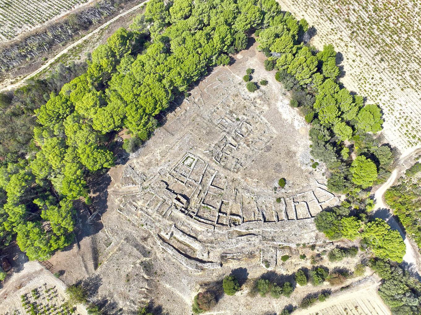
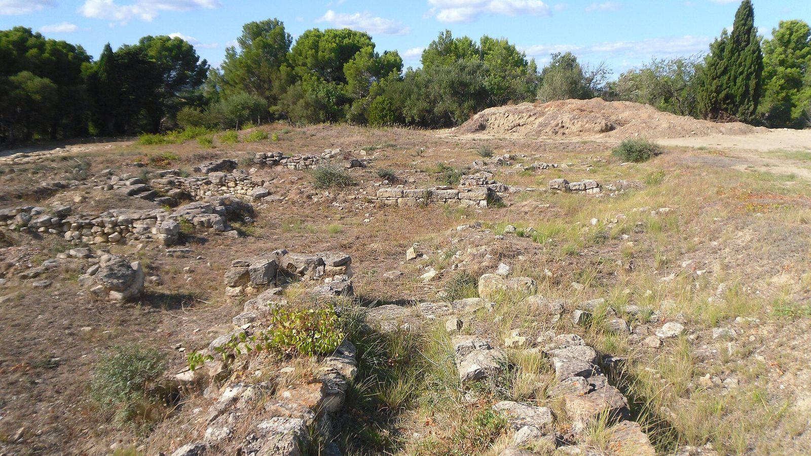
The settlement occupies a triangular limestone hill about 29 metres above sea level. Roughly two hectares in area, the hill includes about 1.5 hectares identified as inhabited. The site slopes westward and rises about 20 metres above the Berre and the former lagoon mouth to the north, and about five metres above the Les Oubiels plateau to the south. The ancient lagoon has since silted up. Most walls were built from uneven local stones arranged in roughly regular courses, bonded with earth and sometimes coated in clay. The overall settlement plan appears fan-shaped, with the southern defenses forming its base.
Settlement Plan and Buildings
Streets and Blocks
Three partly excavated streets in the lower quarter climb from the banks of the Berre toward the hilltop. They probably joined a north-south street extending inward from the cart entrance. An eight-metre stretch of this street contained a channel running along its length. At its end, the street met another at a right angle; the eastbound street led to a raised platform of large cut stones above a cremation burial.
Houses and Building Methods
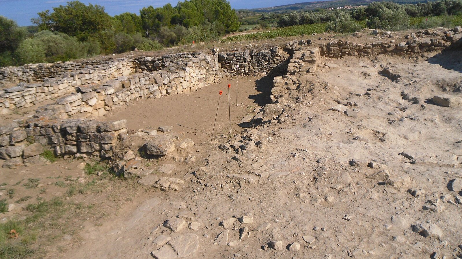
During the second occupation phase, houses were rebuilt with a changed orientation as part of a planned layout, apparently without an interruption in settlement. Sun-dried earth bricks on stone foundations became common. Streets divided the settlement into blocks: some followed the irregular outline of the hill and southern rampart, while central blocks II and III had more regular plans. The main north-south street, Street 1, crossed parallel Street 3 and perpendicular Streets 2 and 4. In the third phase, the street network and block arrangement changed little. Houses were raised or altered in some places, and later Iron Age houses had multiple rooms. Traces of habitation also occur around the southern knoll at Les Oubiels, including an apparently irregular settlement beyond the walls.
Defensive Works
Southern Defenses and Ditch
The Berre and its lagoon provided natural protection, so the defenses were concentrated on the south, where successive walls extended for about 200 metres. Four defensive works followed one another in the especially vulnerable southeast sector, a stretch about 120 metres long. A ditch, established in the sixth century BC, protected its approaches. The partly known ditch measures about 20 to 28 metres across and reaches a maximum depth of four metres; it becomes shallower from west to east as the terrain changes. At its eastern end, staggered rows of stones, set roughly a metre apart and projecting 30 to 40 centimetres above ground, impeded attackers.
Ramparts, Towers, and Terraces
The defenses combined rough local masonry with methods influenced by Greek fortification. The principal wall, built against the hill in the sixth century BC, has a central continuous section about 14 metres long, preserved to a height of 4.70 metres. Its sloping lower part averages four metres in height and supports a vertical upper wall 1.10 metres thick, now partly dismantled. Two massive square towers stood at the ends. Each projected about two metres, was up to four metres thick, and reached the height of the lower wall section.
Other irregular-stone defenses built in the fifth and fourth centuries BC reached a maximum height of 2.50 metres. In the southeast, a two-metre-high rubble slope with a vertical face supported a projecting bastion, a defensive structure, measuring eight by 5.70 metres and about 2.50 metres high. It extended four metres into the ditch. Beyond the main rampart was a terrace for defenders. A later wall, about a metre high and dating to the fifth or fourth century BC, ran along its inner side beside a passage linking the settlement and defenses. It overlapped an earlier enclosure about two metres high, probably dating to the sixth century BC, though the date of its first construction is uncertain.
In the third occupation phase, another wall was built in front of the older enclosure, arranging the defenses as successive walls across terraces. An imposing curved tower in the eastern defenses protected a cart route that ran beside the fortification for several dozen metres from east to west. A new ditch was dug in front of the access terrace.
Cart Entrance
The cart entrance lay in the western defenses. Its approach was 7.80 metres long and three metres wide, leading to a gate whose remains were burned in place. Two limestone blocks, 1.70 and 1.62 metres long, mark the entrance. They retain sockets for the door pivots and rectangular recesses for the frame; wear on their narrower faces is attributed to passing wheels. The gate had two wooden doors that swung inward on an iron pivot. Its angled approach ran between sections of the main wall. A projecting defensive corner on the west survives only in its lowest courses, while the terrace and inner enclosure protected the entrance on the east.
Burial, Ritual, and Finds
Burial Areas
A burial ground dating to the fourth and third centuries BC lies about 500 metres east of the settlement, toward the Grand Salin de Sigean. Within the settlement, the street leading east from an intersection reached a raised platform above a cremation burial. A carefully cut stone bench above a separate burial identified as that of a chief is another notable feature.
Ritual Features
Carved into the base of the principal wall are libation cups, a solar symbol, and an Iberian inscription. These features have been interpreted as evidence of non-bloody offerings made in a ceremony connected with the wall’s construction. A pillar base just beyond a street intersection was visible from the entrance and may have supported the display of severed heads. A small capital, or possibly an altar, found in the residential area imitates the Ionic order, an ancient Greek style whose capitals have scroll-shaped forms.
Excavated Objects and Wall Conservation
Excavations have yielded pottery, including pieces with Iberian inscriptions, jewelry, coins, tools, domestic objects, and human and animal remains. Four rolled lead pieces include some with Iberian writing; another, found in a shop and associated with the second occupation phase, carries both Ionian Greek and Etruscan texts. Corroded into a cylinder, it has a Greek text interpreted as recording a transaction involving goods. A possible reading refers to a boat and goods acquired from Emporion. The Etruscan text has been interpreted as naming two people and referring to Marseille. Finds from the excavations are held and displayed mainly at the Corbières Museum. Walls exposed during excavation have been restored with concrete.