Seleucia Pieria: The Seleucid Port of Antioch
Site at a Glance
- Popularity
- High
- Country
- Turkey
- Primary era
- Classical
- Eras represented
- Classical, Medieval
- Civilizations
- Roman, Seleucid, Umayyad
- Site type
- City
On this page22 sections
History
Foundation and early Seleucid rule
Seleucia Pieria was a Seleucid port city founded around 300 BC at Kapısuyu, near Samandağ in Türkiye. Seleucus I Nicator established it probably to serve as the seaport for Antioch, his new inland capital. After the Battle of Ipsus in 301 BC, a major struggle among the successors to Alexander the Great, Seleucus developed Antioch and its port as part of a wider urban plan that also included Laodicea and Apamea. Seleucia’s coastal position offered strategic advantages, although waterways carrying sediment from the Orontes and nearby mountains demanded extensive engineering. The city may initially have been intended to play a greater political role, before Antioch emerged as the dominant center.
The Macedonians applied the name Pieria to the surrounding landscape, recalling a district in their homeland between the sea and mountains. The city was also called Seleucia by the Sea and Seleucia on the Orontes, and later became known as Suedia. Pausanias and the Antiochene chronicler John Malalas associated the area with an earlier settlement called Palaeopolis, or Old City, but this does not establish that a predecessor stood on Seleucia’s exact site. Finds from coastal caves and evidence of earlier harbor activity and Greek imports at Al-Mina point to activity in the wider estuary region, without confirming a direct connection to the city’s location.
Wars, civic life, and Roman control
Seleucus I was murdered in 281 BC, and his son Antiochus I placed his father’s ashes in a building at Seleucia known as the Nikatoreion. The port later changed hands during the wars between the Seleucid kingdom and Ptolemaic Egypt. Ptolemy III captured it around 246 BC while intervening on behalf of his sister Berenice, and then took Antioch. The city changed hands several times before Antiochus III recovered it in 219 BC during the Fourth Syrian War, another conflict between the Seleucids and Ptolemies over Syria and its territories.
Control of Seleucia’s harbor mattered to Antiochus III’s campaign. His adviser Apollophanes argued that an enemy-held port could obstruct the king’s plans, while its recovery would support operations by land and sea. The general Ardys was remembered for his distinction during the siege. After the city returned to Seleucid control, it gained a measure of freedom and retained the right to issue coins into the Roman period.
Seleucia’s early civic arrangements appear to have followed Macedonian rather than Greek city-state practice. Its council, the peliganes, worked alongside an epistates, a royal-appointed chief official, while the city had no popular assembly. The Ptolemies may later have permitted a Greek civic system. A second-century BC inscription preserves an exchange between Seleucus IV and the city about honors for Aristolochos, and refers to civic tribes and districts as well as an epistates. From the late second century BC, Seleucia also numbered years according to a local civic era, whose starting date is given as either 108/107 or 109/108 BC.
The surrounding region passed from Achaemenid Persian rule to Alexander the Great around 333 BC, then to the Seleucids and Rome. Pompey annexed Syria as a Roman province in 64 BC, and Seleucia came under Roman control around 64–63 BC. It continued to serve as Antioch’s outlet to the sea. The Romans enlarged its harbors more than once under Diocletian and Constantius, and the port also served the Roman navy at times. Work to divert a mountain torrent away from the harbor began under Vespasian and continued under Titus; the wider project may have extended into later reigns and may not have been completed until the second century AD. A later bent access channel and outer harbor are traditionally associated with Diocletian’s period. In the fourth century, Libanius still described the difficulty of keeping the port navigable. He also described the Orontes as navigable between Antioch and the sea, while the traveler Volney later argued that boats could be hauled upstream but not sailed against the river’s swift current.
Christian community, decline, and later history
In AD 45, Paul and Barnabas departed from Seleucia on their first missionary journey. Paul is also associated with a return to the port before continuing to Antioch. Seleucia became an early Christian center, and church councils were held there. Its oldest known bishop, Zenobius, attended the Council of Nicaea in 325, a major gathering of Christian bishops. In the sixth century, Seleucia became an autonomous archbishopric within Antioch’s church hierarchy; its episcopal institution continued until the tenth or eleventh century. Syriac Orthodox bishops are recorded in the eighth and ninth centuries, including Ahron, dated either to 847 or 874. Georgian monastic communities were present in the surrounding area between the eleventh and thirteenth centuries. The historic bishopric remains a Roman Catholic titular see, a title for a former local church jurisdiction, and has been vacant since the last bishop died in 1980.
By the fifth century, efforts to keep the harbor open had stopped, and silting contributed to the city’s decline. Earthquakes in 526 and 528 caused severe damage. Two episodes of uplift, totaling about 0.8 m, together with continuing sedimentation, raised the harbor bed and channel, reduced navigable depth, and helped make the enclosed harbor unusable. The city appears to have remained occupied for a time, while maritime activity shifted toward more open anchorages. Around 540, the Persian king Khosrow I took Seleucia without a fight. The city was largely abandoned and did not return to its former role as a port. Its last residents left around the time of the Arab conquest, about 640. In the medieval period, St. Simeon served as Antioch’s port, while the Umayyad caliph al-Walid built a fortress at Seleucia between 705 and 715.
Victor Chapot systematically surveyed the site in 1906, mapping its terrain, walls, port, and waterworks. By 1907, houses and cultivated plots occupied parts of the walled area, and some city-wall stones had been reused in buildings. A Princeton University expedition investigating Antioch between 1932 and 1939 also excavated at Seleucia.
Remains
Setting and city defenses
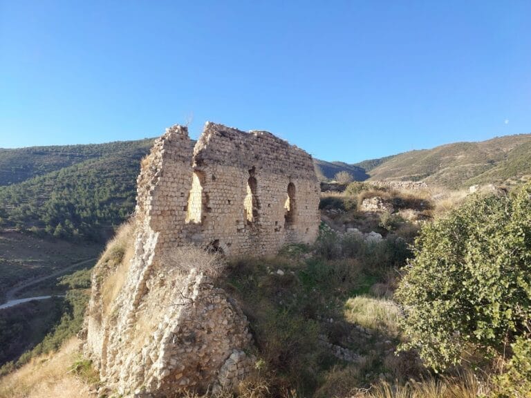
The ancient city stood about 32 km from Antioch, just north of the Orontes estuary, on the western slopes of the Pieria-Amanus mountain region. Steep ground falls toward the sea, and short, fast-flowing streams cut through the landscape. The upper city, roughly 13 km in circumference, remains distinguishable from the smaller, more densely settled lower city. The settlement descended over uneven terrain toward the shore, using high ground and ravines as part of its defensive setting.
Walls
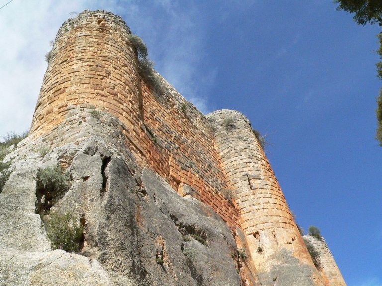
The city wall enclosed upper and lower sectors divided by a steep break in slope, and used torrents as natural ditches. Some stretches appear to have been cut into bedrock. Changes in masonry noted by Chapot may reflect separate construction or repair phases. On the eastern side, Richard Pococke described two lines of defense above a natural ditch formed by a steep descent of about 50–60 feet. He recorded an outer wall about 10 feet thick, made of large stones, and an inner wall of cut stone with square towers set roughly 50 paces apart. North of a gate near the port, the outer wall face used large, irregular polygonal blocks, backed by a core of Roman concrete. A cut made by an old torrent near the diversion works may indicate that part of the wall predates the major Roman water project, though this remains uncertain.
Gateways
Chapot identified the principal southwestern entrance as Bab-el-Kils, or the Gate of Lime. Its large arch was set in the city wall, and nearby cuttings may have held a device for closing it. The Gate of the Port, Bab-el-Mina, lay beside a torrent near another gate position; Chapot questioned whether it offered convenient regular access to the harbor. Towers stood nearby. The Gate of the Wind, Bab-el-Haoua, occupied a passage where Chapot also noted a change in masonry that may have resulted from repairs. Pococke separately described a southern gate decorated with pilasters and flanked by two round towers, which he called the Gate of Antioch.
Upper city and connecting route
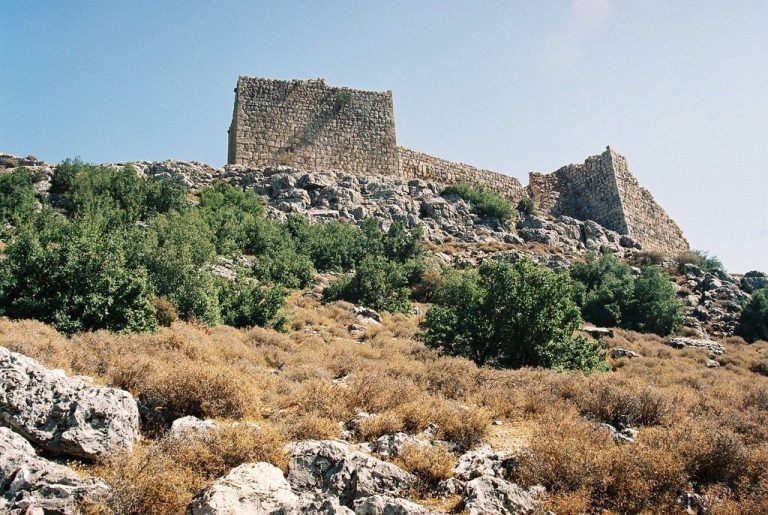
A partly leveled plateau in the upper city held a circular structure on a square base, possibly part of a larger monumental building. Higher up, the fortified high quarter known as the Acropolis, or El-Qal’a, had a thick wall and debris from a rectangular building. A possible redoubt and two additional plateaus may have formed a stepped defensive complex, although their arrangement is uncertain. A route cut by human effort wound between the upper and lower city, following the slope toward the shore. Chapot identified defensive works at two points along its course. A separate complex northwest of a ruined tower has been assigned a strategic purpose, but its function remains uncertain.
Harbor and maritime works
The harbor system lay south or southeast of the city and combined an inner basin, channels, and an outer harbor protected by breakwaters. Its entrances and channels changed as the shoreline advanced and sediment accumulated. The physical remains show successive arrangements for connecting the basin with the sea.
Inner basin
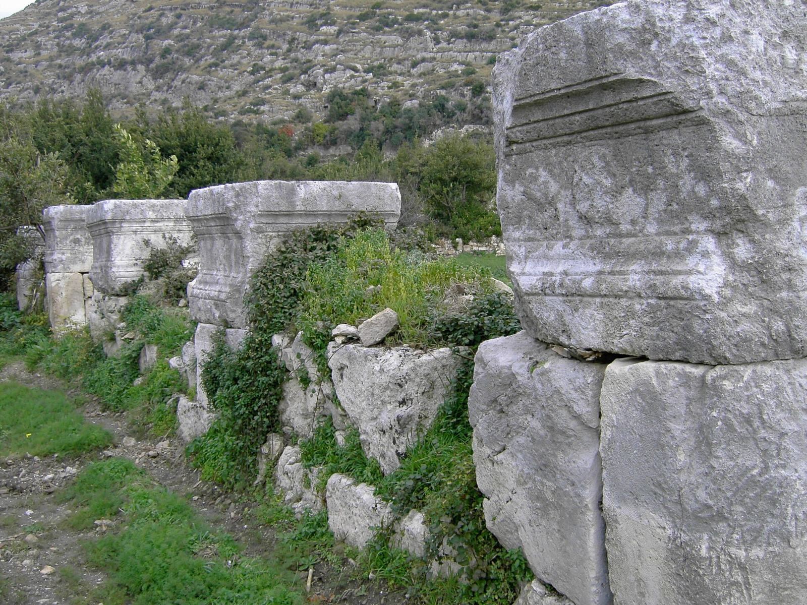
The inner basin lay at the foot of the city and is now a largely silted, marshy depression. Early twentieth-century descriptions still recognized its outline despite extensive infilling. A large area of ruins near the former basin has been tentatively associated with a colonnaded street. Statues, reliefs, and large columns may have been recovered from the area.
Harbor entrances and channels
The earliest identified entrance crossed the southern side of the basin. Two parallel quay walls and ruined guard towers flanked its fortified channel. As the coast moved seaward, this entrance became separated from the shoreline and was abandoned in favor of more northerly arrangements. A later, bent channel extended about 800 m. Its northern side was cut partly through limestone, while a wall bounded the southern side; the route led to an outer harbor with two control posts.
Outer harbor
Two breakwaters protected the outer harbor. Descriptions record large stones joined with iron clamps. The harbor installations were repeatedly affected by sediment carried by the Orontes and mountain streams, changing the conditions in which the port could operate.
Roman flood-diversion works
Dam and approach channel
The Roman waterworks redirected a torrent from west of the city, carrying it away from the harbor. A diversion dam partly embedded in bedrock has stone facings and a core resembling Roman concrete. It rises about 16 m, although sediment partly obscures it. A short approach channel leads from the dam toward the rest of the system. An inscription on the works names the emperors Vespasian and Titus.
Tunnels and discharge channel
Beyond the approach channel, the system passes through two tunnels cut into rock, separated by an open trench, then continues through a long discharge channel that carried water and sediment west of the harbor. The dam, open sections, and tunnels together are described as about 875–900 m long; a broader measurement of the tunnel-and-canal complex is 1,300–1,400 m. The tunnel associated with Vespasian and Titus is about 1,300 m long, 7 m high, and 6 m wide, while tunnel cross-sections are roughly 5–7 m. Both tunnels remain largely intact and can be traversed, though parts have collapsed. Rock-cut tombs also occur on a canal wall.
Religious and residential buildings
Centrally planned church
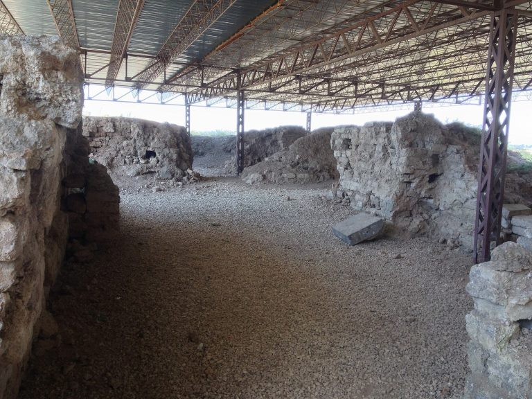
Excavations uncovered a centrally planned church identified as a martyrion, a church or shrine associated with a martyr. It stood within the walls near the market gate and colonnaded street, and measured about 30 m across. Its foundations are the surviving remains and have been reburied for conservation. A mosaic in the surrounding passage depicts a variety of animals, interpreted either as hunting scenes or as a symbolic image of Creation. The church was modified after the earthquake of 526.
Mosaic-decorated houses
Excavations also revealed houses decorated with mosaics, including the House of the Drinking Contest. Finds from the excavations are displayed at the Archaeological Museum in Antakya.
Burial places and other remains
Tombs and burials
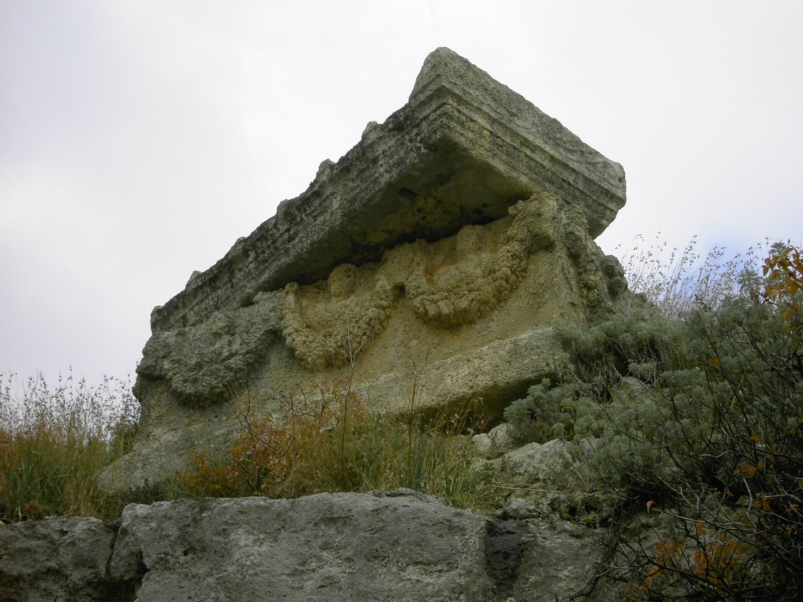
Rock-cut tombs known as the Tombs of the Kings lie north of the harbor basin. A Roman sarcophagus has been identified on the upper hills. Together with the city’s ancient cemetery, these remains form part of the burial landscape around Seleucia.
Public structures and possible spectacle site
The wider remains include an amphitheater, temples, and a citadel. A depression about 2 km east of the city wall has been proposed as the hippodrome described by Polybius. An older description of extensive arcades and galleries in the same area may relate to a structure used for spectacles, but the identification is uncertain. Near a tower by the harbor basin, a substantial underground conduit crossed the diversion channel on an aqueduct.