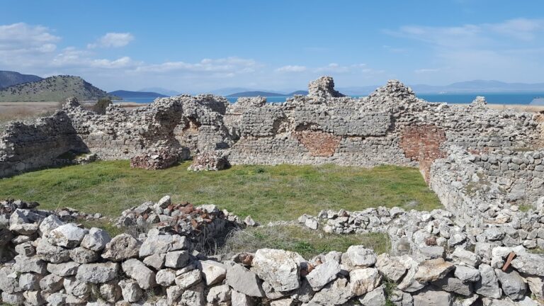
Antioch of Pisidia: A Hellenistic City and Roman Provincial Colony
Site at a Glance
- Popularity
- Very High
- Country
- Turkey
- Primary era
- Classical
- Eras represented
- Classical, Medieval
- Civilizations
- Byzantine, Roman, Seleucid
- Site type
- City
On this page28 sections
History
Seleucid foundation and Roman expansion
Antioch of Pisidia was an ancient city about 1 km northeast of modern Yalvaç in Isparta Province, Türkiye. Its foundation is traditionally attributed to the Seleucid dynasty in the third century BC, during the Hellenistic period that followed the conquests of Alexander the Great. Settlers came from Magnesia on the Maeander, and the city may have begun as a military base intended to help control attacks by the Galatians. Evidence for earlier activity in the surrounding region does not establish when the city itself was founded. A sanctuary on nearby Men Askaenos hill, for example, has finds dating to the fourth century BC.
Rome acquired Pisidia from Antiochus III under the Treaty of Apamea in 188 BC and transferred it to the kingdom of Pergamon. After Pergamon’s king Attalus III left his kingdom to Rome in 133 BC, Rome annexed western Anatolia following its defeat of Aristonikos in 129 BC. Campaigns against piracy helped re-establish Roman control in the region by 102 BC.
Control of the mountainous region remained difficult. Marcus Antonius, also known as Mark Antony, assigned Amyntas, king of Pisidia, to fight the Homonadesians, who threatened routes linking Pisidia and Pamphylia. Amyntas died in the fighting. Rome then established colonies with veteran soldiers. Antioch became part of the Roman province of Galatia when it was created in 25 BC.
Roman colony and provincial centre
The governor of Galatia, Cornutus Arrutius Aquila, began building the Via Sebaste, a network of military roads centred on Antioch. Its branches and connecting routes were designed to encircle the Homonadesians. In 3 BC, the Roman commander Publius Sulpicius Quirinius used this road system to end the conflict; survivors were resettled elsewhere in the region.
Under Augustus, Rome established Antioch as one of eight colonies in Pisidia. It alone received the title Caesarea and Ius Italicum, a legal privilege giving a provincial community status comparable to Italian territory. Known as Colonia Caesarea, the colony drew veteran settlers from poorer parts of Italy. Farming on fertile land irrigated from the Sultan Mountains helped them settle among the local population. The city prospered during the relative stability of the Augustan period, and Latin remained its official language until the end of the third century AD.
Antioch was later the capital of the Roman province of Pisidia and an important administrative centre. Its residents included early Christians. According to the Acts of the Apostles, Paul and Barnabas visited during Paul’s first missionary journey. Paul preached in the Jewish synagogue, but opposition led to their expulsion. They returned later and appointed elders for the Christian community. Paul also travelled in the region on his second and third journeys.
Late antiquity and medieval rule
Antioch became a metropolitan see, the chief bishop’s seat of a church province. A church list compiled around 640 names numerous subordinate bishoprics under its authority. A later list attributed to Leo V revises the group, removing some sees and adding others. By the sixth century, however, the city had begun to decline after losing its strategic position and falling away from the main trade routes.
Arab raids damaged cities across Anatolia. The most severe attack on Antioch was led in 713 by al-Abbas ibn al-Walid, an Umayyad prince, and the city never regained its former importance. As Islam advanced in the region, Antioch ceased to have a residential bishop. The Catholic Church later retained its name as a titular see, a designation for a former diocese without a resident bishop.
Crusaders passed through the area before Seljuk Turks took control in the eleventh century. Antioch continued to serve as a military resting place into the twelfth century and changed hands repeatedly. On 11 September 1176, Seljuk sultan Kılıç Arslan II defeated Byzantine emperor Manuel I Komnenos at Myriokephalon. The battle’s exact location is uncertain, although it is often placed near Yalvaç. Turkish settlement favoured the agricultural valley rather than the ancient hilltop city. The old name fell out of use; Yalvaç, meaning “prophet,” may refer to Saint Paul.
Rediscovery and archaeological work
Francis Vyvyan Jago Arundell identified and studied the city in the 1820s and 1830s. W. J. Hamilton later described its aqueducts, bath, and basilica. From 1880, William Mitchell Ramsay investigated Antioch and its inscriptions with the epigrapher J. R. S. Sterrett. Ramsay, W. M. Calder, and M. M. Hardie began systematic work in 1911. Excavations supported by Princeton University followed from 1912 to 1914 and uncovered important buildings.
A University of Michigan expedition excavated the Great Basilica, Tiberia Platea, Propylon, and western gate in 1924. The work ended after a dispute between Ramsay and the expedition’s director, D. M. Robinson. In the following decades, building blocks were taken from the site for construction in Yalvaç, and parts of the ruins became buried again. A detailed survey in 1962 and later work by K. Tuchelt in 1976 contributed to new study of the imperial sanctuary. Surveys by Stephen Mitchell and Marc Waelkens in 1982–83 brought earlier research together with new findings in a 1998 study.
Mehmet Taşlıalan, director of Yalvaç Museum from 1979 to 2002, continued research and argued that the Great Basilica was the Church of St Paul. The museum’s present building was begun in 1963 and completed in 1966. Its Antioch collection includes restored pieces of the Res Gestae Divi Augusti, Augustus’s account of his achievements.
Remains
City layout and defences
Hilltop setting and street plan
The city occupied a terraced hill rising about 60 m above the plain. Its northern high point reaches 1,236 m, while the upper fortified area covers about 460,000 m². The eastern edge is protected by the deep ravine of the Anthius River, which flows toward Lake Eğirdir. The city’s territory is estimated at about 1,400 km². Fertile land, irrigated with water from the Sultan Mountains, supported crops, fruit-growing, and animal husbandry.
Geophysical surveys indicate a grid of streets meeting at right angles, although much of the city remains unexcavated. The main north–south street, the Cardo Maximus, began at the Nymphaeum; the east–west Decumanus Maximus started at the western gate. The Cardo ran for about 400 m. The Decumanus is described as measuring 90 by 320 m. They crossed about 70 m south of Tiberia Platea. Inscriptions name seven city districts associated with the city’s seven hills: Venerius, Velabrus, Aediculus, Patricius, Cermalus, Salutaris, and Tuscus.
Walls and outer settlement
The defensive walls incorporate reused blocks, mainly of local grey limestone. Massive walls built from large blocks belong to earlier phases, while Byzantine and early Christian sections use mortar. Most of the visible defensive system dates to the fourth century AD. Curving, semicircular wall lines helped defend the northern and southern sides. Houses and farms stood beyond the walls, with house remains on slopes descending toward the plain. Reused sarcophagus fragments, Phrygian door-shaped tombstones, and funerary inscriptions in walls at modern Kızılca indicate a nearby burial area.
Streets and urban buildings
Western gate and water cascade
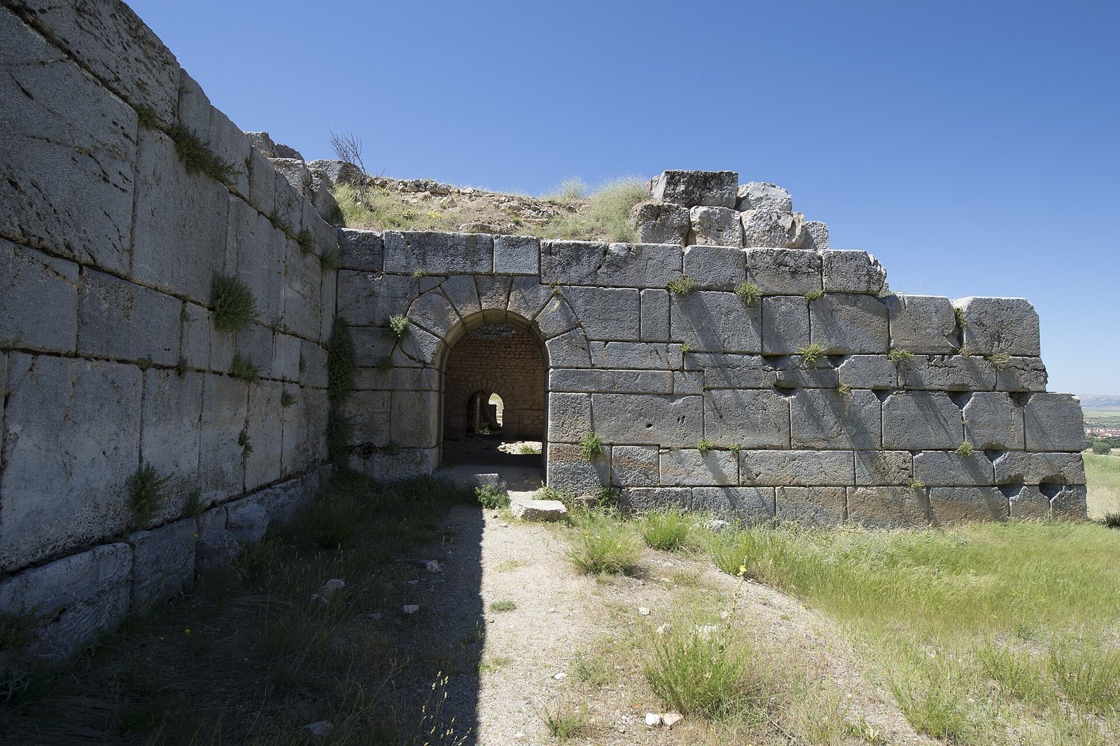
The western gate faced the valley at the meeting point of several ancient roads. Supported by the city walls, it formed a triple-vaulted triumphal arch whose design and decoration drew on the Propylon, the monumental entrance to the imperial sanctuary. An outer inscription dedicates the gate to Hadrian and his wife Sabina, dating its construction to AD 129, when Hadrian visited Asia Minor. Later work may also have taken place.
An inner inscription credits Caius Julius Asper Pansinianus with paying for the gate’s construction and decoration. It identifies him as a duovir, one of a pair of leading municipal magistrates, and as a military tribune and cavalry prefect. The inscription’s wording leaves open whether his magistracy was held for a fifth time or for five years. The decoration included figures of victory, weapons, armour, ox-skull motifs, and garlands.
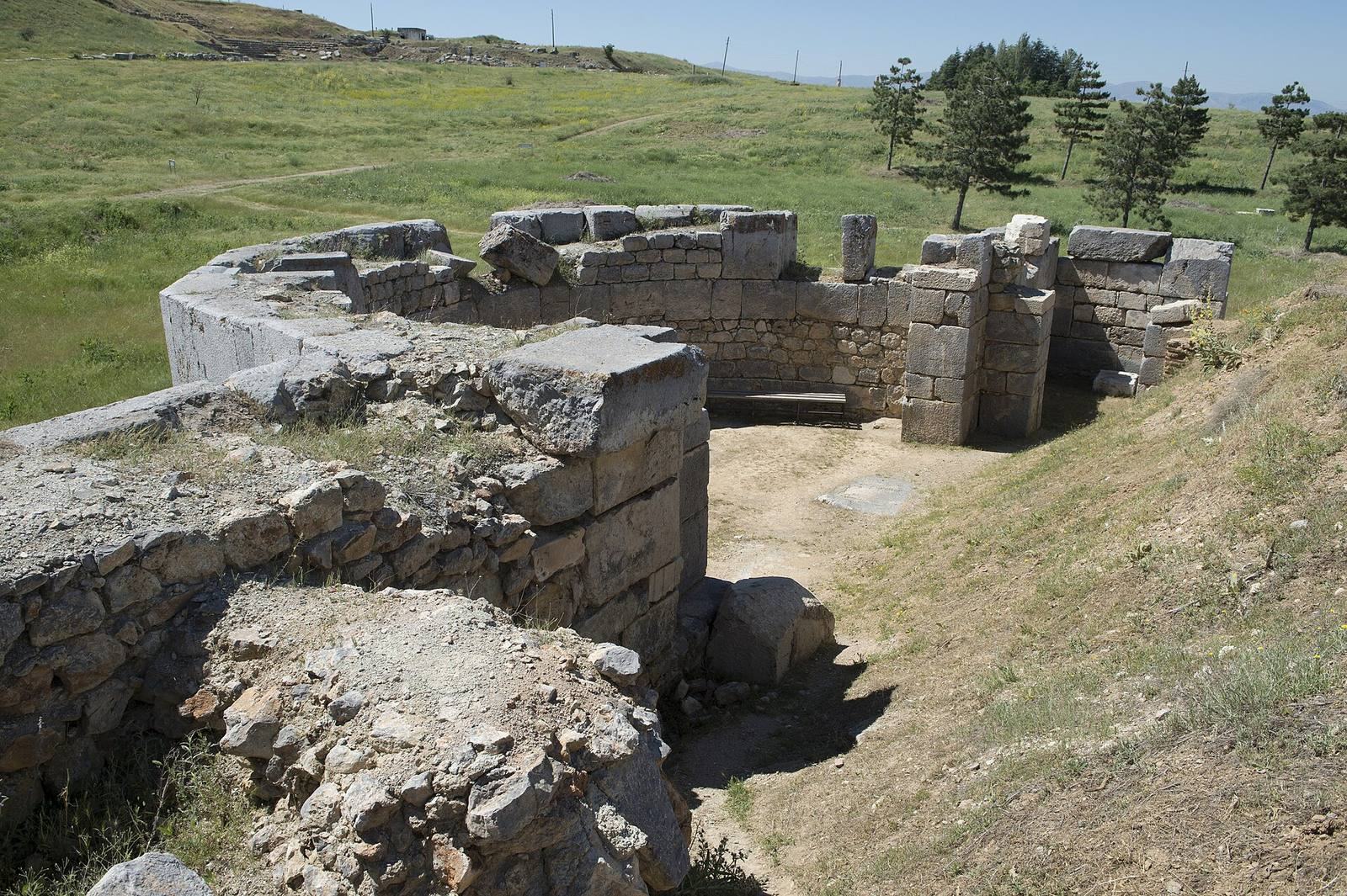
About 7 m inside the gate, a semicircular pool marks the foot of a cascading water feature. Above it, tanks roughly 2 m wide and 0.8 m high were arranged up the slope toward the Decumanus Maximus, allowing water to pass from one to the next.
Theatre
The theatre entrance stood about 50 m along the Decumanus from the western gate. Its surviving semicircular seating marks the auditorium, while the scene building was about 100 m wide. The original theatre may date to the foundation of the colony or to the Hellenistic period. An enlargement in AD 311–313 extended construction over the Decumanus, with a tunnel about 5 m wide and 55 m long passing beneath it. An inscription at the tunnel entrance records the enlargement.
Central Church
The Central Church lies on the same axis as Tiberia Platea, the Propylon, and the Augusteum. From the end of the Decumanus, it is reached by following the Cardo for about 75 m. Excavation revealed a more extensive plan than the small Latin-cross layout first proposed. A southern apse, a projecting rounded end of a church, belongs to an earlier phase; its relationship to the other apse and building phases remains uncertain.
An iron seal found during excavation bears the names of the martyrs Neon, Nikon, and Heliodorus. Taşlıalan associated the church with Saint Bassus, and it is also called St Bassus Church. The building’s date is unsettled: Ramsay proposed the fourth century, while later surveys and excavations point to a date about a century later. A first-century building beneath a ruined Byzantine church in this area may have been the synagogue associated with Paul’s preaching.
Tiberia Platea and the imperial sanctuary
Tiberia Platea
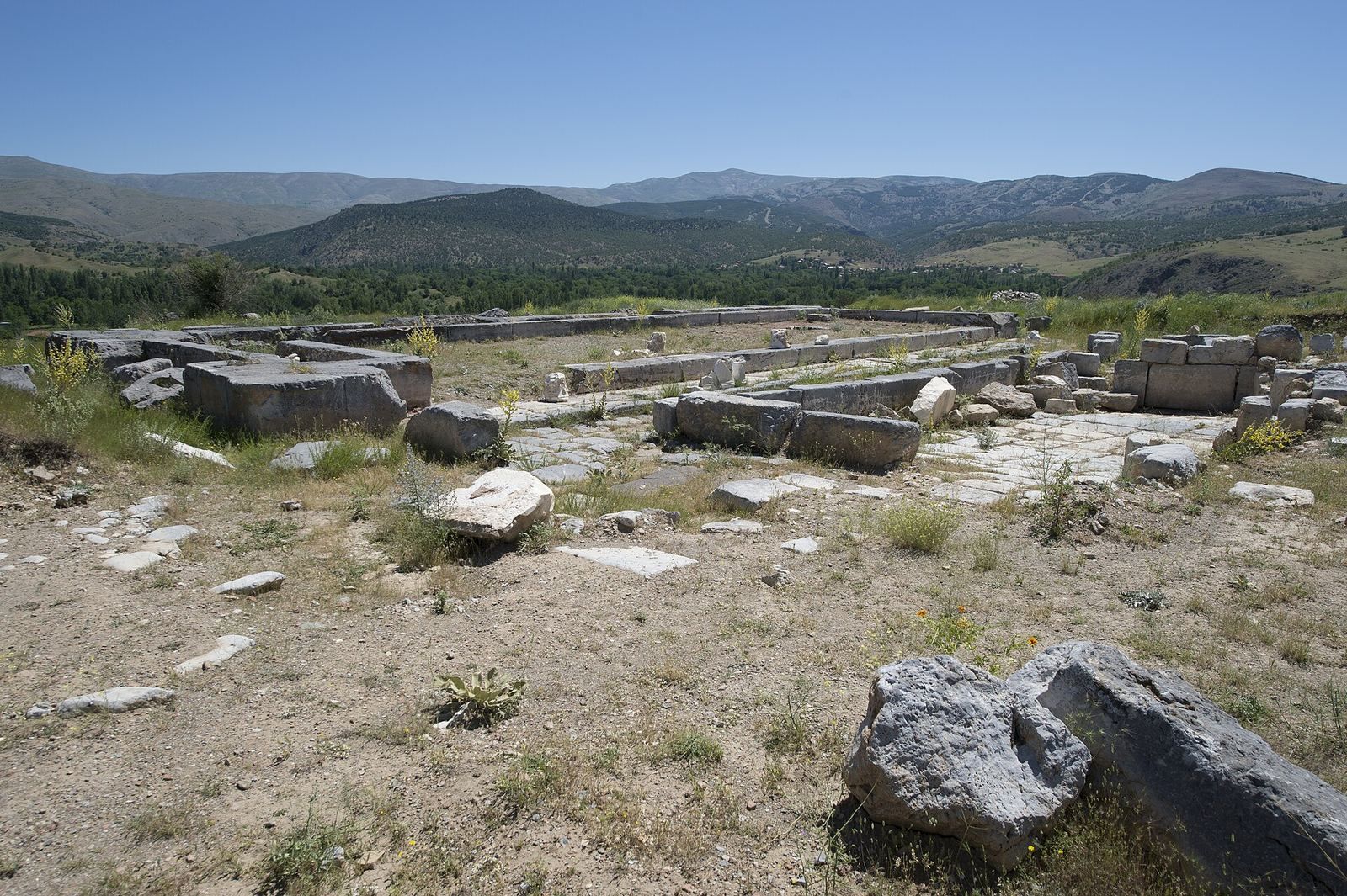
Tiberia Platea is a broad public street and square opposite the Central Church, ending at the steps of the Propylon. Its street section is about 11 m wide and 85 m long, and the square before the gateway is about 30 m wide. Colonnades and statues lined the complex, with shops behind the covered walkways. Finds from the shops, including inscriptions, altars, drinking cups, food-storage pottery, kitchen implements, and hundreds of coins, point to businesses selling food and drink.
An inscription naming the Platea records a grain-hoarding edict issued by L. Antistius Rusticus, governor of Galatia-Cappadocia; it is now in Afyon Museum. More than 200 additional fragments of the Res Gestae Divi Augusti were found during the 1924 excavations. A square paving block, about 1.7 m on each side, remains on the axis of the Platea, Propylon, and Augusteum. Its inscription, originally set in bronze letters, records that Titus Baebius Asiaticus paid for 3,000 Roman feet of street paving. The paving belongs to the Platea’s first building phase, dated AD 25–50. Earthenware pipes carried water from the Nymphaeum to the shops and a fountain near the Propylon.
Circular building
Near the southern corner of the Platea, about 20 m from the Propylon, excavators recovered blocks from a small circular building on a square base measuring about 5.20 m on each side. Eight columns apparently stood directly on the base, and a conical stone roof was shaped to resemble overlapping tiles. A surviving piece of a cornice inscription associates the building with the reign of Marcus Aurelius Antoninus, known as Caracalla.
Propylon
Twelve steps at the end of Tiberia Platea are the surviving remains of the Propylon, a monumental gateway to the imperial sanctuary. It had three arches, with four columns at the front and four at the rear supporting the structure above. The central entrance was 4.5 m wide and the two side entrances 3.5 m wide. A reconstruction proposed by architect Woodbridge has informed its interpretation.
Its sculptural decoration included opposing captives from Pisidia above the central arch, figures of Eros and Nike carrying garlands above the side entrances, and a frieze of victory symbols, weapons, armour, and sea beings. Inscriptions dedicated the gateway to Augustus and recorded his titles, including Father of the Country, a title he assumed on 5 February 2 BC. Fragments of the Res Gestae found in front of the gateway connect the area with the emperor’s account, although the original position of the inscribed panels is uncertain.
Augusteum
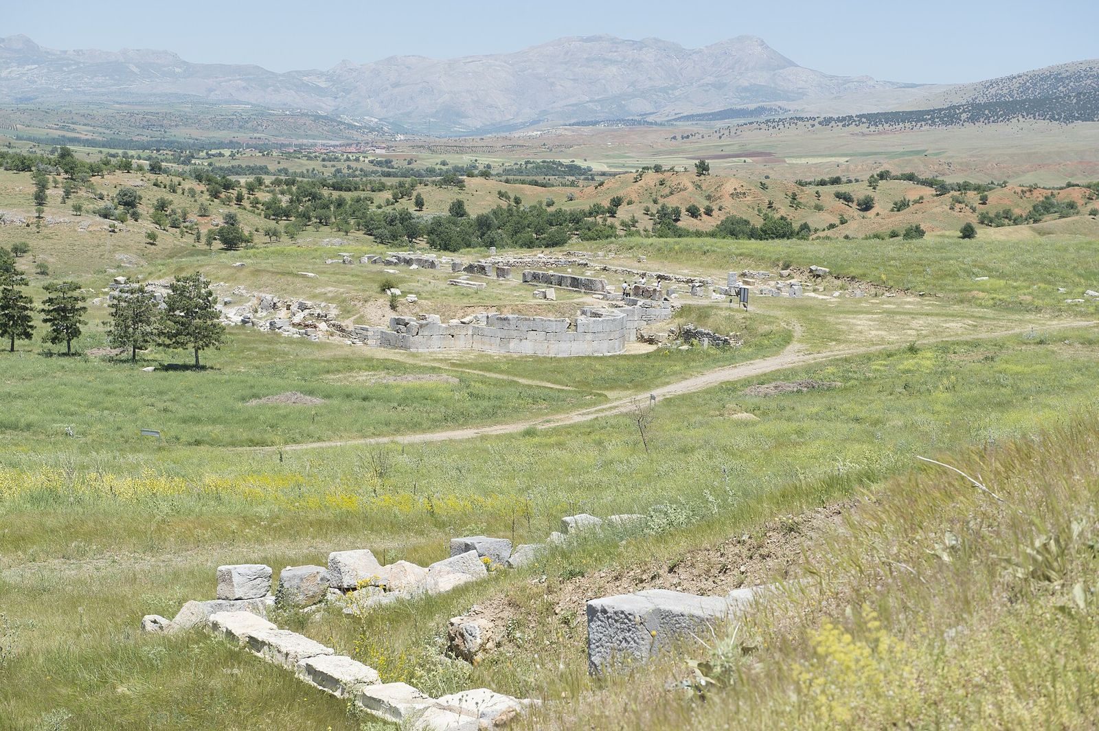
The Augusteum, also called the Sebasteion, was a sanctuary for worship of the emperor and imperial household, set at the city’s highest point beyond the Propylon steps. Its temple appears to have been started during Augustus’s lifetime and dedicated to him after his death. The complex was built alongside the Propylon and Platea, while cut marks in the bedrock indicate earlier cult activity at the site.
The temple platform was cut from bedrock, leaving a raised central platform about 14 by 28 m and 2.5 m high. Its inner chamber was also cut into the rock. Twelve steps led to a temple with four columns across its front. The fluted columns stood 8.72 m high on Anatolian-style bases and had Corinthian capitals, the ornate tops of columns. A horizontal structure above them carried a frieze of garlands and ox-skull motifs. The upper decoration also included a pediment with a central opening intended to frame the deity’s appearance, along with lotus and palmette designs. Floral friezes from the inner chamber survive at the site and in Yalvaç Museum.
The surrounding sanctuary measures about 100 by 85 m. A covered colonnade followed its semicircular edge, with a single-storey colonnade at each end to the north and south. The side colonnades had Doric columns, a plain classical column style. The curved walkway had two levels, with Doric columns below and Ionic columns, another classical column style, above. Reconstruction suggests the complex may have used about 150 columns. The bedrock was coated with hard, stucco-like mortar, and beam holes in the rock supported the upper level.
Water infrastructure
Aqueduct
An aqueduct carried water about 11 km from the Suçıkan spring in the Sultan Mountains to the city. The source lies at about 1,465 m and the Nymphaeum at about 1,178 m, a descent of roughly 287 m. The route used channels, tunnels, stone and earthenware pipes, and arches one or two levels high, adapting to the terrain. Its average slope was about 2.6 percent, decreasing in stages to roughly 0.02 percent at the pressure-fed crossings. The system supplied about 3,000 cubic metres of water daily for centuries.
About 200 m of aqueduct remains visible on the hills, and damaged sections can be traced toward the city. Surviving arches stand about 5–7 m high on massive, rusticated block-built piers. The piers average about 4 m in height and cover roughly 4 m² at ground level; the gaps between them range from 3.8 to 4.7 m. Stone water pipes with openings about 25 cm across also survive. Modern Yalvaç continues to use water from the Suçıkan source.
Nymphaeum
The Nymphaeum, a monumental fountain and water-distribution building, stood at the start of the Cardo. Dated to the first half of the first century AD, its U-shaped layout included a reservoir about 27 by 3 m, a decorated façade about 9 m high, and a pool about 27 by 7 m and 1.5 m deep. Excavation exposed the foundations, while a few marble fragments preserve evidence of the façade’s decoration.
Public and Christian buildings
Building identified as the Bath
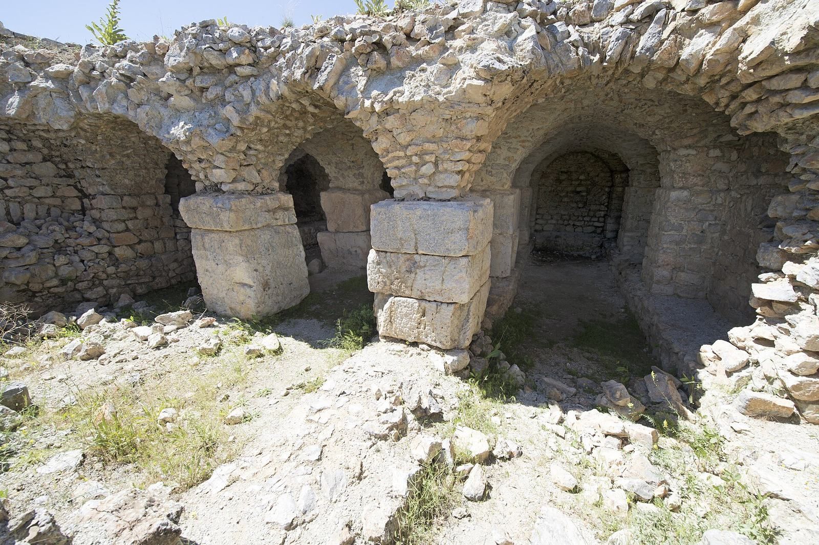
A large building in the northwest of the city, about 70 by 55 m, is identified as the Bath, although that interpretation remains uncertain. Seven sections have been excavated. Its entrances face west and northwest, unlike the south- or east-facing entrances described for baths elsewhere in Anatolia. Its strong arches could instead have supported a large building on the slope or served a defensive purpose.
If the complex was a bath, its eastern court, about 38 by 29 m, may have served as an exercise area surrounded by a colonnaded walkway. One room preserves an underfloor heating system made with fired-clay pipes and rectangular brick supports. Filled spaces and blocked, mortared walls point to building or use over an extended period, possibly for different purposes. Its earliest phase dates to the first half of the first century AD, and the excavated structure is in good condition.
Stadium
Outside the later defensive walls, opposite the Great Basilica, a small valley contains the remains of a U-shaped stadium about 190 by 30 m. The site was used for athletic games and competitions.
Great Basilica
The Great Basilica, a large early Christian church, stands near the outer walls in the northwest of the city. It is aligned east–west and measures about 70 by 27 m. Its entrance vestibule, or narthex, adjoins the defensive wall and measures about 27 by 13 m. Inside, a broad central hall is flanked by two narrower side aisles. The apse, the projecting sanctuary end, has a polygonal outer wall and measures about 10.8 m across.
A mosaic inscription at the start of the apse names Bishop Optimus, who represented Antioch at the Council of Constantinople in 381. This evidence supports a late-fourth-century date and places the basilica among the earliest early Christian churches in Anatolia. In a later phase, probably near the end of that century, the apse and main hall were filled to the level visible today and covered with mosaics. The floor’s axis differs from that of the building, and its geometric floral designs in rectangular frames lie beneath about 30 cm of earth.
Two rows of thirteen columns on polygonal bases divided the central hall. Earlier construction lies beneath the raised floor, including arched foundations that may have supported an upper level. The arches were later filled, and the columns associated with Bishop Optimus’s phase were set on that infill. Three doorways were added in the north wall, including a central entrance about 4 m wide, and two more were added to the south. The northern doors opened onto a ceremonial court with an L-shaped walkway built from reused material. A baptistery pool stood north of the court; foundations beside it may belong to a bishop’s residence.
Taşlıalan proposed that the basilica was the Church of St Paul, partly on the basis of a sixth-century altar bearing a Latin-script form of the name Agios Paulos, meaning Saint Paul. The altar was found at Yalvaç and had earlier been associated with the baths. Taşlıalan also suggested that foundations in the basilica’s south wall belonged to the synagogue where Paul preached. Both identifications remain interpretations.
Sanctuary of Men Askaenos
Sacred precinct
The sanctuary of Men Askaenos occupied a neighbouring hill about 6 km from Antioch by the described route and 3.5 km in a straight line. The hill rises to about 1,600 m, roughly 400 m above Antioch’s territory. Men Askaenos was a local deity associated with lunar symbols, and pine trees were sacred to him as the local Father God. A processional road lined with votive stones led to the sanctuary. The remains include a sacred enclosure, a smaller temple, a stadium, a ceremonial hall, a Byzantine church, and house-shaped structures.
Inscriptions carved on temple walls, many marked with lunar signs, show that worship took place from the fourth century BC to the fourth century AD. Votive texts ask Men for help, health, or protection; others recount sins and dreams, seek forgiveness, or express thanks. The sanctuary has been surveyed but not excavated, and its buildings are in poor condition.
Temple of Men
The Temple of Men was surrounded by a single row of Ionic columns, with eleven along each long side and six along each short side. Its raised platform measured about 31 by 17.4 m at the base and 25 by 12.5 m at the top. Ten steps stood on its southwest and northwest sides, and six on its southeast and northeast sides. Damage to local polytheistic and imperial-cult sites during the fourth century helps explain the temple’s poor condition. Survey work has not established its full plan.
Objects excavated at Antioch and now displayed at Yalvaç Museum include sculpture and fragments, portraits, reliefs, vessels, jewellery, perfume bottles, terracotta and bronze figures, marble statuettes, votive stones from the sanctuary of Men, and early Christian crosses. The museum’s prehistoric finds also include material from settlements near Yalvaç, not all from the ancient city itself.